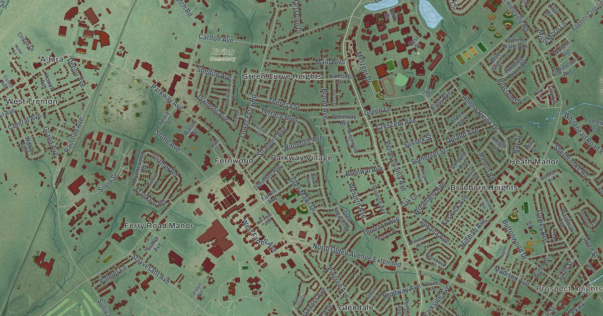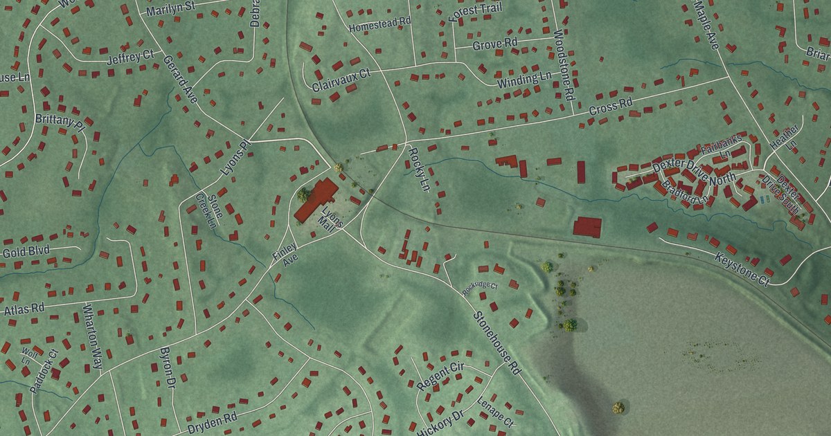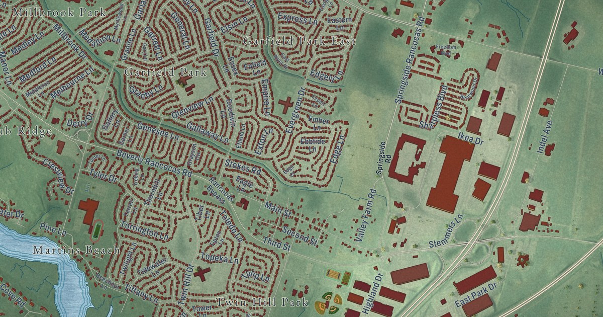
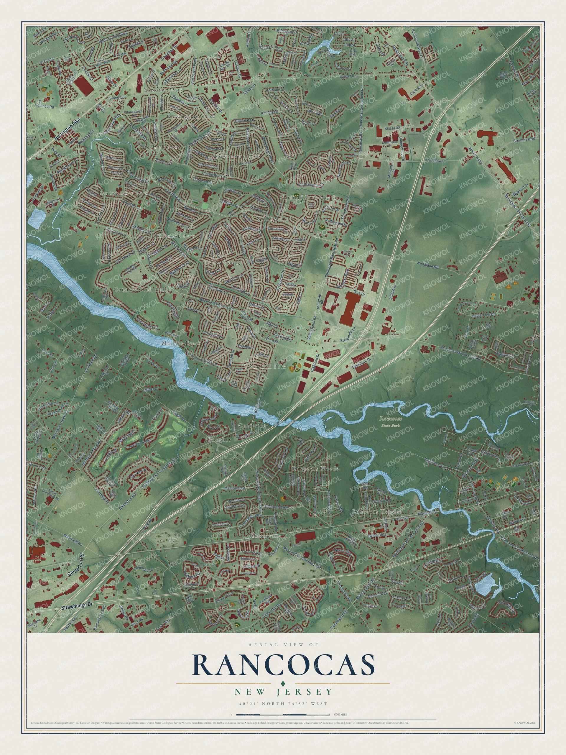
This beautifully detailed map of Rancocas, New Jersey was created in 2026 using aerial imagery combined with modern topographical, census, street and landmark data. It’s a one-of-a-kind view of Rancocas that combines accurate data with a vintage aesthetic. The map shows every building in its true location, many of the roads carry their names, and the shaded topographic relief shows the shape of the land.
Explore an aerial view of Rancocas, New Jersey
On the map you’ll find Rancocas State Park, Hawthorne Park, Masonville, Millbrook Park, Centerton, Rancocas Heights, Garfield Park East, Country Club Ridge, Twin Hill Park, Somerset Park, Charleston, Garfield Park North, and more. If you look closely you can even find your house accurately drawn in its correct location. Zoom in on the preview to look for yours.
Did You Know?
From Internet Archive: "Robert Dimsdale and settled on Dimsdale Run, a branch of Rancocas Creek, in Burlington County, where her husband erected a large brick house."
Rancocas is a community in Burlington County.
Take a closer look at the Rancocas map
Names on this map
These names are printed on this map.
Places: Rancocas State Park, Hawthorne Park, Masonville, Millbrook Park, Centerton, Rancocas Heights, Garfield Park East, Country Club Ridge, Twin Hill Park, Somerset Park, Charleston, Garfield Park North, Martins Beach, Rancocas Woods, Bougher, Pennypacker Park, Garfield Park, Willingboro and Buckingham Park.
Streets and roads: Centerton Road, Burlington Pike, Strawbridge Drive, Levitt Parkway, Van Sciver Parkway, Woodlane Road, Springside Road, Northampton Drive, Springside Rancocas Road, Willow Turn, Washington Street, Chadbury Road.
More street names, A to Z
17th Street, 18th Street, 19th Street, Aberdeen Drive, Acorn Road, Adams Drive, Adams Lane, Adelaide Drive, Albert Street, Alloway Avenue, Almond Road, Alton Way, Amara Lane, Amherst Drive, Anchor Court, Anthony Drive, Ark Road, Augusta Drive, Autumn Drive, Autumn Lane, Babcock Lane, Baldwin Hill Place, Baldwin Lane, Baltusrol Terrace, Bancroft Lane, Barclay Road, Barker Lane, Barnwell Lane, Barrington Lane, Bartlett Lane, Beach Road, Beechnut Lane, Belhurst Lane, Bell Lane, Belmont Lane, Bently Lane, Bentwood Drive, Bernwood Road, Beverly Rancocas Road, Beverly Road, Birchwood Lane, Bischoff Avenue, Bishops Gate Boulevard, Bloomer Drive, Blueberry Lane, Bolton Lane, Bonnie Lane, Boothby Drive, Borton Landing Road, Boxwood Lane, Bramley Road, Brandywine Drive, Bretton Way, Bridge Street, Briggs Road, Bromley Boulevard, Brooklawn Drive, Brooks Road, Buckeye Lane, Buckingham Drive, Bucknell Lane, Buoy Drive, Burlington - Mount Holly, Burlington Bypass, Buttercup Lane, Cadillac Drive, Campbell Drive, Campus Drive, Carey Circle, Carleton Lane, Castle Road, Cedar Lane, Chalford Lane, Charleston Lane, Charleston Road, Chase Road, Chateau Apts Road, Chaucer Road, Clearwater Drive, Club House Drive, Commerce Drive, Connecticut Drive, Connor Court, Cooper Street, Cortland Shire Drive, Country Club Drive, Country Club Road, Courtney Way, Cove Court, Coventry Way, Cove Road, Cox Road, Craig Drive, Creek Road, Creekview Road, Crestview Drive, Croft Court, Crows Nest Court, Crystal Avenue, Cypress Road, Deacon Road, Delancey Place, Delanco Road, Delaware Avenue, Derry Drive, Devon Lane, Diane Court, Dominion Drive, Dukto Drive, Eagle Lane, Earnshaw Lane, Eastbrook Lane, Eastern Lane, Eastgate Lane, Easton Way, East Park Drive, East River Drive, Ebbtide Lane, Echohill Lane, Eckert Road, Edge Court, Edge Lane, Edgely Lane, Edgewater Drive, Efland Lane, Elbow Lane, Elm Avenue, Elm Street, Elsin Lane, Elsinore Drive, Ember Lane, Emerson Lane, Empire Lane, Enfield Lane, Essex Lane, Etoile Court, Evergreen Drive, Evergreen Lane, Expert Lane, Express Lane, Exton Lane, Fairmount Drive, Fern Lane, Fleetwood Avenue, Forrestal Drive, Fostertown Road, Fox Court, Foxwood Drive, Freedom Boulevard, Gaffney Lane, Gallaway Lane, Gallery Lane, Garden Way, Garfield Drive, Garland Lane, Garner Lane, Garnet Drive, Garrett Lane, Gary Lane, General Lane, Genesee Lane, Glenview Lane, Goodwin Lane, Granby Lane, Granite Lane, Grayson Circle, Green Hill Road, Green Street, Greentree Drive, Greenwich Drive, Guilford Place, Hainesport Lumberton Road, Hainesport Mount Laurel Road, Hainesport Road, Hamilton Lane, Hampshire Lane, Hampton Lane, Harrington Circle, Harrison Drive, Hartford Road, Hastings Lane, Haven Lane, Hawthorne Lane, Hazelwood Circle, Heals Farm Road, Heather Lane, Heather Lane Lane, Heath Lane, Hedgerow Drive, Helm Turn, Hemlock Lane, Hendrickson Avenue, Hickory Lane, Highland Drive, Hillcrest Lane, Hillside Road, Hinsdale Lane, Hogan Way, Holbrook Lane, Holiday Lane, Hollis Lane, Holly Road, Holstone Lane, Holyoke Lane, Hopewell Lane, Hospital Drive, Hovetech, Hyde Lane, Ikea Drive, Indel Avenue, Industrial Drive, Iowa Avenue, Irick Road, Ironside Court, Irwin Road, Ivy Lane, Ivy Road, Karemark Drive, Kaye Court, Keith Lane, Kelly Drive, Kendles Run Road, Kissel Road, Knotty Oak Drive, Lakeside Lane, Lancelot Lane, Larchmont Boulevard, Larch Road, Laurel Creek Boulevard, Laurel Ridge Road, Laurel Road, Laurel Tree Drive, Lawrence Lane, Lenape Lane, Lenox Drive, Lewis Drive, Lindale Drive, Lindsley Court, Longwood Drive, Lumberton Road, Magnolia Road, Mahogany Drive, Mainbridge Lane, Maine Avenue, Main Street, Mandolin Lane, Manhatten Drive, Manor Lane, Maple Tree Drive, Mariner Lane, Marne Highway, Marshal Lane, Marter Avenue, Marvin Ellis Way, Masonville Centerton Road, Masonville Fostertwn Road, Mason Woods Lane, McElwee-creek Road, McElwee Road, Medallion Lane, Medford Lane, Medley Lane, Melbourne Lane, Melville Lane, Memorial Lane, Merion Way, Middlebury Lane, Middleton Lane, Midfield Lane, Midlantic Drive, Midvale Lane, Millbrook Drive, Millenium Drive, Miller Court, Moorestown Centerton Road, Mosshill Lane, Mount Holly, Mount Holly Road, Mount Laurel Road, Muirfield Court, Myrtlewood Lane, Narbeth Drive, Nevada Lane, New Castle Lane, New Coach Lane, New Jersey Avenue, New Pond Lane, Niagara Lane, Nikki's Place, Noble Pass, Normandy Drive, Normont Lane, North Broad Street, North Deer Place, North Edge Drive, North Garden Boulevard, North Hill Drive, North Saratoga Drive, Norwick Lane, Oak Lane, Oakmont Drive, Oak Tree Court, Orchard Way, Otto Avenue, Overlook Drive, Oxmead Road, Pageant Lane, Palfrey Lane, Parish Lane, Park Avenue, Parry Drive, Pastoral Lane, Patriot Lane, Patriot Way, Peach Road, Pearl Avenue, Peartree Lane, Penmark Drive, Pennypacker Drive, Peppermint Lane, Pheasant Lane, Pike Road, Pine Lane, Pine Street, Pine Tree Drive, Placid Lane, Plumtree Lane, Potter Lane, Prickett Lane, Primrose Lane, Princeton Lane, Pulaski Avenue, Quincy Manor Lane, Rancocas Avenue, Rancocas Boulevard, Rancocas Bypass, Rancocas Mount Holly Road, Rancocas Road, Rancocas Springfield Road, Red Hill Court, Ridgeview Road, Rittenhouse Drive, Rockland Drive, Rolling Hill Drive, Roosevelt Drive, Rose Street, Rosewood Lane, Salem Crossings Road, Salem Road, Sandal Lane, Sandhurst Drive, Sandstone Lane, Sarazen Drive, Saxony Drive, Schoolhouse Road, Second Street, Sedgefield Drive, Sedgwick Lane, Sharpless Boulevard, Shawmont Lane, Sherwood Lane, Sidney Lane, Silver Lane, Sixth Avenue, Society Court, Somerset Drive, Southampton Drive, South Cottage Street, South Edge Drive, South Garden Boulevard, South Saratoga Drive, South Sunset Road, Spindletop Lane, Spring Drive, Spring Hill Lane, Spring Lane, Spruce Avenue, Spruce Lane, Squirrel Tree Lane, Starboard Way, Starke Lane, Stark Lane, Stark Way, Stemmers Lane, Stern Light Drive, Stokes Avenue, Stokes Road, Stonehaven Lane, Stratford Lane, Sunset Road, Surrey Lane, Sussex Court, Sussex Drive, Swan Lane, Sylon Boulevard, Sylvan Lane, Sylvan Park Road, Taft Court, Taisley Lane, Tallowood Drive, Tallowood Lane, Tasker Avenue, Teddington Way, Terrell Lane, Thackery Road, Theo Court, Third Street, Thorn Briar Lane, Thornhill Lane, Thornwood Drive, Tiber Lane, Tidewater Lane, Tiffany Lane, Timberline Drive, Tipton Lane, Toledo Lane, Topeka Lane, Torrington Lane, Tower Lane, Traynor Lane, Trebing Lane, Trinity Turn, Troon Court, Tudor Drive, Tudor Lane, Tulip Lane, Turner Lane, Twig Lane, Twilight Lane, Twin Hill Drive, Twisting Lane, Tyler Drive, Union Mill Road, Valley Farm Road, Votta Drive, Wall Avenue, Walnut Alley, Walnut Avenue, Walnut Drive, Walnut Lane, Wembley Drive, Western Drive, Westfield Road, West Maple Tree Drive, Wickham Lane, Willingboro Parkway, Willow Way, Windover Lane, Windsor Lane, Winterberry Lane, Woodford Lane, Woodgreen Lane, Woodland Way, Woodside Drive, Woolman Lane, Woolmans Lane, Worthington Drive, Yarmouth Lane, Yorktown Lane.
See it on a wall
The Rancocas map as a framed print. Swipe for more.


This beautifully detailed map of Rancocas makes an attractive addition to your office, library, or den, and it can even be used to teach children the geography and history of the area. It also makes a great gift for someone who left Rancocas and still calls it home. When you’re done exploring, click here to get your copy of the Rancocas map.