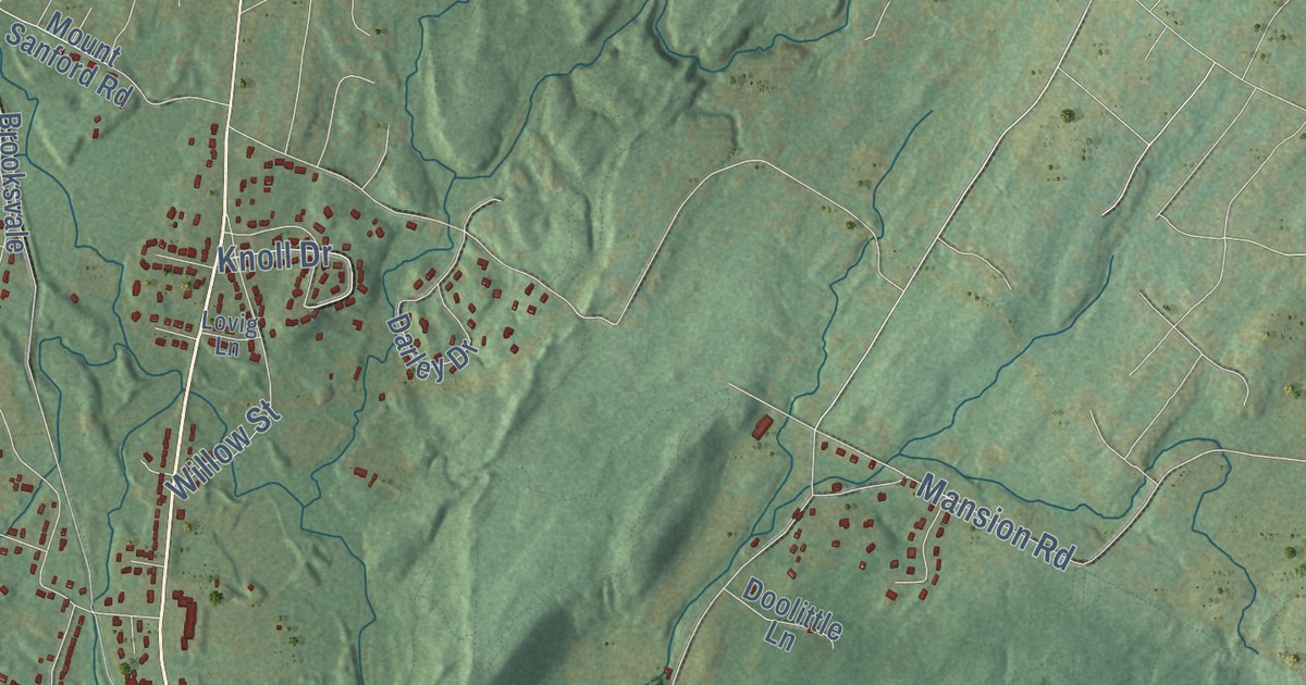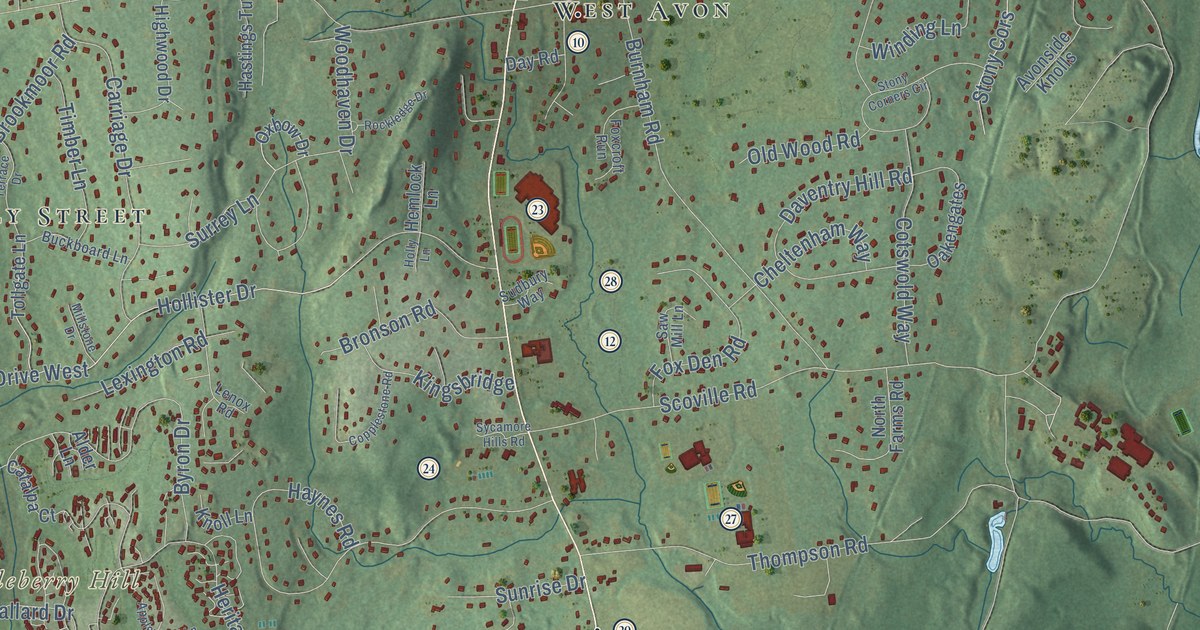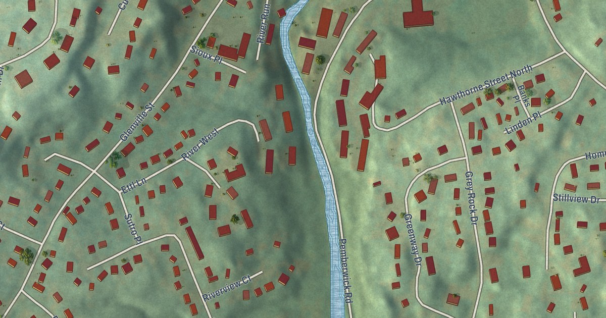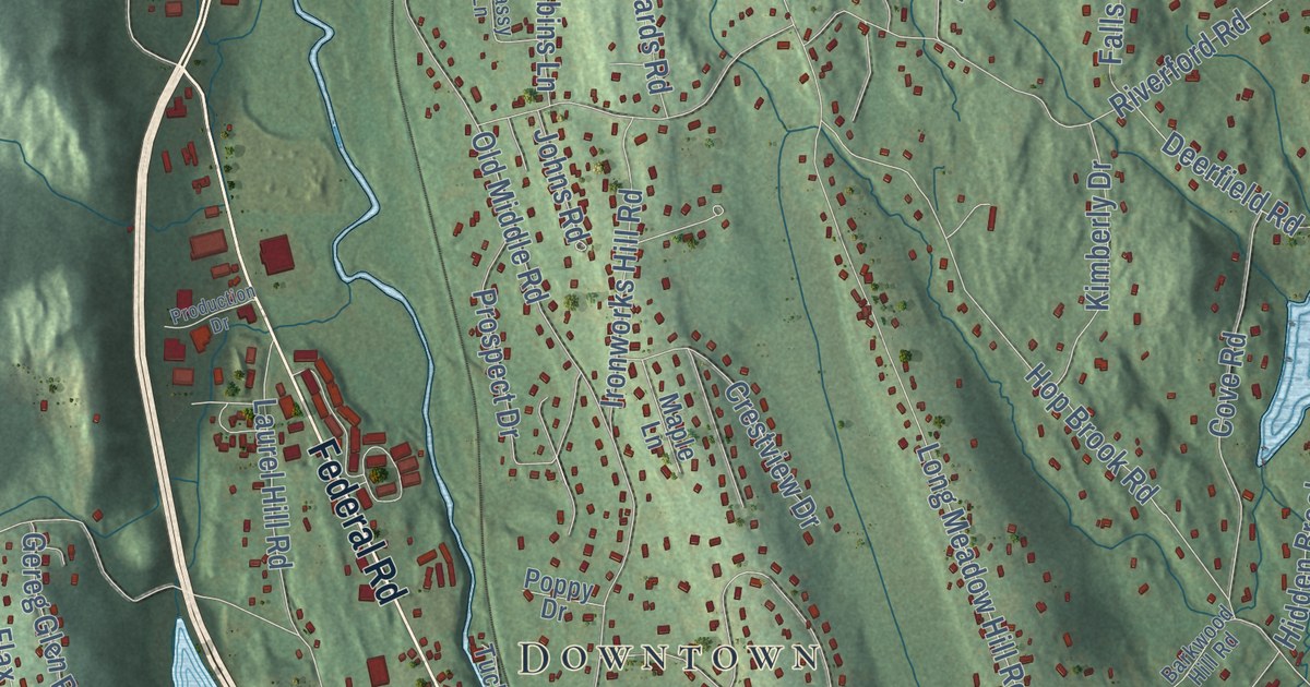
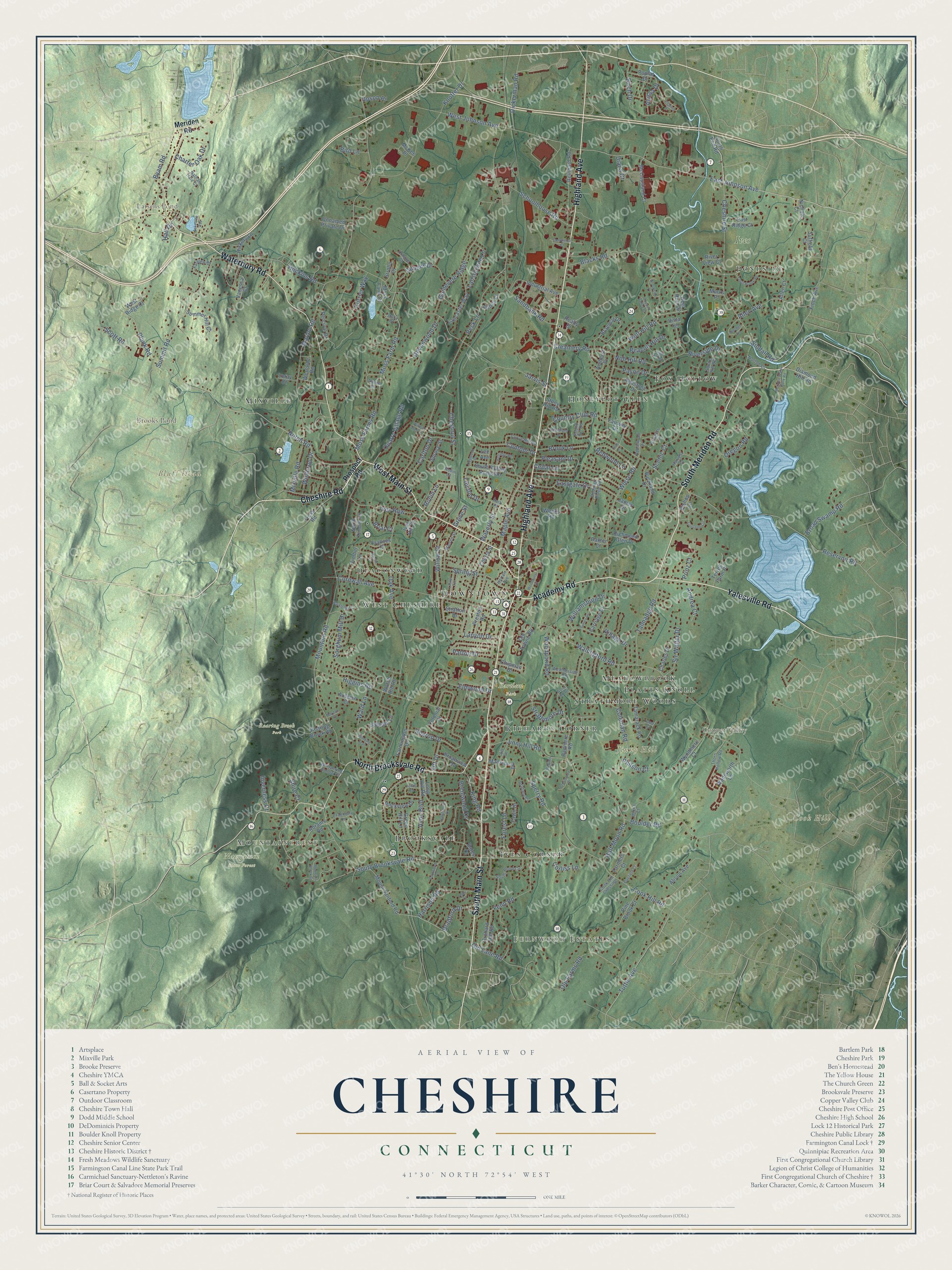
This beautifully detailed map of Cheshire, Connecticut was created in 2026 using aerial imagery combined with modern topographical, census, street and landmark data. It’s a one-of-a-kind view of Cheshire that combines accurate data with a vintage aesthetic. The map shows every building in its true location, many of the roads carry their names, and the shaded topographic relief shows the shape of the land.
See it on a wall
The Cheshire map as an 18 x 24 inch print in a black frame.

Explore an aerial view of Cheshire, Connecticut
On the map you’ll find Downtown, Mountaincrest, Fernwood Estates, Bluff Head, Cook Hill, Copper Valley, Jinny Hill, Brooks Pond, Larsens Pond, Bartlem Park, Ives Farm, Naugatuck State Forest, and more. If you look closely you can even find your house accurately drawn in its correct location. Zoom in on the preview to look for yours. Click here to learn more about the history of Cheshire.
Take a closer look at the Cheshire map
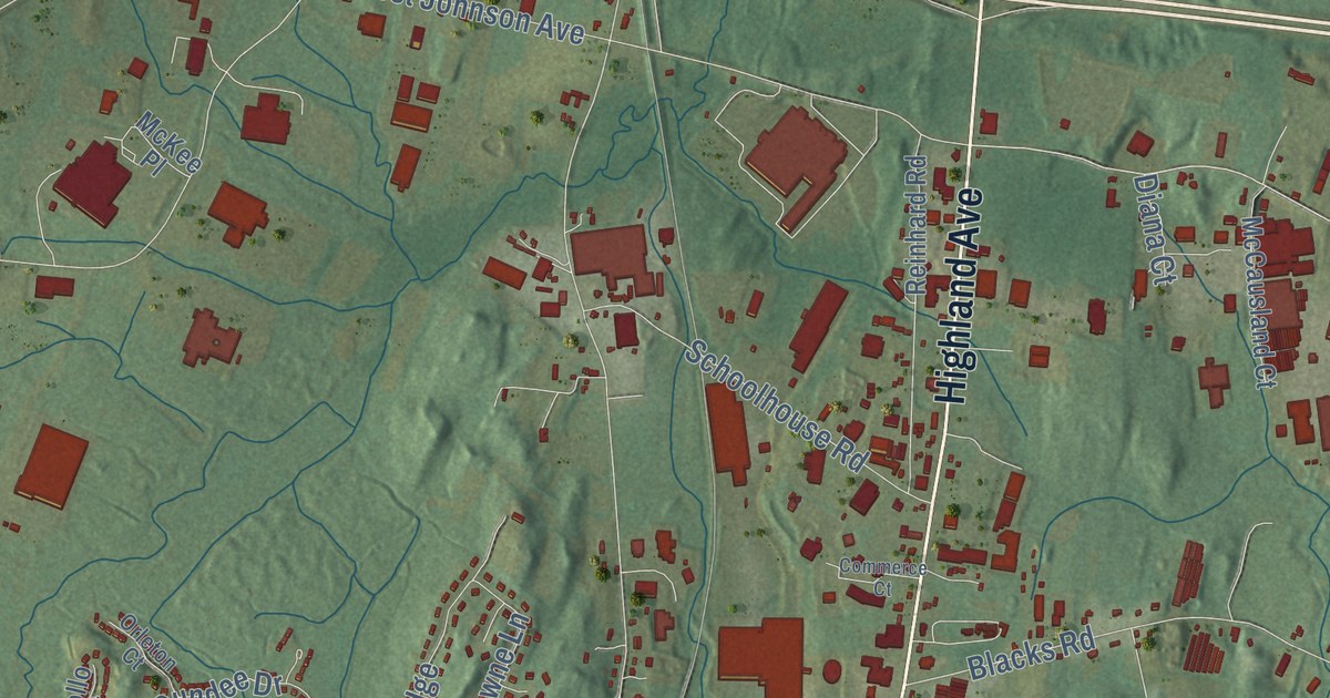
Click to explore a larger preview. The digital watermark does not appear on printed maps.
Names on this map
These names are printed on this map.
Places: Downtown, Mountaincrest, Fernwood Estates, Bluff Head, Cook Hill, Copper Valley, Jinny Hill, Brooks Pond, Larsens Pond, Bartlem Park, Ives Farm, Naugatuck State Forest, Roaring Brook Park, Honeypot Glen, Fox Hollow, Mixville, Deaconwood, Ives Corner, Richards Corner, Brooksvale, Strathmore Woods, Meadowbrook, West Cheshire, Pondside and Platts Knoll.
Streets and roads: South Main Street, South Meriden Road, West Main Street, Academy Road, Cheshire Road, Highland Avenue, Waterbury Road, North Brooksvale Road, Yalesville Road, Cheshire Street, East Johnson Avenue, Notch Road.
More street names, A to Z
Abbey Court, Abrams Road, Alison Avenue, Allen Avenue, Allen Court, Alpine Drive, Alyssa Drive, Amherst Place, Andrea Court, Applewood Drive, Autumn Court, Avon Boulevard, Bardon Court, Barkledge Court, Barytes Drive, Bates Drive, Baxter Court, Beacon Hill Drive, Belridge Road, Birch Drive, Bird Lane, Bishop Lane, Blacks Road, Bluefield Court, Boulder Road, Bradford Drive, Braemar Drive, Brentwood Drive, Briar Court, Bridgets Lane, Brittany Court, Broad Swamp Road, Broadview Road, Brook Lane, Brookside Place, Buckland Drive, Budding Ridge Road, Byam Road, Carlton Drive, Carriage Drive, Cedar Lane, Charles Drive, Charter Oak Drive, Cherry Street, Chestnut Street, Chipman Drive, Club Lane, Coleman Road, Colonial Court, Commerce Court, Contour Drive, Cook Hill Crossing, Cook Hill Road, Copper Valley Court, Corliss Lane, Cornwall Avenue, Cortland Circle, Country Club Road, Cranberry Lane, Creamery Road, Crestwood Drive, Currier Way, Curve Hill Road, Deer Run Circle, Devonwood Drive, Diamond Hill Road, Diana Court, Dickerman Road, Dogwood Drive, Dundee Drive, Eastgate Drive, East Ridge Court, Elmwood Drive, Fairway Drive, Farmers Court, Farmington Drive, Farview Drive, Fawn Drive, Fenn Road, Fernwood Lane, Finch Avenue, Forest Lane, Frances Court, Green Hill Lane, Grove Street, Guinevere Ridge, Half Moon Road, Hall Drive, Harrison Road, Harvest Court, Hawthorne Drive, Hickory Lane, Higgins Road, Horton Avenue, Huckins Road, Industrial Avenue, Inverness Court, Ives Hill Court, Ives Row, James Drive, Jarvis Street, Jill Lane, Jinny Hill Road, King Road, Knotter Drive, Lakeview Avenue, Lancaster Way, Lansdowne Lane, Lanyon Drive, Laurel Terrace, Lee Avenue, Lewis Road, Lincoln Drive, Long Hill Road, Loray Court, Mansion Road, Maple Avenue, Marion Road, Marks Place, McCausland Court, McKee Place, Meriden Road, Meriden Water Work Road, Minna Court, Mixville Road, Moss Farm Court, Moss Farm Road, Moss Farms Road, Mountain Brook Drive, Mountain Road, Mount Sanford Road, Nathan Hale Court, Nichole Court, Nob Hill Road, North Timber Lane, Norton Lane, Oak Avenue, Old Farms Road, Old Lane Road, Old Towne Road, Orchard Hill Road, Oregon Road, Orleton Court, Ott Drive, Park Place, Patton Drive, Payne Drive, Peck Lane, Percival Drive, Philson Court, Pine Brook Court, Plank Road, Pleasant Drive, Poplar Drive, Preston Road, Prinz Court, Prospect Road, Quarry Village Road, Radmere Road, Realty Drive, Redstone Drive, Redwood Lane, Reinhard Road, Reservoir Road, Richmond Glen Drive, Riverside Drive, River View Court, Roaring Brook Road, Robin Court, Robin Lane, Rockview Drive, Round Hill Road, Rustic Lane, Sandbank Road, Scenic Court, Schoolhouse Road, Scott Road, Sharon Drive, Shire Court, Side Hill Road, Sindall Road, Sir Walter Drive, Sorghum Mill Drive, South Brooksvale Road, South End Road, South Pond Circle, South Rolling Acres Road, Sperry Road, Spring Street, Spruce Street, Squire Hill Road, Stacy Court, Stony Hill Road, Strathmore Drive, Stratton Drive, Strollo Court, Suffield Court, Summer Hill Court, Summit Road, Surrey Drive, Talmadge Road, Tamarack Road, Teds Court, Terrell Farm Place, Thorn Hollow Road, Timber Lane, Towpath Lane, Tress Road, Trout Brook Road, Tudor Court, Tuttle Avenue, Unnamed Private Drive, Upson Place, Vanessa Court, Victoria Drive, Village Drive, Vista Terrace, Wadsworth Lane, Wallingford Road, Ward Lane, Warren Street, Watch Hill Road, Waverly Street, Weatherside Road, Weeks Road, West Johnson Avenue, West Ridge Court, Westside Road, Whispering Hollow Court, Wiese Road, Williamsburg Drive, Willow Street, Willow Well Court, Winding Trail, Winthrop Drive, Wolf Hill Road, Woodbury Court, Wood Hill Road, Woodland Drive, Woodpond Road, Worden Circle, Wyndmere Court.
This beautifully detailed map of Cheshire makes an attractive addition to your office, library, or den, and it can even be used to teach children the geography and history of the area. It also makes a great gift for someone who left Cheshire and still calls it home. When you’re done exploring, click here to get your copy of the Cheshire map.