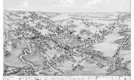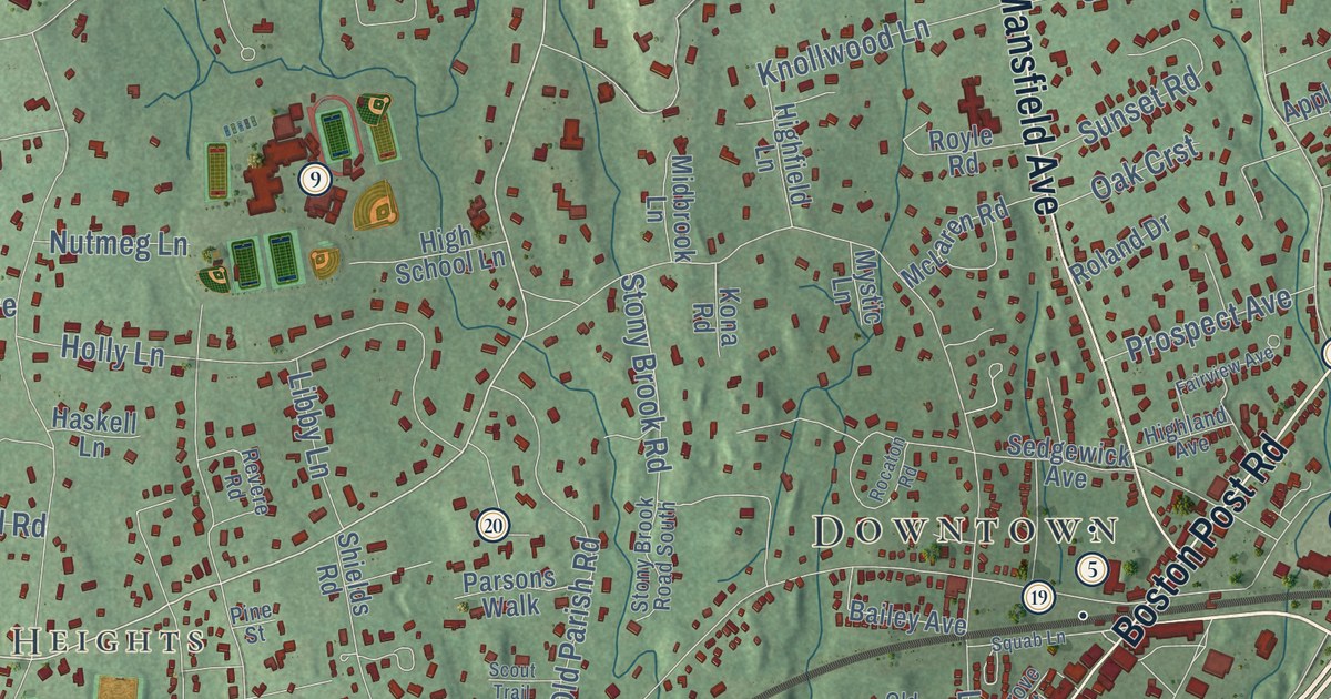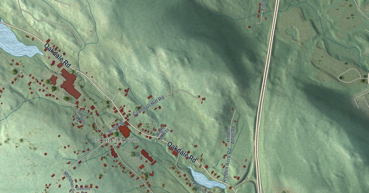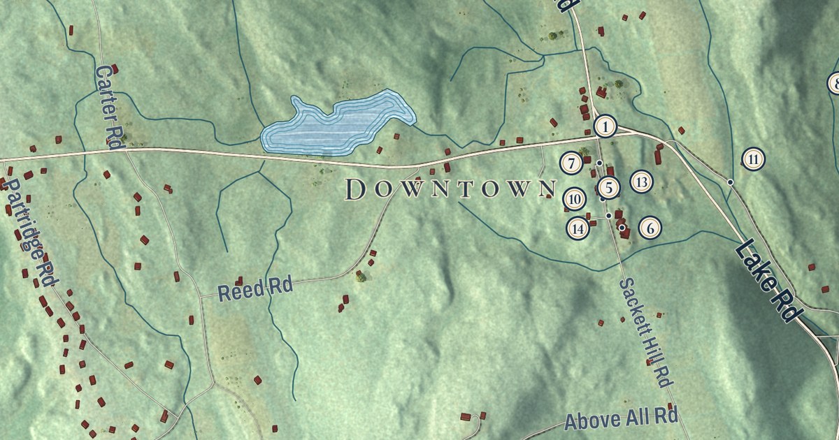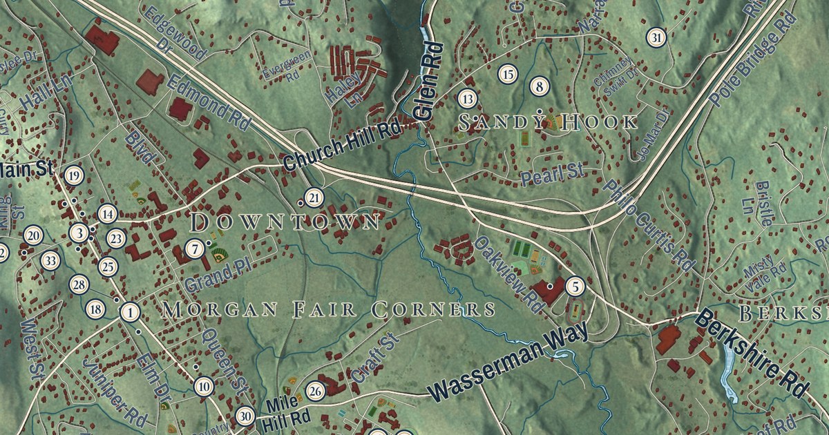
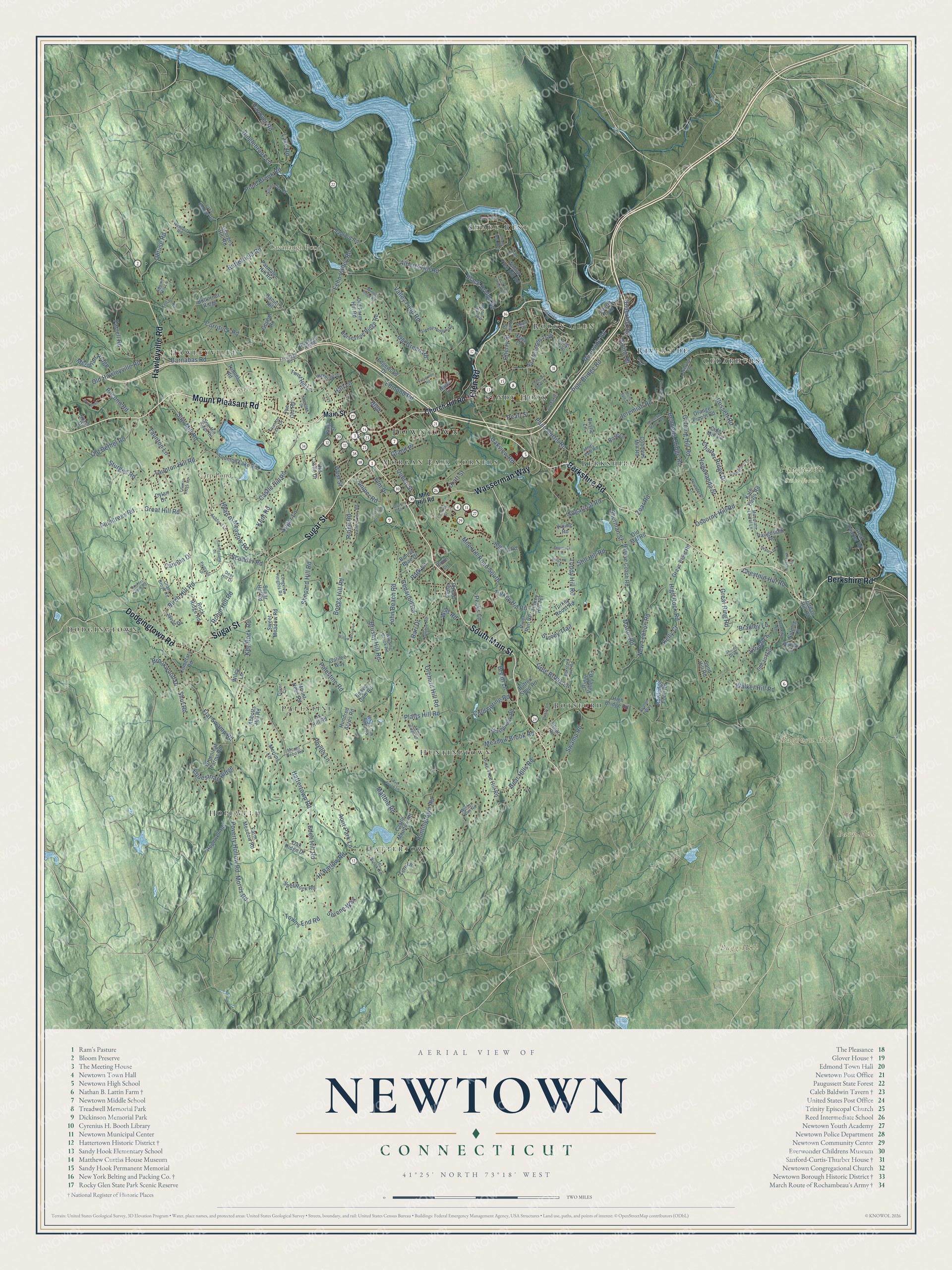
This beautifully detailed map of Newtown, Connecticut was created in 2026 using aerial imagery combined with modern topographical, census, street and landmark data. It’s a one-of-a-kind view of Newtown that combines accurate data with a vintage aesthetic. The map shows every building in its true location, many of the roads carry their names, and the shaded topographic relief shows the shape of the land.
See it on a wall
The Newtown map as an 18 x 24 inch print in a black frame.

Explore an aerial view of Newtown, Connecticut
On the map you’ll find Downtown, Bagburn Hill, Barn Hill, Barnabas Hill, Bugg Hill, Carp Pond, Cavanaugh Pond, Paugussett State Forest, Hopewell, Botsford, Shady Rest, Dodgingtown, and more. If you look closely you can even find your house accurately drawn in its correct location. Zoom in on the preview to look for yours. Click here to learn more about the history of Newtown.
Take a closer look at the Newtown map
Click to explore a larger preview. The digital watermark does not appear on printed maps.
Names on this map
These names are printed on this map.
Places: Downtown, Bagburn Hill, Barn Hill, Barnabas Hill, Bugg Hill, Carp Pond, Cavanaugh Pond, Paugussett State Forest, Hopewell, Botsford, Shady Rest, Dodgingtown, Huntingtown, Berkshire, Riverside, Palestine, Cedarhurst, Hattertown, Rocky Glen, Sandy Hook, Morgan Fair Corners and Hawleyville.
Streets and roads: South Main Street, Sugar Street, Mount Pleasant Road, Glen Road, Berkshire Road, Hawleyville Road, Wasserman Way, Dodgingtown Road, Hattertown Road, Poverty Hollow Road, Riverside Road, Eden Hill Road.
More street names, A to Z
Abbotts Hill Road, Adams Hill Lane, Alberts Hill Road, Alpine Drive, Antler Pine Road, Arlyn Ridge Road, Ashford Lane, Aunt Park Lane, Avalon Way, Bari Drive, Barnabas Road, Bear Hills Road, Beaver Dam Road, Bennetts Bridge Road, Birch Hill Road, Black Bridge Road, Blakeslee Drive, Boggs Hill Road, Bonnie Brae Drive, Botsford Hill Road, Boulder Creek Road, Boulevard, Bradley Lane, Bristle Lane, Brookwood Drive, Brushy Hill Road, Bryan Lane, Butterfield Road, Butternut Ridge, Button Shop Road, Cannon Drive, Canterbury Lane, Castle Hill Road, Castle Meadow Road, Cedarhill Road, Cedar Hill Road, Cemetary Road, Charter Ridge Drive, Cherry Street, Chestnut Hill Road, Chimney Swift Drive, Church Hill Road, Cider Mill Road, Cobblers Mill Road, Cobblestone Lane, Cochran Street, Cold Spring Road, Country Club Road, Craft Street, Cross Brook Road, Currituck Road, Curry Drive, Daniel's Hill, Deep Brook Road, Deerfield Drive, Deer Hill Drive, Dinglebrook Lane, Dover Circle, Dusty Lane, Dylan Drive, Echo Valley Road, Edgelake Drive, Edgewood Drive, Edmond Road, Elm Drive, Equestrian Ridge, Evergreen Road, Farm Field Ridge Road, Farm Meadow Road, Farrell Road, Fern Lane, Flat Swamp Road, Ford Road, Forest Drive, Founders Lane, Frontage Road, Galilee Way, Gelding Hill Road, Georges Hill Road, Gopher Road, Grand Place, Grays Plain Road, Great Hill Road, Great Quarter Road, Great Ring Road, Greenleaf Farms Road, Haley Lane, Hall Lane, Hanover Road, Head of Meadow Road, Hi Barlow Road, High Bridge Road, High Rock Road, Hitfield Road, Honey Lane, Hopewell Road, Horseshoe Ridge Road, Hoseye Coach Road, Housatonic Drive, Hundred Acres Road, Huntingtown Road, Hyvue Drive, Indian Hill, Jeremiah Road, Jet Brook Road, John Beach Road, Jo Mar Drive, Jordan Hill Road, Juniper Road, Kale Davis Road, Kelly Court, Kenan Road, Kent Road, Key Rock Road, King Street, Lake George Road, Lake Road, Lakeview Terrace, Laurel Trail, Little Brook Lane, Longview Heights Road, Lyrical Lane, Main Street, Maltbie Road, Maple Drive, Marlin Road, Meadow Brook Road, Meridian Ridge, Merlins Lane, Mile Hill Road, Mile Hill Road South, Misty Vale Road, Miya Lane, Morris Road, Mountain Laurel Lane, Mountain Manor Road, Mount Nebo Road, Narragansett Trail, Newbury Road, New Lebbon Road, Nighthawk Lane, Nutmeg Lane, Oak Ridge Drive, Oakview Road, Obtuse Road, Old Bethel Road, Old Castle Drive, Old Farm Hill Road, Old Green Road, Old Hawleyville Road, Old Mill Road, Orange Pippin Road, Orchard Hill Road, Osborne Hill Road, Overlook Drive, Ox Hill Road, Palestine Road, Papoose Hill Road, Park Lane, Parmalee Hill Road, Partridge Lane, Paugussett Road, Pearl Street, Pebble Road, Pecks Lane, Philo Curtis Road, Phyllis Lane, Pilgrim Lane, Pine Street, Pine Tree Hill Road, Platts Hill Road, Plumtrees Road, Pocono Road, Pole Bridge Road, Pond Brook Road, Queen Street, Ridge Road, Ridge Valley Road, River Run Road, Robin Hill Road, Rock Ridge Road, Rose Lane, Rowledge Pond Road, Russett Road, Sand Hill Road, Sanford Road, Saw Mill Ridge Road, Saw Mill Road, Scudder Road, Serene Way, Serenity Lane, Shady Rest Boulevard, Shared Dvwy, Shepard Hill Road, Sherman Street, Shut Road, Silver Brook Lane, Silver City Road, Simm Lane, Skytop Drive, Sleepy Hollow Road, Split Rock Road, Still Hill Road, Stone Gate Drive, Stuart Drive, Sturges Road, Sugar Hill Road, Sugar Lane, Sugarloaf Road, Surrey Trail, Suzie Drive, Swamp Road, Sweetbriar Lane, Sweet Meadow Road, Taunton Hill Road, Taunton Lake Drive, Taunton Lake Road, Taunton Lane, Taunton Ridge Road, The Old Road, Toddy Hill Road, Totem Trail, Towns End Road, Tunnel Road, Turkey Hill Road, Turkey Hill Terrace, Turkey Roost Road, Twist Hill Lane, Underhill Road, Valley Field Road, Valley View Road, Vining Road, Walker Hill Road, Walnut Tree Hill Road, Washbrook Road, West Street, White Oak Farm Road, Wiley Lane, Willow Brook Lane, Wills Road, Winding Brook Road, Winter Ridge Road, Winton Farm Road, Woods Lane, Yogananda Street, Zoar Road.
This beautifully detailed map of Newtown makes an attractive addition to your office, library, or den, and it can even be used to teach children the geography and history of the area. It also makes a great gift for anyone with Newtown roots. When you’re done exploring, click here to get your copy of the Newtown map.