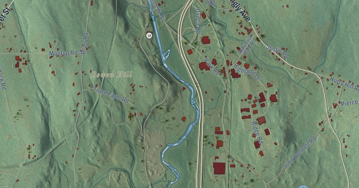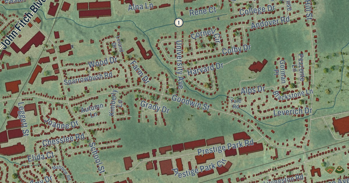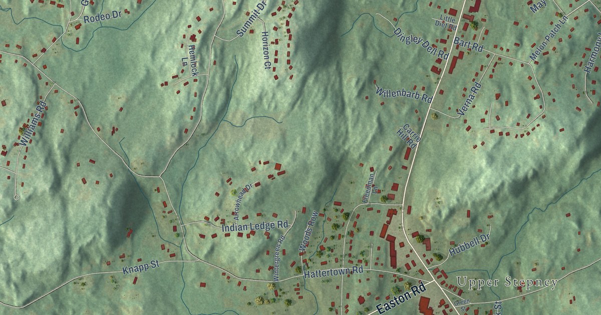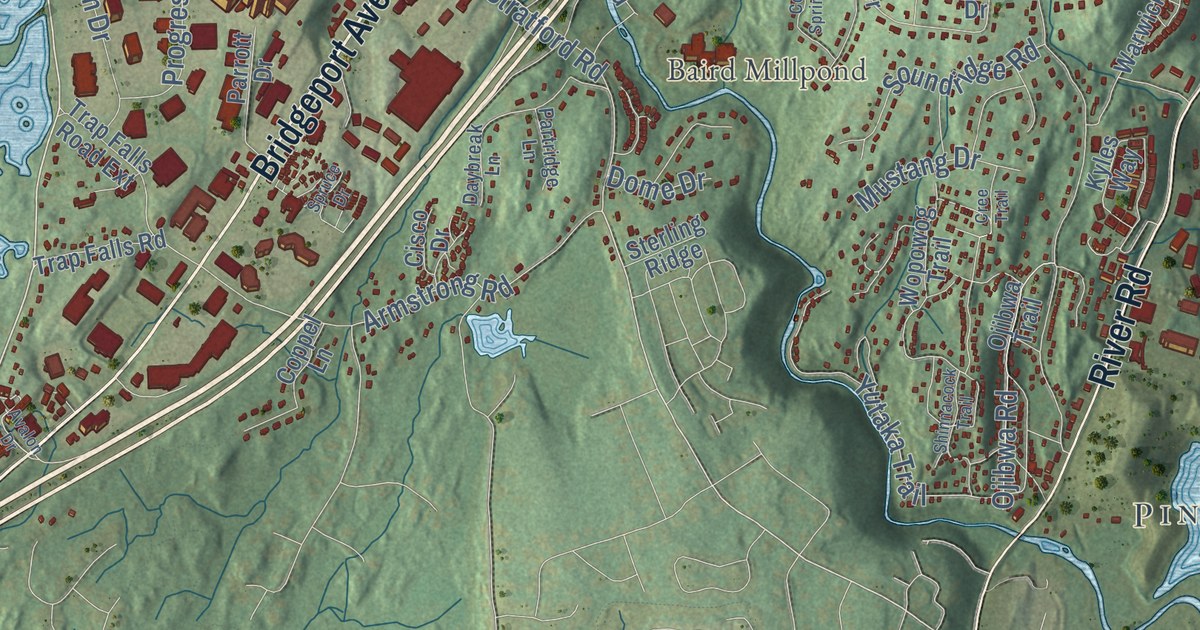
This beautifully detailed map of Shelton, Connecticut was created in 2026 using aerial imagery combined with modern topographical, census, street and landmark data. It’s a one-of-a-kind view of Shelton that combines accurate data with a vintage aesthetic. The map shows every building in its true location, many of the roads carry their names, and the shaded topographic relief shows the shape of the land.
See it on a wall
The Shelton map as an 18 x 24 inch print in a black frame.

Explore an aerial view of Shelton, Connecticut
On the map you’ll find Downtown, Pine Rock Park, Bagburn Hill, Barn Hill, Booth Hill, Ansonia Reservoir, Baird Millpond, Jones Family Farms, Wiacek Open Space, Huntington, Sunnyside, White Hills, and more. If you look closely you can even find your house accurately drawn in its correct location. Zoom in on the preview to look for yours. Click here to learn more about the history of Shelton.
Take a closer look at the Shelton map
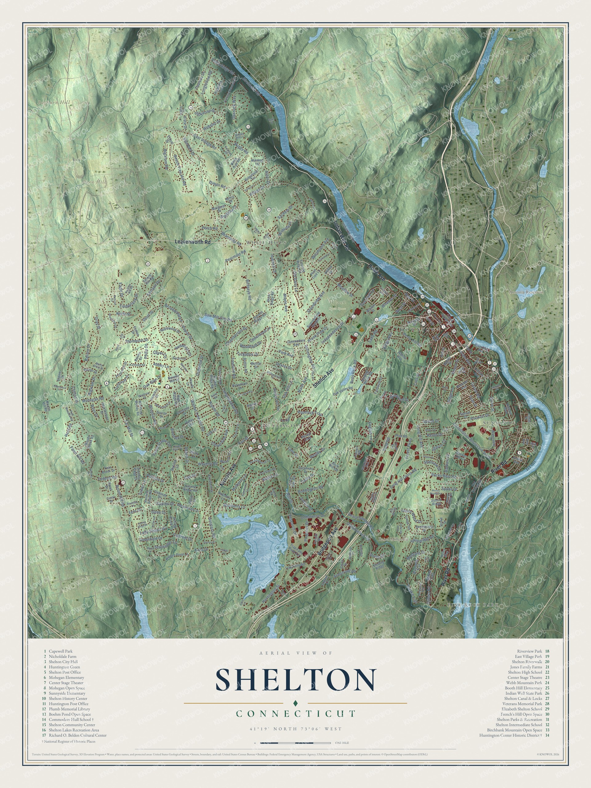
Click to explore a larger preview. The digital watermark does not appear on printed maps.
Names on this map
These names are printed on this map.
Places: Downtown, Pine Rock Park, Bagburn Hill, Barn Hill, Booth Hill, Ansonia Reservoir, Baird Millpond, Jones Family Farms, Wiacek Open Space, Huntington, Sunnyside, White Hills and Woodland Park.
Streets and roads: Bridgeport Avenue, Shelton Avenue, Nichols Avenue, Indian Well Road, Howe Avenue, Leavenworth Road, River Road, Booth Hill Road, Huntington Street, Coram Road, Ripton Road, Coram Avenue.
More street names, A to Z
Abbey Lane, Adams Drive, Ann Avenue, Applewood Drive, April Lane, Armstrong Road, Asbury Ridge, Asbury Ridge Road, Aspetuck Trail, Astor Drive, Autumn Ridge Road, Avalon Drive, Ballaro Drive, Barbara Drive, Barry Road, Basking Brook Road, Bayberry Lane, Beacon Hill Terrace, Beard Sawmill Road, Beardsley Road, Beecher Avenue, Beech Tree Hill Road, Belle Lane, Beverly Hill Drive, Big Horn Road, Birchbank Road, Birch Street, Birdseye Road, Blueberry Lane, Bonita Drive, Brentley Drive, Broc Terrace, Brook Pine Drive, Brookwood Lane, Brownson Drive, Buck Hill Road, Buddington Road, Bunker Hill Circle, Buttercup Lane, Button Road, Cali Drive, Cameo Drive, Canal Street East, Canfield Drive, Capitol Drive, Cathy Drive, Cayer Circle, Cedar Hill Road, Cedarwood Lane, Centerview Drive, Chamberlain Drive, Christine Drive, Cisco Drive, Cliff Street, Clinton Drive, Cloverdale Avenue, Cold Spring Circle, Commerce Drive, Commodore Avenue, Constitution Boulevard South, Coppel Lane, Coral Drive, Cots Street, Country Ridge Drive, Courtland Road, Cree Trail, Cribbins Avenue, Cynthia Lane, Dartmouth Drive, Daybreak Lane, Deborah Drive, Dexter Drive, Dickinson Drive, Dimon Road, Dogwood Drive, Dome Drive, Driftwood Lane, Eagle Drive, Earl Street, East Village Road, Elaine Drive, Elderberry Lane, Elizabeth Street, Elliott Drive, Emerald Ridge Court, English Lane, Fairlane Drive, Fairoaks Drive, Falmouth Drive, Far Mill Street, Fawn Hill Road, Federal Road, Fern Drive, Forest Parkway, Foxhunt Road, Fox Run, Freedom Way, Gene Drive, Golden Hill Lane, Gray Street, Great Oak Road, Greenacre Drive, Greenfield Drive, Greenwood Lane, Grove Street, Hamilton Drive, Haverhill Drive, Hawks Ridge Drive, Hawley Road, Hearthstone Drive, Heather Hill Road, Henry Drive, Hiawatha Trail, Hickory Lane, Hidden Pond Lane, High Meadow Road, High Ridge Road, High Street, Hillside Avenue, Hill Street, Hilltop Drive, Horse Stable Circle, Hubbell Lane, Hull Street, Hunters Ridge Road, Hurd Road, Independence Drive, Isinglass Road, Ivy Lane, Jenyfer Court, Jordan Avenue, Judson Street, Kathleen Road, Kazo Drive, Keron Drive, Kings Highway, King Street, Kneen Street, Kyles Way, Ladas Place, Lady Slipper Drive, Lagana Lane, Lake Road, Lane Street, Laurel Glen Drive, Laurel Wood Drive, Lily Lane, Longfellow Road, Long Hill Avenue, Long Hill Cross Road, Longmeadow Road, Lucille Drive, Lynne Terrace, Main Street, Maler Avenue, Maltby Street, Maple Avenue, Maple Lane, Margaret Drive, Maria Alicia Drive, Martinka Drive, Matilda Lane, Meadowlark Drive, Meadow Street, Meghan Court, Mill Street, Mimosa Lane, Misty Lane, Mohegan Road, Molnar Drive, Moose Hill Road, Mulberry Lane, Mustang Drive, Nature Lane, Navajo Loop, Nells Rock Road, New Castle Drive, New Street, North Street, Nutmeg Lane, Oak Avenue, Oak Glen Drive, Oak Hill Lane, Oak Street, Oak Valley Road, Ojibwa Road, Ojibwa Trail, Okenuck Way, Old Coram Road, Old Dairy Lane, Old Mill Road, Old Stratford Road, Olin Court, Oliver Terrace, Park Avenue, Park Street, Parrott Drive, Partridge Lane, Patricia Drive, Pearmain Road, Perch Road, Perry Avenue, Perry Hill Road, Philip Drive, Pine Street, Plante Lane, Plaskon Drive, Platt Road, Plum Tree Lane, Poplar Drive, Princess Wenonah Drive, Princeton Drive, Progress Drive, Quail Court, Quaker Ridge Road, Rayo Drive, Redwood Circle, Reed Lane, Reiner Drive, Research Drive, Richard Boulevard, Ridgefield Terrace, Ridge Lane, Riverdale Avenue, Roaring Brook Lane, Roberts Street, Robin Lane, Rock Ridge Road, Rocky Rest Road, Rodia Ridge Road, Rolling Brook Lane, Rolling Ridge Road, Rouleau Lane, Rugby Road, Sachem Drive, Saranor Drive, Saw Mill City Road, School Street, September Lane, Sharon Court, Sharon Drive, Shelview Drive, Shinnacock Trail, Short Street, Sorel Drive, Soundcrest Drive, Soundridge Road, Soundview Avenue, Soundview Drive, Spoke Drive, Spruce Drive, Spruce Hill Road, Squire Lane, Stendahl Drive, Sterling Ridge, Stowe Drive, Summerfield Gardens, Summit Ridge Road, Sunrise Circle, Sunset Drive, Sunwood Drive, Suren Lane, Surrey Drive, Sycamore Drive, Sylvan Drive, Tahmore Place, Ten Coat Lane, Thompson Street, Thoreau Drive, Timberlane Drive, Timothy Lane, Toas Street, Todd Road, Tory Lane, Tower Lane, Trap Falls Road, Trap Falls Road Extension, Treeland Road, Tuckahoe Drive, Twin Brook Drive, Valley Road, Village Drive, Vista Drive, Wabuda Place, Walnut Avenue, Walnut Tree Hill Road, Warwick Lane, Waterview Drive, Waverly Road, Waverly Terrace, Webster Drive, Wesley Drive, Wesley Heights Road, West Street, Wheeler Street, Whipporwill Drive, White Oak Road, Wigwam Drive, William Street, Willoughby Road, Windsor Road, Winthrop Drive, Winthrop Woods Road, Wooded Lane, Woodfield Drive, Woodsend Avenue, Woods Grove Road, Wooster Street, Wopowog Trail, Yutaka Trail.
This beautifully detailed map of Shelton makes an attractive addition to your office, library, or den, and it can even be used to teach children the geography and history of the area. It also makes a great gift for anyone with Shelton roots. When you’re done exploring, click here to get your copy of the Shelton map.