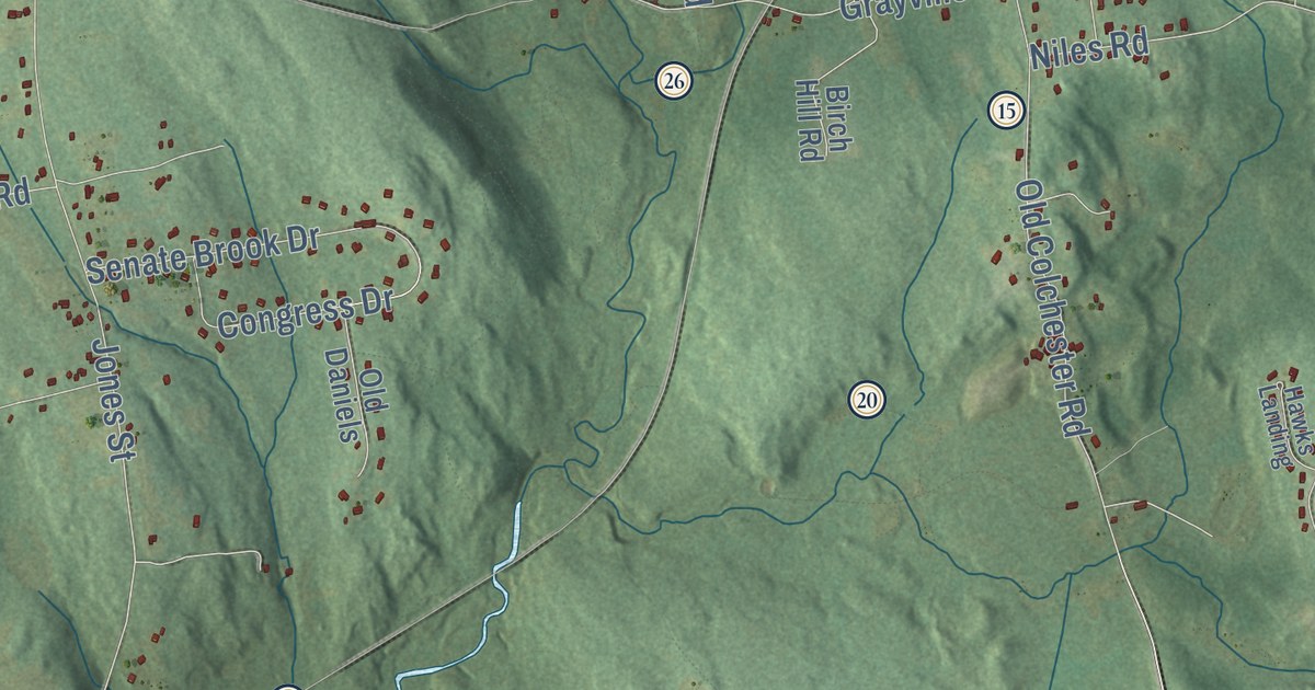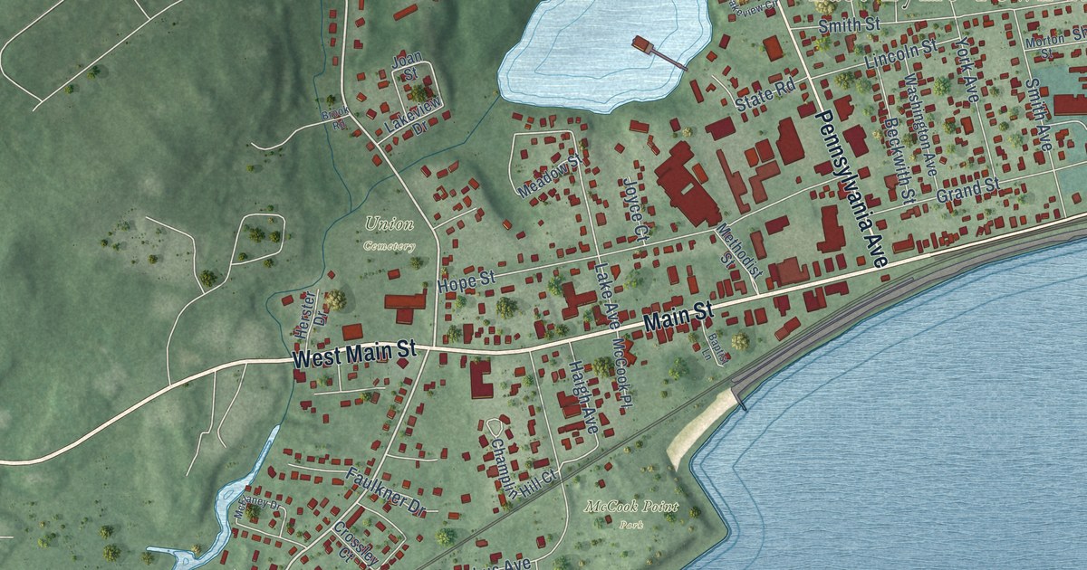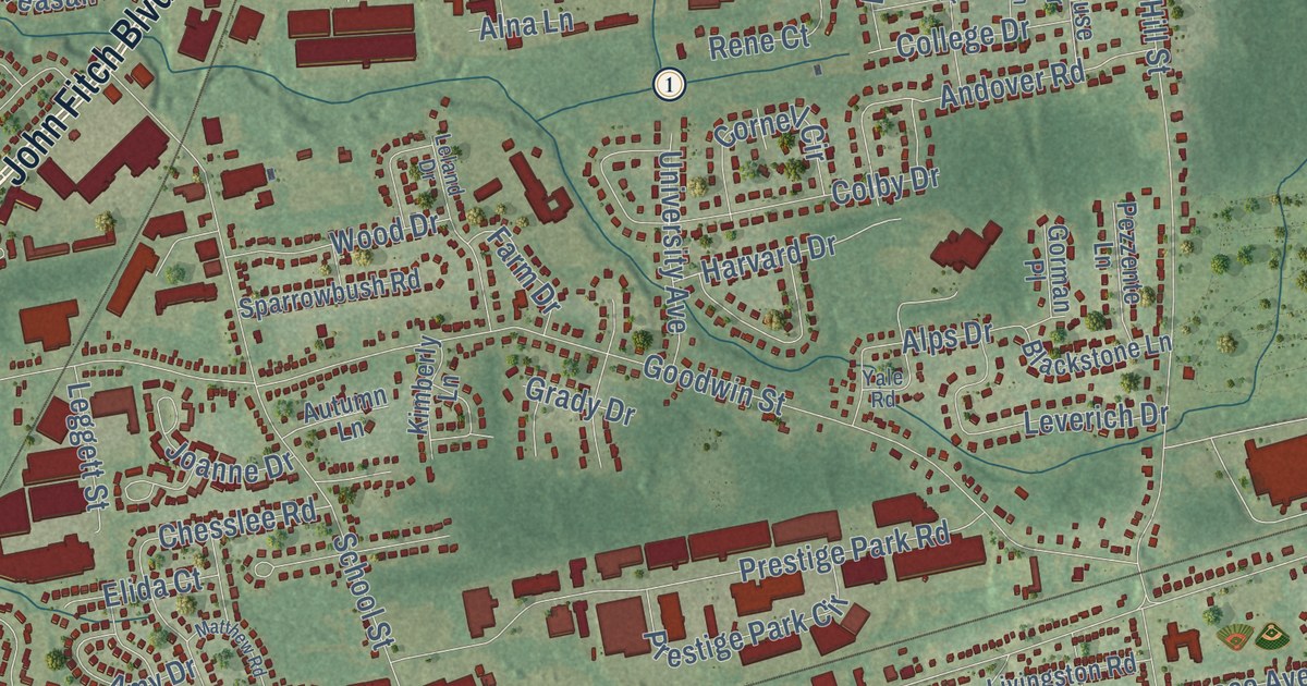
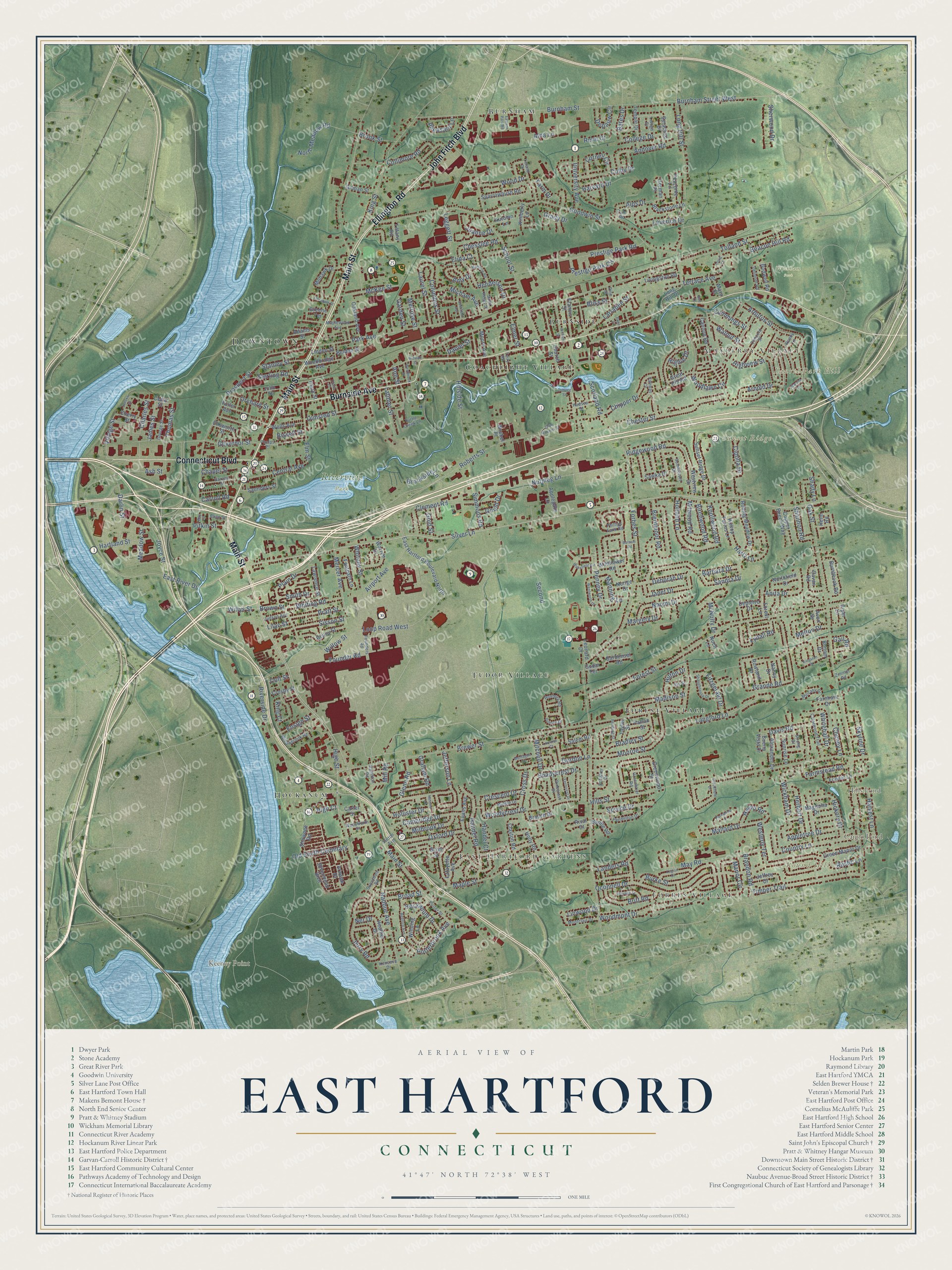
This beautifully detailed map of East Hartford, Connecticut was created in 2026 using aerial imagery combined with modern topographical, census, street and landmark data. It’s a one-of-a-kind view of East Hartford that combines accurate data with a vintage aesthetic. The map shows every building in its true location, many of the roads carry their names, and the shaded topographic relief shows the shape of the land.
See it on a wall
The East Hartford map as an 18 x 24 inch print in a black frame.

Explore an aerial view of East Hartford, Connecticut
On the map you’ll find Downtown, Forbes Village, Mayberry Village, East Hartford Gardens, Keeney Point, Laurel Park Hill, Round Hill, Sunset Ridge, Caiglo Pond, Hills Pond, Riverview Park, Wickham Park, and more. If you look closely you can even find your house accurately drawn in its correct location. Zoom in on the preview to look for yours. Click here to learn more about the history of East Hartford.
Take a closer look at the East Hartford map
Click to explore a larger preview. The digital watermark does not appear on printed maps.
Names on this map
These names are printed on this map.
Places: Downtown, Forbes Village, Mayberry Village, East Hartford Gardens, Keeney Point, Laurel Park Hill, Round Hill, Sunset Ridge, Caiglo Pond, Hills Pond, Riverview Park, Wickham Park, Tudor Village, Hockanum, Forest Village, Coachlight Village, Burnside and Burnham.
Streets and roads: Main Street, Ellington Road, Burnside Avenue, Connecticut Boulevard, John Fitch Boulevard, Silver Lane, Sisson Street, Mercer Avenue, High Street, Broad Street, East River Drive, Village Street.
More street names, A to Z
Adams Street, Airport Avenue, Alexander Drive, Alna Lane, Alps Drive, Amy Drive, Andover Road, Anita Drive, Ann Street, Applegate Lane, Appletree Drive, Arawak Drive, Arbutus Street, Arnold Drive, Ash Street, Atwood Lane, Autumn Lane, Avon Drive, Balsam Road, Bantle Road, Barbara Drive, Barbonsel Road, Bates Drive, Beacon Hill Road, Bedford Avenue, Belden Street, Bell Court, Bidwell Street, Birchwood Road, Bissell Street, Blackstone Lane, Blinn Street, Bliss Street, Bodwell Road, Bonner Drive, Bradley Street, Branch Drive, Brandon Road, Brentmoor Road, Brewer Street, Britt Road, Brookfield Drive, Brookside Lane, Brook Street, Brown Street, Buena Vista Drive, Burke Street, Burnbrook Road, Burnham Street, Burnham Street West, Cambridge Drive, Cannon Road, Carroll Road, Carter Street, Cavan Road, Cedar Street, Central Avenue, Chapel Street, Charles Street, Cheney Lane, Cherry Street, Chesslee Road, Chester Street, Chipper Drive, Church Street, Cipolla Drive, Clark Street, Clayton Road, Clement Road, Clune Court, Colby Drive, College Drive, Collimore Road, Colt Street, Columbus Street, Concord Street, Copper Beech Way, Cornell Circle, Cottage Street, Country Lane, Craig Court, Crescent Drive, Crestwood Trail, Crosby Street, Cross Drive, Cummings Street, Daniel Street, Darlin Street, Davis Road, Deborah Drive, Deerfield Avenue, Delmont Road, Depauw Circle, Depietro Drive, Dobson Drive, Eastern Park Road, East Hartford Boulevard North, Elida Court, Ellsworth Street, Elmer Street, Elm Street, Ensign Street, Evans Avenue, Fairway Court, Farm Drive, Farmstead Road, Farnham Drive, Ferncrest Drive, Fitzgerald Drive, Floradale Drive, Footpath Lane, Forbes Street, Forest Lane, Forest Street, Founder Road, Founders Road, Fowler Lane, Francis Street, Fuller Avenue, Gail Road, Garden Street, Garvan Street, George Street, Gilman Street, Glenn Road, Godar Terrace, Gold Street, Goodwin Street, Gordon Lane, Gorman Place, Gould Drive, Governor Street, Grady Drive, Graham Road, Grande Road, Great Hill Road, Greenbrier Road, Greene Terrace, Green Manor Drive, Greenwood Street, Hamilton Road, Handel Court, Handel Road, Hartland Street, Hartz Lane, Harvard Drive, Harvest Lane, Heather Drive, Heim Road, Henderson Drive, Herbert Drive, Heron Road, Hickory Drive, Higbie Drive, High Court, Highview Street, Hillside Street, Hills Street, Hilltop Farms Lane, Hilton Drive, Hockanum Drive, Holland Lane, Hollister Drive, Holly Road, Hudson Street, James Street, Janet Drive, Jay Street, Jefferson Lane, Jeffrey Drive, Jencks Street, Jerry Road, Joanne Drive, John Street, Joyce Street, Judson Avenue, Kencove Drive, Kimberly Lane, King Court, Kingston Drive, King Street, Knollwood Road, Lafayette Avenue, Landers Road, Langford Lane, Larrabee Street, Latimer Street, Laurel Street, Lawrence Street, Leggett Street, Legion Drive, Lehigh Drive, Leland Drive, Leonard Drive, Leverich Drive, Lilac Street, Linden Street, Linwood Drive, Livingston Road, Long Hill Drive, Long Hill Street, Loop Road West, Lorraine Court, Lydall Road, Madison Street, Magnolia Drive, Mallard Drive, Manning Lane, Manor Circle, Maple Street, Maplewood Avenue, Margery Drive, Mary Street, Matthew Road, May Road, May Street, McKee Street, McNulty Drive, Meadow Street, Melrose Street, Melton Drive, Michael Avenue, Middle Drive, Milbrook Drive, Mill Road, Milwood Road, Mitchell Drive, Mohawk Drive, Monroe Street, Montague Circle, Montclair Drive, Moore Avenue, Mulcahy Drive, Nancy Drive, Naomi Drive, Nassau Lane, Naubuc Avenue, Ner Drive, Noch Lane, Norige Drive, Northfield Drive, North Meadow Road, Nutmeg Lane, Oakland Avenue, Oak Street, Oconnell Drive, Olde Roberts Street, Old South Cemetary, Olmsted Street, Orchard Street, Oxford Drive, Park Avenue, Parkwood Drive, Patton Street, Pendelton Drive, Penney Drive, Pershing Street, Pezzente Lane, Pheasant Lane, Phelps Place, Phillips Farm Road, Pinecrest Drive, Pine Street, Piper Lane, Pitkin Street, Plain Drive, Porterbrook Avenue, Porter Street, Pratt Street, Prestige Park Circle, Prestige Park Road, Price Court, Prospect Street, Rene Court, Ridgewood Road, Risley Street, Rival Court, Rivermead Boulevard, Riverside Drive, Roberts Street, Rolling Meadow Drive, Rondy Lane, Rowland Drive, Roxbury Road, Rustic Lane, Saint Regis Street, Salem Road, Sandra Drive, Saunders Street, Sawka Drive, Schaffer Drive, School Street, Scotland Road, Scott Street, Second, Shadycrest Drive, Shady Lane, Shannon Road, Shaughnessy Drive, Shawnee Road, Sherwood Drive, Simmons Road, Skyline Drive, Smith Drive, Sparrowbush Road, Spruce Drive, Stanley Street, Sterling Road, Stevens Street, Strong Drive, Summerset Drive, Sunnydale Road, Sunrise Lane, Sunset Ridge Drive, Sutton Avenue, Syracuse Drive, Taylor Street, Temple Drive, Terrace Avenue, Terry Road, Thomas Street, Tiffany Road, Timber Trail, Tolland Street, Turtle Creek Lane, University Avenue, Wadsworth Street, Wakefield Circle, Walnut Street, Warren Drive, Wells Avenue, Wentworth Drive, Westbrook Street, Westerly Terrace, Westview Drive, Whitehall Drive, Whiting Road, Whitney Street, Wickham Drive, Wildflower Road, William Street, Willowbrook Road, Willow Street, Willys Street, Winding Lane, Woodbridge Avenue, Wood Drive, Woodlawn Circle, Woodmont Drive, Woodycrest Drive, Wrobel Place, Yale Road, Zimmer Road.
This beautifully detailed map of East Hartford makes an attractive addition to your office, library, or den, and it can even be used to teach children the geography and history of the area. It also makes a great gift for someone who left East Hartford and still calls it home. When you’re done exploring, click here to get your copy of the East Hartford map.