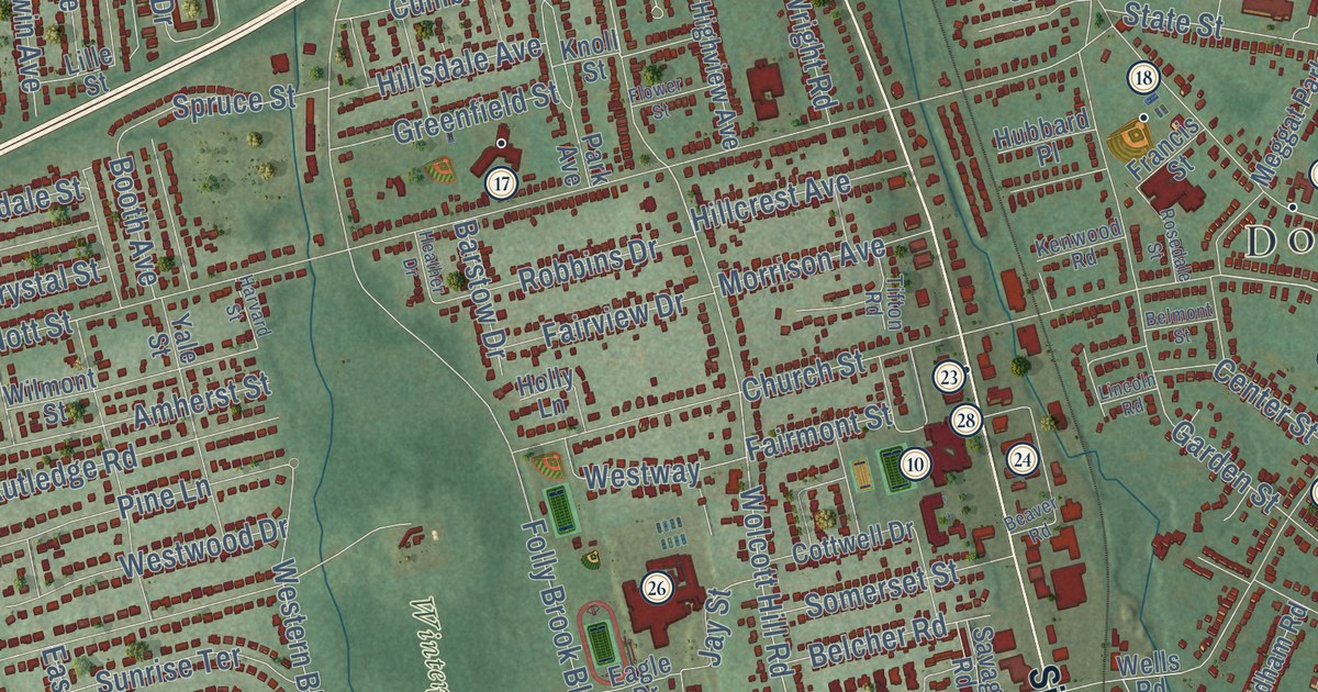
This beautifully detailed map of Wethersfield, Connecticut was created in 2026 using aerial imagery combined with modern topographical, census, street and landmark data. It’s a one-of-a-kind view of Wethersfield that combines accurate data with a vintage aesthetic. The map shows every building in its true location, many of the roads carry their names, and the shaded topographic relief shows the shape of the land.
See it on a wall
The Wethersfield map as an 18 x 24 inch print in a black frame.

Explore an aerial view of Wethersfield, Connecticut
On the map you’ll find Downtown, Griswoldville, Crow Point, Glastonbury Meadows, Hang-Dog Hill, Bell Pond, Bell Reservoir, Goodwin Park, Cedar Hill Cemetery, Cove Park, Mill Woods Park, Wintergreen Woods, and more. If you look closely you can even find your house accurately drawn in its correct location. Zoom in on the preview to look for yours. Click here to learn more about the history of Wethersfield.
Take a closer look at the Wethersfield map
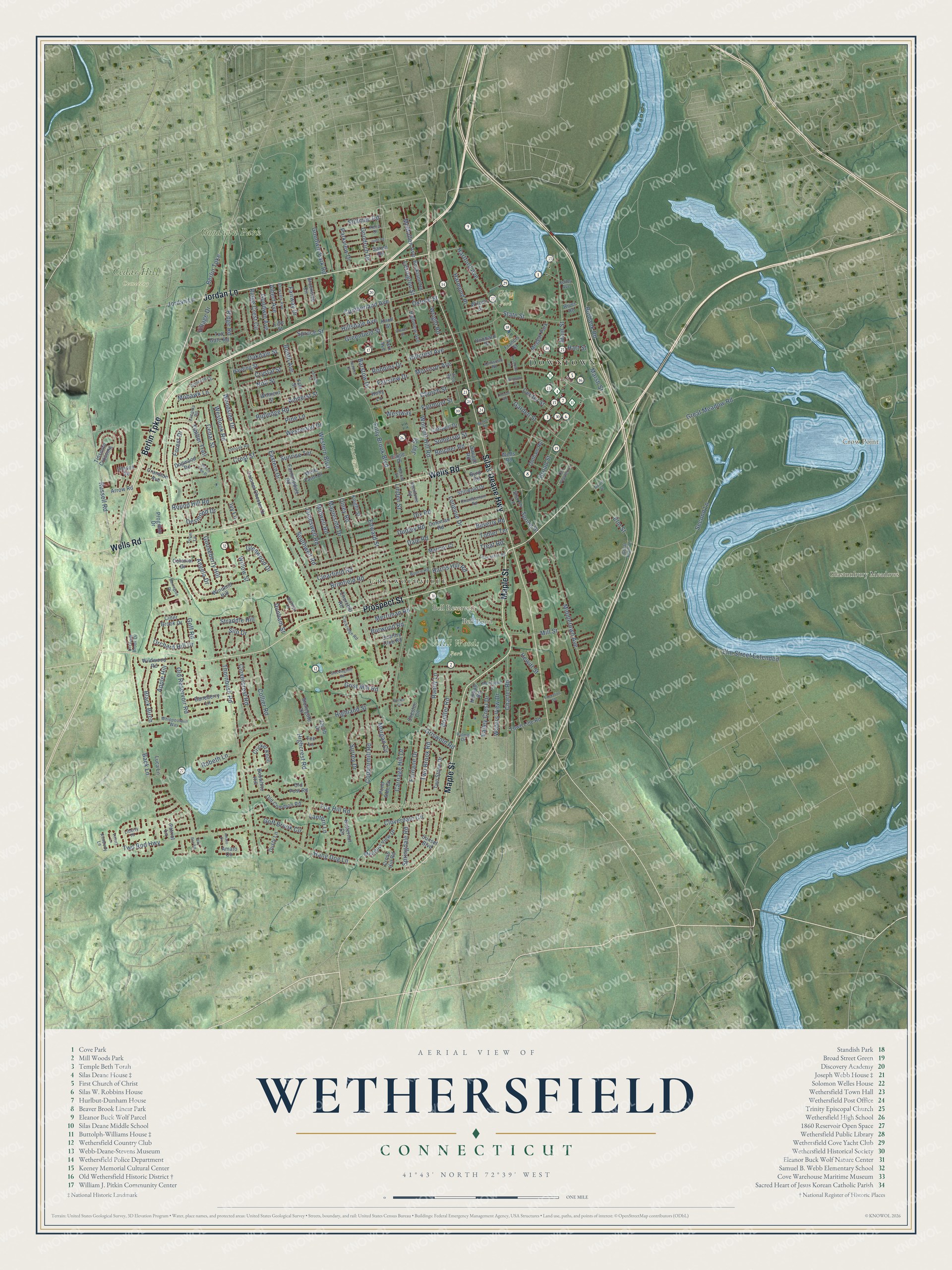
Click to explore a larger preview. The digital watermark does not appear on printed maps.
Names on this map
These names are printed on this map.
Places: Downtown, Griswoldville, Crow Point, Glastonbury Meadows, Hang-Dog Hill, Bell Pond, Bell Reservoir, Goodwin Park, Cedar Hill Cemetery, Cove Park, Mill Woods Park, Wintergreen Woods and Meggat Park.
Streets and roads: Wells Road, Maple Street, Berlin Turnpike, Jordan Lane, Silas Deane Highway, Prospect Street, Russell Road, Church Street, Marsh Street, Wolcott Hill Road, Elm Street Extended, Spring Street.
More street names, A to Z
Albert Avenue, Amato Circle, Amato Drive, Amherst Street, Angela Drive, Apple Hill, Arrow Road, Back Lane, Baileys Lane, Baneberry Lane, Barrington Drive, Barstow Drive, Bay Roc Road, Beaver Road, Beech Tree Drive, Belcher Road, Belmont Street, Beverly Road, Black Birch, Bobwhite Hill, Booth Avenue, Boulter Road, Brimfield Road, Broad Street, Brookside Circle, Brussels Avenue, Buckland Road, Bunce Road, Burbank Road, Burwood Road, Butternut Circle, Byrd Road, Carriage Hill Drive, Cedar Street, Center Street, Chamberlain Road, Charter Road, Cheston Circle, Churchill Road, Cider Brook Drive, Clarkridge Road, Clearfield Road, Clovercrest Road, Cloverdale Circle, Coleman Road, Collier Road, Colonel Chester Drive, Colonial Drive, Concord Circle, Coppermill Road, Cottwell Drive, Country Club Road, Cranston Avenue, Crest Street, Cricket Knoll, Cross Hill Road, Crystal Street, Cumberland Avenue, Dale Road, Desmond Drive, Dix Road, Dogwood Road, Dorlen Circle, Dudley Road, Dunham Street, Dusty Lane, Eagle Drive, Eastern Drive, Edward Street, Elm Street, Executive Square, Fairlane Drive, Fairmont Street, Fairview Drive, Fairway Drive, Farmingdale Road, Flower Street, Folly Brook Boulevard, Forest Drive, Fox Hill Road, Francis Street, Garden Street, Glenwood Drive, Goff Brook Circle, Goff Road, Goodrich Drive, Goodwin Avenue, Goodwin Park Road, Gooseberry Hill, Great Meadow Road, Great Plain Lane, Greenfield Street, Grist Mill Road, Griswold Road, Hang Dog Lane, Harding Street, Harmund Place, Harold Street, Harris Hill Road, Hartford Avenue, Hart Street, Harvard Street, Heather Drive, Hewitt Street, Highcrest Road, Highland Street, Highview Avenue, Hillcrest Avenue, Hillsdale Avenue, Holly Lane, Hubbard Place, Ivy Lane, Jacob Drive, Jameswell Road, Jay Street, Judd Road, Kelley Avenue, Kenwood Road, Kimball Road, Kimberly Lane, Knight Street, Knoll Street, Laconia Road, Lancaster Road, Lantern Lane, Lexington Street, Liberty Hl, Lille Street, Lincoln Road, Linden Street, Longvue Drive, Luca Lane, Main Street, Mapleside Drive, Marmor Court, McMullen Avenue, Meadow View Drive, Merriman Road, Middletown Avenue, Midwell Road, Mill Street, Mohawk Lane, Montague Street, Morgan Circle, Morrison Avenue, Morris Street, Nott Street, Oakdale Street, Old Common Road, Oldham Road, Old Pewter Lane, Old Post Road, Old Reservoir Road, Olesen Road, Olney Road, Onlook Road, Orchard Brook Drive, Orchard Hill Drive, Oxford Street, Palmer Drive, Park Avenue, Parkview Drive, Patriot Lane, Pine Lane, Pond Side Drive, Progress Drive, Randy Lane, Reed Drive, Ridge Crest Circle, Ridge Road, River Road, Robbins Drive, Robeth Lane, Rosedale Street, Round Hill Road, Rutledge Road, Savage Road, Saxon Road, Second Lane, Sharon Lane, Sherburne Road, Silo Drive, Somerset Street, Southwell Road, Springdale Road, Spruce Street, State Street, Stillman Road, Stillwold Drive, Stockingmill Road, Stonegate Drive, Straddle Hill, Sunrise Terrace, Sunset Boulevard, Surrey Drive, Tee Lane, Thornbush Road, Tifton Road, Timber Trail, Tinsmith Crossing, Tobler Terrace, Toll Gate Road, Town Line Road, Treat Road, Trivet Lane, Two Brook Road, Two Rod Highway, Two Stone Drive, Valley Crest Drive, Victory Lane, Village Drive, Waters View Drive, Wells Farm Drive, Western Boulevard, Westlook Road, Westway, Westwood Drive, Whippoorwill Way, Wilcox Street, Wildwood Road, Willow Street, Wilmont Street, Windmill Hill, Woodside Drive, Wright Road, Yale Street.
This beautifully detailed map of Wethersfield makes an attractive addition to your office, library, or den, and it can even be used to teach children the geography and history of the area. It also makes a great gift for anyone with Wethersfield roots. When you’re done exploring, click here to get your copy of the Wethersfield map.