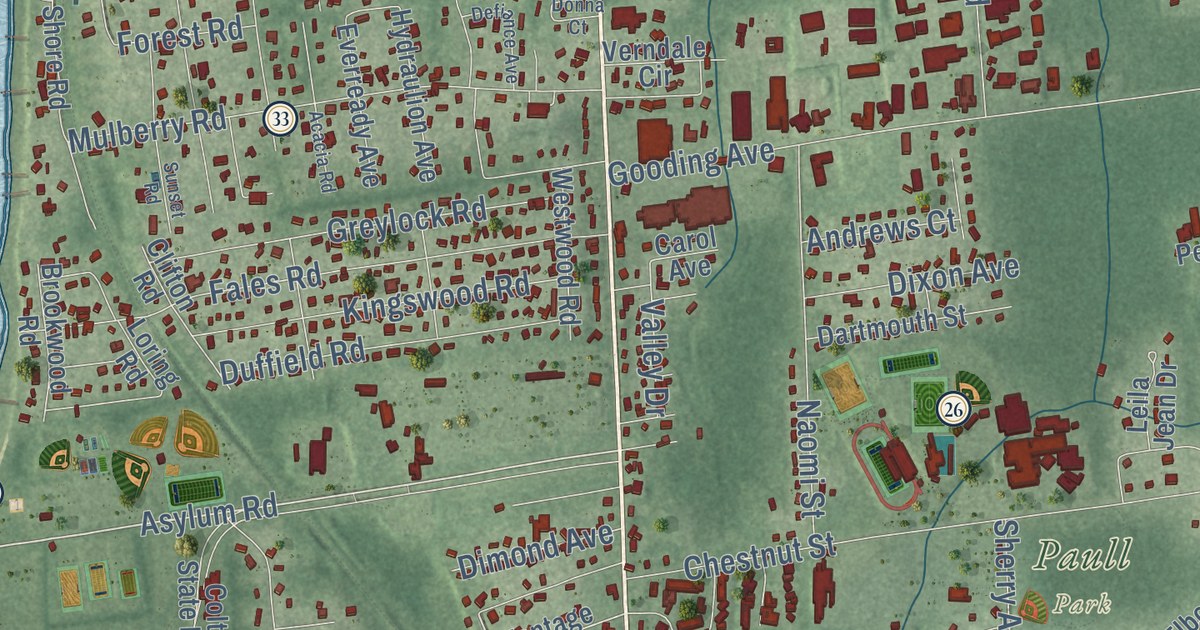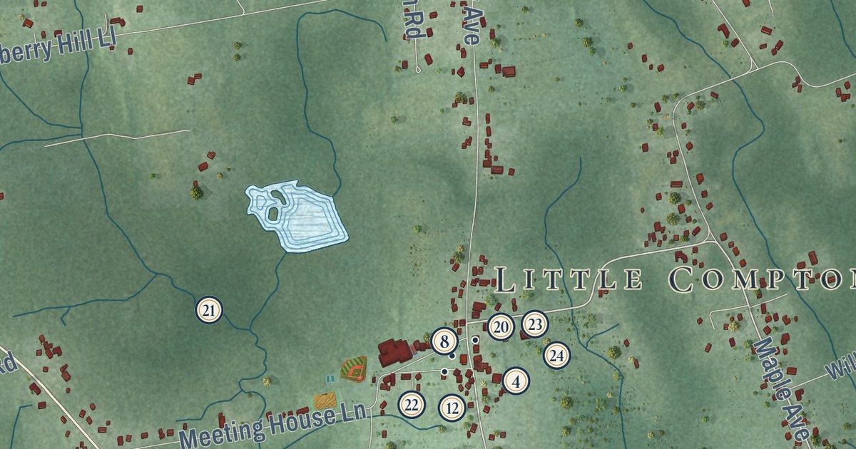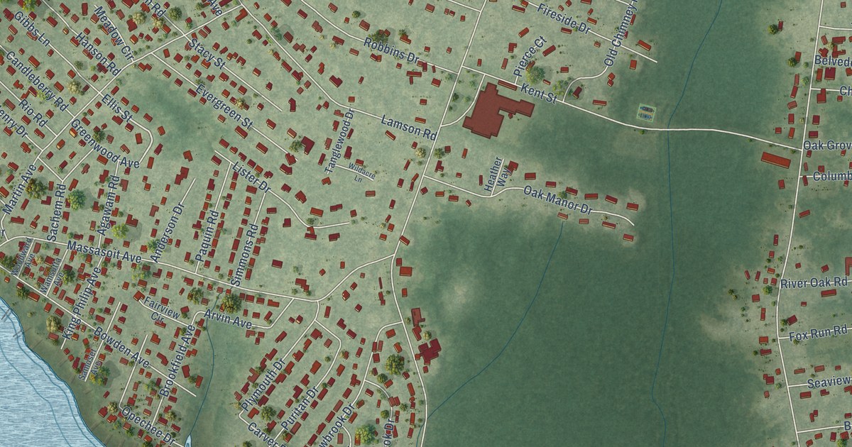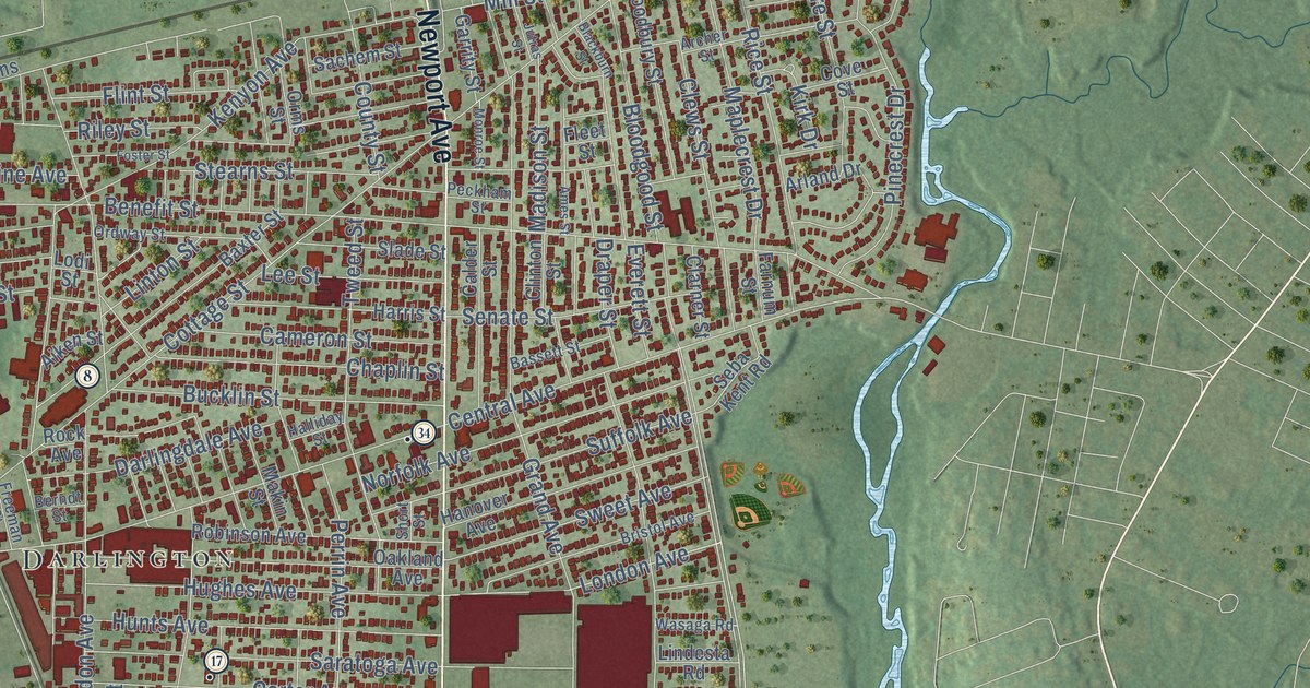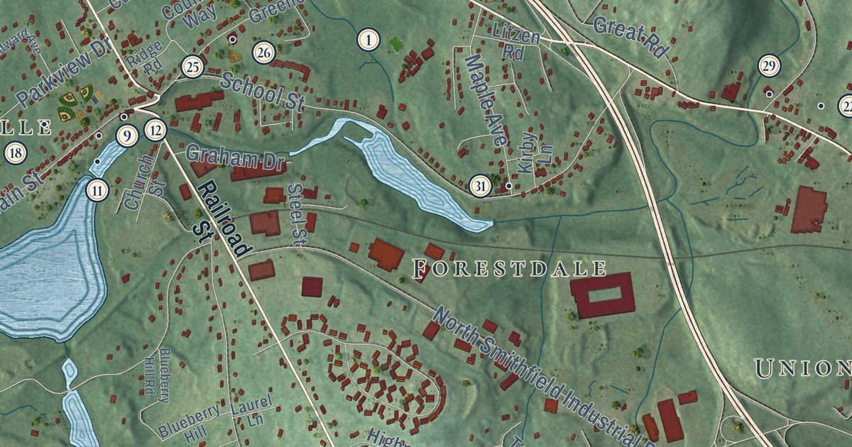
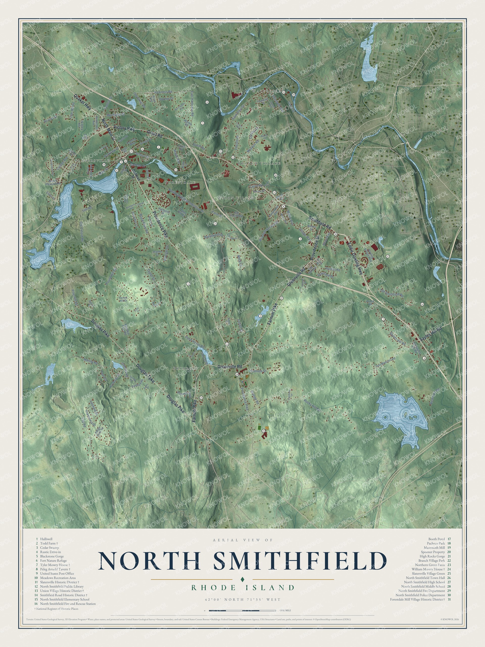
This beautifully detailed map of North Smithfield, Rhode Island was created in 2026 using aerial imagery combined with modern topographical, census, street and landmark data. It’s a one-of-a-kind view of North Smithfield that combines accurate data with a vintage aesthetic. The map shows every building in its true location, many of the roads carry their names, and the shaded topographic relief shows the shape of the land.
See the North Smithfield, Rhode Island map on a wall
The North Smithfield map as an 18 x 24 inch print in a black frame.

Explore an aerial view of North Smithfield, Rhode Island
On the map you’ll find Waterford, Booth Pond, Primrose, Union Village, Forestdale, Slatersville, and Branch Village, along with North Main Street, Quaker Highway, Providence Pike, Eddie Dowling Highway, Smithfield Road, and more. If you look closely you can even find your house accurately drawn in its correct location. Zoom in on the preview to look for yours.
Did you know this piece of North Smithfield, Rhode Island history?
Samuel Slater and his brother John began building the village of Slatersville in North Smithfield in 1803. It was the first planned industrial mill village in America. Its worker housing, shops and church on a village green still survive. The Slater family owned the mill until about 1900.
Take a closer look at the North Smithfield map
Click to explore a larger preview. The digital watermark does not appear on printed maps.
Street and place names on the North Smithfield, Rhode Island map
These names are printed on the map of North Smithfield, Rhode Island.
Places: Waterford, Booth Pond, Primrose, Union Village, Forestdale, Slatersville and Branch Village.
Streets and roads: North Main Street, Quaker Highway, Providence Pike, Eddie Dowling Highway, Smithfield Road, Farnum Pike, Douglas Pike, Douglas Turnpike, Great Road, Providence Street, Greenville Road, Victory Highway.
More street names, A to Z
Bailey Road, Bearskin Farm Road, Belcher Avenue, Black Plain Road, Blueberry Hill, Blueberry Hill Road, Blunders Way, Bourget Court, Brentwood Drive, Brian Avenue, Brookside Drive, Bruce Drive, Buxton Street, Canal Street, Carlin Drive, Carlton Avenue, Central Street, Church Street, Cider Mill Road, Country Way, Cranberry Lane, Cristy Court, Cross Street, Cynthia Drive, Deerfield Drive, Doire Court, Dorene Drive, Dowling Village Boulevard, Duncan Street, East Harkness Road, Eaton Street, Edward Avenue, Elizabeth Avenue, Farm Street, Follett Street, Forest Hill Drive, Fountain Street, Franconia Drive, Franklin Way, Georgianna Avenue, Graham Drive, Grange Road, Graves Avenue, Greene Street, Hanton Road, Harkness Road, Heroux Drive, Highpoint Drive, Hillview Avenue, Homecrest Avenue, Homestead Avenue, Indigo Farm Road, Iron Mine Hill Road, Jeanne Court, Jefferson Road, Jennifer Lane, Keene Street, Kirby Lane, Knollridge Drive, Lapre Road, Laurel Lane, Leonard Drive, Lincoln Drive, Litzen Road, Log Road, Main Street, Maple Avenue, Mara Lane, Martha Road, Mattity Road, Mechanic Street, Mendon Road, Milton Avenue, Morse Avenue, Mount Pleasant Road, Mowry Avenue, North Smithfield Industrial Drive, Oak Hill Avenue, Old Field Drive, Old Great Road, Old Oxford Road, Old Pound Road, Old Sayles Hill Road, Old Smithfield Road, Overlea Road, Parkview Drive, Pine Hill Road, Pine Street, Pomona Street, Pond House Road, Pound Hill Road, Primrose Lane, Prince Road, Railroad Street, Rankin Path, Reservoir Road, Rhodes Avenue, Ridge Road, Rising Sun Trail, Rocky Hill Road, Saint Paul Street, Sayles Hill Road, School Street, Silver Pines Boulevard, Spring Road, Steel Street, Stoney Drive, Taber Hill Road, Taylor Drive, Tifft Road, Tom Lee Drive, Toni Circle, Village Way, Weeks Street, White Parkway, Winchester Avenue, Woonsocket Hill Road.
This beautifully detailed map of North Smithfield makes an attractive addition to your office, library, or den, and it can even be used to teach children the geography and history of the area. It also makes a great gift for someone who left North Smithfield and still calls it home. When you’re done exploring, click here to get your copy of the North Smithfield map.