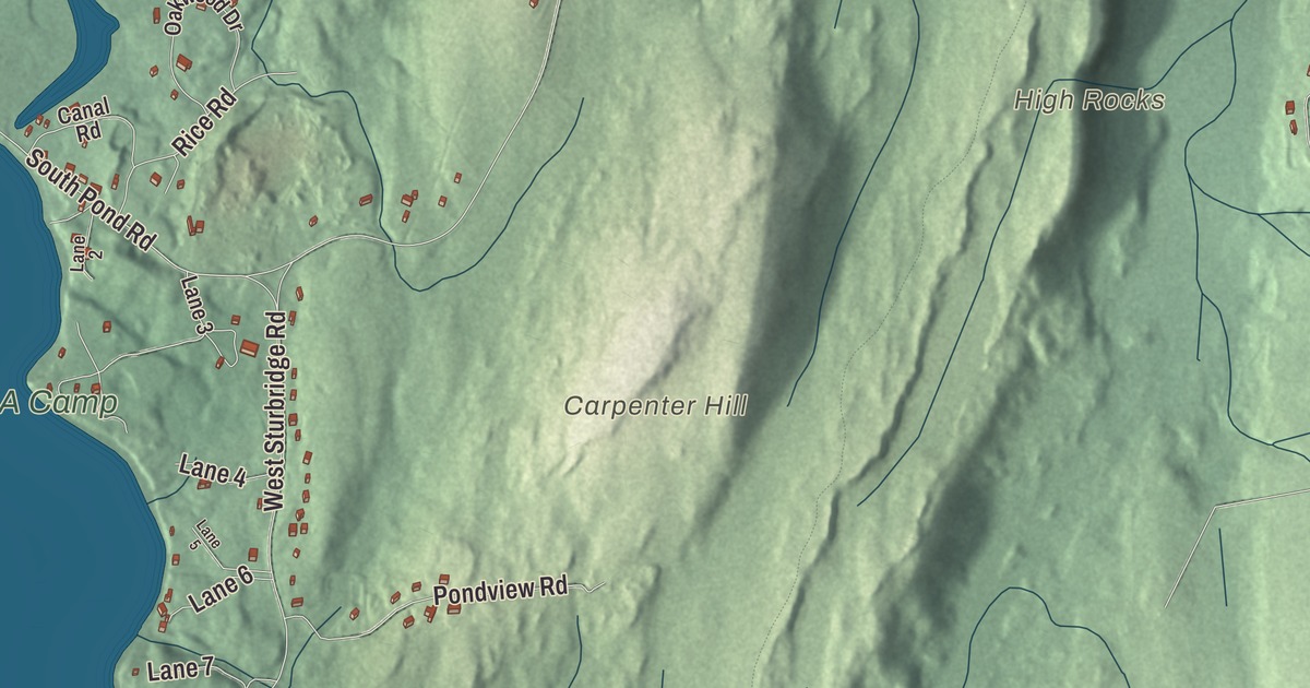
East Brookfield is the small town on Route 9, the road from Spencer to North Brookfield, with Lake Lashaway on the north side of the road and Quaboag Pond to the south. This map prints East Main Street, West Main Street, North Brookfield Road, Podunk Road, Shore Road and North Street, with Lake Lashaway, Quaboag Pond, Quacumquasit Pond, Claypit Pond and Carpenter Hill. Click here to purchase a print of this map for your wall.
East Brookfield is in Worcester County, the newest town in Massachusetts by date of incorporation.
KNOWOL made this map in 2026 from public survey data and gave it the look of an old atlas. The relief comes from United States Geological Survey elevation data, and the roads and the town line come from the Census Bureau. East Brookfield covers 10.4 square miles, with North Brookfield to the north, Brookfield to the west, Sturbridge and Charlton to the south and Spencer to the east. The town had 2,224 people at the 2020 census.
From Quaboag Plantation to 1920
The Quaboag and Lashaway peoples, part of the Nipmuc Nation, lived along these rivers and used them as routes for trade. The Town of East Brookfield’s recorded history, in the Secretary of the Commonwealth’s list, dates European settlement to 1664, when the land was part of the Quaboag Plantation. It became part of the new town of Brookfield in 1673. East Brookfield was incorporated as a town in 1920, on March 24, which makes it the newest town in the state by that measure, and the town remains part of Worcester County today. Its public library followed in 1921.
Connie Mack, the baseball manager and longtime owner of the Philadelphia Athletics, was born Cornelius McGillicuddy in 1862 in what is now East Brookfield. He went to school here, worked summers in the cotton mills from the age of 9, and in 1879 joined East Brookfield’s town team as its catcher and de facto captain, though he was years younger than his teammates. The philosopher and educator Anna Brackett taught school here, and the inventor Charles Thurber is also among the town’s notable people.
Lake Lashaway and the ponds
Lake Lashaway, 293 acres, is a man-made lake. Around 1825 Jeduthan Stevens, a Revolutionary War lieutenant who lived in East Brookfield, bought meadowland along a small stream and, over several years, built a dam and rerouted the water through his mill-dam to power grist and saw mills. The pond was first called Stevens Pond, and also Furnace Lake and Crystal Lake. Summer cottages went up around it by the 1890s, and in 1967 the lake and dam were deeded to the town. The East Brookfield and North Brookfield town lines both run through it. Its outflow, the East Brookfield River, runs about two miles to Quaboag Pond, between East Brookfield and Brookfield, which was once named Podunk Pond and is the source of the Quaboag River. Quacumquasit Pond lies just to the south, and the two are also known as North and South ponds. On Quacumquasit Pond is Camp Frank A. Day, a YMCA summer camp. Click here to learn more about the history of East Brookfield.
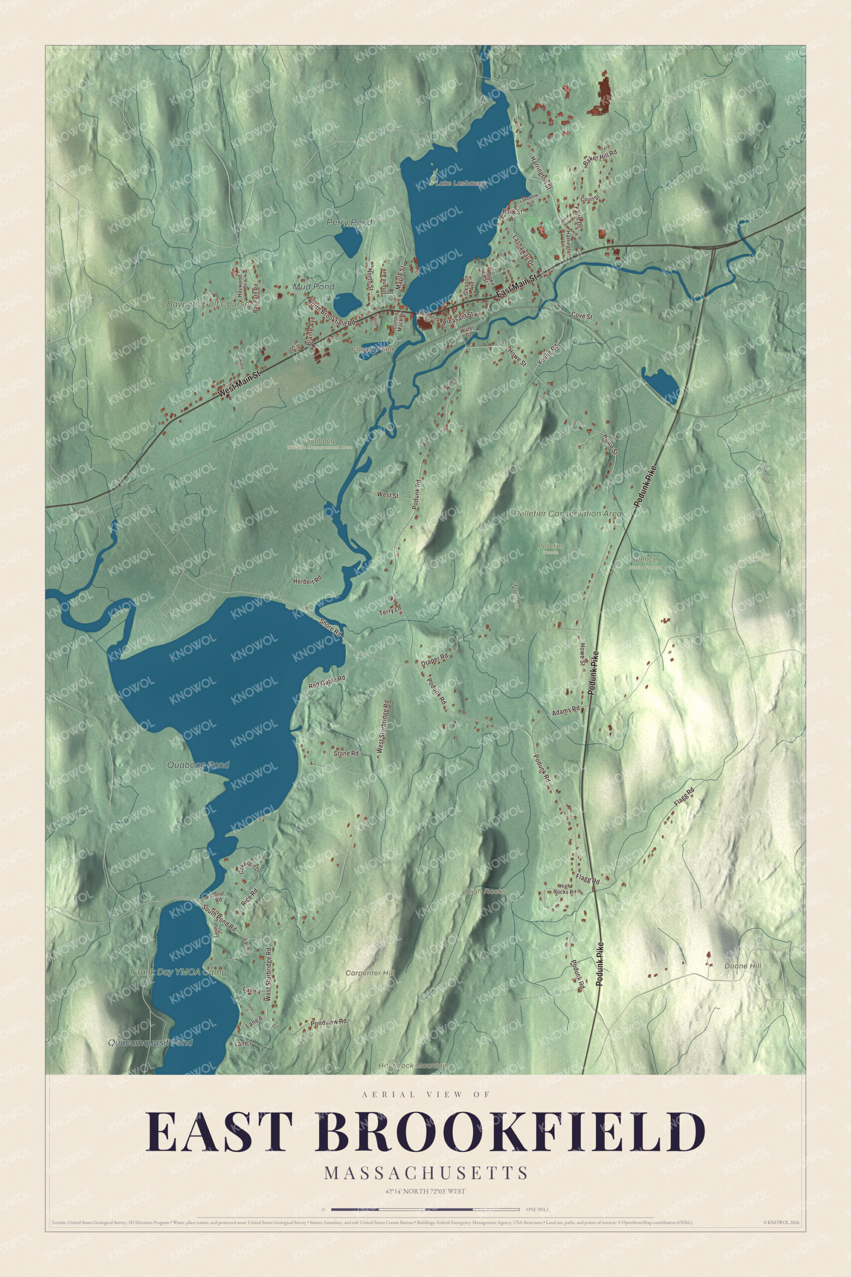
Click to explore a larger preview. The digital watermark does not appear on printed maps.
Names on this map
These names are printed on this map.
Places: Carpenter Hill, Doane Hill, High Rocks, Hitchcock Mountain, Claypit Pond, Lake Lashaway, Quaboag Pond, Quacumquasit Pond, Perry Pond, Mud Pond, Pelletier Conservation Area, Frank Day YMCA Camp, Baypath Golf Course, Pelletier Woods, Quaboag Wildlife Management Area, Spencer State Forest and Wood Farm.
Streets and roads: East Main Street, West Main Street, Podunk Pike, North Brookfield Road, Podunk Road, Shore Road, North Street, South Pond Road, Howe Street, West Sturbridge Road, Adams Road, Flagg Road.
More street names, A to Z
Baker Hill Road, Bay Path Road, Blaine Avenue, Canal Road, Connie Mack Drive, Court Street, Cove Street, Doane Avenue, Drake Street, Draper Road, Elm Street, Faith Drive, Gleason Avenue, Harrington Lane, Harrington Street, Haywood Drive, Herbert Road, High Rocks Road, Jean Avenue, Lakeview Avenue, Lane 2, Lane 3, Lane 4, Lane 5, Lane 6, Lane 7, Lashaway Drive, Maple Street, Mechanic Street, Oakland Drive, Oakwood Drive, Park Street, Pleasant Street, Pondview Road, Red Gable Road, Rice Road, South Street, Stone Road, Terry Lane, Water Street, West Street, Young Road.
See it on a wall
The East Brookfield map as a framed print. Swipe for more.


Podunk
South of the marshes in the middle of town is sparsely settled woodland that was once a village called Podunk, remembered today by a small cemetery along Podunk Road near the Sturbridge line, and a hilly area called High Rocks. The town’s page says the vaudeville star George M. Cohan spent boyhood summers with relatives in Podunk, loved East Brookfield and made “Podunk” famous in his comedy acts; other entertainers picked it up, and the word came to stand for any backwater town. Cohan’s own page places those summers at his grandmother’s home in North Brookfield, where he befriended Connie Mack.
Around the map
Start with East Main Street, then follow West Main Street, North Brookfield Road, Podunk Road, Shore Road and North Street across town. Most of the town’s life is along Route 9 near Lake Lashaway, where its churches, its school, most of its shops and its town offices sit within a block of one another, and the town offices are on Depot Square, near the post office and Redmans Hall. West of the center, the Quaboag River plains are known locally as “the Flats,” with the rail line running beside Main Street. The old Hodgkins School, also called the Lashaway Junior High, was, at its closing in 2002, the oldest operating original wooden school building in the nation, according to the town’s page; it’s now home to the East Brookfield Historical Museum, the Quaboag Valley Railroaders Club and the Massasoit Art Guild. Claypit Pond, Lake Lashaway, Quaboag Pond, Quacumquasit Pond, the Pelletier Conservation Area, Carpenter Hill, Doane Hill and High Rocks are all printed on the map.
The East Brookfield map makes a fine addition to an office, library or den, and it can help teach children the geography and history of the newest town in Massachusetts. It’s made for people who call East Brookfield home, from Lake Lashaway to Podunk Road, and it shows the town as it looks today. Zoom in on the preview above to explore the details, then click here to get your copy of the East Brookfield, Massachusetts map.

Sources