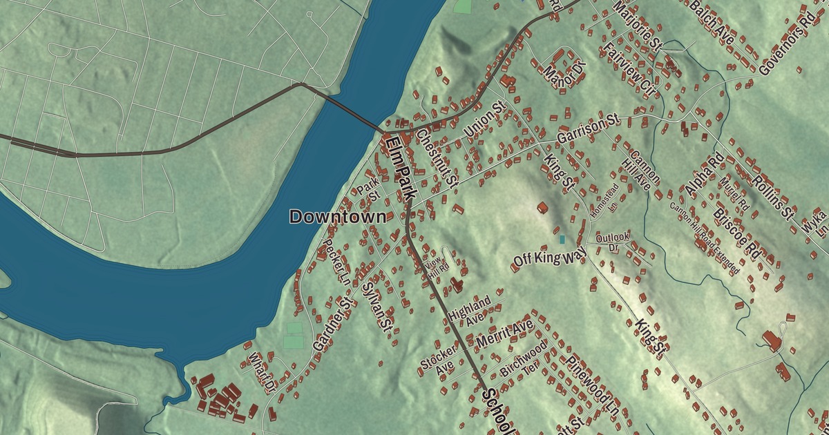
Groveland is a Merrimack River town of two precincts, Groveland and South Groveland, with a park of elms at its heart. This map prints Main Street, School Street, Salem Street, Gardner Street, Garrison Street and Rollins Street, with Johnsons Pond, Rock Pond, Lower Pond, the Pentucket Pond Outlet Reservoir, the Center Street Greenway, Bear Hill, Dead Hill and Golden Hill. Click here to purchase a print of this map for your wall.
Groveland is in Essex County.
KNOWOL made this map in 2026 from public survey data and gave it the look of an old atlas. The relief comes from United States Geological Survey elevation data, and the streets and the town line come from the Census Bureau. Groveland is thirty-four miles north of Boston, on the Merrimack River, and it had 6,752 people at the 2020 census.
From Rowley to Bradford to Groveland
Groveland’s story begins in Yorkshire. In December 1638 the Reverend Ezekiel Rogers lost his post as rector of Rowley, England, after refusing to read the Book of Sports, and he sailed for New England with twenty families of his congregation on the John of London, the same ship that carried the first printing press brought to America. They wintered at Salem and in the spring of 1639 settled between Ipswich and Newbury, buying out those towns’ grants for £800. The Town of Groveland’s recorded history, in the Secretary of the Commonwealth’s list, dates European settlement to 1639, the year Rowley was incorporated. Rowley then took in the land of today’s Rowley, Georgetown, Groveland and Boxford and the Bradford part of Haverhill.
Bradford split from Rowley in 1672, and before that the area was called “Rowley on the Merrimack,” or just “Merrimack.” Groveland was Bradford’s East Parish until it became a town of its own: Groveland was incorporated as a town in 1850, on September 9, a date its people still celebrate as Groveland Day. Bradford itself was annexed by Haverhill in 1897. The town remains part of Essex County today.
A Revere bell and an old fire engine
The Congregational church in Groveland has a bell made by Paul Revere’s company. Of the 900 bells the company cast, the town page says this is one of two still in active service; the other is in Lowell. Town hall shows off what the town page calls the oldest hand-pump fire engine in the country. It was built in 1798 as the Torrent of Roxbury, moved to Bradford in 1828 as Engine 2, and renamed Veto in 1850, the year East Bradford became Groveland.
The first post office opened in 1810 in Squire Greenough’s store on Main Street, back when this was still Bradford, and it later moved to Captain Benjamin Parker’s store and then to a blacksmith shop near the Haverhill Bridge. After Groveland became a town, a new post office went up about half a mile from today’s spot on Main Street. John G. B. Adams, born in Groveland in 1841, rose from private to captain in the Civil War and received the Medal of Honor for his actions at the Battle of Fredericksburg.
Elm Park
Downtown Groveland is framed by the gazebo in Elm Park. It began in 1832 as Constitution Park, and the elm trees and the new name came in 1857. The town page calls it the first planned housing development in the area, with house lots laid out around the common and rights to the well at its south end. Dutch elm disease killed most of the trees by the 1950s, and the last one came down in the early 1960s. Thirty years later, with state grants and a lot of local persistence, Groveland restored the park, with new lampposts, a fountain like the old one, a gazebo modeled on the Methodist meeting house that once stood at its south end, a clock and new disease-resistant elms planted in roughly the old pattern.
Along the Merrimack, the Pines Recreation Area has ball fields, courts, a dog park and a nature trail through the woods by the river, closed to cars. North Groveland has Stickney’s Boulder, and South Groveland has Washington Park and Nuns’ Hill.
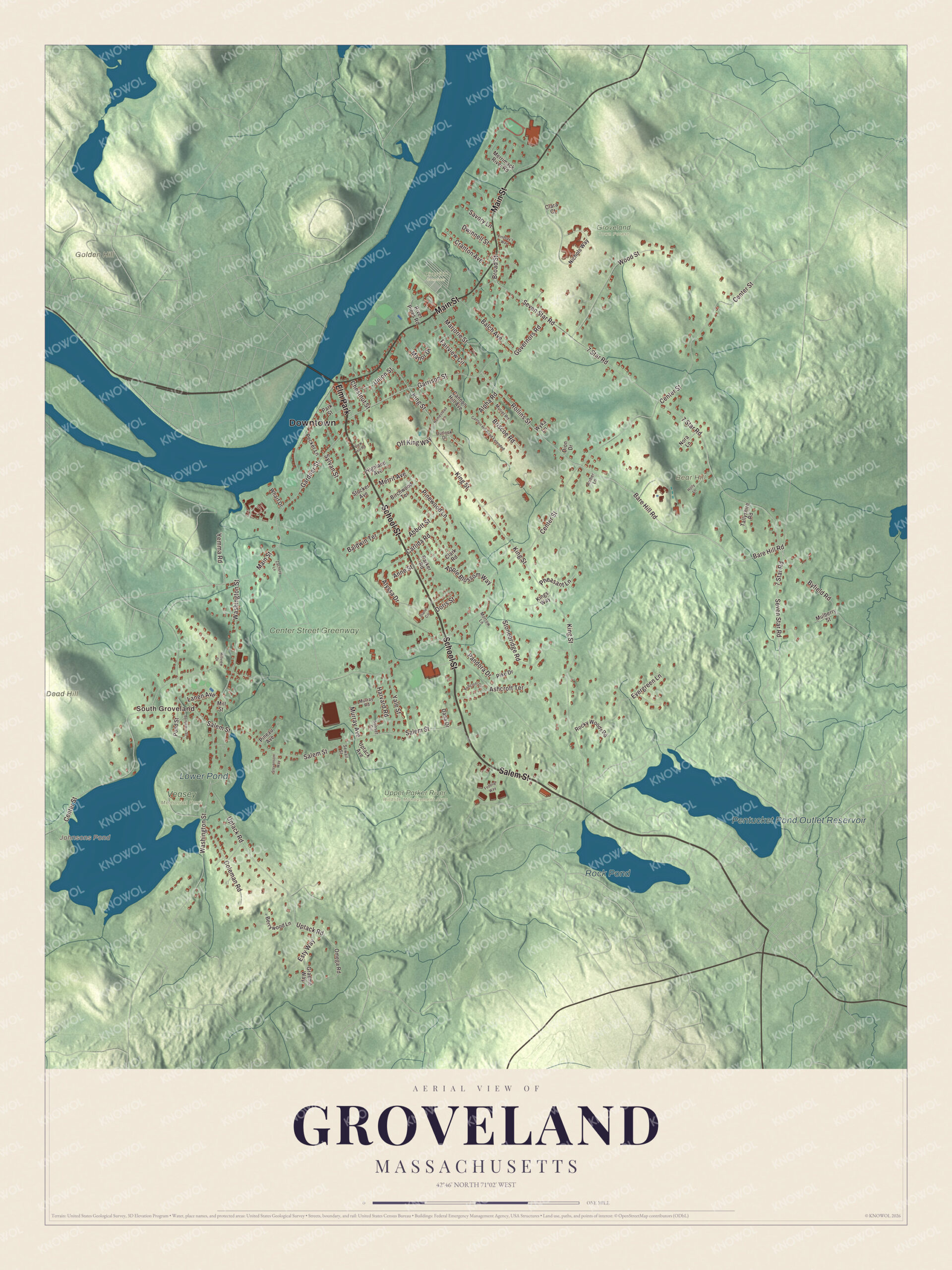
Click to explore a larger preview. The digital watermark does not appear on printed maps.
Names on this map
These names are printed on this map.
Places: Downtown, South Groveland, Bear Hill, Dead Hill, Golden Hill, Johnsons Pond, Pentucket Pond Outlet Reservoir, Rock Pond, Lower Pond, Center Street Greenway, Groveland Town Forest, Riverview Cemetery, Upper Parker River Wildlife Management Area, Veasey Memorial Park and Elm Park.
Streets and roads: School Street, Salem Street, Main Street, Gardner Street, Garrison Street, Rollins Street, Bare Hill Road, 7 Star Road, Seven Star Road, Byfield Road, Alyssa Drive, Center Street.
More street names, A to Z
Abbott Street, Alpha Road, Amber Lane, Anne Street, Apple Blossom Way, Ashcroft Circle, Ashcroft Terrace, Balch Avenue, Baldwin Terrace, Benjamin Street, Berrywood Lane, Birchwood Terrace, Briscoe Road, Broad Street, Cannon Hill Avenue, Cannon Hill Road Extended, Carlida Road, Chestnut Street, Clara Court, Clark Road, Coleman Road, Cranton Avenue, Dana Drive, Diane Circle, Dion Drive, Doris Street, Dwinnell Street, Esty Way, Evergreen Lane, Fairview Circle, Federal Way, Governors Road, Graeme Way, Harvard Road, Highland Avenue, Hillview Drive, Holly Lane, Homestead Lane, King Street, Kings Way, Lanen Avenue, Lindsay's Way, Manor Drive, Marjorie Street, Merrimack River Road, Merrit Avenue, Mill Street, Morrow Lane, Mulberry Street, Muriel Road, Murray Avenue, Murray Road, Nichols Way, Nora Lane, Off King Way, Omega Road, Outlook Drive, Pandora Drive, Parker Road, Park Street, Pecker Lane, Pheasant Lane, Pike Drive, Pineau Avenue, Pinewood Lane, Pond Street, River Pines Road, Rocky Woods Road, Savory Lane, Sewall Street, Stevenson Way, Stocker Avenue, Stonebridge Road, Sunset Circle, Sylvan Street, Tallyshire Road, Union Street, Uptack Avenue, Uptack Road, View Hill Road, Washington Street, Wharf Drive, Wood Street, Wyka Lane, Yale Street, Yemma Road, Zachery Lane.
Around the map
Start with South Groveland, then follow School Street, Salem Street, Main Street, Gardner Street, Garrison Street and Rollins Street across town. Johnsons Pond, the Pentucket Pond Outlet Reservoir, Rock Pond, Lower Pond, the Center Street Greenway, Bear Hill, Dead Hill and Golden Hill are all printed on the map. Every one of those names is right there on the artwork.
The Groveland map makes a fine addition to an office, library or den, and it can help teach children the geography and history of the town that saved its elm park. It’s made for people who call Groveland home, from South Groveland to the Merrimack, and it shows the town as it looks today. Zoom in on the preview above to explore the details, then click here to get your copy of the Groveland, Massachusetts map.

We made a map for every town and city in Massachusetts. Explore the complete Massachusetts map collection and find your town.
Sources