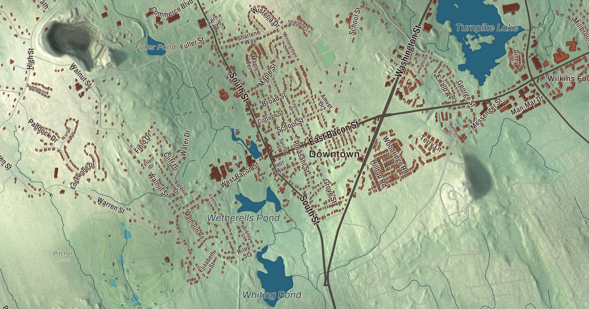
In its early days Plainville was nicknamed Slackville, after a well-off landowner named Benjamin Slack. This map of the town prints East Bacon Street, Washington Street, Messenger Street, Taunton Street and South Street, with Lake Mirimichi, Turnpike Lake, Fuller Pond, Cargill Pond and Red Brush Hill. Click here to purchase a print of this map for your wall.
Plainville is in Norfolk County.
KNOWOL made this map in 2026 from public survey data and gave it the look of an old atlas. The land comes from United States Geological Survey elevation data, and the streets and the town line come from the Census Bureau. Plainville borders Wrentham, Foxborough, Mansfield, North Attleboro and Cumberland, Rhode Island, and it belongs to both the Boston and the Providence metropolitan areas. It covers 11.6 square miles and had 9,945 people at the 2020 census.
From Wollomonuppoag to Plainville
The land was first part of a 1635 grant for Dedham, then the Plantation of Wollomonuppoag, then Wrentham. The Town of Plainville’s recorded history dates European settlement to 1661. One of the earliest records of settlement here comes from 1674, when a Wampanoag man named Matchinamook petitioned for and received a few acres at the head of the Ten Mile River, at what’s now Fuller’s Dam. After a post office opened in 1856, the village took the name Plainville, for the many plains in the area. Plainville was incorporated as a town in 1905. The town remains part of Norfolk County today. It separated from Wrentham on April 4, 1905, which makes it the third youngest town in the state, after Millville in 1916 and East Brookfield in 1920.
Astride the line with North Attleboro stands the Angle Tree Stone, which Plainville shares with North Attleboro and shows on its town seal. In 1664 commissioners from Plymouth Colony and the Massachusetts Bay Colony chose a tree on this spot as a point on the line between the two colonies. When the old tree died, the state replaced it in 1790 with a slate marker carved by Samuel Fisher and his son, gravestone makers, lettered “Massachusetts Colony” on its north side and “Plymouth Colony” on its south. It still marks the turn in the line between Bristol and Norfolk counties, and it has been listed on the National Register since 1976.
Plainville was also home to George Robert Twelves Hewes, a Revolutionary War veteran who fought in the Battle of Rhode Island. Hewes, born in Wrentham, was a Boston shoemaker who took part in the Boston Tea Party in 1773, and he became one of its last survivors, living to 98. The author Jeff Kinney, who created Diary of a Wimpy Kid, has lived in Plainville since 2002, and in 2015 he and his wife, Julie, opened a bookstore and cafe in town called An Unlikely Story. Click here to learn more about the history of Plainville.
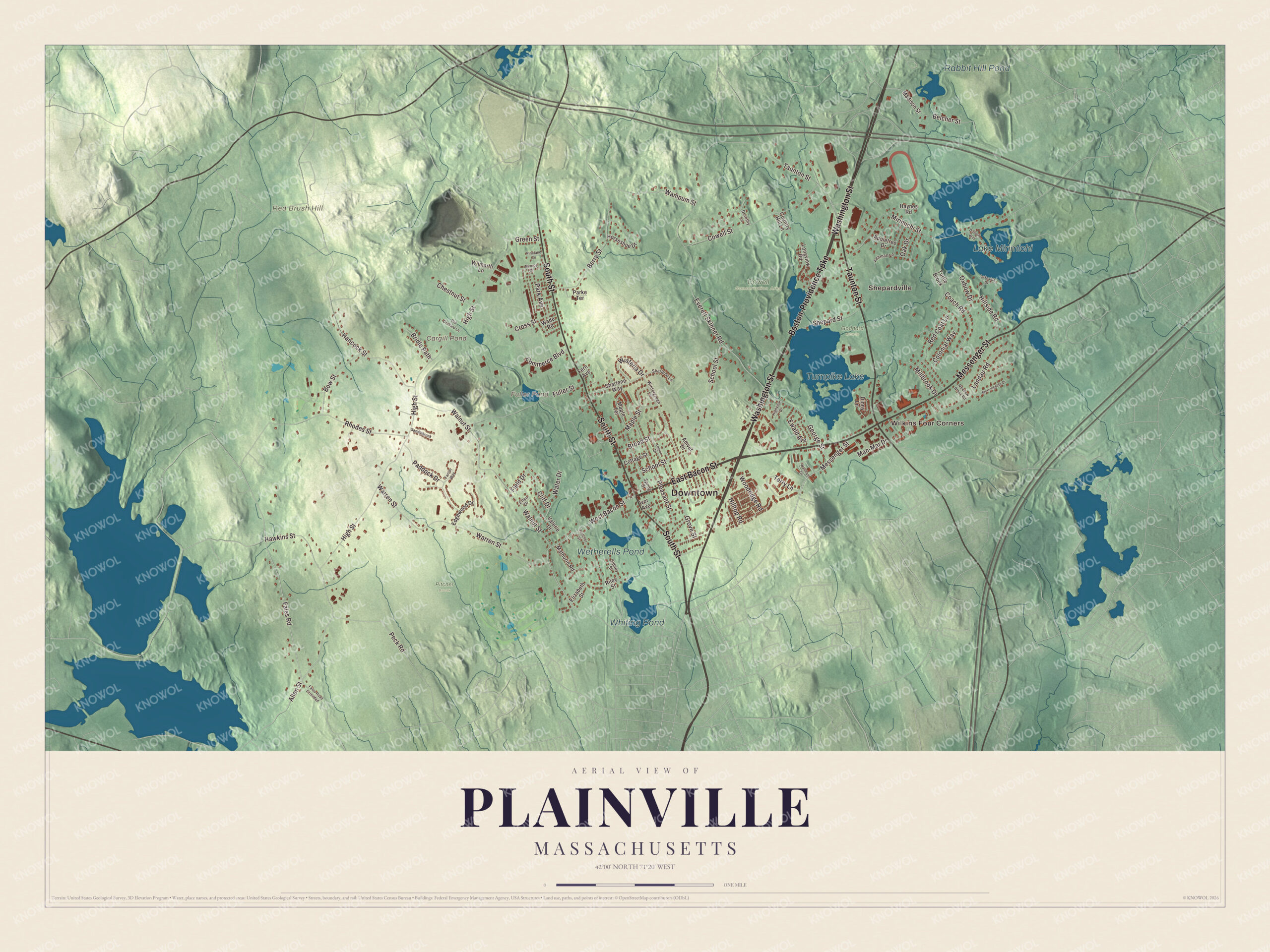
Click to explore a larger preview. The digital watermark does not appear on printed maps.
Names on this map
These names are printed on this map.
Places: Downtown, Wilkins Four Corners, Shepardville, Red Brush Hill, Cargill Pond, Fuller Pond, Lake Mirimichi, Turnpike Lake, Whiting Pond, Rabbit Hill Pond, Wetherells Pond, Cowell Conservation Area, Goddard Woods and Pitcher Brook.
Streets and roads: East Bacon Street, Boston-Providence Turnpike, Washington Street, Messenger Street, Taunton Street, South Street, West Bacon Street, Fales Road, Allen Street, Hawkins Street, High Street, Walnut Street.
More street names, A to Z
Amvet Drive, Appletree Drive, Ashman Lane, Belcher Street, Berry Street, Bow Street, Bridle Path, Broad Street, Chestnut Street, Cliff Drive, Coach Road, Colonial Way, Commerce Boulevard, Cottage Street, Country Hill Lane, Cowell Street, Cross Street, Dinny Lane, Doreen Way, Dorothy Lane, Edgewood Drive, Elizabeth Street, Ellen Drive, Everett Skinner Road, Ewald Avenue, Fales Road Extended, Farrier Way, Fern Avenue, Field Drive, Fletcher Street, Fuller Street, George Street, Green Street, Grove Street, Hancock Street, Haynes Road, Highview Drive, Hillside Road, Hilltop Road, Horseshoe Drive, Ivor Avenue, Lakeside Drive, Landau Road, Legion Drive, Longview Road, Madison Street, Man-Mar Drive, Maple Street, Maple Terrace, Mathurin Road, Meadow Brook Road, Millbrook Drive, Mirimichi Street, Morningside Drive, Munroe Drive, Oak Drive, Old Orchard Lane, Oxbow Drive, Paddock Drive, Park Avenue, Parke Terrace, Peck Road, Pineland Drive, Pleasant Street, Red Coat Lane, Rhodes Street, Riley Street, Saddlebrook, School Street, Sharlene Lane, Sharlene Way, Shepard Street, Sidney Street, Spring Street, Terry Lane, Turtle Brook, Valerie Drive, Wade Road, Waltham Drive, Wampum Street, Warren Street, Water Drive, Wilmarth Lane, Wintergreen Lane, Wisteria Drive, Woodridge Road.
See it on a wall
The Plainville map as a framed print. Swipe for more.


Around the map
Start with Wilkins Four Corners, then follow East Bacon Street, the Boston-Providence Turnpike, Washington Street, Messenger Street, Taunton Street and South Street across town. Then look outward toward Shepardville. Cargill Pond, Fuller Pond, Lake Mirimichi, Turnpike Lake and Red Brush Hill are all printed on the map. Plainridge Park opened in Plainville in 1999 as a harness racing track, on a 90-acre site, and it took its present name, Plainridge Park Casino, in 2015.
The Plainville map makes a fine addition to an office, library or den, and it can help teach children the geography and history of one of the youngest towns in Massachusetts. It’s made for people who call Plainville home, from Shepardville to the Angle Tree Stone, and it shows the town as it looks today. Zoom in on the preview above to explore the details, then click here to get your copy of the Plainville, Massachusetts map.

Sources