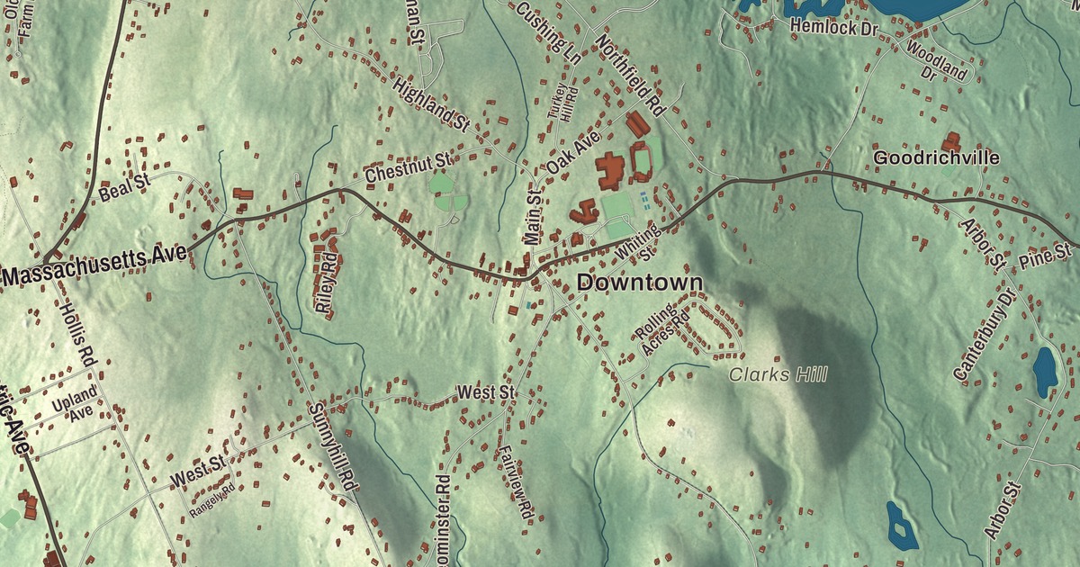
Lunenburg runs along Massachusetts Avenue through the center, with Electric Avenue heading down toward Leominster and Lake Whalom, where Whalom Park drew summer crowds for 107 years. This map prints Massachusetts Avenue, Electric Avenue, Chase Road, Main Street, Prospect Street and Royal Fern Drive, with Lake Shirley, Hickory Hills Lake, Baker Pond and Clarks Hill. Click here to purchase a print of this map for your wall.
Lunenburg is in Worcester County.
KNOWOL made this map in 2026 from public survey data and gave it the look of a vintage atlas. The hills come from United States Geological Survey elevation data, and the Census Bureau supplied the streets and the town line. Lunenburg covers 27.7 square miles, bordered by Townsend, Shirley, Lancaster, Leominster, Fitchburg and Ashby, and it had 11,782 people at the 2020 census. Three state highways cross it. Route 2A follows Massachusetts Avenue from the Shirley line to the Fitchburg line, Route 13 follows Electric Avenue up from the Leominster line and then Chase Road north to Townsend, and Route 225 begins near the Shirley line on West Groton Road.
A king’s title
Lunenburg takes its name from one of the titles of King George II of Great Britain, Duke of Brunswick-Luneburg. The Town of Lunenburg’s recorded history, in the Secretary of the Commonwealth’s list, dates European settlement to 1721, while the town page says Europeans first settled here in 1718. Lunenburg was incorporated as a town in 1728. Parts of today’s Fitchburg once belonged to Lunenburg, but the settlers there found the walk to church and town meeting too long and broke away around 1764 to have a town center of their own. The town remains part of Worcester County today.
The potato and the treasury
Luther Burbank, born on a farm in neighboring Lancaster, used his inheritance after his father died to buy a 17-acre plot near Lunenburg center, and there he developed the Burbank potato. He sold the rights for $150 and used the money to travel to Santa Rosa, California, in 1875. A russet-skinned sport of his potato became the Russet Burbank, which its page calls the most widely grown potato in the United States today.
George S. Boutwell grew up on his family’s farm in Lunenburg, tending oxen and picking chestnuts in summer and going to the public schools until he was 17. He served as governor of Massachusetts from 1851 to 1853 and as Secretary of the Treasury from 1869 to 1873, and in 1855 he urged the state’s quarreling political factions to form a “union against slavery,” work that helped give birth to the Massachusetts Republican Party.
Whalom Park and the lakes
The Fitchburg and Leominster Street Railway opened Whalom Park on Lake Whalom in 1893 as an English-style park of gardens and walking paths, and it ran every season for 107 years. When it closed in 2000, its page says, it was the 13th oldest amusement park in the country and the second-oldest trolley park in the world. The Cars shot their “Touch and Go” video there in 1982. The park and its Flyer Comet wooden roller coaster were torn down in 2006, and apartments now stand on the site along a street named Carousel Lane.
Hickory Hills Lake, which its page calls the largest private lake in Massachusetts, began as a swampy stretch of Mulpus Brook. Charles P. Dickinson cleared it in 1925 and built an earthen dike, and by 1926 water was filling the new Dickinson Reservoir. The lake covers 319 acres, and since the late 1970s the families around it have owned it together, with three beaches and a boat parade every Fourth of July.
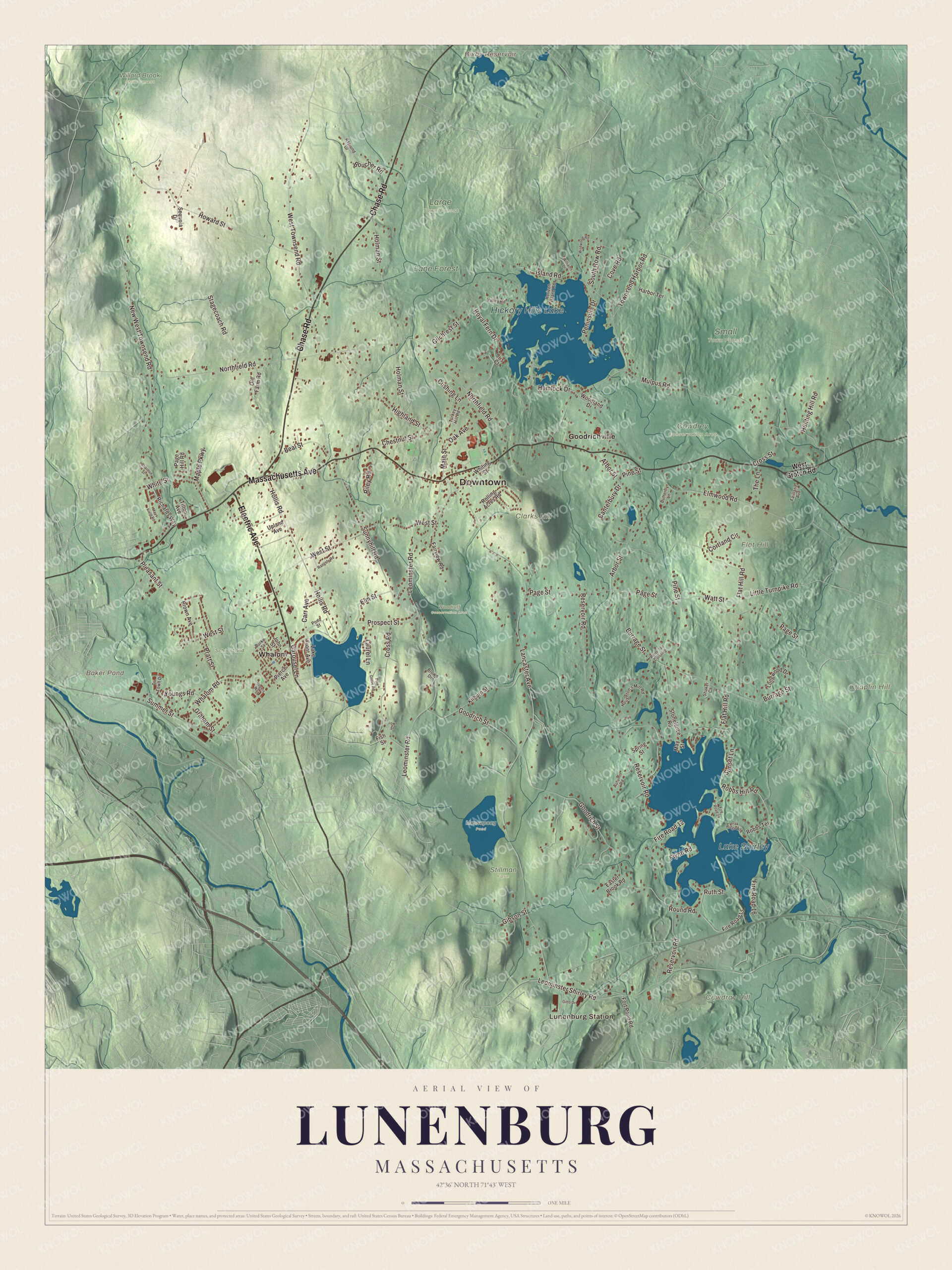
Click to explore a larger preview. The digital watermark does not appear on printed maps.
Names on this map
These names are printed on this map.
Places: Downtown, Lunenburg Station, Chaplin Hill, Clarks Hill, Cowdray Hill, Flat Hill, Baker Pond, Bixby Reservoir, Lake Shirley, Hickory Hills Lake, Cowdrey Conservation Area, Lane Forest, Large Town Forest, Massapoag Pond, School Land, Small Town Forest, Stillman Farm, Willard Brook State Forest, Woodruff Conservation Area, Goodrichville and Whalom.
Streets and roads: Electric Avenue, Massachusetts Avenue, Chase Road, Main Street, Royal Fern Drive, Prospect Street, New West Townsend Road, Leominster Shirley Road, West Townsend Road, Lancaster Avenue, Northfield Road, Reservoir Road.
More street names, A to Z
Arbor Street, Asplund Drive, Autumn Road, Beal Street, Boucher Road, Brown Avenue, Brown Drive, Burke Street, Burrage Street, Butterfly Lane, Canterbury Drive, Carousel Lane, Carr Avenue, Charlton Street, Chestnut Street, Cortland Circle, Cove Road, Cross Road, Cross Street, Cushing Lane, Easter Brook Road, Elm Street, Elmwood Road, Fairland Avenue, Fairview Road, Fire Road 12, Fire Road 15, Fire Road 16, Fire Road 24, Fish Street, Flat Hill Road, Flynn Road, Fort Pond Road, Gibson Street, Gilchrest Street, Gitto Drive, Goodrich Street, Graham Street, Harbor Terrace, Hemlock Drive, Highland Street, Hollis Road, Holman Street, Horizon Island Road, Houghton's Mill Road, Howard Street, Hunting Hill Road, Iris Court, Island Road, John Street, Kilburn Street, Lake Front Avenue, Laurel Lane, Leominster Road, Little Turnpike Road, Longwood Drive, Maple Parkway, Mays Field Road, May Street, Mulpus Road, Oak Avenue, Oak Ridge Road, Old Farm Road, Page Hill Road, Page Street, Peninsula Drive, Pierce Avenue, Pine Grove Road, Pine Street, Pleasant Street, Pond Street, Pratt Street, Rangely Road, Richards Way, Riley Road, Robbs Hill Road, Robbs Terrace, Rogers Way, Rolling Acres Road, Round Road, Ruth Street, Sequoia Drive, Shaker Court, South Row Road, Spring Street, Stagecoach Road, Stonefence Road, Summer Street, Sunnyhill Road, Sunset Lane, The Lane, Tilton Avenue, Townsend Harbor Road, Town Street, Tri Town Drive, Turkey Hill Road, Upland Avenue, Valley Road, Watt Street, West Groton Road, West Street, Whalom Road, White Street, White Tail Crossing, Whiting Street, Wildwood Road, Williams Drive, Woodland Drive, Youngs Road.
See it on a wall
The Lunenburg map as a framed print. Swipe for more.


Around the map
Start with Lunenburg Station. Follow Electric Avenue, Massachusetts Avenue, Chase Road, Main Street, Royal Fern Drive and Prospect Street across town. Then look outward toward Goodrichville and Whalom. Baker Pond, Bixby Reservoir, Lake Shirley, Hickory Hills Lake, Lane Forest, Chaplin Hill, Clarks Hill and Cowdray Hill are all printed on the map, with the names set right on the artwork.
The Lunenburg map makes a fine addition to an office, library or den, and it can help teach children the geography and history of the town where the Burbank potato began. It’s made for people who call Lunenburg home, from Whalom to Goodrichville, and it shows the town as it looks today. Zoom in on the preview above to explore the details, then click here to get your copy of the Lunenburg, Massachusetts map.

Sources