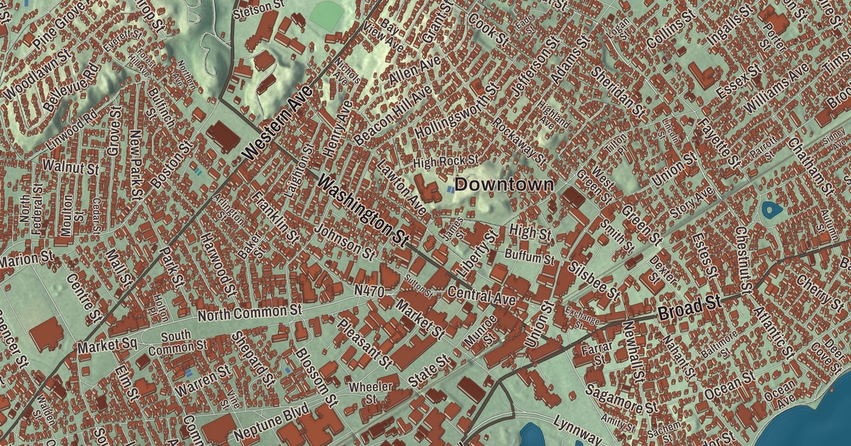
Lynn people know the city in pieces: downtown around Central Square, East Lynn and the Diamond District along the shore, West Lynn toward the Saugus River, and the wild acres of Lynn Woods to the northwest. This map prints Chestnut Street, Broad Street, Boston Street, Lewis Street, Washington Street and Broadway, with Breeds Pond, the Lynn Woods Reservation and the Atlantic Ocean. Click here to purchase a print of this map for your wall.
Lynn is in Essex County.
KNOWOL made this map in 2026 from public survey data and gave it the look of a vintage city atlas. The ledges and ponds take their shape from United States Geological Survey elevation data, and the Census Bureau supplied the streets and the city line. Lynn covers 13.5 square miles beside Massachusetts Bay, about 10 miles northeast of Boston, and had 101,253 people at the 2020 census. The town of Nahant splits its shoreline in two, with Lynn Harbor to the south and Nahant Bay to the north, and the Lynn Woods Reservation fills much of the northwest. Breed’s Pond and Walden Pond, which has no tie to the one in Concord, are the largest of its ponds.
Saugus, then Lynn
Naumkeag people under the sachem Nanepashemet held this coast when the English arrived. Edmund Ingalls began European settlement in 1629, and the place was first incorporated that year as Saugus, the Massachusett name for the area. The City of Lynn’s recorded history, in the Secretary of the Commonwealth’s list, dates European settlement to 1629, and Lynn was incorporated as a town that same year. The city page counts it the fifth oldest colonial settlement in the Commonwealth. The name honors the Reverend Samuel Whiting, Lynn’s first official minister, who came from King’s Lynn in Norfolk, England, in 1637. Reading, Lynnfield, Saugus, Swampscott and Nahant all grew out of old Lynn, and the City of Lynn was incorporated on May 14, 1850.
Shoes and electricity
Tanning and shoemaking began in Lynn in 1635. The boots worn by Continental Army soldiers in the Revolution were made here, and a colonial boot still sits on the city seal. On February 22, 1860, about 3,000 Lynn shoemakers marched through the streets and handed in their tools to protest falling wages, starting the New England Shoemakers Strike. Within a week it had spread to 25 more towns, some 20,000 workers walked out across New England, and the strike’s page calls it the largest mass walkout in American history before the Civil War. It ended that April with modest gains, including raises. By the start of the 1900s Lynn led the world in making shoes, with 234 factories turning out more than a million pairs a day, thanks in part to Jan Ernst Matzeliger. Born in Dutch Guiana, now Suriname, he came to Massachusetts for the shoe trade, patented an automated lasting machine in 1883, and lived out his life in Lynn.
Shoe money built the electric industry here too. Manufacturers led by Charles A. Coffin and Silas Abbott Barton backed Elihu Thomson and Edwin J. Houston’s Thomson-Houston Electric Company in 1883, and in 1892 it merged with the Edison Electric Company of Schenectady to form General Electric, with its two original plants in Lynn and Schenectady. Coffin became GE’s first president. The Lynn plant built aircraft engines during World War II and grew into the jet engine plant that still works in the city.
Douglass in Lynn
Frederick Douglass moved to Lynn in 1841, still a fugitive from slavery, and wrote his first autobiography, the Narrative of the Life of Frederick Douglass, while he lived here. He, his wife and their five children stayed until 1848. In 2021 the city dedicated Frederick Douglass Park on Exchange Street, with a bronze relief of Douglass, across from the site of the Central Square depot where he was forcibly removed from a train in 1841. Esther Hill Hawks, a physician and activist, moved to Lynn in 1870 as one of its first three women doctors and opened her own practice in 1874.
The woods and the shore
Lynn set its woods aside early. In 1693 the town restricted use of the land that’s now Lynn Woods and fined anyone who took young trees, and in 1850 residents formed the Lynn Exploring Circle, which the city page calls the first hiking club in New England. Breed’s Pond, at the south end of the woods, was dammed for industry in the 1840s. In 1881 the Trustees of the Free Public Forest began buying land and giving it to the city, and in 1889 Frederick Law Olmsted advised keeping it wild. The Lynn Woods Reservation’s 2,200 acres, a small corner of them in Saugus, hold the Stone Tower, the Steel Tower, the Wolf Pits and Dungeon Rock, and the city page calls it the largest municipal park in New England. It joined the National Register as a historic district in 1996.
Along the water, the Diamond District became a fashionable summer resort after 1840, and its houses run from Federal and Greek Revival to Italianate, Queen Anne, Shingle Style and Colonial Revival. The Metropolitan District Commission later built Lynn Shore Drive, and its opening in 1910 brought much of the building now found in the 69.5-acre Diamond Historic District. Up in the Highlands, the 85-foot stone High Rock Tower of 1905 stands in a park the Olmsted Brothers designed in 1907, with views out to the ocean. The hill was once home to the Hutchinson Family Singers, a family group who sang for abolition, workers’ rights and women’s rights, and their page calls them the most popular American entertainers of the 1840s.
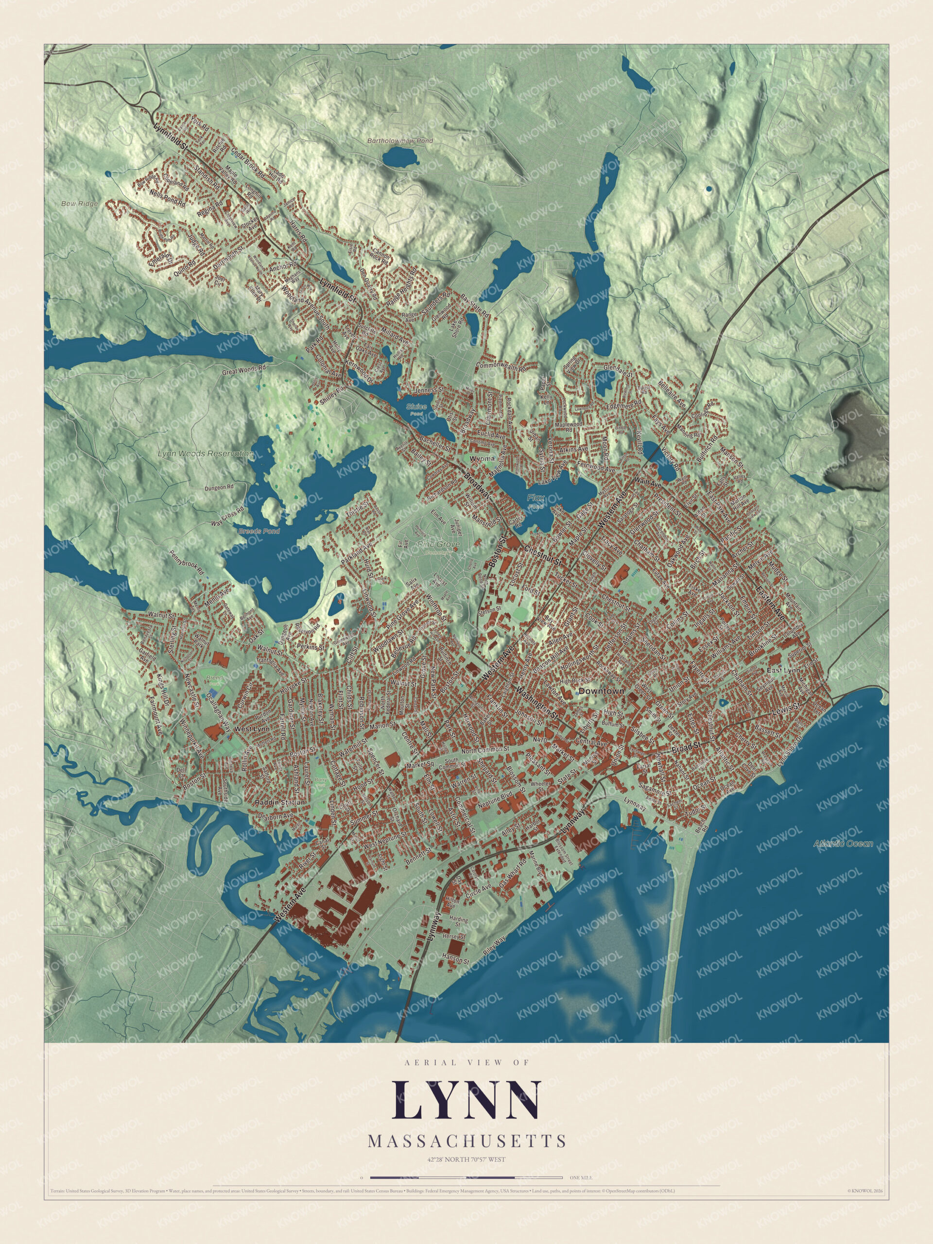
Click to explore a larger preview. The digital watermark does not appear on printed maps.
Names on this map
These names are printed on this map.
Places: Downtown, Bow Ridge, Bartholowmew Pond, Breeds Pond, Atlantic Ocean, Flax Pond, Lynn Woods Reservation, Pine Grove Cemetery, Sluice Pond, Barry Park, Breed Park, East Lynn, Raddin Station, West Lynn, Wyoma and Walnut Park.
Streets and roads: Chestnut Street, Broad Street, Boston Street, Lewis Street, Washington Street, Broadway, Lynnfield Street, Eastern Avenue, Lynnway, Western Avenue, Market Square, Ocean Street.
More street names, A to Z
Adams Street, Alan Road, Alden Street, Alison Way, Allen Avenue, Alley Street, Amity Street, Anchor Road, Archer Street, Arlington Street, Ashland Street, Astor Street, Atkins Avenue, Atlantic Street, Autumn Street, Averill Street, Bacheller Street, Bailey Street, Baker Street, Baltimore Street, Basse Road, Bassett Street, Bay State Road, Bay View Avenue, Beach Road, Beacon Hill Avenue, Belleaire Avenue, Bellevue Road, Belmont Avenue, Bennett Street, Bessom Street, Bickford Street, Birch Street, Blakeley Street, Blossom Street, Blossom Street Extended, Bonavesta Street, Bowler Street, Bow Ridge Road, Bridle Path Road, Brookline Street, Buffum Street, Bulfinch Road, Bulfinch Street, Canal Street, Cannon Rock Road, Carolyn Road, Carter Road, Casco Road, Cedar Brook Road, Cedar Street, Central Avenue, Centre Street, Chatham Street, Cherry Street, Childs Street, Cholla Avenue, Circle Avenue, Clairmont Street, Clarendon Avenue, Clark Circle, Clearview Avenue, Cliff Street, Clifton Avenue, Clough Street, Clovelly Street, Collins Street, Colonial Avenue, Columbia Avenue, Commercial Street, Commonwealth Road, Conomo Avenue, Cook Street, Coolidge Road, Copeland Road, Cottage Street, Court Street, Cowdrey Avenue, Crest Avenue, Curwin Circle, Daigle Road, Dartmouth Street, Day Street, Daytona Road, Dearborn Avenue, Deer Cove Street, Dell Court, Den Quarry Road, Dexter Street, Dibble Road, Dungeon Avenue, Dungeon Road, Eade Street, East Park Avenue, Edgemere Road, Elm Avenue, Elm Street, Elsie Road, Elvir Street, Emerald Drive, Empire Street, Erie Street, Essex Street, Estes Street, Euclid Avenue, Eutaw Avenue, Everett Street, Exchange Street, Fairmount Avenue, Fair Oaks Avenue, Falls Street, Farrar Street, Farrell Road, Fayette Street, Fays Avenue, Fay Street, Fernwood Avenue, Fir Avenue, Fiske Avenue, Flint Street, Ford Street, Forest Hill Avenue, Franklin Street, Fuller Street, Gage Street, Gallo Road, Gardiner Street, Garfield Avenue, Gas Wharf Road, Gateway Lane, Geneva Avenue, Glendale Street, Glenwood Road, Glenwood Street, Grant Street, Great Woods Road, Green Street, Greenwood Avenue, Grove Street, Hanson Street, Harbor Street, Harding Street, Harmon Street, Harris Road, Harwood Street, Hemlock Avenue, Henry Avenue, Hersey Street, Highland Avenue, High Rock Street, High Street, Hilton Avenue, Hollingsworth Street, Hollis Avenue, Hollis Road, Holly Avenue, Holton Place, Holyoke Street, Hood Street, Hurd Street, Ingalls Street, Jackson Street, James Street, Janice Road, Jefferson Street, Jenness Street, Joel Circle, Johnson Street, Judge Road, Juniper Avenue, Kelly Lane, Kent Road, Kernwood Drive, Kevill Road, Kings Hill Drive, Kirtland Street, Ladd Hill Road, Laighton Street, Lake Avenue, Lake Shore Road, Lake View Avenue, Laurel Street, Lawrence Road, Lawton Avenue, Liberty Street, Light Street, Lincoln Street, Linden Street, Linton Road, Linwood Road, Linwood Street, Lockwood Road, Locust Avenue, Locust Street, Logan Street, Longhill Road, Lowell Street, Lynn Shore Drive, Magnolia Avenue, Mall Street, Manning Road, Mansfield Street, Manson Street, Maple Avenue, Maple Street, Maple Valley Road, Maplewood Road, Margin Street, Marianna Street, Marine Boulevard, Marion Street, Market Street, Martin Road, Mary Ellen Drive, Meghans Way, Melvin Avenue, Menlo Avenue, Menlo Terrace, Merrill Avenue, Michigan Avenue, Millard Avenue, Miller Place, Minot Street, Moffett Road, Moon Road, Morton Hill Avenue, Moulton Street, Mountain Avenue, Mudge Street, Munroe Street, Myrtle Street, Mystic Avenue, Nahant Street, Nells Pond Road, Nelson Street, Neptune Boulevard, Newcastle Street, Newhall Street, New Park Street, Newton Avenue, Nichols Avenue, Nicholson Street, North Bend Street, North Common Street, Northern Avenue, North Federal Street, Oak Street, Oakwood Avenue, Ocallaghan Way, Ocean Avenue, Ocean Terrace, Orchard Street, Otis Street, Pacific Street, Paper Street, Parkland Avenue, Park Road, Park Street, Parrott Street, Pennybrook Road, Perkins Street, Piedmont Street, Pierce Road, Pine Grove Avenue, Pleasant Street, Pleasant View Avenue, Porter Street, Prescott Road, President Street, Purdon Avenue, Quinn Road, Range Avenue, Range Heights Road, Regina Road, Reservoir Road, Richardson Road, Riley Way, Ritchie Road, River Street, Robinson Street, Rockaway Street, Rockdale Avenue, Rollin Avenue, Sachem Street, Safford Street, Sagamore Street, Salix Avenue, Saratoga Street, Saunders Road, Savory Street, Sewall Street, Seymour Avenue, Sheilas Way, Shepard Street, Sheridan Street, Shirley Road, Sidney Avenue, Silsbee Street, Smith Street, South Common Street, Southside Avenue, South Street, Spencer Street, Spring View Drive, Standish Road, State Street, Sterling Street, Stetson Street, Stocker Avenue, Story Avenue, Summer Street, Superior Street, Sutcliffe Road, Sutton Street, Sylvia Street, Thistle Street, Tilton Place, Timson Street, Tower Avenue, Towns Court, Tracy Avenue, Tranfaglia Avenue, Trevett Avenue, Tucker Street, Tudor Street, Union Street, Urban Street, Valley Road, Varnum Street, Verona Street, Victory Road, Vine Street, Waitt Avenue, Waitt Road, Walden Street, Walnut Street, Walter Street, Ware Street, Warren Street, Waterhill Street, Way Cross Road, Wentworth Place, West Green Street, West Neptune Street, Wheeler Street, Williams Avenue, William Street, Winnepurkit Avenue, Winthrop Street, Woodland Avenue North, Woodland Avenue South, Woodlawn Street, Wyman Street, York Road, York Terrace.
Around the map
Start with East Lynn. Follow Chestnut Street, Broad Street, Boston Street, Lewis Street, Washington Street and Broadway across the city. Then look outward toward Raddin Station, West Lynn and Wyoma. Broad Street and Lewis Street run along the north side of the Diamond Historic District, and the district’s few shops sit on those two streets. Bartholowmew Pond, Breeds Pond, the Atlantic Ocean, the Lynn Woods Reservation and Bow Ridge are printed on the map as well, their names lettered right on the artwork.
The Lynn map makes a fine addition to an office, library or den, and it can help teach children the geography and history of a shoe city by the sea. It’s made for people who call Lynn home, from Wyoma to West Lynn, and it shows the city as it looks today. Zoom in on the preview above to explore the details, then click here to get your copy of the Lynn, Massachusetts map.

We made a map for every town and city in Massachusetts. Explore the complete Massachusetts map collection and find your town.
Sources
- Lynn, Massachusetts, Wikipedia
- 1860 New England Shoemakers Strike, Wikipedia
- Jan Ernst Matzeliger, Wikipedia
- Lynn Woods Reservation, Wikipedia
- Diamond Historic District (Lynn, Massachusetts), Wikipedia
- High Rock Tower Reservation, Wikipedia
- Hutchinson Family Singers, Wikipedia
- City and Town Incorporation and Settlement Dates, Secretary of the Commonwealth of Massachusetts (archived copy)