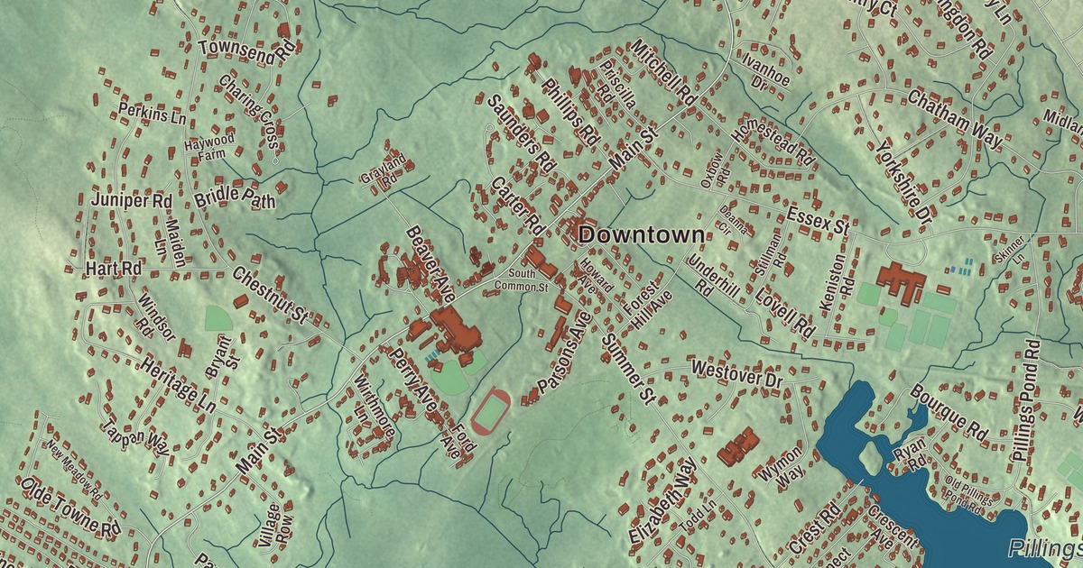
Lynnfield has always been two villages under one town government: Lynnfield Center around the old meetinghouse and common on Main Street and Summer Street, and South Lynnfield down by the old Newburyport Turnpike. This map prints Main Street, Summer Street, Salem Street, Lowell Street, Walnut Street and Broadway, with Suntaug Lake, Pillings Pond, Cedar Pond and Devils Dishfull Pond. Click here to purchase a print of this map for your wall.
Lynnfield is in Essex County.
KNOWOL made this map in 2026 from public survey data and gave it the look of a vintage atlas. The hills and wetlands come from United States Geological Survey elevation data, and the Census Bureau supplied the streets and the town line. Lynnfield covers 10.5 square miles about 14 miles north of Boston and had 13,000 people at the 2020 census. The Ipswich River forms its northern border, several brooks cross the town, and Suntaug Lake, Reedy Meadow, Pillings Pond and a Walden Pond of its own lie inside it. A corner of the Lynn Woods Reservation reaches into the southeast, and Middleton Hill in the north is the highest ground.
Lynn Farms
Lynnfield began as the outlying part of Lynn known as Lynn Farms. The Town of Lynnfield’s recorded history, in the Secretary of the Commonwealth’s list, dates European settlement to 1638. In January 1711/12 the people of Lynn Farms petitioned to become Lynn’s second precinct, since the first church on Lynn Common was too far to travel, and in 1714 they agreed to buy the land that’s now the town common and put up a meetinghouse. Lynnfield became a district apart from Lynn in 1782, and it was incorporated as a town in 1814. The town remains part of Essex County today.
The Old Meeting House still stands at the heart of the Meetinghouse Common District, on Summer, South Common and Main Streets, and its page calls it the second oldest Puritan Congregationalist meetinghouse still standing in Massachusetts, after the Old Ship Meeting House in Hingham. The town set up its Historical Commission in 1967 to look after it, and the district, with fifteen other buildings and sites around the common, joined the National Register in 1976.
Two villages
For most of its history Lynnfield Center held a mostly farming population, while South Lynnfield was a crossroads among bigger neighboring towns. The town had two inns, a granite quarry, a small soda bottler and a few places to eat, and in 1812 it was one of the towns drawn into “The Gerry-mander,” the district the Boston Gazette named that March. The stagecoach line from Boston to Portsmouth, New Hampshire, the “Newburyport Turnpike,” ran through South Lynnfield and later became U.S. Route 1, bringing new families north after World War II. Lynnfield Center kept a small commuter rail platform near today’s town hall offices into the late 1950s or early 1960s.
During the Civil War, Camp Stanton stood on the Newburyport Turnpike near the Peabody line, with streets of tents and cook houses on both sides of the turnpike down toward Suntaug Lake. From 1861 to 1862 it trained ten Massachusetts infantry regiments and four light artillery batteries, and Henry Wilson and Nelson A. Miles were among the soldiers who drilled there. Today Lynnfield is mostly a residential suburb, home to the dairy company HP Hood and the Market Street shopping center, and the Wakefield-Lynnfield Rail Trail, still partly under construction, follows the old Newburyport Railroad over the Reedy Meadow wetland. Click here to learn more about the history of Lynnfield.
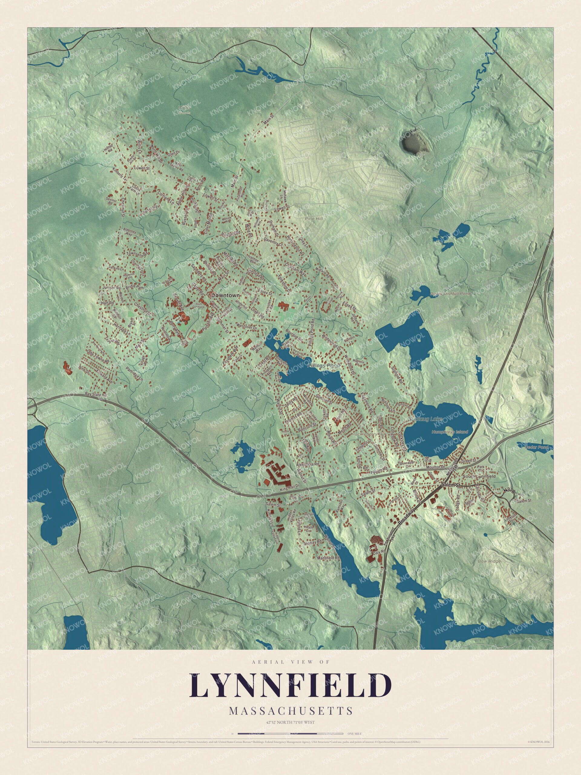
Click to explore a larger preview. The digital watermark does not appear on printed maps.
Names on this map
These names are printed on this map.
Places: Downtown, South Lynnfield, Bow Ridge, Huckleberry Hill, Humphreys Island, Pine Hill, Cedar Pond, Devils Dishfull Pond, Suntaug Lake, Pillings Pond and Willis Woods.
Streets and roads: Salem Street, Broadway, Main Street, Summer Street, Lowell Street, Walnut Street, Chestnut Street, Essex Street, King Rail Drive, Locksley Road, Edgemere Road, Grey Lane.
More street names, A to Z
Alderney Way, Alexandra Road, Apple Hill Lane, Baldwin Lane, Bancroft Street, Bay State Road, Beaver Avenue, Bishops Lane, Bluejay Road, Bourque Road, Bridle Path, Brook Drive, Bryant Street, Carter Road, Charing Cross, Chatham Way, Cider Mill Road, Cooks Farm Lane, Cortland Lane, Crescent Avenue, Crest Road, Daly Road, Daventry Court, Deanna Circle, Doncaster Circle, Drury Lane, Dunstan Road, Durham Drive, Edward Avenue, Elizabeth Way, Essex Village, Fairview Road, Fall Way, Fern Lane, Fernway, Fletcher Road, Ford Avenue, Forest Hill Avenue, Gerry Road, Glen Drive, Grayland Road, Green Street, Grove Street, Hampton Court, Hart Road, Haywood Farm, Heath Circle, Heritage Lane, Herrick Road, Hidden Valley Farm, Hidden Valley Road, Hilltop Road, Homestead Road, Horseshoe Drive, Howard Avenue, Huntingdon Road, Ivanhoe Drive, Jensen Street, Jordan Road, Juniper Road, Keniston Road, Kimball Lane, Kimberly Terrace, Knoll Road, Lakeview Avenue, Lander Road, Lantern Lane, Ledge Road, Longbow Road, Lookout Terrace, Lovell Road, Lynnfield Cmns, Magnolia Drive, Maiden Lane, Mansfield Road, Melch Road, Melody Lane, Merrow Road, Midland Road, Mitchell Road, Mohawk Lane, Moran Road, Moulton Drive, Newburyport Turnpike, New Meadow Road, Norris Road, North Hill Drive, Oak Street, Olde Towne Road, Old Pillings Pond Road, Orchard Lane, Ostis Way, Oxbow Road, Park Street, Parsons Avenue, Partridge Lane, Perkins Lane, Perry Avenue, Phillips Road, Pillings Pond Road, Pine Hill Road, Pine Street, Pocahontas Way, Powder Hill Road, Priscilla Road, Prospect Avenue, Putney Lane, Pyburn Road, Ramsdell Way, Robin Road, Ross Drive, Rourke Lane, Russet Lane, Ryan Road, Saunders Road, Sevinor Road, Skinner Lane, Smith Farm Trail, South Common Street, Sparhawk Drive, Stafford Road, Stillman Road, Sylvan Circle, Tapley Road, Tappan Way, Tedford Lane, Thistle Lane, Thomas Road, Timberhill Lane, Todd Lane, Tophet Road, Townsend Road, Trickett Road, Underhill Road, Village Row, Westover Drive, West Tapley Road, Wildewood Drive, Wildwood Drive, Williams Road, Willis Lane, Willowby Way, Winchester Drive, Windsor Road, Wing Road, Wirthmore Lane, Wymon Way, Yorkshire Drive.
See it on a wall
The Lynnfield map as a framed print. Swipe for more.


Around the map
Start with South Lynnfield. Follow Salem Street, Broadway, Main Street, Summer Street, Lowell Street and Walnut Street across town. Cedar Pond, Devils Dishfull Pond, Suntaug Lake, Pillings Pond, Bow Ridge, Huckleberry Hill, Pine Hill and Humphreys Island are all printed on the map. In the northwest corner lies part of Camp Curtis Guild, a Massachusetts National Guard base named for Governor Curtis Guild Jr., which Lynnfield shares with Reading and Wakefield.
The Lynnfield map makes a fine addition to an office, library or den, and it can help teach children the geography and history of a town that grew from Lynn Farms. It’s made for people who call Lynnfield home, from the Center to South Lynnfield, and it shows the town as it looks today. Zoom in on the preview above to explore the details, then click here to get your copy of the Lynnfield, Massachusetts map.

Sources