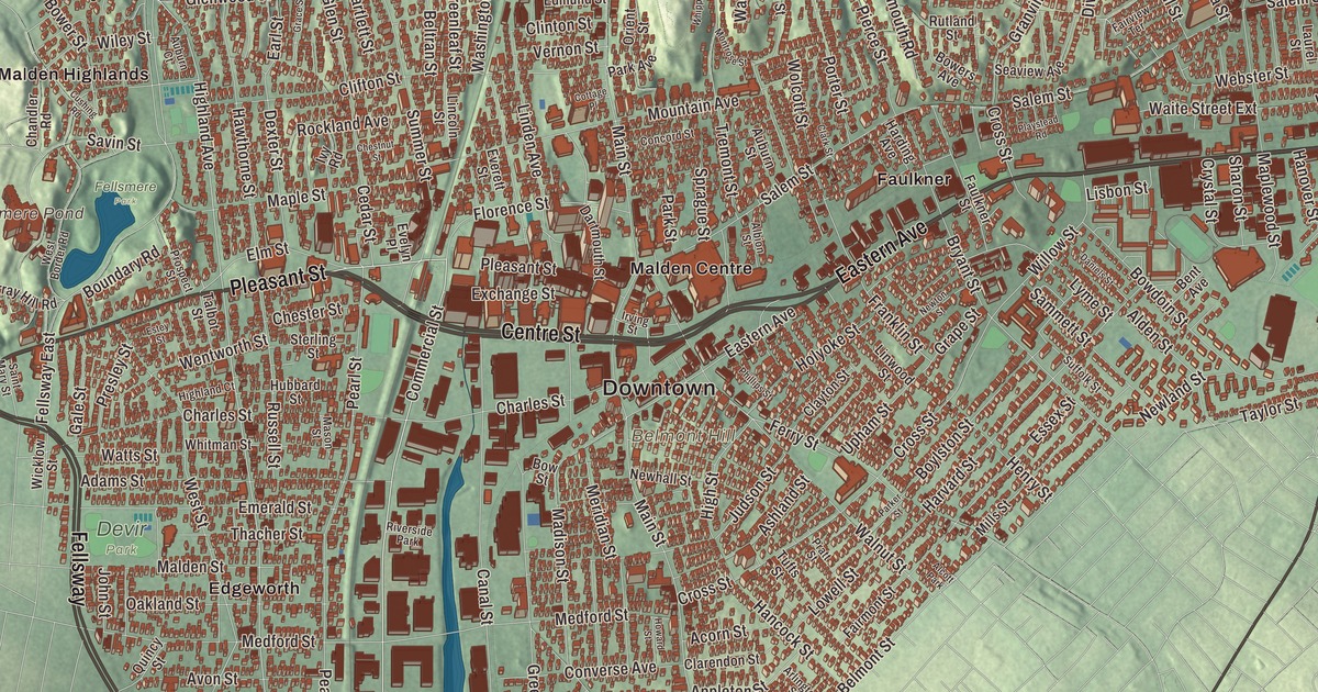
Malden is a city of squares, Malden Square at Main and Pleasant streets, Maplewood Square, Linden Square and Bellrock, with the cliffs of the Middlesex Fells rising along its northwest edge. This map prints Pleasant Street, Eastern Avenue, Broadway, Temple Street, the Fellsway and the Bennett Highway, with Fellsmere Pond, Fells Reservoir, Belmont Hill and Boojum Rock. Click here to purchase a print of this map for your wall.
Malden is in Middlesex County.
KNOWOL made this map in 2026 from public survey data and gave it the look of a vintage city atlas. The hills come from United States Geological Survey elevation data, and the Census Bureau supplied the streets and the city line. Malden covers 5.1 square miles north of the Mystic River, bordered by Melrose, Medford, Everett, Revere and Saugus, and it had 66,263 people at the 2020 census. The Malden River drains it. Boojum Rock, in the northwest corner inside the Middlesex Fells Reservation, is the highest point in the city at about 275 feet.
Mistick Side
Puritans settled Malden’s hilly woodland north of the Mystic River in 1640 on land bought in 1629 from the Mystic people of the Pawtucket Confederation, with a further grant in 1639 from the Squaw Sachem of Mistick and her husband Webcowet. The City of Malden’s recorded history, in the Secretary of the Commonwealth’s list, dates European settlement to 1640. The place was first called the “Mistick Side” and belonged to Charlestown, until Malden was incorporated as a town in 1649 under the name “Mauldon.” Joseph Hills, an early settler and landholder, chose the name after Maldon in England. Melrose was part of Malden until 1850 and Everett until 1870. It was incorporated as a city in 1881.
Malden’s roughly 1,000 people joined the resistance to British rule early. They boycotted tea in 1770 to protest the Revenue Act, and the city page says Malden was the first town to petition the colonial government to break away from the British Empire. Adoniram Judson was born in Malden on August 9, 1788, the son of a Congregational minister. He went to Burma as a Baptist missionary at 25, worked there for almost 40 years, and spent 24 years translating the whole Bible into Burmese, finishing in 1834.
Rubber, maples and a Richardson library
Elisha S. Converse moved to Malden in 1850 and in 1853 opened the Boston Rubber Shoe Company here, which grew to 3,500 workers and became one of the largest rubber manufacturers in the country. When Malden became a city in 1881, he was elected its first mayor. He and his wife Mary gave the Converse Memorial Building in memory of their son Frank, and Henry Hobson Richardson designed it in brown Longmeadow sandstone. It opened as the public library in 1885, it was the last of Richardson’s library designs, and it’s a National Historic Landmark. A different Converse, Marquis Mills Converse, founded the Converse Rubber Shoe Company in Malden in 1908, and its All-Star basketball shoe followed in 1917. That Converse factory operated at the bottom of Pearl Street in Edgeworth, the original home of the All-Star.
In 1847 Joshua Webster, president of the Saugus Branch Railroad, bought 200 acres along the line’s planned route and laid out a neighborhood of wide streets and ornamental trees. He planted hundreds of maples, and the place became Maplewood. Frederick Law Olmsted designed Fellsmere Park on land Converse had given, a swamp he first bought as an emergency water reservoir after his factory fire of 1875, and the park was built from 1893 to 1899 around a pond. Malden High School and Medford High School have played on Thanksgiving Day since 1889, and the city page calls it the second-oldest continuous high school football rivalry in the United States. Click here to learn more about the history of Malden.
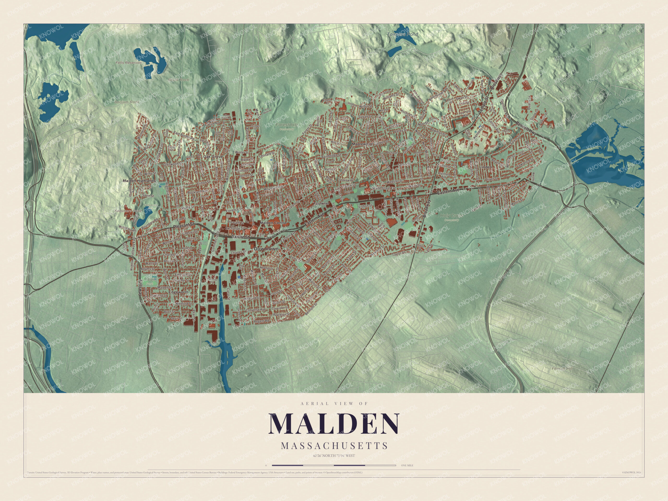
Click to explore a larger preview. The digital watermark does not appear on printed maps.
Names on this map
These names are printed on this map.
Places: Downtown, Belmont Hill, Black Rock, Boojum Rock, Fennos Hill, Fells Reservoir, Fellsmere Pond, Towners Pond, Fellsmere Park, Forestdale Cemetery, Holy Cross Cemetery, Devir Park, Edgeworth, Faulkner, Linden, Malden Centre, Malden Highlands, Maplewood, Oak Grove, Riverside Park and Alcott Park.
Streets and roads: Eastern Avenue, Pleasant Street, Broadway, Bennett Highway, Temple Street, Fellsway, Centre Street, Salem Street, Commercial Street, Central Avenue, Elwell Street, Beachview Avenue.
More street names, A to Z
Acorn Street, Adams Street, Albion Street, Alden Street, Andrew Street, Appleton Street, Arlington Street, Ashland Street, Auburn Court, Auburn Street, Autumn Street, Avon Street, Bainbridge Street, Barker Road, Bartlett Street, Bayrd Road, Bayrd Street, Beach Street, Bellvale Street, Belmont Street, Beltran Street, Bent Avenue, Blomerth Street, Boulder Street, Boundary Road, Bowdoin Street, Bowers Avenue, Bower Street, Bowman Street, Bow Street, Boylston Street, Bryant Street, Canal Street, Cedar Street, Chandler Road, Charles Street, Cherry Street, Chester Street, Chestnut Street, Church Street, Claremont Street, Clarendon Street, Clark Street, Clayton Street, Cleveland Street, Cliff Street, Clifton Street, Clinton Street, Coleman Street, Columbia Street, Concord Street, Converse Avenue, Corey Road, Cottage Place, Crescent Lane, Cross Street, Crystal Street, Curve Street, Cushing Road, Daniels Street, Dartmouth Street, Davis Street, Delta Terrace, Devir Street, Dexter Street, Division Street, Dodge Street, Durso Avenue, Earl Street, East Border Road, Echo Street, Edmund Street, Elm Street, Emerald Street, Essex Street, Estey Street, Evelyn Place, Everett Street, Exchange Street, Fairlawn Street, Fairmont Street, Fairview Terrace, Faulkner Street, Fellsway East, Ferry Street, First Street, Floral Avenue, Florence Street, Forest Court, Forest Street, Franklin Street, Fulton Street, Gale Street, Garden Street, Glen Court, Glendale Avenue, Glen Rock Avenue, Glen Rock Road, Glen Street, Glenwood Street, Goodhue Street, Grace Street, Granite Street, Grant Road, Granville Avenue, Grape Street, Greenleaf Street, Green Street, Grove Street, Hadley Street, Hancock Road, Hancock Street, Hanover Street, Harding Avenue, Harvard Street, Hawthorne Street, Henry Street, Highland Avenue, Highland Court, High Street, Hill Street, Holyoke Street, Home Street, Howard Street, Hubbard Street, Hunting Street, Hurd Street, Irving Street, Island Hill Avenue, Ivy Road, John Street, Judson Street, Kennedy Drive, Kimball Street, Lake Street, Lanark Road, Las Casas Street, Laurel Street, Lawrence Street, Lebanon Street, Leonard Street, Lillian Road, Lincoln Street, Linden Avenue, Linwood Street, Lisbon Street, Lodgen Court, Loomis Street, Lora Street, Lowell Street, Lyle Street, Lyle Terrace, Lyme Street, Lynn Street, Madison Street, Main Street, Malden Street, Manley Terrace, Maple Street, Maplewood Street, Marlboro Street, Marshall Avenue, Mason Street, McCormack Street, Medford Street, Meridian Street, Mills Street, Milton Street, Mingo Street, Montrose Street, Morris Street, Mountain Avenue, Mount Vernon Street, Murray Hill Road, Neal Street, Nevada Avenue, Newhall Street, Newland Street, Newton Street, Nichols Road, Noble Street, North Milton Street, Oakland Street, Oak Terrace, Olive Avenue, Olive Avenue Extended, Oliver Street, Orchard Street, Orient Street, Pamela Circle, Park Avenue, Parker Street, Parkside Place, Park Street, Pearl Street, Phillips Street, Pierce Street, Pine Banks Road, Plainfield Avenue, Playstead Road, Plymouth Road, Porter Street, Pratt Street, Prentiss Street, Presley Street, Princeton Road, Prospect Street, Prosper Street, Quarry Lane, Quincy Street, Regent Road, Revere Street, Ridge Hill Avenue, Ripley Street, Rivers Lane, Roberts Street, Rockingham Avenue, Rockland Avenue, Rockwell Street, Rocky Nook, Russell Street, Rutland Street, Saint Mary Street, Sammett Street, Savin Street, Seaview Avenue, Seery Street, Sharon Street, Sheafe Street, Skyline Drive, Sprague Street, Spruce Street, Sterling Street, Stone Lane, Suffolk Street, Summer Street, Swan Street, Sylvan Street, Talbot Street, Taylor Street, Tea Party Way, Thacher Street, Third Street, Tremont Street, Trueman Drive, Tufts Street, Tyler Street, Upham Street, Valley Street, Vernon Street, Waite Street, Waite Street Extension, Wallace Street, Walnut Street, Washington Street, Watts Street, Webster Street, Wentworth Street, Wescott Street, Wesley Street, West Border Road, West Street, Wheeler Street, Whipple Street, Whitman Street, Wicklow Street, Wilbur Street, Wiley Street, Willard Street, Williams Street, Willow Street, Winter Street, Wolcott Street, Woodland Road, Wyoming Avenue.
See it on a wall
The Malden map as a framed print. Swipe for more.


Around the map
Start with Edgeworth, the southwest corner of the city by the Medford and Everett lines. Follow Eastern Avenue, Pleasant Street, Broadway, the Bennett Highway, Temple Street and the Fellsway across the city. Then look outward toward Faulkner, Linden, Malden Centre, Malden Highlands and Maplewood. Fells Reservoir, Fellsmere Pond, Towners Pond, Belmont Hill, Black Rock and Boojum Rock are all printed on the map. Fellsmere Pond covers 25 acres, and in winter the hill called Seven Bumps in Fellsmere Park fills with sledders. Belmont Hill lies between Bellrock and Ferryway.
The Malden map makes a fine addition to an office, library or den, and it can help teach children the geography and history of a city of squares at the edge of the Fells. It’s made for people who call Malden home, from Edgeworth to Maplewood, and it shows the city as it looks today. Zoom in on the preview above to explore the details, then click here to get your copy of the Malden, Massachusetts map.

Sources
- Malden, Massachusetts, Wikipedia
- Adoniram Judson, Wikipedia
- Elisha S. Converse, Wikipedia
- Converse Memorial Library, Wikipedia
- Converse (brand), Wikipedia
- Fellsmere Park Parkways, Wikipedia
- City and Town Incorporation and Settlement Dates, Secretary of the Commonwealth of Massachusetts (archived copy)