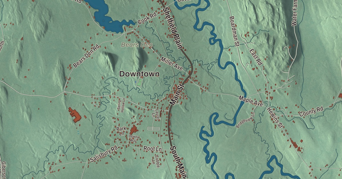
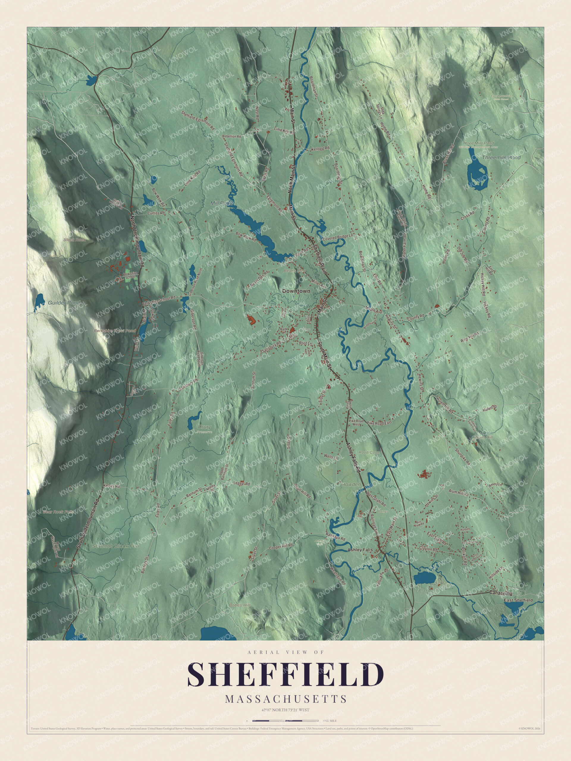
In 1781 Elizabeth Freeman, held in slavery in a Sheffield house, went to court and won her freedom under the new state constitution. This map of her town prints Main Street, South Main Street, Ashley Falls Road, Canaan Road and the North and South Undermountain roads along the Housatonic valley, with East Sheffield and Ashley Falls. Click here to purchase a print of this map for your wall.
Sheffield is in Berkshire County.
KNOWOL made this map in 2026 from public survey data and gave it the look of an old atlas. United States Geological Survey elevation data shapes the valley and the mountains on either side, and the roads and the town line come from the Census Bureau. Sheffield covers 48.6 square miles on the Connecticut line, with Great Barrington to the north, New Marlborough to the east, North Canaan and Salisbury, Connecticut, to the south, Mount Washington to the west and Egremont to the northwest. U.S. Route 7 divides the town roughly in half, and the Appalachian Trail crosses its northern third. Sheffield had 3,327 people at the 2020 census.
The first Berkshire town
On April 25, 1724, the land was bought from Chief Konkapot and 20 other Stockbridge Mahicans. The town page says Matthew Noble of Westfield settled first, in 1725, in what was then the lower township of Housatonic. The Town of Sheffield’s recorded history, in the Secretary of the Commonwealth’s list, dates European settlement to 1726. New York said the land west of the Housatonic was its own under the Westenhook Patent of 1705, but Sheffield was incorporated as a town in 1733, on June 22, the first town incorporated in what’s now Berkshire County. Its north parish became Great Barrington in 1761. The town sits on the fertile floodplain of the Housatonic River, and farming was its main work.
John Ashley, who came from Westfield, built his house west of Ashley Falls in 1735, and it’s one of the oldest houses in southern Berkshire County. In its upstairs study the Sheffield Declaration was drafted, a petition against British policies and a statement of individual rights that the town approved on January 12, 1773. Theodore Sedgwick wrote the text, and its first resolution says that “Mankind in a state of nature are equal, free, and independent of each other,” words echoed three years later in the Declaration of Independence. Elizabeth Freeman, an enslaved woman in the Ashley household, heard the new Massachusetts Constitution of 1780 with its words that all men are born free and equal. She asked Sedgwick to take her case, and in August 1781 a jury ruled in her favor, making her the first African American woman set free under the state constitution, in a court battle that signaled the end of slavery in Massachusetts. She took the name Elizabeth Freeman, and in August 2022 the Sheffield Historical Society unveiled a statue in her honor. The Ashley house is now a museum of The Trustees of Reservations.
Click to explore a larger preview. The digital watermark does not appear on printed maps.
Names on this map
These names are printed on this map.
Places: Downtown, East Sheffield, Alum Hill, Babes Hill, Bears Den, Black Rock, Bear Rock Falls, Berkshire Trout Pond, Mill Pond, Threemile Pond, Guilder Pond, Ashley Field, Bangs, Drury Preserve, East Mountain State Forest, Howden, Schenob Brook Fen, Three Mile Pond Wildlife Management Area and Ashley Falls.
Streets and roads: Main Street, Ashley Falls Road, North Undermountain Road, South Main Street, South Undermountain Road, Canaan Road, North Main Street, Sheffield Plain, Berkshire School Road, Cook Road, Egremont Road, Sheffield Egremont Road.
More street names, A to Z
Alum Hill Road, Amory Lane, Barnum Street, Bears Den Road, Berkshire School, Blair Lane, Boardman Street, Bow Wow Road, Bridgeview Lane, Brush Hill Road, Bull Hill Road, Bunce Road North, Bunce Road South, Bus Park Road, Clayton Road, Cobble Lane, Cooper Hill Road, County Road, Covered Bridge Lane, Cross Road, Curtiss Road, Dewey Way, East Main Street, East Road, East Stahl Road, Foley Road, Ford Hill Road, Galvin Farm Trail, Giberson Road, Giberson Road North, Giberson Road South, Glennana Way, Guilder Hollow Road, Hewins Street, Hickey Hill Road, Hickey Road, Hillside Lane, Home Road, Huldahs Lane, Hulett Hill Road, Hulett Street, Kellogg Road, Kelsey Road, Laurel Lane, Legeyt Road, Lime Kiln Road, Maple Avenue, Miller Avenue, Mount Washington Road, Oak Street, Old Joe Road, Park Lane, Pike Road East, Pike Road West, Polikoff Road, Railroad Street, Rannapo Road, Rebellion Road, Root Lane, Rote Hill Road, Salisbury Road, Sheffield-Egremont Road, Shunpike Road, Silver Street, Soda Spring Creek Drive, Soda Springs Lane, Spring Hollow Lane, Tulip Lane, Upper Barnnum Street, Valley View Road, Veeley Road, Water Farm Road, Weatogue Road, Wells Lane, West Road, West Stahl Road.
Around the map
Start with East Sheffield. Follow Main Street, Ashley Falls Road, North Undermountain Road, South Main Street, South Undermountain Road and Canaan Road across town. Then look outward toward Ashley Falls. Berkshire Trout Pond, Mill Pond, Threemile Pond, Guilder Pond, Alum Hill, Babes Hill, Black Rock and Bear Rock Falls are all printed on the map. Ashley Falls, named for Colonel Ashley, is home to Bartholomew’s Cobble, a 329-acre National Natural Landmark on the Konkapot and Housatonic rivers with more than 800 kinds of plants, North America’s greatest diversity of ferns and a view from Hurlburt’s Hill. To the west, Mount Everett State Reservation reaches into Sheffield from Mount Washington; Guilder Pond, in the reservation, has old growth forest around it, with picnicking and canoeing. The Old Covered Bridge crosses the Housatonic near Sheffield Plain. It’s a 1996 replica of an 1837 lattice truss bridge that burned in 1994, which was the oldest covered bridge in Massachusetts at the time, and it’s open to people on foot. Sheffield is also home to the Berkshire School, a private preparatory school.
The Sheffield map makes a fine addition to an office, library or den, and it can help teach children the geography and history of the town where Elizabeth Freeman won her freedom. It’s made for people who call Sheffield home, from East Sheffield to Ashley Falls, and it shows the town as it looks today. Zoom in on the preview above to explore the details, then click here to get your copy of the Sheffield, Massachusetts map.

We made a map for every town and city in Massachusetts. Explore the complete Massachusetts map collection and find your town.
Sources
- Sheffield, Massachusetts, Wikipedia
- Colonel John Ashley House, Wikipedia
- Sheffield Declaration, Wikipedia
- Elizabeth Freeman, Wikipedia
- Bartholomew’s Cobble, Wikipedia
- Mount Everett State Reservation, Wikipedia
- Old Covered Bridge, Wikipedia
- City and Town Incorporation and Settlement Dates, Secretary of the Commonwealth of Massachusetts (archived copy)