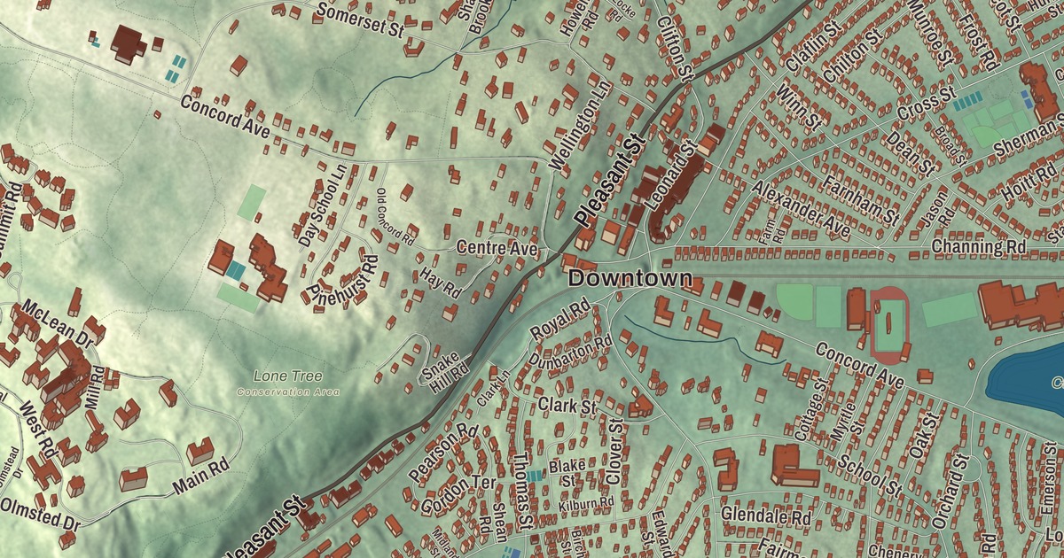
Ask someone from Belmont where they live and you’ll likely hear Belmont Center, Cushing Square or Waverley Square before a street name. This map prints Pleasant Street, Trapelo Road, Park Avenue, Payson Road, Clifton Street and Elm Street, with Payson Park, Claypit Pond, Rock Meadow and Meetinghouse Hill, and Fresh Pond and Spy Pond just over the town line. Click here to purchase a print of this map for your wall.
Belmont is in Middlesex County, between Cambridge, Arlington, Lexington, Waltham and Watertown.
KNOWOL made this map in 2026 from public survey data and gave it the look of an old atlas. The rise and fall of the land comes from United States Geological Survey elevation data, and the streets and the town line come from the Census Bureau. Belmont is small, 4.7 square miles, and it had 27,295 people at the 2020 census.
Bellmont
The Town of Belmont’s recorded history, in the Secretary of the Commonwealth’s list, dates European settlement to 1636, the year Roger Wellington, an early settler, bought the 14 acres where the Homer House stands today. Until 1859 this ground belonged to Watertown, Waltham and West Cambridge, now Arlington. Belmont was incorporated as a town on March 18, 1859, by residents of those towns who wanted a dry township of their own. They named it for Bellmont, the 200-acre estate of John Perkins Cushing, a wealthy China trader and the largest donor to the new town, and Cushing Square carries his name. The town remains part of Middlesex County today. In 1880 Cambridge annexed Belmont’s easternmost corner, including the western part of Fresh Pond, after a dispute over a slaughterhouse built beside the pond, which supplied Cambridge’s water.
Belmont stayed a farm town, sending produce and livestock to Boston, until trolleys and better roads arrived around the turn of the 20th century and large estates went up; the population grew by over 70 percent in the 1920s. In 1907 the railroad was raised over the road at Belmont Center on a stone arch bridge, and at Waverley the tracks were lowered to pass under Trapelo Road. The little Wellington Hill Station, built in the 1840s as a private school and used by the Fitchburg Railroad from 1852 to 1879, was given to the Belmont Historical Society in 1974, restored, and moved to its present spot in Belmont Center in 1980.
Winslow Homer’s Belmont
The Homer House on Pleasant Street, a 15-room Italianate mansion, was built in 1853 as a summer home for the Boston merchant William Flagg Homer. His nephew, the painter Winslow Homer, spent much of his youth nearby and used the house as the setting for several works, among them The War, Making Havelocks for the Volunteers, from 1861, set in its parlor. He made The New Town of Belmont on the very day the town was incorporated. The Belmont Woman’s Club, founded in 1920, bought the house in 1927 to save it from demolition and has used it ever since. It’s part of the Pleasant Street Historic District, which runs along Pleasant Street, Route 60, and takes in the town hall and the library; the district joined the National Register of Historic Places in 1979.
Claypit Pond, between Concord Avenue and Belmont High School, began as a hole in the ground. The Parry Brothers opened a brickyard there in 1888, and after 1900 the New England Brick Company made 15 million bricks a year there. The best clay ran out by 1926, and in 1927 the town bought the pit for $22,500 to use as a dump, and in 1933 it turned Wellington Brook into the pit through a culvert, filling it with 80 million gallons of water. The town page calls the reclaimed dump and quarry a lasting example of environmental planning.
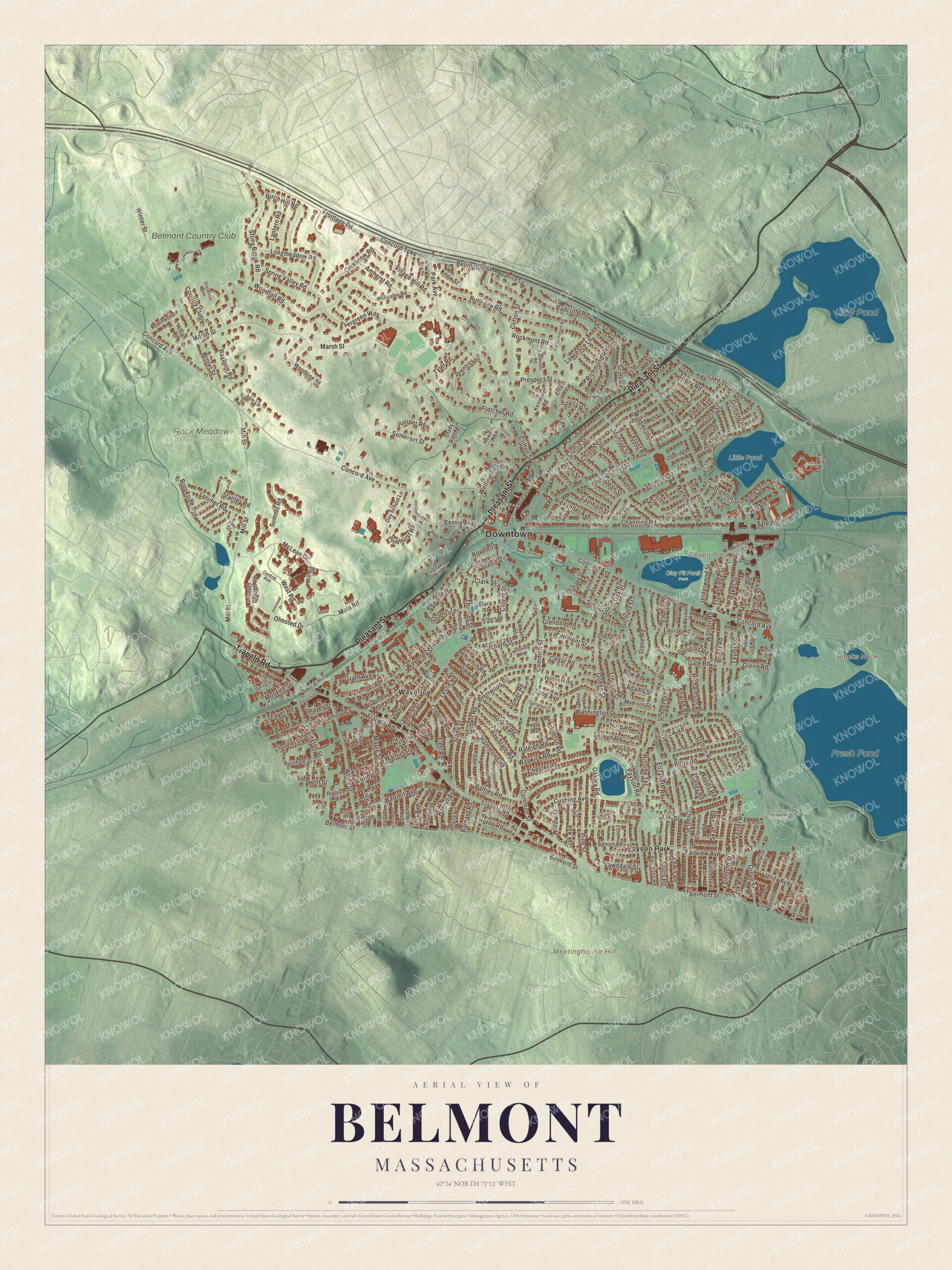
Click to explore a larger preview. The digital watermark does not appear on printed maps.
Names on this map
These names are printed on this map.
Places: Downtown, Meetinghouse Hill, Blacks Nook, Claypit Pond, Fresh Pond, Spy Pond, Belmont Cemetery, Clay Pit Pond Park, Little Pond, Lone Tree Conservation Area, Rock Meadow Conservation Area, Payson Park, Waverley, Belmont Country Club and Greybirch Park.
Streets and roads: Pleasant Street, Trapelo Road, Park Avenue, Payson Road, Clifton Street, Elm Street, Bellington Street, Concord Turnpike, Village Hill Road, Lexington Street, Hillside Terrace, Leonard Street.
More street names, A to Z
Acorn Park Drive, Acorn Street, Adams Street, Albert Avenue, Alexander Avenue, Alma Avenue, Amherst Road, Anis Road, Arthur Road, Audrey Road, Audubon Lane, Baker Street, Barnard Road, Bartlett Avenue, Bay State Road, Beatrice Circle, Becket Road, Beech Street, Belmont Street, Benjamin Road, Benton Road, Berwick Street, Betts Road, Birch Hill Road, Birch Street, Blake Street, Bow Road, Brettwood Road, Brighton Street, Bright Road, Broad Street, Brookside Avenue, Burnham Street, Carleton Circle, Carleton Road, Cedar Road, Central Avenue, Centre Avenue, Chandler Street, Channing Road, Chenery Terrace, Chester Road, Chilton Street, Choate Road, Church Street, Claflin Street, Clairemont Road, Clarendon Road, Clark Lane, Clark Street, Clover Street, Colby Street, Common Street, Concord Avenue, Coolidge Road, Cottage Street, Country Club Lane, Cowdin Street, Creeley Road, Crestview Road, Cross Street, Cushing Avenue, Dalton Road, Dante Avenue, Davis Road, Day School Lane, Dean Street, Douglas Road, Drew Road, Dunbarton Road, Edgemoor Road, Edward Street, Elizabeth Road, Emerson Street, Ernest Road, Essex Road, Evergreen Way, Exeter Street, Fairmont Street, Fairview Avenue, Falmouth Street, Farm Road, Farnham Street, Fieldmont Road, Flanders Road, Fletcher Road, Flett Road, Foster Road, Frederick Street, Frontage Road, Frost Road, Gale Road, George Street, Gilbert Road, Gilmore Road, Glendale Road, Glenn Road, Goden Street, Gordon Terrace, Gorham Road, Grant Avenue, Grove Street, Hamilton Road, Hammond Road, Harding Avenue, Harriet Avenue, Harris Street, Hawthorne Street, Hay Road, Hillcrest Road, Hill Road, Hittinger Street, Hoitt Road, Holden Road, Holt Street, Homer Road, Horace Road, Horne Road, Hough Road, Howells Road, Hull Street, Hurd Road, Hurley Street, Irving Street, Jackson Road, Jason Road, Jeanette Avenue, Jonathan Street, Juniper Road, Kenmore Road, Kent Street, Kilburn Road, King Street, Knox Street, Lake Street, Lantern Road, Larch Circle, Lawndale Street, Lawrence Lane, Leicester Road, Leslie Road, Lewis Road, Lincoln Street, Livermore Road, Locke Road, Locust Street, Long Avenue, Longmeadow Road, Lorimer Road, Loring Street, Louise Road, Madison Street, Main Road, Mannix Circle, Maple Street, Marion Road, Marlboro Street, Marsh Street, McLean Drive, Middlecot Street, Midland Street, Mill Road, Mill Street, Moraine Street, Munroe Street, Myrtle Street, Newcastle Road, Oak Avenue, Oakley Road, Oakmont Lane, Oak Street, Old Concord Road, Oliver Road, Olmstead Drive, Olmsted Drive, Orchard Street, Oxford Avenue, Palfrey Road, Park Road, Payson Terrace, Pearson Road, Pinehurst Road, Pine Street, Plymouth Avenue, Pond Street, Preble Gardens, Prentiss Lane, Prospect Street, Radcliffe Road, Raleigh Road, Rayburn Road, Richardson Road, Richmond Road, Ridge Road, Ripley Road, Robinwood Road, Rockmont Road, Ross Road, Royal Road, Russell Terrace, Rutledge Road, Sargent Road, School Street, Scott Road, Selwyn Road, Shady Brook Lane, Sharpe Road, Shaw Road, Shean Road, Sherman Street, Simmons Avenue, Skahan Road, Slade Street, Snake Hill Road, Somerset Street, South Cottage Road, Spring Street, Spring Valley Road, Stanley Road, Statler Road, Stearns Road, Stella Road, Stewart Terrace, Stone Road, Stony Brook Road, Stults Road, Summit Road, Sycamore Street, Taylor Road, Thayer Road, Thayer Street, Thomas Street, Tobey Road, Townsend Road, Trowbridge Street, Troy Road, Tyler Road, Underwood Street, Unity Avenue, Vale Road, Van Ness Road, Vincent Avenue, Walnut Street, Warwick Road, Washington Street, Waterhouse Road, Watson Road, Waverley Street, Wellesley Road, Wellington Lane, West Road, West Street, White Street, Willow Street, Wilson Avenue, Winn Street, Winslow Road, Winter Street, Winthrop Road, Woodbine Road, Woodfall Road, Woods Road, Worcester Street, York Road.
See it on a wall
The Belmont map as a framed print. Swipe for more.


Around the map
Start at Payson Park, then follow Pleasant Street, Trapelo Road, Park Avenue, Payson Road, Clifton Street and Elm Street out toward Waverley. Old farms and greenhouse estates have become open land, and Rock Meadow is one of them. On the Waltham line, Beaver Brook Reservation was the very first reservation of the Metropolitan Park Commission, created in 1893 to protect the Waverly Oaks, a stand of 22 white oaks; the last of them died of old age in the 1920s. McLean Hospital, a psychiatric hospital tied to Harvard Medical School, has its campus in Belmont too. Fresh Pond, a reservoir and park, now lies in Cambridge, with Belmont to its west, and Spy Pond, a 103-acre kettle hole pond, sits near the heart of Arlington. Claypit Pond, Rock Meadow and Meetinghouse Hill are printed on the map along with both of them.
This Belmont map makes a fine addition to an office, library or den, and it can help teach children the geography and history of the town Winslow Homer drew on the day it was born. It’s made for people who call Belmont home, from Payson Park to Waverley, and it shows the town as it looks today. Zoom in on the preview above to explore the details, then click here to get your copy of the Belmont, Massachusetts map.

Sources
- Belmont, Massachusetts, Wikipedia
- Homer House, Wikipedia
- Pleasant Street Historic District (Belmont, Massachusetts), Wikipedia
- Clay Pit Pond, Wikipedia
- Beaver Brook Reservation, Wikipedia
- McLean Hospital, Wikipedia
- Fresh Pond (Cambridge, Massachusetts), Wikipedia
- Spy Pond, Wikipedia
- John Perkins Cushing, Wikipedia
- City and Town Incorporation and Settlement Dates, Secretary of the Commonwealth of Massachusetts (archived copy)