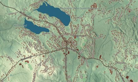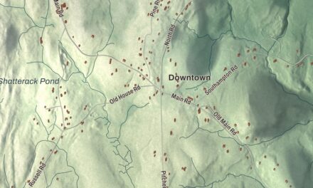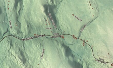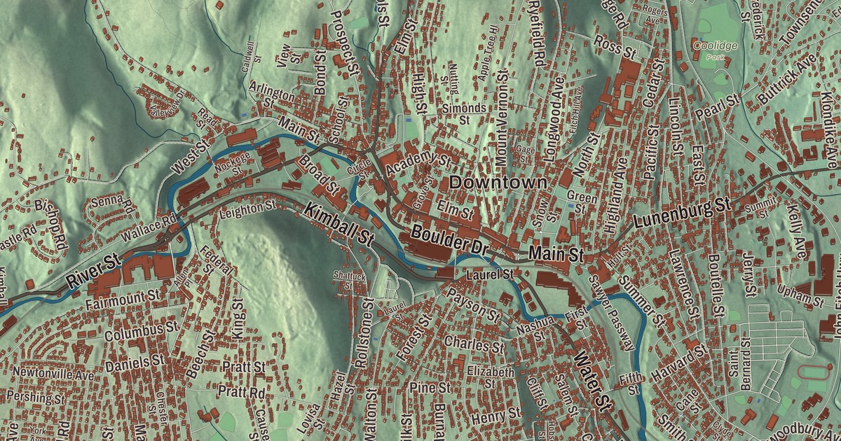
Fitchburg is a mill city on the Nashua River, known for its Victorian buildings, and one road on its map is named for a boulder. This map prints Main Street, River Street, Water Street, Kimball Street, Boulder Drive and the George West Stanton Highway, with Brown Hill, Alpine Hill, Forest Hill, Buck Hill, Baker Pond, Sawmill Pond and the Falulah Reservoir. Click here to purchase a print of this map for your wall.
Fitchburg is in northern Worcester County, and it’s one of the county’s two shire towns.
KNOWOL made this map in 2026 from public survey data and gave it the look of an old atlas. The relief comes from United States Geological Survey elevation data, and the roads and the city line come from the Census Bureau. Fitchburg covers 28.1 square miles, almost all of it land, drained by the Nashua River. Ashby lies to the north, Lunenburg to the east, Leominster to the south and Westminster to the west, with a small piece of Ashburnham to the northwest. The highest point is the top of Brown Hill, near the northwest corner, at 1,210 feet. Fitchburg had 41,946 people at the 2020 census, the third-largest city in the county.
Paper, rails and a tunnel
The Nipmuc lived here before the English. The City of Fitchburg’s recorded history, in the Secretary of the Commonwealth’s list, dates European settlement to 1730, when the land was part of Lunenburg, and Fitchburg was incorporated as a town in 1764. It’s named for John Fitch, one of the committee that won the act of incorporation. Fitchburg was incorporated as a city in 1872.
In the 1800s Fitchburg was an industrial center, and its large mills, first run by water power, turned out machines, tools, clothing, paper and firearms. Alvah Crocker borrowed the money to start a paper mill here in 1823, and his mills grew into the largest in the United States. He then pushed for a railroad to the coast, and the Fitchburg Railroad opened between Boston and Fitchburg in 1845. Crocker was also the leading champion of the Hoosac Tunnel through the Berkshires, and the Fitchburg Railroad ran through it to link Boston with Albany, New York. The tunnel was built using the Burleigh Rock Drill, designed and built in Fitchburg, and when it was finished in 1875 it was the second-longest tunnel in the world. The city’s mill-era prosperity shows in its Victorian buildings, such as the Fay Club and the old North Worcester County Courthouse.
The boulder on the traffic island
A huge glacial boulder once sat on the summit of Rollstone Hill, and it became a landmark where people hiked up to picnic. In 1929, with two quarries cutting away the last of the hill around it, the mayor made them stop so the boulder could be moved. It was blasted into pieces and rebuilt in 1929 and 1930 on a small traffic island near the Upper Common, facing the same way it had on the hill. The Rollstone Boulder is 10 feet tall and weighs 110 tons, and it has lent its name to Rollstone Street, Boulder Drive and the Boulder Cafe. The Fitchburg Art Museum, founded in 1925 through the bequest of the artist Eleanor Norcross, opened its galleries downtown in 1929. The Fitchburg Public Library, founded in 1859, opened one of the country’s first children’s rooms in 1899.
Volunteers created the Fitchburg Abolitionist Park in 2017 to honor the city’s history of anti-slavery work, including its role in the Underground Railroad. Fitchburg’s Finnish-American community had its own newspaper, Raivaaja, “The Pioneer,” published here in Finnish from 1905 to 2009. Clara Hapgood Nash, born in Fitchburg in 1839, became the first woman admitted to the bar in New England, in Maine in 1872. Art Longsjo, born here in 1931, was the first American to compete in the Winter and Summer Olympics in the same year, as a speed skater and a cyclist in 1956. And Don Featherstone, who created the plastic pink flamingo in 1957, lived in Fitchburg and kept 57 of them on his back lawn. Click here to learn more about the history of Fitchburg.
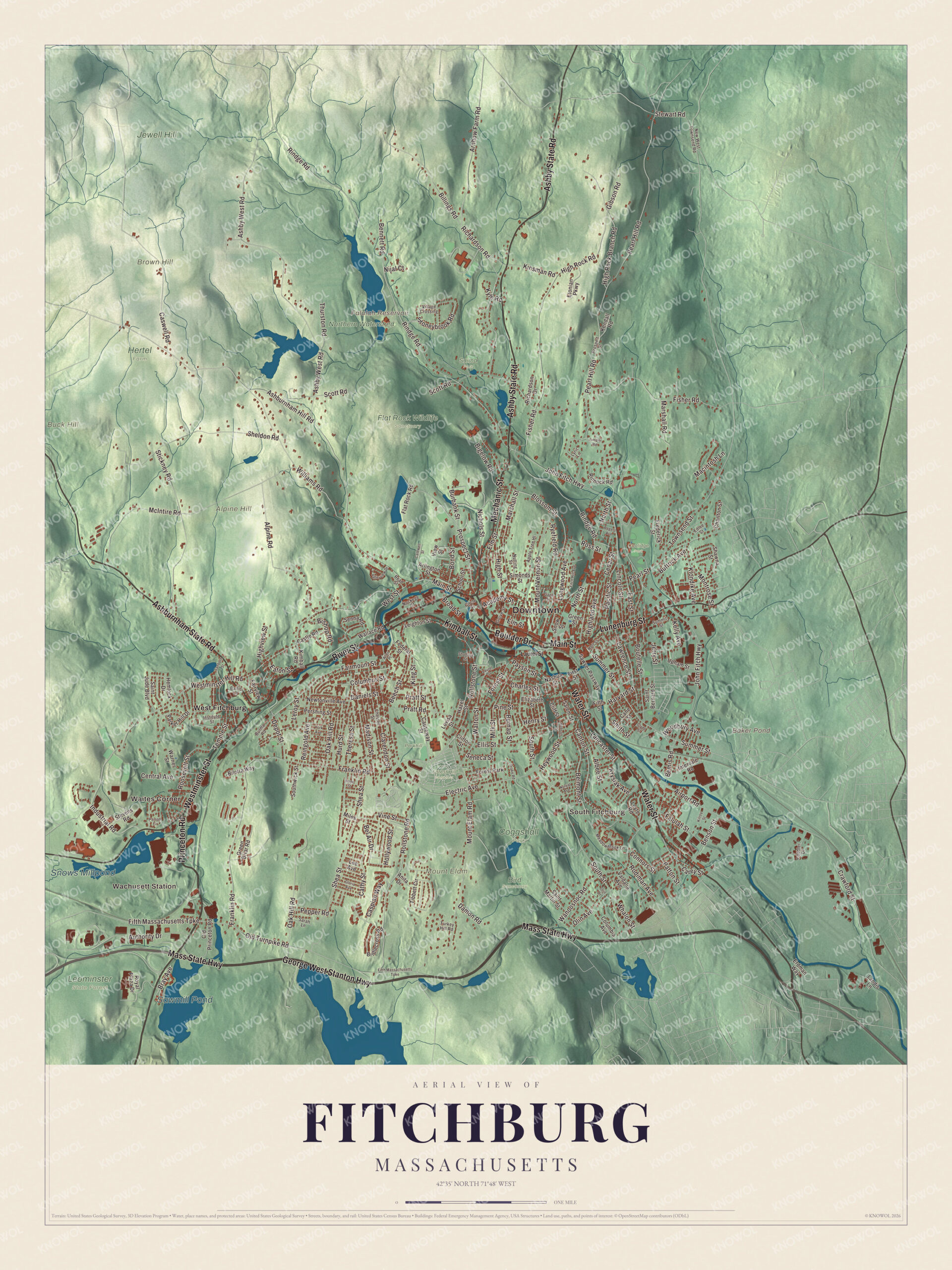
Click to explore a larger preview. The digital watermark does not appear on printed maps.
Names on this map
These names are printed on this map.
Places: Downtown, Wachusett Station, Waites Corner, South Fitchburg, Alpine Hill, Brown Hill, Buck Hill, Mount Elam, Baker Pond, Falulah Reservoir, Sawmill Pond, Snows Millpond, Bird Sanctuary, Coggshall Park, Coolidge Park, Flat Rock Wildlife Sanctuary, Forest Hill Cemetery, Hertel Farm, Jewell Hill, Leominster State Forest, Northern Watershed, Parkhill, Saima Park, West Fitchburg and Forest Park.
Streets and roads: River Street, Kimball Street, Boulder Drive, Main Street, Water Street, George West Stanton Highway, Mass State Highway, Lunenburg Street, Princeton Road, Westminster Street, Ashby State Road, Ashburnham State Road.
More street names, A to Z
Academy Street, Airport Road, Albee Street, Allen Place, Alpine Road, Anita Drive, Apple Tree Hl, Arlington Street, Arnhow Farm Road, Ashburnham Hill Road, Ashby West Road, Authority Drive, Baltic Lane, Beech Street, Bel Air Drive, Belmont Street, Bemis Road, Bennett Road, Benson Street, Bigelow Road, Billings Road, Bilotta Way, Bishop Road, Blossom Street, Bond Street, Boutelle Street, Bray Avenue, Bridlecross Road, Broad Street, Burbank Street, Burma Road, Burnap Street, Buttrick Avenue, Caldwell Street, Cane Street, Canton Street, Carey Street, Caspian Way, Castle Road, Caswell Road, Cathy Street, Causeway Street, Cedar Street, Central Avenue, Charles Street, Charlton Street, Chester Street, Circle Street, Clarendon Street, Cliff Street, Clifton Street, Clyde Street, Cobbler Drive, Columbia Avenue, Columbus Street, Connors Street, Crawford Street, Damon Road, Daniels Street, Depot Street, Drake Road, East Street, Eaton Street, Edlee Street, Electric Avenue, Elizabeth Street, Ellis Street, Elm Street, Erdman Way, Etonian Parkway, Fairmount Street, Fairview Street, Falulah Street, Federal Street, Fifth Massachusetts Turnpike, Fifth Street, First Street, Fisher Road, Fitch Hill Avenue, Flat Rock Road, Forest Street, Franklin Road, Frederick Street, Gage Street, Gibson Road, Gloria Avenue, Green Briar Road, Green Street, Grove Street, Harvard Street, Hazel Street, Hemlock Drive, Henry Street, Heywood Street, Highland Avenue, High Rock Branch Road, High Rock Road, High Street, Highview Street, Hobson Street, Hollywood Street, Holt Street, Hope Street, Hurd Street, Industrial Road, Institute Street, Intervale Road, Jerry Street, John Fitch Highway, Juniper Road, Kelly Avenue, Kendall Road, Kilroy Street, Kimball Road, King Street, Kinsman Road, Klondike Avenue, Krysiak Avenue, Kyle Road, Lancaster Street, Landis Lane, Laurel Street, Lawrence Street, Lee Avenue, Leighton Street, Leroy Street, Leyte Road, Lincoln Street, Longwood Avenue, Lovisa Street, Lyric Lane, Macintosh Lane, Madison Street, Marshall Road, Marshall Street, McIntire Road, Meadowbrook Lane, Mechanic Street, Miles Street, Milk Street, Montrose Street, Mount Elam Road, Mount Vernon Street, Nashua Street, Newtonville Avenue, New West Townsend Road, Nichols Street, Nijal Court, Nockege Street, North Street, Norval Avenue, Nutting Street, Oak Hill Road, Old Princeton Road, Old Turnpike Road, Olin Avenue, Olin Drive, Pacific Street, Parker Hill Drive, Parson Circle, Patton Street, Payson Street, Pearl Hill Road, Pearl Street, Pepper Road, Pershing Street, Pine Street, Pratt Road, Pratt Street, Prospect Street, Prospelt Street, Read Street, Reingold Avenue, Richardson Drive, Richardson Road, Rindge Road, Rinnock Road, Rodiman Avenue, Rogers Avenue, Rollstone Road, Rollstone Street, Roosevelt Street, Ross Street, Royal Plaza Drive, Ryefield Road, Saint Bernard Street, Saint Jude Boulevard, Saint Martin Street, Salem Street, Sanborn Street, Sarah Lane, Sawyer Passway, School Street, Scott Road, Seneca Street, Senna Road, Shattuck Street, Shawna Street, Shea Street, Sheldon Road, Simonds Street, Smith Street, Snow Street, South Street, Southwick Street, Stevens Road, Stewart Road, Stickney Road, Stoneybrook Road, Summer Street, Summit Street, Temple Street, Theresa Street, Thurston Road, Tibbett Circle, Townsend Street, Turkey Hill Road, Upham Street, Valdalia Avenue, Valleyview Drive, View Street, Village Crossing, Vine Street, Wallace Road, Walton Street, Wanoosnoc Road, Warner Street, Westminster Hill Road, West Street, Whalon Street, Williams Road, Woodbury Avenue, York Avenue.
See it on a wall
The Fitchburg map as a framed print. Swipe for more.


Parks and the river
Coggshall Park, set aside in 1894, covers 300 acres, with wooded trails and access to Mirror Lake, and Featherstone once let a duck he’d bought as a model go free there. Crocker Field, a gift to the city’s children from Alvah Crocker II in 1916, was built mostly in 1918 near the Nashua River, with landscaping by the Olmsted Brothers, and it’s now a historic district. The West Fitchburg Steam Line Trail follows the Nashua River and Flag Brook through the Waites Corner neighborhood.
Around the map
Start with Wachusett Station, the commuter rail stop that opened in 2016 and was the farthest MBTA Commuter Rail station in Massachusetts, 54 miles from North Station, until 2025. Then follow River Street, Kimball Street, Boulder Drive, Main Street, Water Street and the George West Stanton Highway across the city. Look outward toward Waites Corner, South Fitchburg and West Fitchburg. Baker Pond, the Falulah Reservoir, Sawmill Pond, Forest Hill, Alpine Hill, Brown Hill and Buck Hill are all printed on the map.
The Fitchburg map makes a fine addition to an office, library or den, and it can help teach children the geography and history of a paper and railroad city. It’s made for people who call Fitchburg home, from Waites Corner to the Upper Common, and it shows the city as it looks today. Zoom in on the preview above to explore the details, then click here to get your copy of the Fitchburg, Massachusetts map.

Sources
- Fitchburg, Massachusetts, Wikipedia
- Alvah Crocker, Wikipedia
- Hoosac Tunnel, Wikipedia
- Rollstone Boulder, Wikipedia
- Fitchburg Art Museum, Wikipedia
- Raivaaja, Wikipedia
- Clara Hapgood Nash, Wikipedia
- Art Longsjo, Wikipedia
- Don Featherstone (artist), Wikipedia
- Crocker Field, Wikipedia
- Wachusett station, Wikipedia
- City and Town Incorporation and Settlement Dates, Secretary of the Commonwealth of Massachusetts (archived copy)