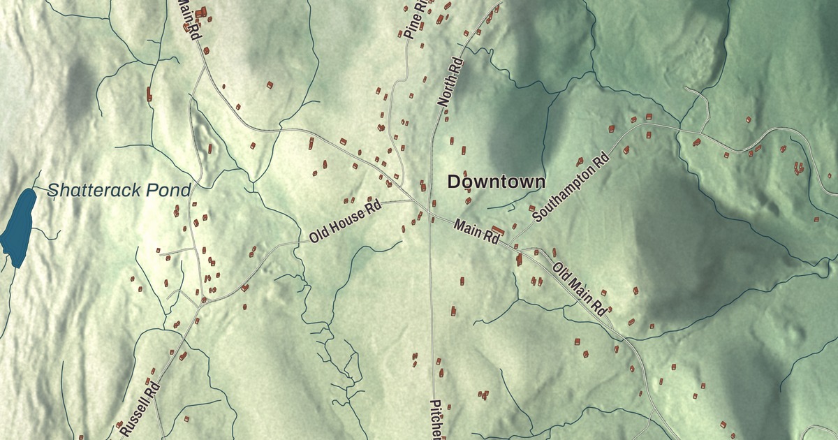
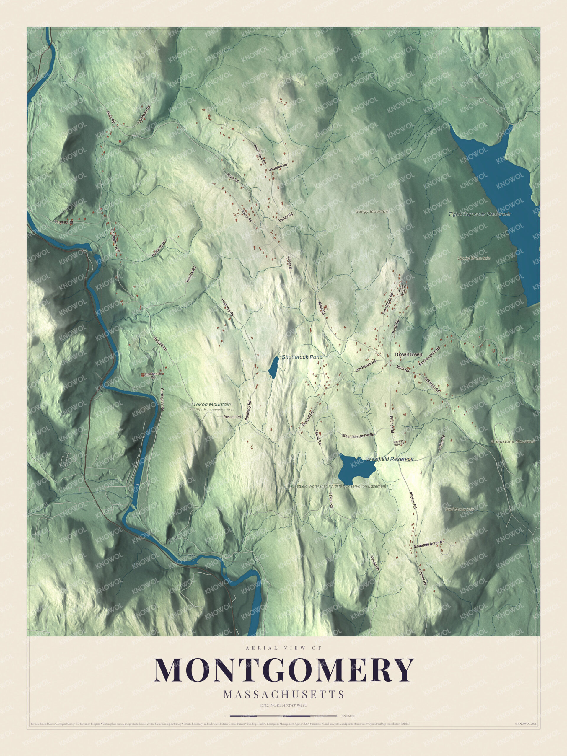
Montgomery sits on a high plain above the Westfield River, with Tekoa and Shatterack mountains dropping to the gorge on its southern and western edges. This map prints Main Road, Russell Road, Carrington Road, Pomeroy Road, Pitcher Road and Mountain House Road, with Westfield Reservoir, Shatterack Pond, Ball Mountain and Grindstone Mountain. Click here to purchase a print of this map for your wall.
Montgomery is in Hampden County.
KNOWOL made this map in 2026 from public survey data and set it down in the manner of an old atlas. United States Geological Survey elevation data shapes the plain and its mountain walls, and the Census Bureau supplied the roads and the town line. Montgomery covers 15.2 square miles, bordered by Southampton to the northeast, Westfield to the southeast, Russell to the southwest and Huntington to the northwest, and it had 819 people at the 2020 census. Moose Meadow Brook runs north to south through town, with Westfield Reservoir up on the plain and the smaller Tekoa Reservoir near the foot of its mountain. Only nine roads cross the town line, and apart from a stretch of Interstate 90 less than 200 yards long at the southern tip, no state or federal highway passes through.
A Revolutionary name
The Town of Montgomery’s recorded history, in the Secretary of the Commonwealth’s list, dates European settlement to 1767. The new town took land from Westfield and Southampton, along with unincorporated land that’s now part of Huntington. Montgomery was incorporated as a town in 1780, in the middle of the Revolutionary War, and took its name from General Richard Montgomery. Born in Ireland, he joined the Patriot cause, captured Fort St. Jean and Montreal in November 1775, and was killed on December 31, 1775, leading the attack on Quebec City. The town remains part of Hampden County today.
On the north side of Tekoa Mountain, where it flattens into Montgomery’s upland plain, Richard Falley Jr. ran a secret musket factory for the Patriots, and the summit served as a lookout for British spies. For two centuries Montgomery stayed a farming town with a small center, until the building of Interstate 90 in 1957 started its population growing. Today it’s an outer commuter town for Springfield.
Click to explore a larger preview. The digital watermark does not appear on printed maps.
Names on this map
These names are printed on this map.
Places: Downtown, Ball Mountain, Bungy Mountain, Grindstone Mountain, Lizzie Mountain, Tighe Carmody Reservoir, Westfield Reservoir, Shatterack Pond, Tekoa Mountain Wildlife Management Area and Westfield Watershed Wildlife Conservation Easement.
Streets and roads: Mountain House Road, Main Road, Russell Road, Carrington Road, Pomeroy Road, Pitcher Road, Tekoa Road, New State Road, Southampton Road, Pine Ridge Road, Jourdan Road, Fuller Road.
More street names, A to Z
Avery Road, Birch Bluff Road, Bungy Road, Campus View Road, Chamberlain Road, Herrick Road, Jason Road, Lambson Road, Mountain Acres Road, North Road, Old House Road, Old Main Road, Thomas Road.
See it on a wall
The Montgomery map as a framed print. Swipe for more.


Around the map
Start with Mountain House Road. Follow Main Road, Russell Road, Carrington Road, Pomeroy Road and Pitcher Road across town. Tighe Carmody Reservoir, Westfield Reservoir, Shatterack Pond, Westfield Watershed Wildlife Conservation Easement, Ball Mountain, Bungy Mountain and Grindstone Mountain are all printed on the map, with each name placed directly on the artwork.
Tekoa Mountain, 1,121 feet high in Montgomery and Russell, is a rocky cleaver cut by the Westfield River and Moose Meadow Brook, and with Shatterack Mountain it forms a cliff about 700 feet high along the river gorge. The Woronoake people lived in the Tekoa Mountain region before the colonists came. The eastern part of the mountain belongs to the Westfield Watershed lands, owned by the City of Westfield and open to hiking and hunting under a conservation easement with the state’s Division of Fisheries and Wildlife, and from the summit ledges you can see Westfield and Springfield to the east.
The Montgomery map makes a fine addition to an office, library or den, and it can help teach children the geography and history of a hill town above the Westfield River. It’s made for people who call Montgomery home, from Mountain House Road to the slopes of Grindstone Mountain, and it shows the town as it looks today. Zoom in on the preview above to explore the details, then click here to get your copy of the Montgomery, Massachusetts map.

Sources