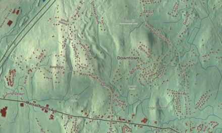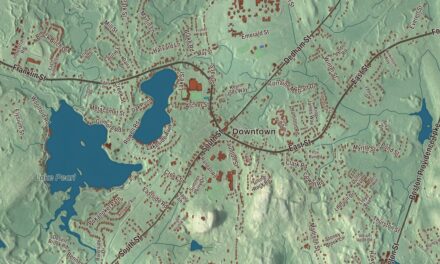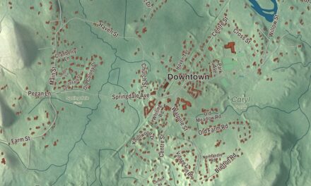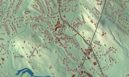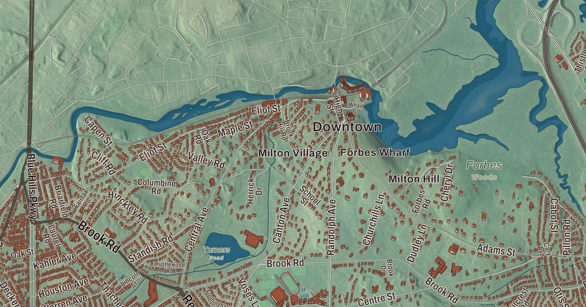
Milton runs from the Neponset River up to the Blue Hills, where the observatory on Great Blue Hill keeps the oldest continuous weather record in North America. This map prints Blue Hill Avenue, Canton Avenue, Brush Hill Road, Randolph Avenue, Reedsdale Road and Brook Road, with Houghtons Pond, Great Pond, Milton Hill and Brush Hill. Click here to purchase a print of this map for your wall.
Milton is in Norfolk County.
KNOWOL made this map in 2026 from public survey data and gave it the bearing of an old atlas plate. The hills come from United States Geological Survey elevation data, and the Census Bureau supplied the streets and the town line. Milton covers 13.3 square miles of hilly ground between the Neponset River and the Blue Hills, bounded by Brush Hill on the west, Milton Hill on the east, the Blue Hills on the south and the river on the north. Boston’s Dorchester, Mattapan and Hyde Park lie to the north and west, with Quincy to the east, Randolph to the south and Canton to the west. Milton had 28,630 people at the 2020 census, and its glacial past left kettle ponds all over town.
Unquatiquisset
People lived here for more than ten thousand years before Europeans arrived; charcoal from the Fowl Meadow archaeological site in Milton has been dated to about 12,140 years ago. The Neponset people of the Massachusett called the place Unquatiquisset, meaning “Lower Falls,” for the spot where the river’s rapids meet Massachusetts Bay, and the Massachusett took their own name from the Great Blue Hill, “at the great hill.” English colonists began settling here as part of Dorchester in the late 1620s and early 1630s, by the town page’s account, while the Town of Milton’s recorded history, in the Secretary of the Commonwealth’s list, dates European settlement to 1636. Richard Collicott built a trading post near the Neponset and bargained with the sachem Cutshamekin for the land. Milton was incorporated as a town in 1662, named for Milton Abbey in Dorset, England. The town remains part of Norfolk County today.
The falls made Milton a place of mills. Israel Stoughton’s grist mill of 1634 gave Lower Falls the name Lower Mills, and the town page calls it the earliest mill in the United States. A powder mill of 1674 may have been the earliest in the colonies, and Daniel Henchman’s paper mill on the Neponset, in 1729, was the first in New England. In 1801 Josiah Bent began baking water crackers here that kept on long voyages out of Boston; his company later sold hardtack to Civil War troops, and Bent’s Cookie Factory is still in Milton. In 1774 the Suffolk Resolves, which the drafters of the Declaration of Independence later used as a model, were passed in Milton. The Daniel Vose house at 1370 Canton Avenue, headquarters of the Milton Historical Society, has long been named as the place they were signed, a point still argued over in town.
Milton Hill and East Milton
Thomas Hutchinson, the last civilian royal governor of Massachusetts, kept a country estate on Milton Hill. The house is gone, but Governor Hutchinson’s Field on Adams Street, owned by the Trustees of Reservations since 1898, still looks out over Boston and Quincy. Across the street stands the Captain Robert Bennet Forbes House, built in 1833 by the China Trade merchant Robert Bennet Forbes and his brother John Murray Forbes for their mother, with an elliptical staircase like a lighthouse’s rising to a cupola for watching ships come into Boston Harbor; it’s now a National Historic Landmark and museum. George H. W. Bush, the 41st president, was born at 173 Adams Street on Milton Hill on June 12, 1924.
East Milton grew up around the Granite Railway, which began running in 1826 to carry Quincy granite to a dock on the Neponset, where boats took the stone to Charlestown for the Bunker Hill Monument. The town page says it’s often called the first commercial railroad in the United States. Stone workers settled in the Railway Village, and after 1871 a passenger station stood in East Milton Square. A switch frog and a piece of the old track now sit in the gardens over the Southeast Expressway where it passes under the square. On Canton Avenue, the Eustis Estate’s 1878 stone mansion by William Ralph Emerson backs onto the Blue Hills, and Historic New England opened it as a museum in 2017.
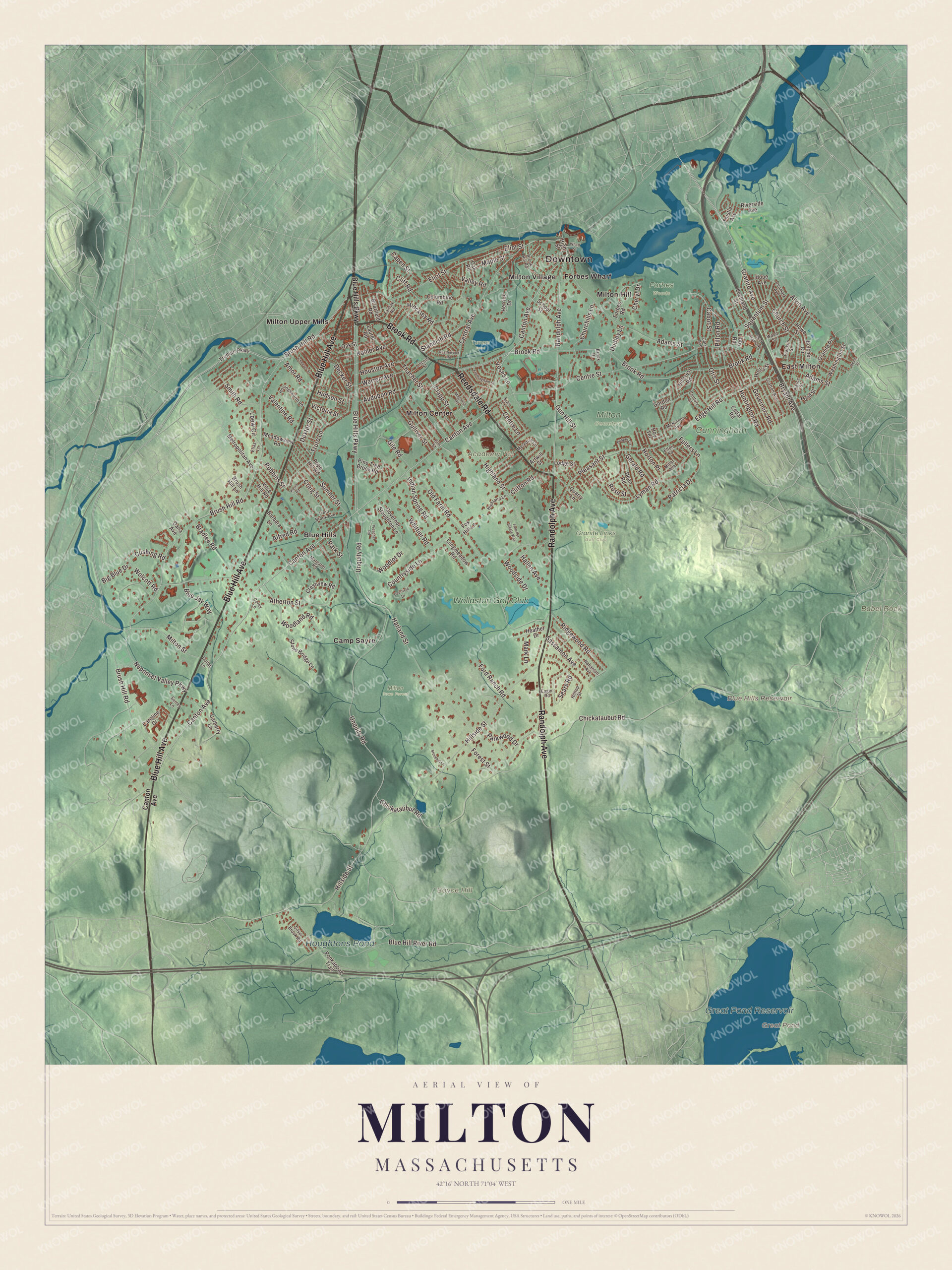
Click to explore a larger preview. The digital watermark does not appear on printed maps.
Names on this map
These names are printed on this map.
Places: Downtown, East Milton, Academy Hill, Babel Rock, Boyce Hill, Blue Hills Reservoir, Great Pond, Great Pond Reservoir, Houghtons Pond, Cunningham Park, Forbes Woods, Granite Links Golf Club, Milton Cemetery, Milton Town Forest, Turners Pond, Blue Hills, Camp Sayre, Forbes Wharf, Milton Center, Milton Hill, Milton Upper Mills, Milton Village and Wollaston Golf Club.
Streets and roads: Blue Hill Avenue, Reedsdale Road, Brook Road, Randolph Avenue, Canton Avenue, Brush Hill Road, Granite Avenue, Bryant Avenue, Central Avenue, Blue Hills Parkway, Ridgewood Road, Milton Street.
More street names, A to Z
Adams Street, Alfred Road, Alvin Avenue, Amor Road, Artwill Street, Atherton Street, Audubon Road, Badger Circle, Barbara Lane, Beale Street, Belcher Circle, Big Blue Drive, Blue Hill River Road, Blue Jay Way, Bradlee Road, Briarfield Road, Brook Drive, Brook Hill Road, Brush Hill Lane, Cabot Street, Capen Street, Carberry Lane, Caroline Drive, Cary Avenue, Cedar Road, Centre Lane, Centre Street, Century Lane, Cheever Street, Cheryl Drive, Chickataubut Road, Churchills Lane, Church Street, Clapp Street, Cliff Road, Clifton Road, Columbine Road, Corey Lane, Countryside Lane, Craig Street, Crestview Road, Cushing Road, Dana Avenue, Dean Road, Decker Street, Deerfield Drive, Denmark Avenue, Dexter Street, Dollar Lane, Dudley Lane, Eager Road, Edge Hill Road, Elias Lane, Eliot Street, Elm Street, Elton Road, Fairfax Road, Fletcher Steele Way, Forbes Road, Ford Ranch Road, Forest Street, Fox Hill Lane, Franklin Street, Frothingham Street, Fullers Lane, Gerald Road, Gile Road, Gordon Road, Governors Road, Governor Stoughton Lane, Grafton Avenue, Granite Place, Gulliver Street, Gun Hill Street, Hallen Avenue, Harland Street, Heather Drive, Herrick Drive, Highland Lane, Highland Street, High Street, Hillcrest Road, Hillside Street, Hilltop Street, Hinckley Road, Hollingsworth Road, Hollis Street, Hope Avenue, Horton Place, Houston Avenue, Howe Street, Hoy Terrace, Hudson Street, Huntington Road, Indian Spring Road, Kahler Avenue, Kevin Road, Laurel Road, Libby Road, Lincoln Street, Lochland Street, Lodge Street, Loew Circle, Longmeadow Road, Lyman Road, Magnolia Road, Maple Street, Margaret Road, Mark Lane, McKinnon Avenue, Meadowview Road, Meredith Circle, Metropolitan Avenue, Miller Avenue, Nahanton Avenue, Neponset Valley Parkway, Oak Road, Oak Street, Old Farm Road, Otis Street, Park Street, Parkwood Drive, Patricia Drive, Pierce Street, Pillon Road, Pine Tree Brook Road, Pleasant Street, Pond Street, Ponkapoag Trail, Pope Hill Road, Preacher Road, Quarry Lane, Riverside Avenue, Robbins Street, Rose Street, Rustlewood Road, Saint Agatha Road, Sassamon Avenue, School Street, Sears Road, Sias Lane, Silver Brook Road, Smith Road, Squantum Street, Standish Road, Stone Bridge Lane, Stonehill Lane, Sumner Street, Surrey Lane, Thacher Street, Thistle Avenue, Trout Brook Avenue, Truman Parkway, Truro Lane, Unquity Road, Valentine Road, Valley Road, Victoria Street, Vose Hill Road, Voses Lane, Warren Avenue, Washington Street, Wharf Street, Whittier Road, Wolcott Road, Woodland Road, Woodlot Drive, Woodside Drive, Wood Street.
See it on a wall
The Milton map as a framed print. Swipe for more.


Around the map
Start with East Milton. Follow Blue Hill Avenue, Reedsdale Road, Brook Road, Randolph Avenue, Canton Avenue and Brush Hill Road across town. Then look outward toward the Blue Hills, Forbes Wharf, Milton Center, Milton Hill and Milton Upper Mills. Blue Hills Reservoir, Great Pond, Great Pond Reservoir, Houghtons Pond, Brush Hill, Academy Hill, Babel Rock and Boyce Hill are all printed on the map, with each name set directly on the artwork.
Brush Hill Road, probably a Native path before the colonists came, crosses the low rise of Brush Hill between the Blue Hills and the Neponset, and its historic district joined the National Register in 1998. To the south, the 7,000-acre Blue Hills Reservation, bought by the Metropolitan Parks Commission in 1893, reaches into Milton, Quincy, Braintree, Canton, Randolph and Dedham. Great Blue Hill, at 635 feet the highest point in Norfolk County, has carried Abbott Lawrence Rotch’s weather observatory since 1885, and in the 1938 hurricane the station recorded a gust of 186 miles an hour. Houghtons Pond is a 24-acre spring-fed kettle pond. Around 1690 the settler Ralph Houghton bought 360 acres including the pond to farm, and today it’s a swimming and picnic spot inside the reservation.
The Milton map makes a handsome addition to an office, library or den, and it can help teach children the geography and history of a town between the river and the hills. It’s made for people who call Milton home, from East Milton to Milton Upper Mills, and it shows the town as it looks today. Zoom in on the preview above to explore the details, then click here to get your copy of the Milton, Massachusetts map.

Sources
- Milton, Massachusetts, Wikipedia
- Suffolk Resolves House, Wikipedia
- Governor Hutchinson’s Field, Wikipedia
- Milton Hill Historic District, Wikipedia
- Captain Robert Bennet Forbes House, Wikipedia
- Granite Railway, Wikipedia
- Railway Village Historic District, Wikipedia
- Eustis Estate, Wikipedia
- Brush Hill Historic District, Wikipedia
- Blue Hills Reservation, Wikipedia
- Great Blue Hill, Wikipedia
- Blue Hill Meteorological Observatory, Wikipedia
- Houghton’s Pond, Wikipedia
- City and Town Incorporation and Settlement Dates, Secretary of the Commonwealth of Massachusetts (archived copy)