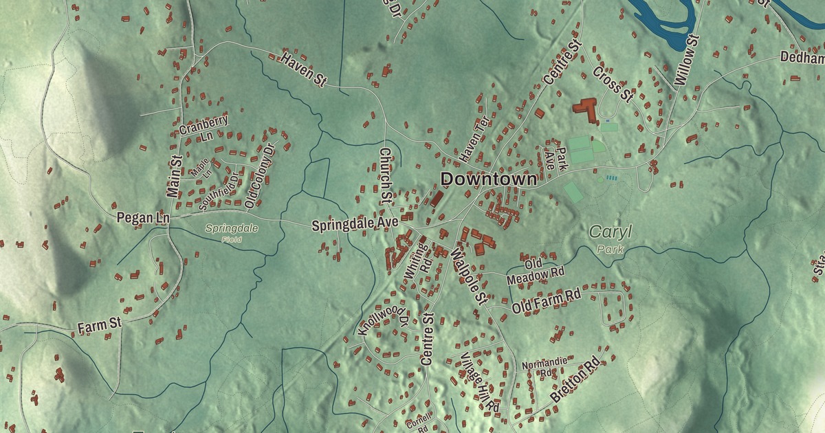
Dover sits on the south bank of the Charles River, and its old center, Dover Center, gathers around the corner of Centre Street and Dedham Street. This map prints County Street, Dover Road, Centre Street, Farm Street, Walpole Street and Dedham Street, with Buckmaster Pond, Channings Pond, Noannet Pond, Broad Hill, Carver Hill and Castle Hill. Click here to purchase a print of this map for your wall.
Dover is in Norfolk County, about 15 miles southwest of downtown Boston.
KNOWOL made this map in 2026 from public survey data and gave it the look of an old atlas. The relief comes from United States Geological Survey elevation data, and the roads and the town line come from the Census Bureau. Dover covers 15.4 square miles, with Natick, Wellesley and Needham to the north, Westwood to the east, Walpole and Medfield to the south and Sherborn to the west. The town had 5,923 people at the 2020 census.
Springfield Parish
The Town of Dover’s recorded history, in the Secretary of the Commonwealth’s list, dates European settlement to 1635, while the town’s page puts the first recorded settlement in 1640. The land was long part of Dedham. It became Dedham’s Springfield Parish in 1748 and was made a district in 1784, and Dover was incorporated as a town in 1836. The town remains part of Norfolk County today.
The parish’s first minister, the Reverend Benjamin Caryl, built his house on Dedham Street around 1777. His son George was the town’s first doctor, and the family lived there until 1897. The Dover Historical Society has run the Benjamin Caryl House since 1920 and has restored it to show life in the 1790s, when the first two Caryl families lived and worked there together. A short walk away, at the corner of Centre and Dedham streets in Dover Center, is the Sawin Museum. Benjamin and Eudora Sawin left land, money and their old household goods to the society so the building could go up, and it was dedicated on May 14, 1907. It has held thousands of Dover relics, books and photographs since, it was overhauled in the 1960s, and it’s open to the public free of charge.
Woods, fields and an early sun house
Almost all of Dover’s residential zoning calls for lots of an acre or more. The town’s page notes that as recently as the early 1960s, three quarters of the town budget went to snow removal, since only one and a half miles of Dover’s roads are state highway. Noanet Woodlands owes much to the philanthropist and sculptor Amelia Peabody. She bought land here in 1923, laid out bridle paths, rebuilt the old mill-pond dams on Noanet Brook in 1954, and left most of what is now Noanet Woodlands to The Trustees of Reservations at her death in 1984. The 595-acre preserve has 17 miles of trails, several of them climbing the 387-foot Noanet Peak for a view of the Boston skyline, and it’s believed to be named for a chief of the Natick people. The Trustees’ Peters Reservation and Chase Woodlands face each other across Farm Street, and the Charles River Link Trail crosses both.
On Peabody’s property, in 1948, the architect Eleanor Raymond and the physicist Mária Telkes built the Dover Sun House, one of the world’s first solar-heated houses. Salt melted in a sun-warmed space stored the day’s heat and gave it back at night, and for its first two years the house drew crowds of visitors and wide publicity. The system was replaced in 1954, and the house itself has since been demolished. Along the Charles, most of the old Cheney estate at Elm Bank lies in Dover, though its entrance is in Wellesley; the Massachusetts Horticultural Society keeps its gardens there.
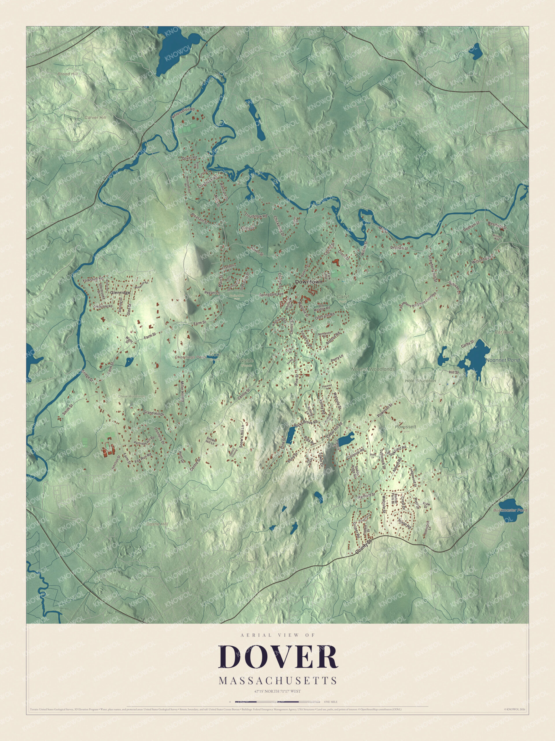
Click to explore a larger preview. The digital watermark does not appear on printed maps.
Names on this map
These names are printed on this map.
Places: Downtown, Broad Hill, Carver Hill, Castle Hill, Cat Rock, Buckmaster Pond, Channings Pond, Noannet Pond, Caryl Park, Chase Woodlands, Hale Education, Noanet Woodlands, Powissett Farm, Springdale Field, Trout Brook, Wylde Woods and Glenridge.
Streets and roads: County Street, Dover Road, Centre Street, Farm Street, Walpole Street, Dedham Street, Claybrook Road, Main Street, Pine Street, Powisset Street, Haven Street, Reservation Road.
More street names, A to Z
Abbott Road, Beldon Road, Bretton Road, Bridge Street, Brookfield Road, Brook Road, Carby Street, Cedar Hill Road, Chickering Drive, Church Street, Circle Drive, Colonial Road, Cornell Road, Cranberry Lane, Crest Drive, Cross Street, Cullen Road, Dancer Farm Drive, Donnelly Drive, Draper Road, Forest Street, Fox Run Road, Francis Street, Glen Street, Grand Hill Drive, Greystone Road, Hamlin's Crossing, Hartford Street, Haven Terrace, High Rock Road, Hill Street, Hilltop Road, Hunt Drive, Junction Street, Knollwood Drive, Kraw Drive, Ledgewood Drive, Maple Lane, Meadowbrook Road, Miller Hill Road, Mill Street, Normandie Road, Old Colony Drive, Old Farm Road, Old Meadow Road, Park Avenue, Partridge Hill Road, Pegan Lane, Perry Lane, Pinewood Road, Pleasant Street, Pond Street, Riga Road, Rocky Brook Road, Rolling Lane, Ruel Drive, Saddle Ridge Road, Schaffner Lane, Shady Lane, Sherbrooke Drive, Smith Street, Snow's Hill Lane, Snows Hill Lane, Southfield Drive, Springdale Avenue, Sterling Drive, Stonegate Lane, Strawberry Hill Street, Strawberry Hill Street Extended, Sullivan Lane, Tisdale Drive, Tower Drive, Troutbrook Road, Tubwreck Drive, Valley Road, Village Hill Road, Wakeland Road, Westfield Street, Whiting Road, Wight Street, Wildwood Road, Willow Street, Wilsondale Street, Wilsons Way, Windsor Road, Woodridge Road, Yorkshire Road.
Around the map
Start with Glenridge, then follow County Street, Dover Road, Centre Street, Farm Street, Walpole Street and Dedham Street across town. The Sawin Museum stands where Centre Street meets Dedham Street in Dover Center, and the Caryl House is in Caryl Park at 107 Dedham Street. Governor Francis W. Sargent, U.S. Senator Leverett Saltonstall and the Olympic sailor George O’Day are among the notable people from Dover. Buckmaster Pond, Channings Pond, Noannet Pond, Broad Hill, Carver Hill and Castle Hill are all printed on the map.
The Dover map makes a fine addition to an office, library or den, and it can help teach children the geography and history of a quiet town on the Charles. It’s made for people who call Dover home, from Glenridge to Dover Center, and it shows the town as it looks today. Zoom in on the preview above to explore the details, then click here to get your copy of the Dover, Massachusetts map.

We made a map for every town and city in Massachusetts. Explore the complete Massachusetts map collection and find your town.
Sources
- Dover, Massachusetts, Wikipedia
- Benjamin Caryl House, Wikipedia
- Noanet Woodlands, Wikipedia
- Peters Reservation, Wikipedia
- Dover Sun House, Wikipedia
- Elm Bank Horticulture Center, Wikipedia
- City and Town Incorporation and Settlement Dates, Secretary of the Commonwealth of Massachusetts (archived copy)