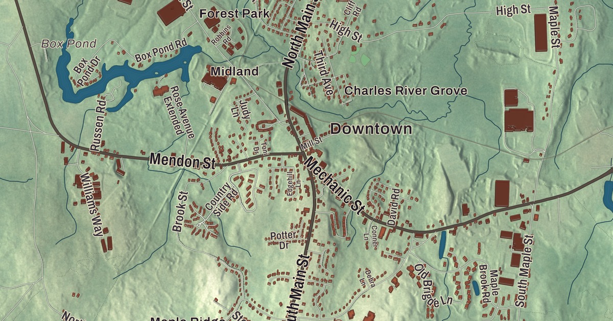
Bellingham sits in the far corner of Norfolk County, where Route 126 runs down to the Rhode Island line and Interstate 495 cuts across the north end of town. This map prints Hartford Avenue, Mechanic Street, Mendon Street, Pulaski Boulevard, North Main Street and South Main Street, with the Charles River, Silver Lake, Box Pond, Beaver Pond, Harris Pond, Bald Hill, Bear Hill and Butman Hill. Click here to purchase a print of this map for your wall.
Bellingham is in Norfolk County, at its southwestern corner, next to Woonsocket, Rhode Island.
KNOWOL made this map in 2026 from public survey data, styled like a page from an old atlas. The terrain shading comes from United States Geological Survey elevation data, and the roads and the town line come from the Census Bureau. The town covers 19.0 square miles at a mean elevation of 293 feet, and it had 16,945 people at the 2020 census.
Westham becomes Bellingham
The land south of the Charles River was the far southwestern corner of the Dedham Grant; it was swampy, and Dedham didn’t think it worth settling. North of the river, the land went to Edward Rawson, the colony’s secretary, and in time the two pieces grew together. The first land bought here was purchased in 1696. By 1713 there were enough people for village meetings, and the Town of Bellingham’s recorded history, in the Secretary of the Commonwealth’s list, dates European settlement to that year. The village, called Westham for West Dedham, asked to be set off in 1718, and it was incorporated on November 27, 1719, under a new name, Bellingham, for Richard Bellingham, an early governor of the Massachusetts Bay Colony and one of the authors of the Massachusetts Body of Liberties. The town remains part of Norfolk County today.
Liberty of conscience, and a soldier in disguise
Bellingham began with a Congregational meeting house, like every town in the colony, but by the middle of the 1700s a Baptist church had taken its place. John Leland joined that Baptist church in 1775. He went on to preach in Virginia, where he met James Madison and, his page says, agreed not to oppose him in exchange for guarantees of religious freedom in the new Constitution; he’s remembered as an important figure in the struggle for freedom of religion in the United States. Near the end of the Revolution, Deborah Sampson disguised herself as a man to serve in the Continental Army. The town page says she enlisted at Bellingham; her own page says she enlisted at Uxbridge in May 1782 under the name Robert Shirtliff and that her company, the light infantry of the 4th Massachusetts Regiment, was first quartered in Bellingham. Massachusetts named her its official heroine in 1983. Bathsheba Adams Barber, born in Bellingham in 1809, married the Pawtucket banker Stephen Benedict and later gave the money to buy the campus of a Baptist school for freed people in Columbia, South Carolina. It was named for her: Benedict College.
Caryville and the mill ponds
The town grew slowly on its rough land, and during the industrial era several ponds were made on old swampland to serve industry. The village of Caryville, in the northeastern corner of town and reaching into Franklin, grew up along the Country Road, the old name for today’s Hartford Avenue. Joseph Fairbanks opened the Caryville Mill in 1813, the second active mill in Bellingham, with a dam, a grist mill and a cotton mill. William H. Cary, who came from Attleboro to work in the cotton mills, rebuilt and enlarged the mill after a fire and put up three tenement houses, and in 1866 the villagers named their new post office for him. Electric streetcars ran between Milford, Caryville and Medway from 1897. The village faded as the suburbs grew and Interstate 495 came through in 1965, and the last big mill, from 1918, was taken down in 2016 along with its small dam.
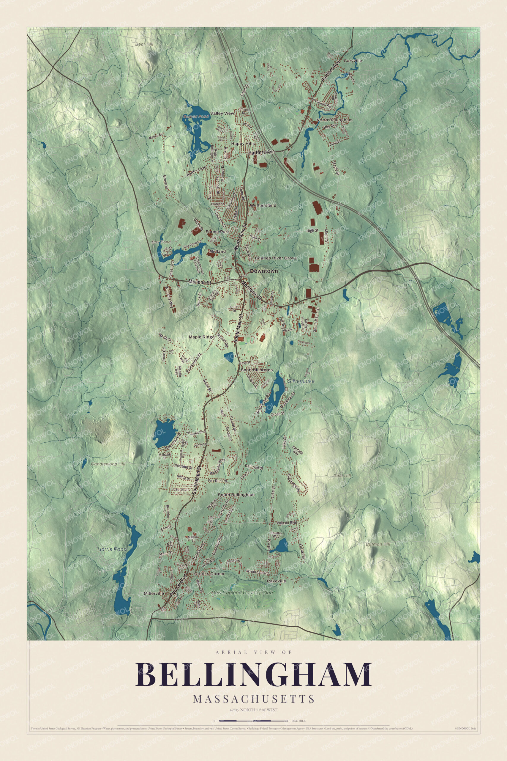
Click to explore a larger preview. The digital watermark does not appear on printed maps.
Names on this map
These names are printed on this map.
Places: Downtown, Caryville, Crooks Corner, Rakeville, North Bellingham, Bald Hill, Bear Hill, Butman Hill, Candlewood Hill, Beaver Pond, Box Pond, Silver Lake, Harris Pond, Charles River Grove, Forest Park, Happy Hills, Maple Ridge, Midland, Millerville, Scott Hill Acres, South Bellingham, Valley View, Wethersfield and New England Country Club.
Streets and roads: South Main Street, Hartford Avenue, North Main Street, Pulaski Boulevard, Mechanic Street, Mendon Street, Wrentham Road, Lakeshore Drive, Russen Road, Steven Road, Maple Street, Lake Street.
More street names, A to Z
Apache Road, Archer Street, Bainbridge Road, Barrett Lane, Beaver Pond Road, Beechwood Road, Bellstone Drive, Blackmar Street, Blackstone Street, Bliss Road, Box Pond Drive, Box Pond Road, Brisson Street, Brook Street, Buffy Road, Candlelight Lane, Caroline Drive, Center Street, Chestnut Street, Clarence Road, Cliff Road, Conner Lane, Country Side Road, Country Way, Cross Street, Damon Road, David Road, Debra Lane, Deer Run Road, Denault Drive, Depot Street, Douglas Drive, Easy Street, Edgehill Lane, Elm Road, Elm Street, Farm Street, Florida Avenue, Fox Run Road, Freeman Street, Gail Drive, Granite Street, Grove Street, Harpin Street, Heritage Way, Highridge Road, High Street, Hilltop Drive, Hixon Street, Irene Court, Judy Lane, Julia Drive, Kathy Drive, Lakeview Avenue, Laurel Lane, Liberty Street, Linda Way, Lizotte Drive, Locust Street, Lynn Court, Maddie Way, Mann Street, Maple Brook Road, Marc Avenue, Mellen Street, Mill Street, Mohawk Street, Monique Drive, Nason Street, Newland Avenue, North Street, Old Brigde Lane, Paine Street, Park Street, Pearl Street, Penny Lane, Pheasant Hill, Phillip Drive, Pickering Avenue, Pine Acres Drive, Pine Grove Avenue, Pine Street, Plymouth Road, Pothier Street, Potter Drive, Prospect Street, Railroad Street, Rawson Road, Ray Avenue, Reservoir Drive, Robbins Road, Roger Belanger Drive, Rome Avenue, Rose Avenue Extended, Roy Street, Sandcastle Lane, Scott Hill Boulevard, Sidney Lane, Silver Lake Road, South Maple Street, Squire Lane, Stella Road, Stone Street, Susan Lane, Taunton Street, Temi Road, Theresa Road, Third Avenue, Toni Drive, Whitehall Way, Williams Way, Winter Street, Yvonne Road.
See it on a wall
The Bellingham map as a framed print. Swipe for more.


Around the map
Start in Caryville and follow Hartford Avenue, where the North Cemetery and the Oak Hill Cemetery sit, then Mechanic Street, home of the Union Cemetery, and Mendon Street, Pulaski Boulevard, North Main Street and South Main Street. Route 126 runs north to south from Medway to the Rhode Island border, and Route 140 east to west from Franklin to Mendon; the town page notes Bellingham had no traffic lights in the late 1980s and well over a dozen by 2006. Look outward toward Crooks Corner, Rakeville, North Bellingham, Charles River Grove and Forest Park. Beaver Pond, Box Pond, Silver Lake, Harris Pond, Bald Hill, Bear Hill and Butman Hill are all printed on the map, along with the Charles River.
This Bellingham map makes a good addition to an office, library or den, and it can help teach children the geography and history of the town where Bathsheba Benedict was born. It’s made for people who call Bellingham home, from Caryville to Crooks Corner, and it shows the town as it looks today. Zoom in on the preview above to explore the details, then click here to get your copy of the Bellingham, Massachusetts map.

Sources
- Bellingham, Massachusetts, Wikipedia
- Caryville, Massachusetts, Wikipedia
- Richard Bellingham, Wikipedia
- John Leland (Baptist), Wikipedia
- Deborah Sampson, Wikipedia
- Bathsheba A. Benedict, Wikipedia
- City and Town Incorporation and Settlement Dates, Secretary of the Commonwealth of Massachusetts (archived copy)