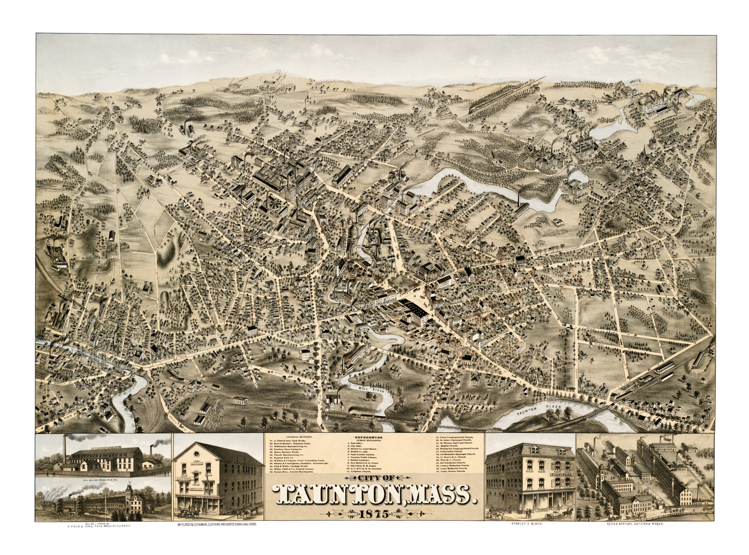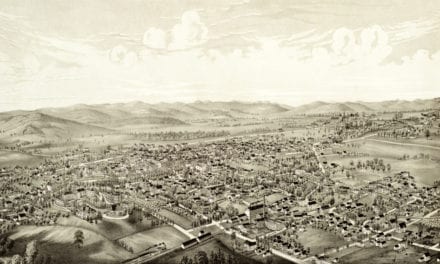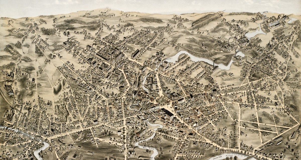
This map shows Taunton, Massachusetts as it looked in 1875. The map was originally created by O.H. Bailey & Co, and has been restored to its original condition by KNOWOL.
The map includes Taunton landmarks such as the State Lunatic Asylum, Taunton Public Library, Taunton City Hall, Whittenton Manufacturing, Taunton Tack Co., Bristol County Court House and more.
Explore a larger copy of the map below, and then click here to get a high resolution poster print of the map.
Click here to see a larger version of the map.