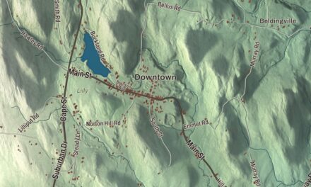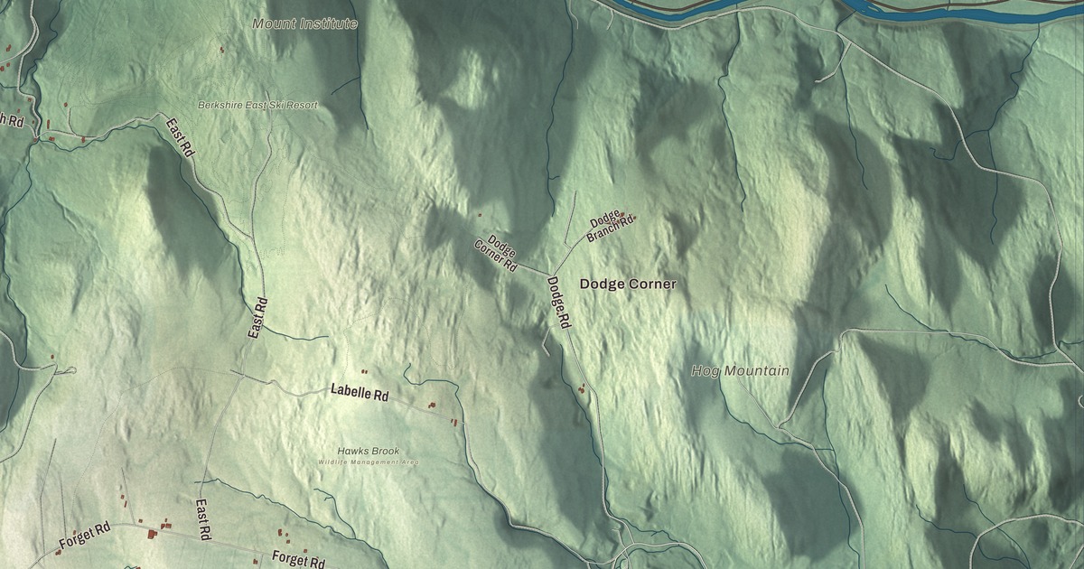
Hawley is hill country above the Deerfield River, with two state forests, a handful of farms and back roads with names like Hells Kitchen Road. This map prints West Hawley Road, Buckland Road, Dodge Road, Plainfield Road, Hells Kitchen Road and South Road, with the Mohawk Trail, Hawks Mountain, Hog Mountain and Forge Hill. Click here to purchase a print of this map for your wall.
Hawley is in Franklin County.
KNOWOL made this map in 2026 from public survey data and gave it the character of an old atlas. United States Geological Survey elevation data shapes the hills, and the roads and the town line come from the Census Bureau. Hawley covers 30.9 square miles in the southwestern corner of Franklin County, with Hampshire County to the south and Berkshire County to the west, and it had 353 people at the 2020 census. The northern edge of town falls to the valley of the Deerfield River, and the Chickley River and several brooks run down into it.
Plantation Number 7
The Town of Hawley’s recorded history, in the Secretary of the Commonwealth’s list, dates European settlement to 1760, when a group from Hatfield settled the land as Plantation Number 7. It was known as the Hatfield Reserve until Hawley was incorporated as a town in 1792. The name honors Joseph Hawley of Northampton, a leader of the popular party in the Stamp Act years who urged the Massachusetts delegates to the Second Continental Congress to declare independence. The town first took in the land of its neighbor Plainfield, which split off in the early 1800s. The town remains part of Franklin County today.
Forestry was Hawley’s main industry, and in time recreation joined it. Today a few farms, artisans and small businesses remain, and the town page notes that Hawley has no gas stations or convenience stores and no police department, though it does have a fire department. Massachusetts Route 8A is the main road through town, and Route 2, the Mohawk Trail, runs just north of the town line along most of the border.
Forests, a bog and a lost village
Kenneth Dubuque Memorial State Forest spreads across Hawley, Plainfield and Savoy, and Parker Hill, the highest of Hawley’s peaks, lies within it. The forest holds the cellar holes of the abandoned village of South Hawley, a beehive-shaped fieldstone charcoal kiln and the remains of a mill complex at Hallockville Pond, and a one-mile interpretive trail circles the pond. In the northwest corner, Mohawk Trail State Forest reaches in from Charlemont and Savoy. It’s named for the old Mohawk Trail, a Native American footpath between the Hudson and Connecticut river valleys, and its page says it’s known for its tall old growth trees. The town page calls Hawley Bog one of the few bogs in Massachusetts kept in its natural state, and Stump Sprout Cross-Country Ski Area sits between the two forests.
Hawley’s notable people include David Dunnels White, a Union private whose page credits him with capturing the Confederate Major General G. W. Custis Lee at the Battle of Sailor’s Creek on April 6, 1865, though another soldier also claimed the capture. White is buried in the Bozrah cemetery in East Hawley. The composer Alice Parker spent her childhood summers at Singing Brook Farm in Hawley, moved there for good at 70 and founded the professional choir Melodious Accord in town in 1985.
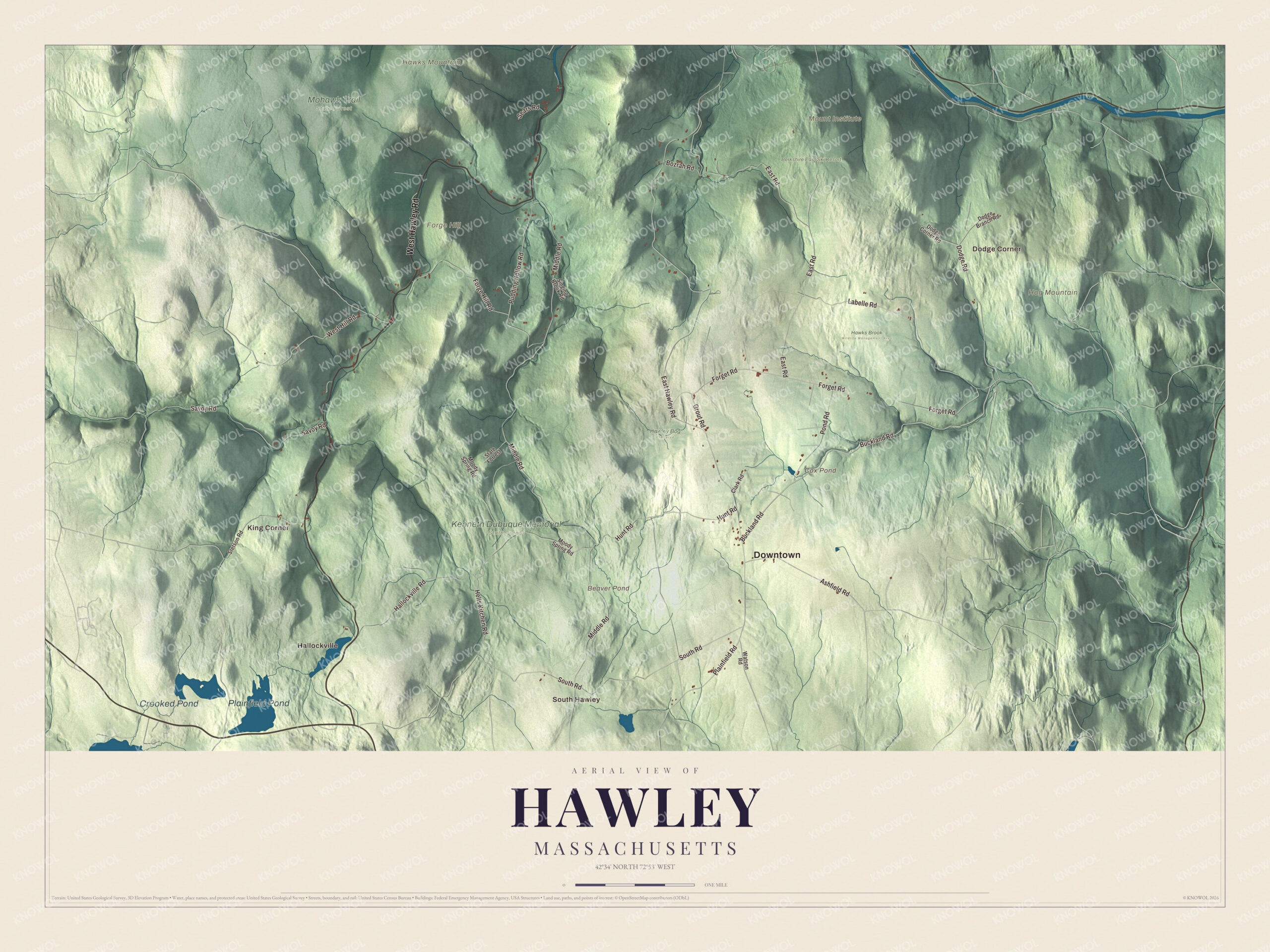
Click to explore a larger preview. The digital watermark does not appear on printed maps.
Names on this map
These names are printed on this map.
Places: Downtown, Dodge Corner, Hallockville, King Corner, South Hawley, Forge Hill, Hawks Mountain, Hog Mountain, Mount Institute, Beaver Pond, Cox Pond, Plainfield Pond, Crooked Pond, Berkshire East Ski Resort, Hawks Brook Wildlife Management Area, Hawley Bog Preserve, Kenneth Dubuque Memorial State Forest and Mohawk Trail State Forest.
Streets and roads: West Hawley Road, Buckland Road, Dodge Road, Plainfield Road, Hells Kitchen Road, South Road, Middle Road, East Hawley Road, East Road, Hallockville Road, Forget Road, West Hill Road.
More street names, A to Z
Ashfield Road, Bozrah Road, Clark Road, Dodge Branch Road, Dodge Corner Road, Forge Hill Road, Grout Road, Hunt Road, Labelle Road, Moody Spring Road, Pond Road, Pudding Hollow Road, Savoy Road, Sears Road, Singing Brook Road, State Forrest, Stetson Road, Watson Road.
Around the map
Start with Dodge Corner. Follow West Hawley Road, Buckland Road, Dodge Road, Plainfield Road, Hells Kitchen Road and South Road across town, then look outward toward Hallockville, King Corner and South Hawley. Cox Pond, Plainfield Pond, Crooked Pond, the Mohawk Trail, Forge Hill, Hawks Mountain, Hog Mountain and Beaver Pond are all printed on the map, and every one of those names is right there on the artwork.
The Hawley map makes a fine addition to an office, library or den, and it can help teach children the geography and history of a small hill town in the northern Berkshires. It’s made for people who call Hawley home, from Dodge Corner to South Hawley, and it shows the town as it looks today. Zoom in on the preview above to explore the details, then click here to get your copy of the Hawley, Massachusetts map.

We made a map for every town and city in Massachusetts. Explore the complete Massachusetts map collection and find your town.
Sources
- Hawley, Massachusetts, Wikipedia
- Joseph Hawley (Massachusetts politician), Wikipedia
- Kenneth Dubuque Memorial State Forest, Wikipedia
- Mohawk Trail State Forest, Wikipedia
- David Dunnels White, Wikipedia
- Alice Parker, Wikipedia
- City and Town Incorporation and Settlement Dates, Secretary of the Commonwealth of Massachusetts (archived copy)