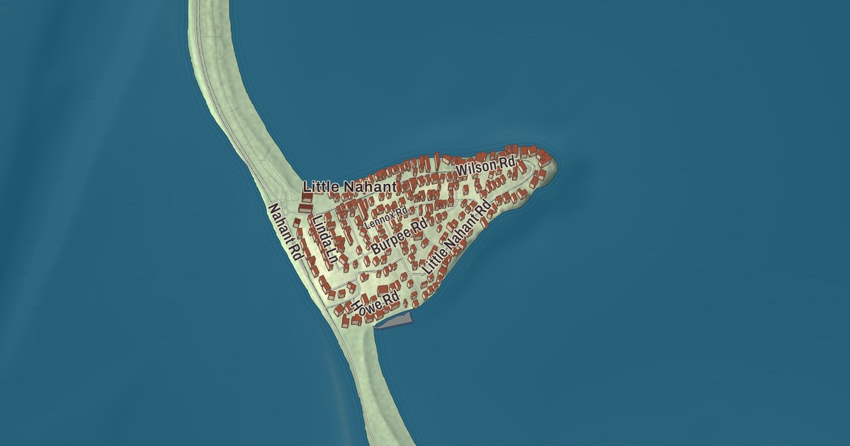
Nahant hangs off the coast at the end of a narrow sandy isthmus, and the one road out runs along it: Nahant Road, the causeway beside Long Beach. This map follows it past Little Nahant to the main part of town, where Gardner Road, Ocean Street, Burpee Road, Willow Road and Castle Road carry printed names. Click here to purchase a print of this map for your wall.
Nahant is in Essex County.
KNOWOL made this map in 2026 from public survey data and gave it the look of an old atlas. The rocky shape of the peninsula comes from United States Geological Survey elevation data, and the streets and the town line come from the Census Bureau. Nahant is a tied island, two near-islands called Little Nahant and Big Nahant joined to the mainland by a natural sandy tombolo. Its town line takes in 15.5 square miles, but only 1.0 square mile of it lies above water, and the town page calls it the smallest municipality in Massachusetts by area. Nahant Bay lies to the east, Nahant Harbor to the south and Lynn Harbor to the west, and the town touches only one other town by land, a short stretch of Lynn. It sits 14 miles by land northeast of Boston, and 3,334 people lived here at the 2020 census.
Nahant Poynt
The name may mean “at the point” or “twin islands,” or it may come from an important local man named Nahantum. Samuel de Champlain met Native people here in 1605 and wrote of the cleared land along the coast planted with corn. By the 1630s the sachem known to the English as Blacke William may have controlled the island, and around 1632 he let Thomas Dexter use it in exchange for an English suit. The Town of Nahant’s recorded history, in the Secretary of the Commonwealth’s list, dates European settlement to 1630, when Isaac Johnson’s servants grazed his cattle here, and people from Lynn brought cattle, sheep and goats out to pasture. William Wood listed Nahant in 1633 as one of thirty “noted Habitations” in New England, and a 1639 chart of the Massachusetts coast already shows Nahant Poynt.
Before 1800 only three houses stood here, those of the Breeds and the Hoods and a Johnson house built by Jeremiah Gray. One of the Johnsons built the first hotel in 1802, and by 1817 a steamboat ran daily from Boston. Nahant was still part of Lynn, and when the temperance movement threatened the summer resort trade, Nahant was incorporated as a town in 1853. The town remains part of Essex County today.
Summer people and the Ice King
In the late nineteenth century Nahant had some of the country’s first amusement parks and was a summer retreat for wealthy families, among them the poet Henry Wadsworth Longfellow. The geologist Louis Agassiz lived here, and the artist William Stanley Haseltine produced many versions of his oil picture “The Rocks at Nahant.” Frederic Tudor, Boston’s “Ice King,” who made his fortune shipping New England pond ice as far as India, built a summer cottage in the center of town in 1825 and spent the rest of his life planting trees on a treeless Nahant. By 1832 his nursery held 3,358 trees, and he offered them free to summer residents who would plant them. The Tudor family grounds are now the Nahant Country Club.
Senator Henry Cabot Lodge recalled childhood years at the family house at 5 Cliff Street, a stuccoed brick house wrapped in a two-story veranda in a style borrowed from the West Indies; it’s now a National Historic Landmark. The Army acquired the Lodge family’s land at East Point in 1917, and during World War II its gun batteries made Nahant, in the words of its page, the most heavily armed portion of Boston’s coast defenses. Since 1967 the site has been Northeastern University’s Marine Science Center. His grandson and namesake, Henry Cabot Lodge Jr., was born in Nahant.
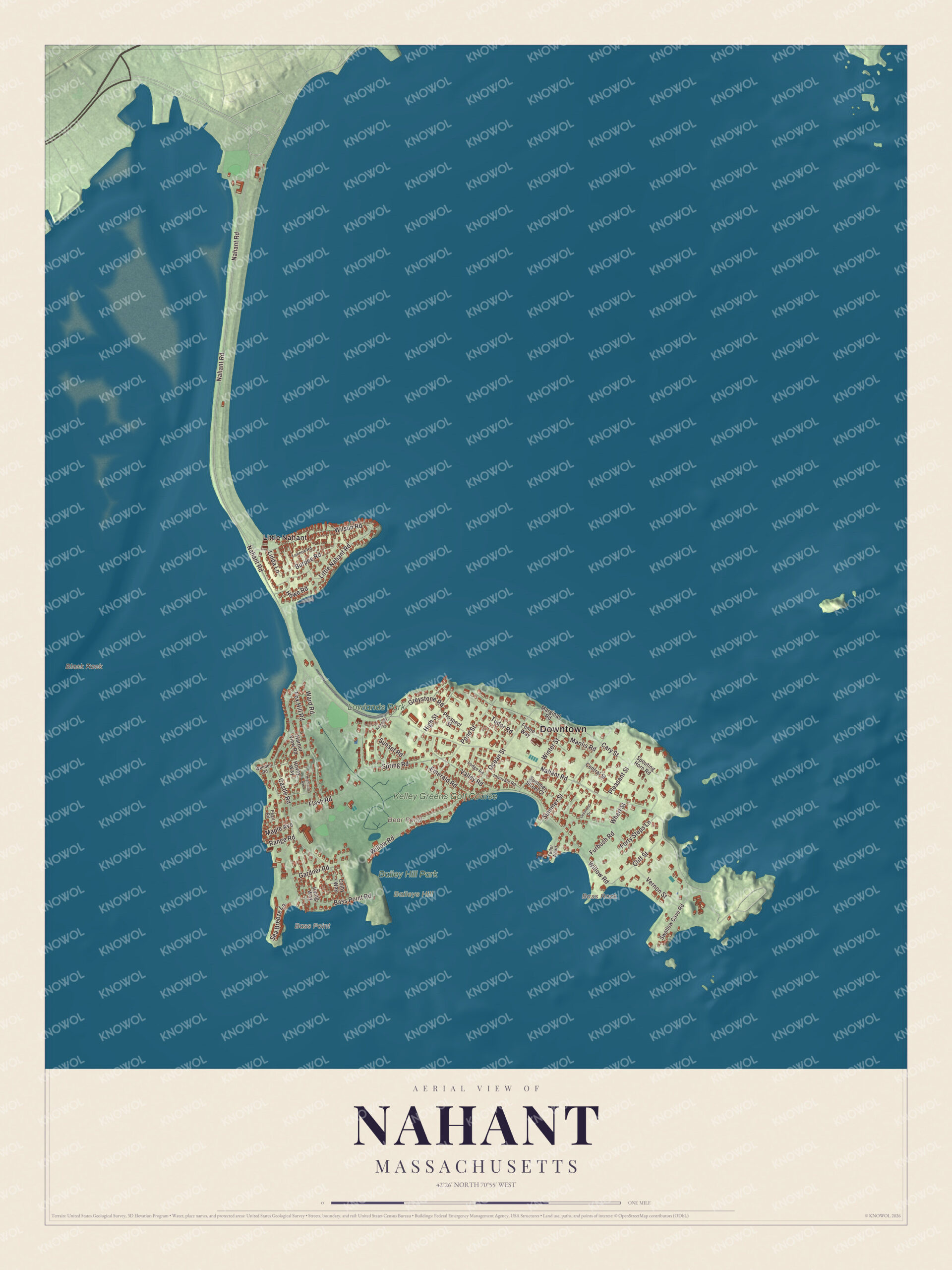
Click to explore a larger preview. The digital watermark does not appear on printed maps.
Around the map
Start with Little Nahant, then follow Nahant Road, Gardner Road, Ocean Street, Burpee Road, Willow Road and Castle Road across town. Bear Pond, Lowlands Park, Bailey Hill Park and Baileys Hill are all labeled on the map, and every one of those names is printed directly on the artwork. Nahant Road, once called Nahant Beach Boulevard and listed on the National Register of Historic Places in 2003, runs past 7,000-foot Long Beach in the Nahant Beach Reservation, shoreline the Metropolitan District Commission acquired in the early 1900s and cleared of buildings, the Hotel Nahant among them, to give the public access to the beaches. Between Little Nahant and the rest of town stands the Nahant Life-Saving Station, built in 1900 with a square tower and doors on both sides for launching boats to either shore; the Coast Guard ran it until 1964, and the town has had it since 1999. On top of Baileys Hill, the Calantha Sears Gazebo was rebuilt in 2005 to replace the one put up for the bicentennial in 1976.
The Nahant map makes a fine addition to an office, library or den, and it can help teach children the geography and history of a little island town joined to the shore by its beach. It’s made for people who call Nahant home, from Little Nahant to East Point, and it shows the town as it looks today. Zoom in on the preview above to explore the details, then click here to get your copy of the Nahant, Massachusetts map.

We made a map for every town and city in Massachusetts. Explore the complete Massachusetts map collection and find your town.
Sources
- Nahant, Massachusetts, Wikipedia
- Nahant Beach Reservation, Wikipedia
- Nahant Life-Saving Station, Wikipedia
- Frederic Tudor, Wikipedia
- Henry Cabot Lodge House, Wikipedia
- East Point Military Reservation, Wikipedia
- City and Town Incorporation and Settlement Dates, Secretary of the Commonwealth of Massachusetts (archived copy)