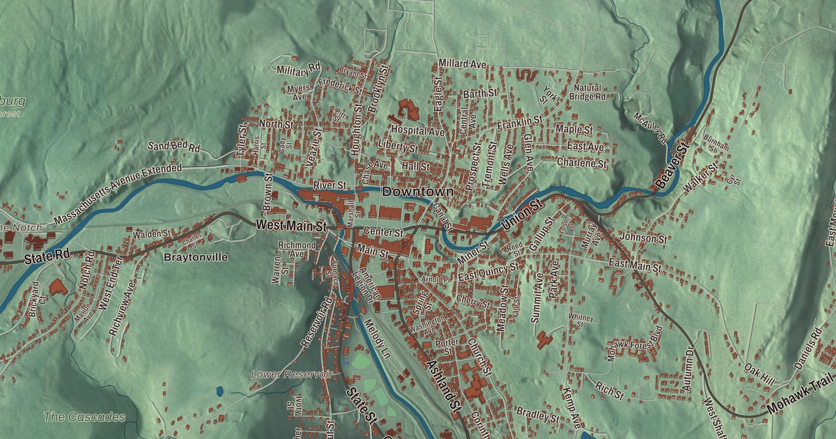
North Adams sits in the valley of the Hoosic River with mountains on both sides. This map prints its main streets: West Main Street, Church Street, Union Street, Ashland Street, State Road and Hodges Cross Road. The Notch, Spruce Hill and Brayton Hill are printed on it, along with Mount Williams Reservoir, Notch Reservoir and Lower Reservoir. Click here to purchase a print of this map for your wall.
North Adams is in Berkshire County.
KNOWOL made this map in 2026 from public survey data and gave it the look of an old atlas. The mountains come from United States Geological Survey elevation data, and the streets and the city line come from the Census Bureau. The Hoosac Range rises along the city’s eastern edge, and to the southwest the northern end of the Mount Greylock State Reservation ends at Mount Williams, the city’s highest point at 2,951 feet, where the Appalachian Trail crosses the summit. North Adams covers 20.6 square miles and had 12,961 people at the 2020 census. Clarksburg lies to the north, Florida to the east, Adams to the south and Williamstown to the west.
A mill city on the Hoosic
North Adams was first settled in 1745, when Fort Massachusetts, the westernmost of a line of forts, went up on the bank of the Hoosic River. The City of North Adams’ recorded history, in the Secretary of the Commonwealth’s list, dates European settlement to 1737. Where the two branches of the Hoosic meet, the water powered small industry even before the Revolution, and by the early 1800s the town had shoe makers, a brickyard, marble works, wagon and sleigh makers and an ironworks that supplied pig iron for the armor plates of the Civil War ship Monitor. Three mill villages pushed the town west along the river: Blackinton in 1821, Braytonville in 1832 and Greylock in 1846. North Adams was incorporated as a town in 1878, separate from Adams, and it’s named for Samuel Adams. It was incorporated as a city in 1895.
The city was the headquarters for building the Hoosac Tunnel, begun in 1851 and finished in the mid-1870s, 4.75 miles through the Hoosac Range to the town of Florida. Its own page says that when it was done it was the world’s second-longest tunnel, and it gave North Adams a rail link east toward Boston. Downtown, Oliver Arnold and Company began printing cloth in 1860; Arnold Print Works became one of the world’s leading textile printers and, by 1905, the city’s largest employer, with about 3,200 workers. When it left its Marshall Street mills in 1942, the Sprague Electric Company moved in, and its scientists and workers made parts for advanced weapons in World War II and later for the launch systems of NASA’s Gemini missions. Sprague closed on Marshall Street in 1985. When Thomas Krens of the Williams College Museum of Art went looking for room to show very large works of contemporary art, Mayor John Barrett III suggested the empty complex, the community and private donors pledged more than $8 million, and in 1999 the Massachusetts Museum of Contemporary Art opened there. MASS MoCA is now one of the largest centers for contemporary visual and performing arts in the United States.
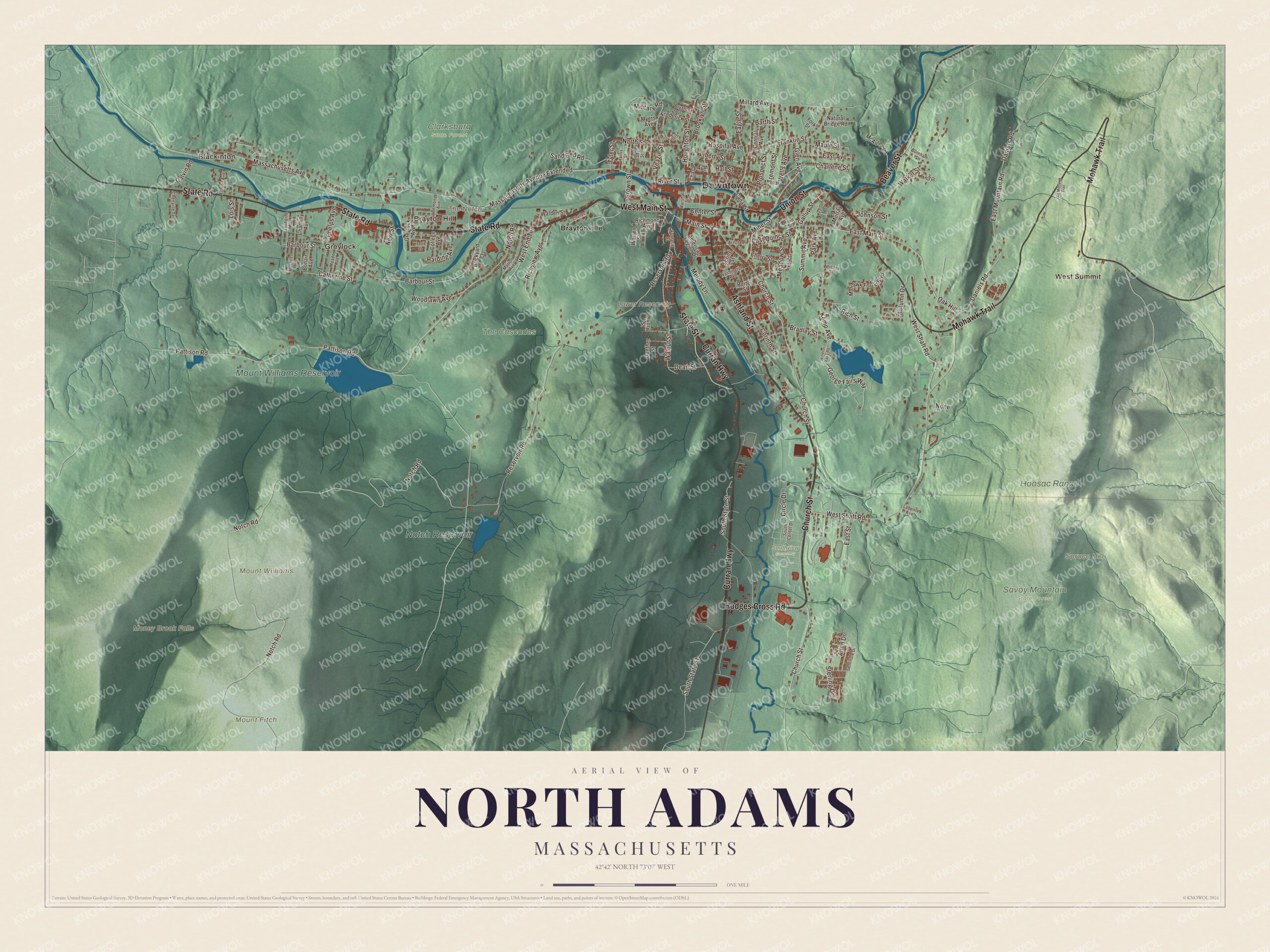
Click to explore a larger preview. The digital watermark does not appear on printed maps.
Names on this map
These names are printed on this map.
Places: Downtown, Blackinton, West Summit, Greylock, Brayton Hill, Mount Fitch, Mount Williams, Spruce Hill, The Notch, Lower Reservoir, Money Brook Falls, Mount Williams Reservoir, Notch Reservoir, Clarksburg State Forest, Hoosac Range, Savoy Mountain State Forest, Southview Cemetery, The Cascades and Braytonville.
Streets and roads: Ashland Street, Church Street, West Main Street, State Road, Union Street, Hodges Cross Road, State Street, Curran Highway, Beaver Street, Mohawk Trail, Eagle Street, Main Street.
More street names, A to Z
Allen Drive, American Legion Drive, Arnold Place, Ashton Avenue, Autumn Drive, Barbour Street, Barth Street, Bonair Avenue, Bradley Street, Brickyard Court, Brooklyn Street, Brown Street, Bryant Street, Burnham Street, Cady Street, Canal Street, Catherine Street, Center Street, Central Avenue, Chantilly Avenue, Charlene Street, Charles Street, Chase Avenue, Chenaille Terrace, Cherry Street, Circle Drive, College Avenue, Corinth Street, Cyr Street, Daniels Road, Dean Street, Demond Avenue, East Avenue, East Main Street, East Mountain Road, East Quincy Street, East Street, Folsom Street, Franklin Street, Frederick Street, Furnace Street, Gallup Street, Galvin Road, George Fairs Way, Glen Avenue, Greylock Avenue, Gunther Street, Hall Street, Harding Avenue, Harris Street, Hawthorne Avenue, Hospital Avenue, Houghton Street, Isbell Street, Ivory Street, Johnson Street, Kemp Avenue, Labonte Avenue, Liberty Street, Lois Street, Maple Street, Marion Avenue, Marshall Street, Massachusetts Avenue, Massachusetts Avenue Extended, McAuley Road, Meade Avenue, Meadow Street, Melody Lane, Military Road, Millard Avenue, Miner Street, Mohawk Forest Boulevard, Murray Avenue, Myers Avenue, Natural Bridge Road, New Street, None, North Street, Notch Road, Oak Hill, Old Mohawk Trail, Park Avenue, Pattison Road, Phelps Avenue, Pitt Street, Porter Street, Prospect Street, Reed Street, Reservoir Road, Richmond Avenue, Rich Street, Richview Avenue, River Street, Sand Bed Road, Seminole Drive, South Center Drive, South State Street, Spring Street, Sterling Drive, Summit Avenue, Tremont Street, Tyler Street, Veazie Street, Versailles Avenue, Walden Street, Walker Street, Walnut Street, Warren Street, Washington Avenue, Wells Avenue, West End Terrace, West Shaft Road, Whitney Street, Windsor Lake Road, Woodlawn Avenue, Wood Street, Yale Street, York Street.
See it on a wall
The North Adams map as a framed print. Swipe for more.


Around the map
Start with Blackinton, then follow Ashland Street, Church Street, West Main Street, State Road, Union Street and Hodges Cross Road across the city. Then look outward toward West Summit, Greylock, Brayton Hill and Braytonville. Lower Reservoir, Mount Williams Reservoir, Notch Reservoir, Spruce Hill, The Notch and Money Brook Falls are all labeled on the map, and every one of those names is printed directly on the artwork. Blackinton grew around the woolen mills Sanford Blackinton and his partners founded in 1821 on the north bank of the Hoosic; it filled large orders for the Union Army, and the historic district there is the city’s best preserved mill village. From West Summit on the Hoosac Range the view takes in three states. In Natural Bridge State Park, glacial meltwater carved a natural bridge of white marble, which the park’s page calls unique in North America; marble was quarried there from 1810 to 1947, and Nathaniel Hawthorne visited in 1838.
The North Adams map makes a fine addition to an office, library or den, and it can help teach children the geography and history of a mill city that turned its factories into an art museum. It’s made for people who call North Adams home, from Blackinton to Braytonville, and it shows the city as it looks today. Zoom in on the preview above to explore the details, then click here to get your copy of the North Adams, Massachusetts map.

Sources
- North Adams, Massachusetts, Wikipedia
- Hoosac Tunnel, Wikipedia
- Massachusetts Museum of Contemporary Art, Wikipedia
- Blackinton Historic District, Wikipedia
- Natural Bridge State Park (Massachusetts), Wikipedia
- City and Town Incorporation and Settlement Dates, Secretary of the Commonwealth of Massachusetts (archived copy)