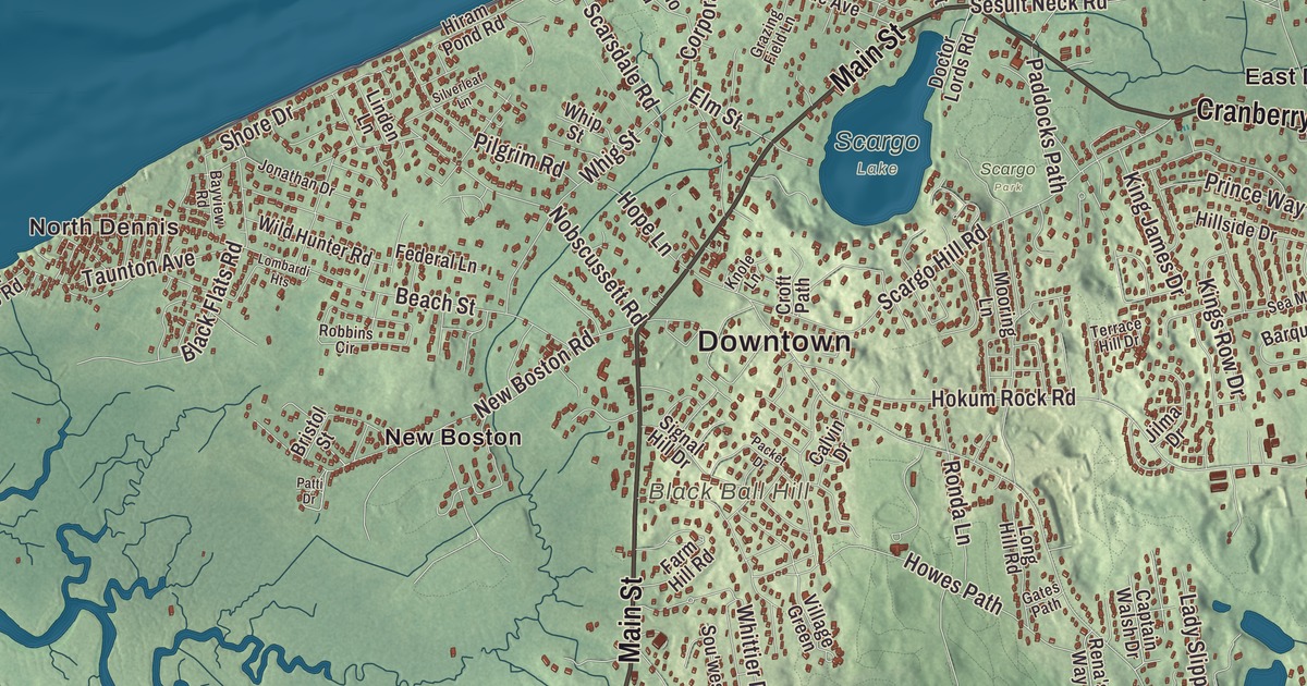
Dennis runs the whole width of Cape Cod, from the bay beaches on the north shore to Nantucket Sound on the south, with the Bass River along its western edge. This map prints Main Street, Old Main Street, Cranberry Highway, East-West Dennis Road and Trotting Park Road, with Follins Pond, Bakers Pond, Aunt Pattys Pond, Bells Neck and Davis Beach. Click here to purchase a print of this map for your wall.
Dennis is in Barnstable County, about 78 miles southeast of Boston.
KNOWOL made this map in 2026 from public survey data and gave it the look of an old atlas. The relief comes from United States Geological Survey elevation data, and the roads and the town line come from the Census Bureau. Dennis covers 22.3 square miles, with Cape Cod Bay to the north, Brewster to the northeast, Harwich to the southeast and Yarmouth to the west. The town had 14,674 people at the 2020 census, and it holds five villages, each with its own post office: Dennis, Dennis Port, East Dennis, South Dennis and West Dennis.
The East Precinct of Yarmouth
Indigenous peoples have lived on Cape Cod for at least 9,000 years, among them the Wampanoag, and the original inhabitants called the northern parts of town Nobscussett, Sesuit and Quivet. English colonists from Plymouth Colony settled here as part of Yarmouth, and the area became the East Precinct. The Town of Dennis’s recorded history, in the Secretary of the Commonwealth’s list, dates European settlement to 1639. The town takes its name from the Reverend Josiah Dennis, the parish minister for 38 years, whose saltbox house of about 1736 on Whig Street is now the Josiah Dennis Manse Museum, run by the Dennis Historical Society. Dennis was incorporated as a town in 1793, when it separated from Yarmouth, and the town remains part of Barnstable County today.
With little land fit for farming, the town turned to the sea. In the 1800s Asa Shiverick and his three sons built schooners, brigs and clipper ships at Sesuit Harbor in East Dennis, two of the clippers weighing more than 1,000 tons, and Shiverick Road near the harbor honors the family, while Wild Hunter Road is named for one of their clippers, which sailed as far as China. Captain John Sears built salt works in East Dennis in the 1700s, and Dennis was once the Cape’s leader in making salt until the works closed in 1888. In West Dennis the Baker family sent 29 captains to sea.
Scargo Hill and the Playhouse
Scargo Lake is a glacial kettle pond, and the stories told about it say a princess had the women of the village dig it out with clam shells to keep three fish alive, and the dirt they dug became Scargo Hill. On top of the hill stands Scargo Tower, a 30-foot cobblestone tower put up around the turn of the 20th century as a memorial to the Tobey family, whose ancestors settled in Dennis in 1678. On a clear day the view from the top reaches as far as Provincetown. In northern Dennis, Raymond Moore turned the old 1838 Unitarian meeting house into the Cape Playhouse in 1927, and its first play starred Basil Rathbone. The town’s page calls it the oldest summer theater in the United States, and its own page says it’s often considered the longest continuously operating summer theater in America. Dennis has also been home to the author Mary Higgins Clark and the actress Bette Davis.
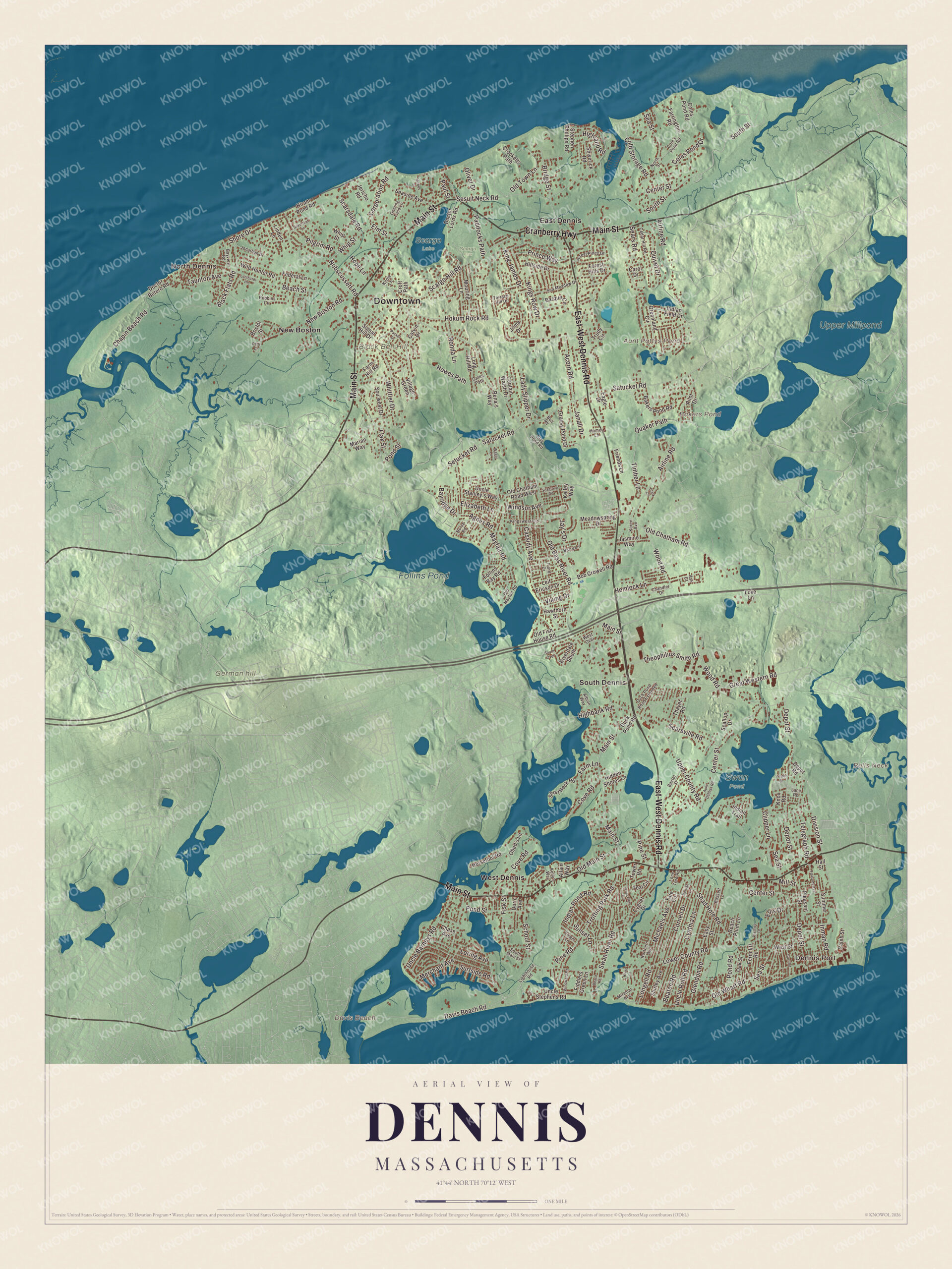
Click to explore a larger preview. The digital watermark does not appear on printed maps.
Names on this map
These names are printed on this map.
Places: Downtown, North Dennis, Dennis Port, Bells Neck, Black Ball Hill, Davis Beach, German hill, Aunt Pattys Pond, Bakers Pond, Follins Pond, Upper Millpond, Scargo Lake, Scargo Park, Swan Pond, East Dennis, New Boston, South Dennis and West Dennis.
Streets and roads: Main Street, East-West Dennis Road, Cranberry Highway, Old Main Street, Trotting Park Road, Quaker Path, Davis Beach Road, Timber Lane, Pine Road, Old Bass River Road, Center Street, Lower County Road.
More street names, A to Z
Acorn Road, Agnes Road, Airline Road, Albion Way, Allain Way, Ash Court, Aunt Debbys Road, Bakers Pond Road, Barque Circle, Barry Lane, Bassett Lane, Baxter Street, Bayridge Drive, Bayview Road, Beach Plum Lane, Beach Road, Beach Street, Beaten Road, Bell Road, Black Flats Road, Bob Crowell Road, Bridge Street, Bristol Street, Caleb Street, Calvin Drive, Captain Walsh Drive, Carol Drive, Carr Road, Cassidy Avenue, Cedar Hill Road, Chandler Drive, Chapin Beach Road, Chase Avenue, Clark Circle, Clay Pond Road, Clipper Lane, Cold Storage Road, Cole's Pond Road, Coles Pond Drive, Coles Pond Road, Cornell Drive, Corporation Road, Cove Road, Crocketts Path, Croft Path, Cygnet Drive, Cynthia Lane, Depot Road, Depot Street, Division Street, Doctor Botero Road, Doctor Lords Road, Doric Avenue, Duck Pond Road, Duck Pond Road Extended, Eagle Drive, Easy Street, Edwards Avenue, Elizabeth Lane, Ellis Drive, Elm Street, Farm Hill Road, Farm Lane, Farrington Road, Federal Lane, Ferncliff Road, Fiddlers Green Lane, Fiord Drive, Fisk Street, Flax Street, Folger Lane, Follins Bay Road, Forest Hills Drive, Forest Pines Drive, Friends Lane, Gates Path, Glendon Road, Grassy Pond Drive, Grazing Field Lane, Great Western Road, Greenland Circle, Hall Street, Hawthorn Street, Hemlock Lane, Hidden Shores Lane, Highbank Road, Highland Road, Hillside Drive, Hiram Pond Road, Hokum Rock Road, Homer Lane, Hope Lane, Horsefoot Road, Howes Path, Howes Street, Indian Field Drive, Indian Pond Road, Indian Trail, Inman Road, Janall Drive, Jasmine Way, Jay's Drive, Jericho Road, Jilma Drive, Jonathan Drive, Karen Avenue, Kelley Way, Kelly's Way, King James Drive, Kings Row Drive, Kingswear Circle, Knole Lane, Knox Road, Lady Slipper Drive, Lane Road, Leif Ericson Drive, Lighthouse Road, Linden Lane, Lombardi Heights, Lone Tree Road, Longell Road, Long Hill Road, Loring Avenue, Love Lane, Marian Way, Mayfair Road, Meadowspring Drive, Merchant Avenue, Michaels Avenue, Mill Street, Miramar Avenue, Mooring Lane, New Boston Road, Nobscussett Road, Norse Road, Northern Avenue, North Street, Oak Street, Obed's Lane, Old Chatham Road, Old Chatham Road West, Old Fish House Road, Old Mayfair Road, Old Town Lane, Old Wharf Road, Oliver Drive, Packet Drive, Paddocks Path, Patti Drive, Paul Street, Pilgrim Road, Pilot Drive, Pine Street, Plashes Drive, Pleasant Street, Pond Road, Pond Street, Princeton Circle, Prince Way, Puritan Lane, Quivet Drive, Rena's Way, Riverdale South, River Lane, Robbins Circle, Ronda Lane, Satucket Road, Scallop Drive, Scargo Hill Road, Scarsdale Road, School Street, Seagrove Road, Sea Meadow Drive, Sears Road, Searsville Road, Seaside Avenue, Sea Street, Sesuit Neck Road, Setucket Road, Shad Hole Road, Shirley Avenue, Shiverick Road, Shore Drive, Short Neck Road, Signal Hill Drive, Silverleaf Lane, Sou'west Drive, South Main Street, South Over, South Street, Stephen Phillips Road, Summer Street, Sunset Lane, Surfside Road, Swan River Road, Taunton Avenue, Teal Circle, Telegraph Road, Terrace Hill Drive, Thayer Road, Theophilius Smith Road, Tower Road, Trudy Circle, Uncle Barneys Road, Uncle Rolf Road, Uncle Stanley's Way, Uncle Stephens Road, Upper County Road, Vester Drive, Viking Drive, Village Green, Wager Lane, West Over, West Street, Whig Street, Whip Street, Whittier Drive, Wild Hunter Road, Windsor Avenue, Windward Road, Wood Road, Yale Circle.
See it on a wall
The Dennis map as a framed print. Swipe for more.


Bass River and the south shore
Follins Pond, at the head of the Bass River, separates Dennis from Yarmouth and is named for Thomas Follins, a settler of the 1600s. In the 1950s Frederick J. Pohl claimed that holes drilled in its shore rocks were Norse mooring stones; professional historians don’t take the Viking theory seriously, but streets near the pond and the river, such as Norse Road and Vinland Drive, are named for it. Down on the Sound, the West Dennis Light went into service in 1855 at the mouth of the Bass River, went dark in 1914, and was relit in 1989 atop the Lighthouse Inn as one of very few privately owned working lighthouses in the country. Davis Beach is the old name of West Dennis Beach, after Charles Henry Davis, who sold the beach to the town in the early 1900s. Trotting Park Road took its name from a popular race track off the street in the late 1800s.
Around the map
Start with North Dennis, then follow Main Street, Old Main Street, East-West Dennis Road, Cranberry Highway, Trotting Park Road and Quaker Path across town, and look outward toward Dennis Port, East Dennis, South Dennis, West Dennis, New Boston, Black Ball Hill and German hill. New Boston, an area with a road and a river of the same name, was named for a group of Bostonians who settled there. Dennis Port was named in 1850 by Thomas Howes, the village’s first postmaster, and was earlier called Crooks Neck, for Samuel Crook, a Native man who sold the land to English settlers. Aunt Pattys Pond, Bakers Pond, Follins Pond, Bells Neck, the Trotting Park and Davis Beach are all printed on the map.
The Dennis map makes a fine addition to an office, library or den, and it can help teach children the geography and history of a town that stretches from bay to sound. It’s made for people who call Dennis home, from North Dennis to Dennis Port, and it shows the town as it looks today. Zoom in on the preview above to explore the details, then click here to get your copy of the Dennis, Massachusetts map.

Sources
- Dennis, Massachusetts, Wikipedia
- Josiah Dennis House, Wikipedia
- Scargo Lake, Wikipedia
- Scargo Tower, Wikipedia
- The Cape Playhouse, Wikipedia
- Follins Pond, Wikipedia
- West Dennis Light, Wikipedia
- City and Town Incorporation and Settlement Dates, Secretary of the Commonwealth of Massachusetts (archived copy)