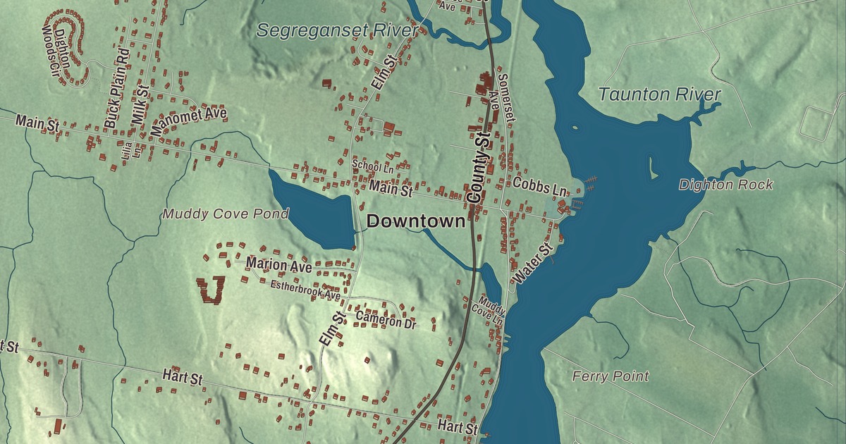
Dighton sits on the western shore of the Taunton River, and just north of town the river grows too shallow for ships. This map prints Somerset Avenue, County Street, Winthrop Street, Williams Street, Summer Street and Park Street, with the Taunton River, the Three Mile River, the Segreganset River, Muddy Cove Pond and Beals Ledge. Click here to purchase a print of this map for your wall.
Dighton is in Bristol County, across the Taunton River from Berkley.
KNOWOL made this map in 2026 from public survey data and gave it the look of an old atlas. The relief comes from United States Geological Survey elevation data, and the roads and the town line come from the Census Bureau. Dighton covers 22.6 square miles, with Rehoboth to the west, Swansea to the southwest, Somerset to the south and the city of Taunton to the north. Its highest ground is in the northwest corner, above 236 feet. The town had 8,101 people at the 2020 census.
Frances Dighton’s town
Dighton began as part of Taunton’s South Purchase, on the “Old Bristol Path” that carried early settlers from Plymouth to Bristol, Rhode Island, the home of Massasoit, with a ferry across the Taunton River. The Town of Dighton’s recorded history, in the Secretary of the Commonwealth’s list, dates European settlement to 1678, and the town’s page says it was separated in 1672. Dighton was incorporated as a town in 1712 and named for Frances Dighton Williams, the wife of Richard Williams, a town elder. The town remains part of Bristol County today.
In 1765, shortly after the Molasses Act was renewed, Dighton’s wharves saw the “Molasses Affair.” A local ship reported 63 casks of molasses to the customs officer while carrying double that, and when he left for Newport to get help, forty local men with blackened faces took the cargo, ran the ship aground and drilled holes in its hull to protest British taxes. During the Revolution the town took in people who had fled the British occupation of Newport, among them Ezra Stiles, who kept a diary of his time in Dighton. In January 1778 the town council voted for the Articles of Confederation.
Shipyards and herring
The town’s page says the shallow water upstream, along with Dighton’s central location, let it become a shipping hub for southeastern Massachusetts. It was made a port of entry in 1789; ships unloaded here, and goods went on to Taunton in smaller boats or were towed by oxen along a path on the east bank. Shipbuilding started as early as 1698, and Thomas Coram, an English sea captain who lived in Dighton for ten years, built the town’s first shipyard on the west side of the river. Coram went home to London and founded the Foundling Hospital for abandoned children, which is said to be the world’s first incorporated charity. Shipbuilding grew after 1800 and peaked around 1850; between 1840 and 1845 the yards turned out twenty-two schooners, two sloops, four brigs and three barks. Herring were so plentiful in the Taunton River that at one point the fishery brought the town more income than any other industry, and salted fish went as far as the West Indies. From before the Civil War to at least 1912, Dighton was known around the region for its strawberry farms. The town’s historic places include the Coram Shipyard and Dighton Wharves historic districts.
The rock across the river
When the town was incorporated it took in land on both banks of the Taunton River, including Assonet Neck and Dighton Rock, a sandstone boulder carved with lines, shapes and figures whose makers are still debated. In 1799 Berkley annexed the east bank, which left Assonet Neck and the rock in Berkley. State officials took the 40-ton boulder out of the river in 1963, and it’s kept in a small museum in Dighton Rock State Park, on the Berkley shore. The Berkley-Dighton Bridge links Center Street in Dighton with Elm Street in Berkley; a new two-lane bridge opened there in August 2015, the only span over the Taunton River between the Brightman Street Bridge to the south and the Plain Street Bridge in Taunton.
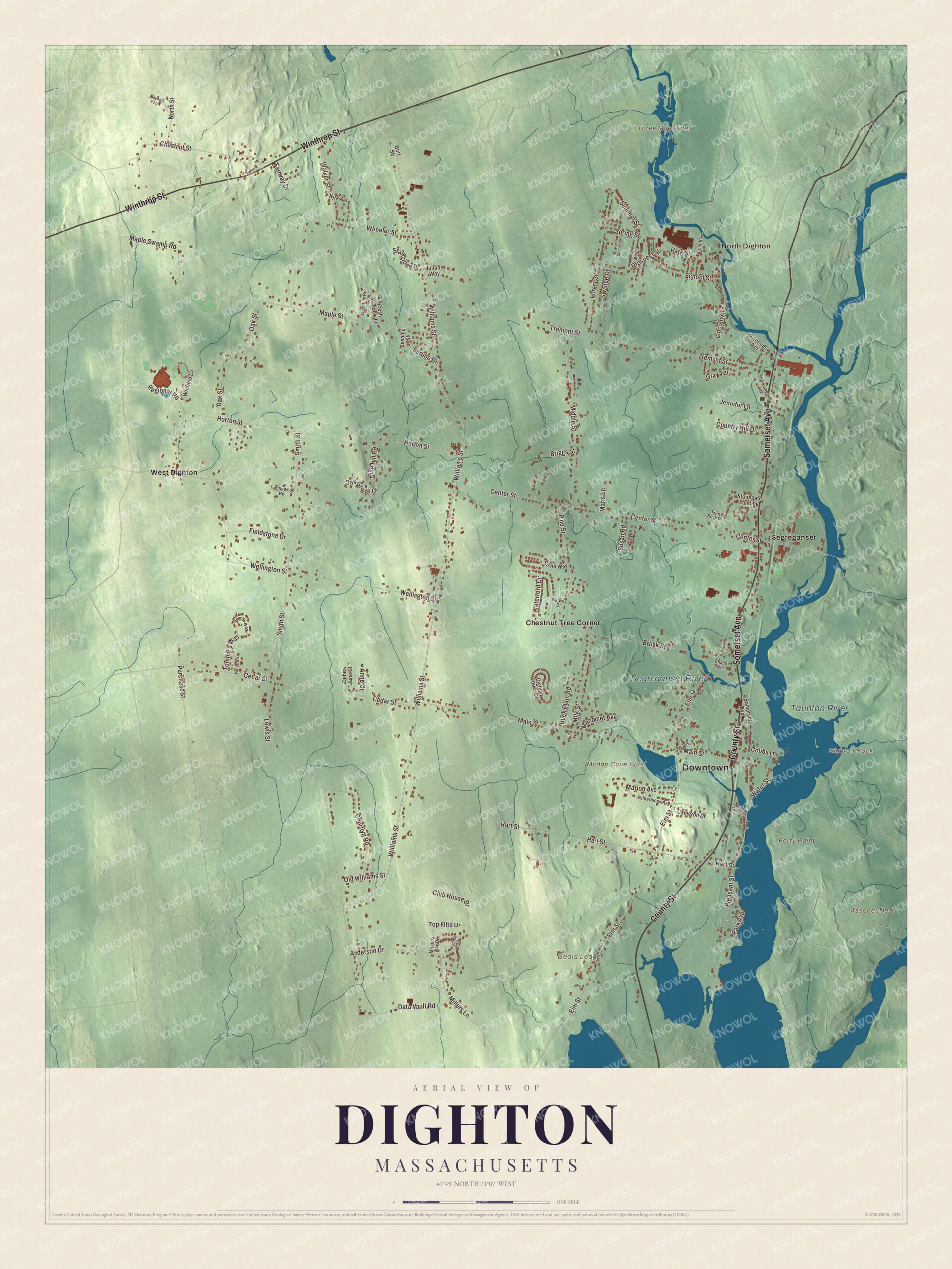
Click to explore a larger preview. The digital watermark does not appear on printed maps.
Names on this map
These names are printed on this map.
Places: Downtown, North Dighton, Assonet Neck, Beals Ledge, Dighton Rock, Ferry Point, Muddy Cove Pond, Three Mile River, Segreganset River, Taunton River, Chestnut Tree Corner, Segreganset and West Dighton.
Streets and roads: Somerset Avenue, County Street, Winthrop Street, Williams Street, Summer Street, Park Street, Park Avenue, Millers Lane, Pleasant Street, Purchase Street, Club House Drive, Elm Street.
More street names, A to Z
Anderson Drive, Anne Circle, Baylies Street, Berube Drive, Billys Lane, Briggs Street, Brook Street, Buck Plain Road, Burt Street, Cameron Drive, Cedar Street, Center Street, Chace Avenue, Chestnut Street, Cobbs Lane, Country Hill Drive, Courtlyn Road, Data Vault Road, Debra Jane Court, Dighton Woods Circle, Estherbrook Avenue, Fairway Drive, Fieldstone Drive, Forest Street, Fresh Meadow Lane, Galway Drive, Gray Terrace, Hart Street, Horton Street, Hunters Hill Drive, Jennifer Lane, Julians Way, Kirk Terrace, Lewis Street, Lilia Lane, Lincoln Avenue, Main Street, Manomet Avenue, Maple Street, Maple Swamp Road, Marion Avenue, Maris Lane, Maynard Lane, Middle Street, Milk Street, Miranda Way Drive, Muddy Cove Lane, North Street, Oak Grove Drive, Oak Street, Old Somerset Avenue, Old Williams Street, Pilot Rock Drive, Pine Hill Road, Pine Street, Prospect Street, Rebecca Road, Regional Road, Riverside Avenue, Rose Terrace, School Lane, School Street, Sesame Street, Silvia Way, Smith Street, Sonnys Way, Spring Street, Stanzione Drive, Stonegate Landing, Susan Road, Swanee Drive, Tanglewood Road, Tiger Lily Road, Tommy's Way, Top Flite Drive, Tremont Street, Walker Street, Warner Boulevard, Waterford Circle, Water Street, Wellington Street, Wheeler Street, Winfield Lane.
See it on a wall
The Dighton map as a framed print. Swipe for more.


Around the map
Start with North Dighton, then follow Somerset Avenue, County Street, Winthrop Street, Williams Street, Summer Street and Park Street across town, and look outward toward Chestnut Tree Corner, Segreganset and West Dighton. The Segreganset River flows 9.6 miles southeast through Taunton and Dighton and crosses the center of town on its way to the Taunton River, and the town’s police station stands on its banks along Route 138. The Three Mile River runs 13.5 miles from Norton and meets the Taunton along the town’s northeast border. Sweets Knoll State Park, fifty-six acres bought in June 2009, takes in two miles of old railroad bed, picnic areas and a small boat launch, and Tricentennial Park is a small waterfront park on the Taunton River. Every June the Dighton Lions Club holds the Cow Chip Festival behind the Town Hall. Muddy Cove Pond, Beals Ledge, Assonet Neck, the Taunton River, the Three Mile River and the Segreganset River are all printed on the map.
The Dighton map makes a fine addition to an office, library or den, and it can help teach children the geography and history of an old river port. It’s made for people who call Dighton home, from North Dighton to Chestnut Tree Corner, and it shows the town as it looks today. Zoom in on the preview above to explore the details, then click here to get your copy of the Dighton, Massachusetts map.

Sources