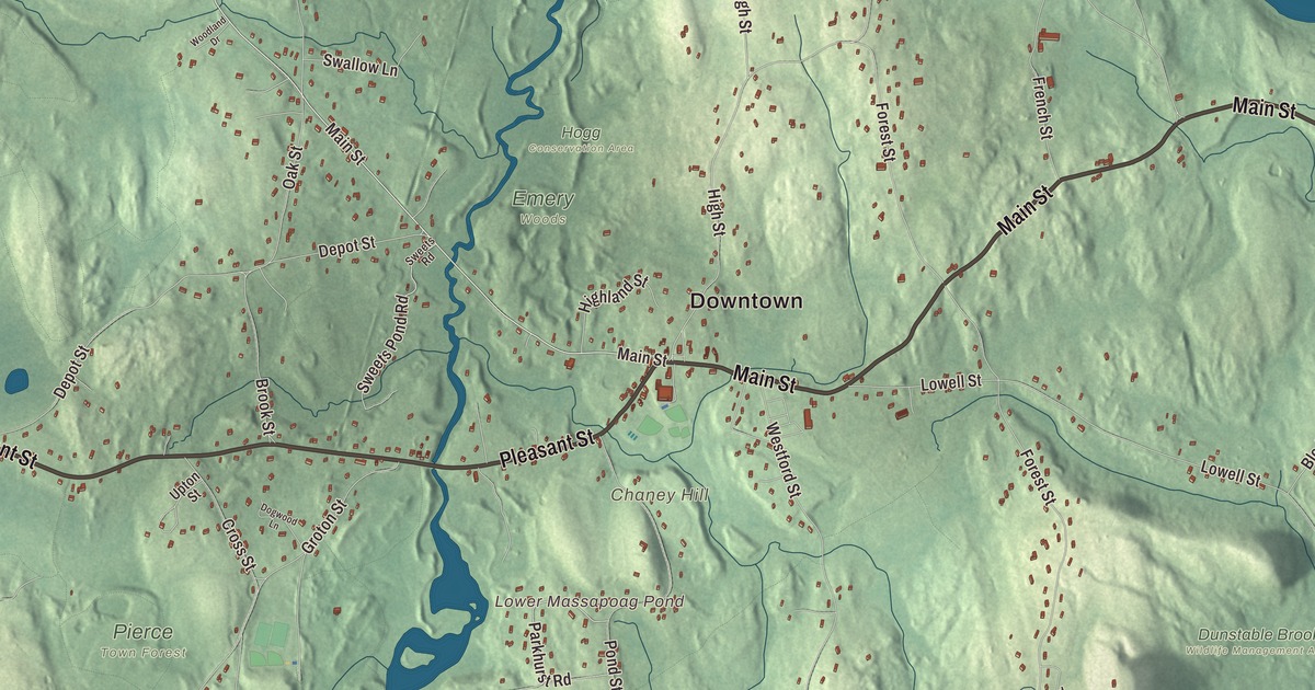
Dunstable is a small country town on the New Hampshire line, with Main Street, which is also Route 113, running past the Town Hall, the common and the one church in town. This map prints Main Street, Pleasant Street, Hollis Street, Kemp Street, Groton Street and High Street, with Lower Massapoag Pond, Hawk Pond, Salmon Brook, Unkety Woods and Blanchard Hill. Click here to purchase a print of this map for your wall.
Dunstable is in Middlesex County, bordered by Nashua and Hollis, New Hampshire, to the north.
KNOWOL made this map in 2026 from public survey data and gave it the look of an old atlas. The relief comes from United States Geological Survey elevation data, and the roads and the town line come from the Census Bureau. Dunstable covers 16.7 square miles, with Pepperell to the west, Groton to the south and Tyngsborough to the east. Route 113 is the only numbered route through town, and there’s no train or bus service. The town had 3,358 people at the 2020 census.
Two hundred square miles
The Town of Dunstable’s recorded history, in the Secretary of the Commonwealth’s list, dates European settlement to 1656. The town is likely named for Dunstable in Bedfordshire, England, the home of Edward Tyng, its first settler, and the two towns are sister towns today. Where the old English name came from is less clear; one theory reads it as “the boundary post of Duna,” another as a hill and a marketplace. The original township, granted in 1661, covered two hundred square miles, taking in what are now Dunstable, Pepperell, Townsend and Tyngsborough in Massachusetts and Hudson, Nashua and Hollis in New Hampshire. Dunstable was incorporated as a town in 1673. Over time parts of it became towns of their own, and the drawing of the province’s northern line in 1740 left the northern part, today’s Nashua, in New Hampshire. The town remains part of Middlesex County today, and its page says it has held on to a largely rural character in the face of suburban sprawl.
Sons and daughters of Dunstable
Ellen Swallow Richards was born in Dunstable in 1842. She became the first woman admitted to the Massachusetts Institute of Technology and later its first female instructor, and her work in sanitary engineering and the chemistry of food helped found the science of home economics. The Swallow Union Elementary School in town is named for her. Amos Kendall, born in Dunstable into a family of prominent landowners who owned the tavern where elections and town meetings were held, graduated at the top of his class at Dartmouth and became Postmaster General under President Andrew Jackson. Amos Lawrence, later a Boston merchant whose firm helped build New England’s cotton textile industry, started out at 13 as a clerk in a Dunstable country store.
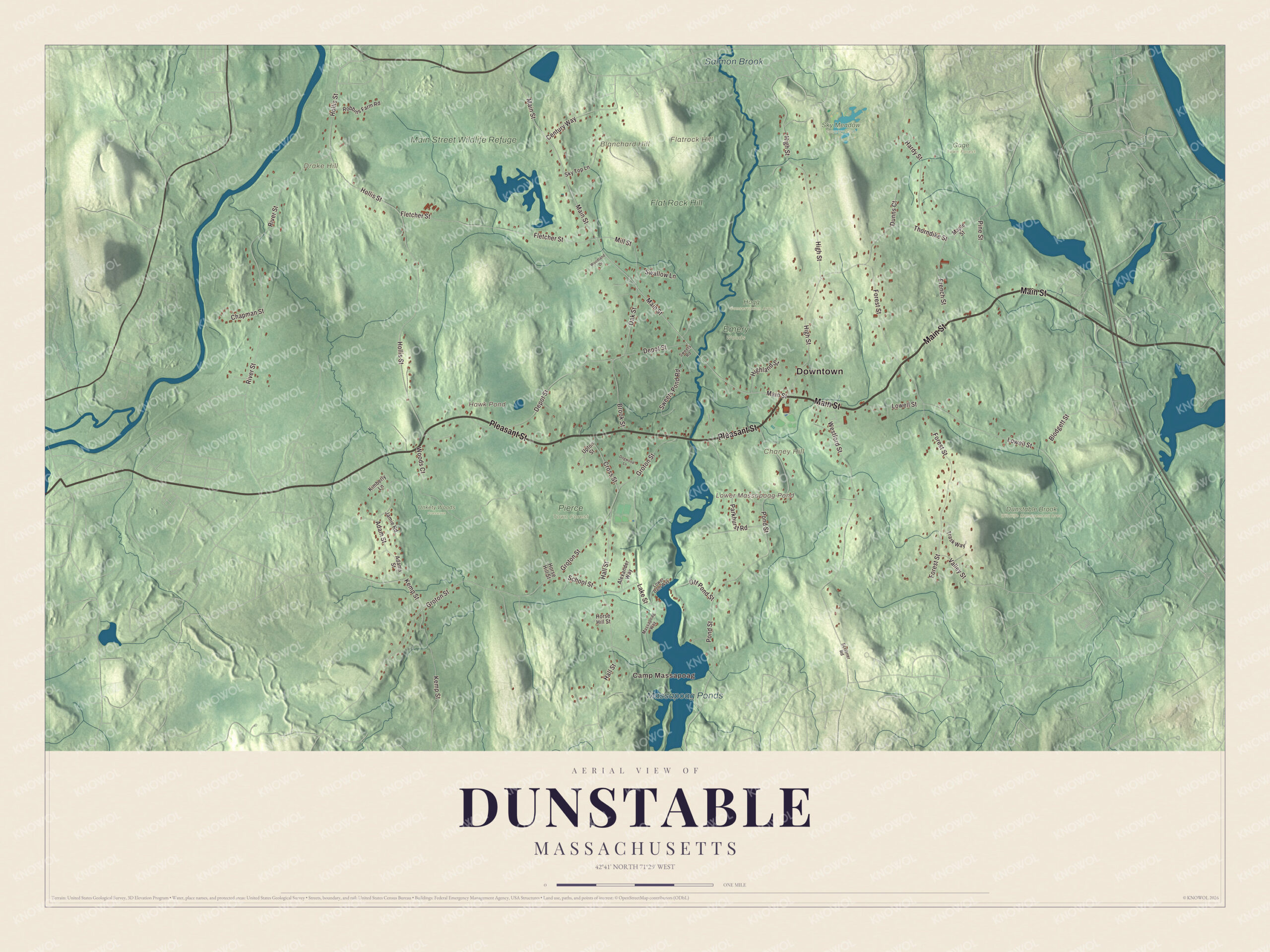
Click to explore a larger preview. The digital watermark does not appear on printed maps.
Names on this map
These names are printed on this map.
Places: Downtown, Camp Massapoag, Blanchard Hill, Chaney Hill, Drake Hill, Flatrock Hill, Hawk Pond, Lower Massapoag Pond, Massapoag Ponds, Salmon Brook, Dunstable Brook Wildlife Management Area, Emery Woods, Flat Rock Hill, Gage Town Forest, Hogg Conservation Area, Main Street Wildlife Refuge, Pierce Town Forest, Sky Meadow Country Club and Unkety Woods Preserve.
Streets and roads: Main Street, Pleasant Street, Hollis Street, Kemp Street, Groton Street, High Street, Sweets Pond Road, Forest Street, Pond Street, River Street, Thorndike Street, Westford Street.
More street names, A to Z
Adams Street, Adam Street, Alexander Way, Blodgett Street, Brook Street, Century Way, Chapman Street, Cross Street, Depot Street, Dogwood Lane, Dunns Court, Fletcher Street, French Street, Hall Street, Hardy Street, Highland Street, Horse Hill Street, Jamie Road, Kimberly Lane, Lake Street, Lowell Street, Lower Dam Way, Maple Street, Massapoag Way, Mill Street, Oak Street, Off Pond Street, Parkhurst Road, Pine Street, Robbins Farm Road, School Street, Scribner Road, Sky Top Lane, Swallow Lane, Sweets Road, Trask Way, Upton Street, Valley Street, Woodland Drive, Woods Court.
The town center
The Sarah R. S. Roby Town Hall, at 511 Main Street, was built in 1909 and renovated in 2003. Across Route 113 is the Town Common, home to summer “Concerts on the Common” and the Grange Fair in August. The Dunstable Evangelical Congregational Church at 518 Main Street has had its congregation on that spot since 1831, and because it’s the only church in town, people often call it simply “the Dunstable Church.” The Dunstable Free Library is at 588 Main Street, and near the Tyngsborough line the “Little Red Schoolhouse,” brought over from Tyngsborough, hosts school field trips and an annual Strawberry Festival.
Around the map
Start with Main Street, then follow Pleasant Street, Hollis Street, Kemp Street, Groton Street and High Street across town. Salmon Brook begins at the outlet of Lower Massapoag Pond near the center of town and flows about 9.3 miles north-northeast through Nashua to the Merrimack River, roughly parallel to the Nashua River the whole way. Blanchard Hill, 1.7 miles from the town center, was a ski area from 1959 to 1988, with tows, a T-bar and a lodge, and a 39-acre conservation area now takes in part of the old slopes. Hawk Pond, Lower Massapoag Pond, Salmon Brook, the Main Street Wildlife Refuge, Sky Meadow, Unkety Woods, Blanchard Hill, Chaney Hill and Drake Hill are all printed on the map.
The Dunstable map makes a fine addition to an office, library or den, and it can help teach children the geography and history of a town that once stretched far into New Hampshire. It’s made for people who call Dunstable home, from Blanchard Hill to the Nashua line, and it shows the town as it looks today. Zoom in on the preview above to explore the details, then click here to get your copy of the Dunstable, Massachusetts map.

We made a map for every town and city in Massachusetts. Explore the complete Massachusetts map collection and find your town.
Sources
- Dunstable, Massachusetts, Wikipedia
- Ellen Swallow Richards, Wikipedia
- Amos Kendall, Wikipedia
- Amos Lawrence, Wikipedia
- Salmon Brook (Merrimack River tributary), Wikipedia
- Blanchard Hill (Massachusetts), Wikipedia
- City and Town Incorporation and Settlement Dates, Secretary of the Commonwealth of Massachusetts (archived copy)