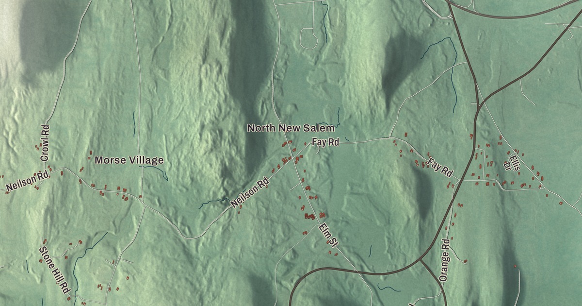
New Salem lies just south of Route 2 and reaches down into the Quabbin Reservoir. This map prints the roads that cross it: the Daniel Shays Highway, Petersham Road, Meacham Road, Blackinton Road, Millington Road and Cooleyville Road. North New Salem, Morse Village, Bassett Pond, South Athol Pond, Andrews Hill and Bassett Hill are printed too. Click here to purchase a print of this map for your wall.
New Salem is in Franklin County.
KNOWOL made this map in 2026 from public survey data and gave it the look of an old atlas. The hills come from United States Geological Survey elevation data, and the roads and the town line come from the Census Bureau. New Salem covers 58.6 square miles, 13.9 of them water, which its page says makes it the largest town by area in Franklin County. It had 983 people at the 2020 census. Orange lies to the north, Athol to the northeast, Petersham to the east and Pelham, Shutesbury and Wendell to the west, and Ware and Belchertown lie across the reservoir to the south, with no land link to them.
Settlers from Salem
The land was granted in 1734 to people from Salem, Massachusetts, and the town is named for them. The Town of New Salem’s recorded history, in the Secretary of the Commonwealth’s list, dates European settlement to 1737, the year the town center was laid out around a large common. New Salem was incorporated as a town in 1775, according to that list; the town page gives 1753. The town remains part of Franklin County today. It grew as a farming and lumber town, and its center did well as a stagecoach stop between Worcester and Brattleboro, Vermont, until the railroads passed it by. The New Salem Common Historic District along South Main Street keeps the two-acre common that survives from 1737, the town pound, the First Congregational Church of 1794, town halls of 1838 and 1909 and the buildings of New Salem Academy. A memorial on the common honors William Stacy, a Revolutionary War soldier who became an early settler of the Ohio Country.
The Quabbin and the Prescott Peninsula
Until the Quabbin Reservoir was built, New Salem reached little farther south than Cooleyville. The reservoir flooded the Swift River Valley, displacing 2,500 people, and in 1938 four towns, Dana, Enfield, Greenwich and Prescott, were disincorporated. New Salem took in most of the old town of Prescott, along with parts of Greenwich and Enfield, all the land above the water line between the reservoir’s two forks. That land, the Prescott Peninsula, is now protected as part of the Quabbin Reservation and closed to the public except for the Swift River Valley Historical Society’s annual tour and hikes. The society’s home in North New Salem is the North Prescott Methodist Episcopal Church, moved here in 1985. Today most of the reservoir lies in New Salem or Petersham.
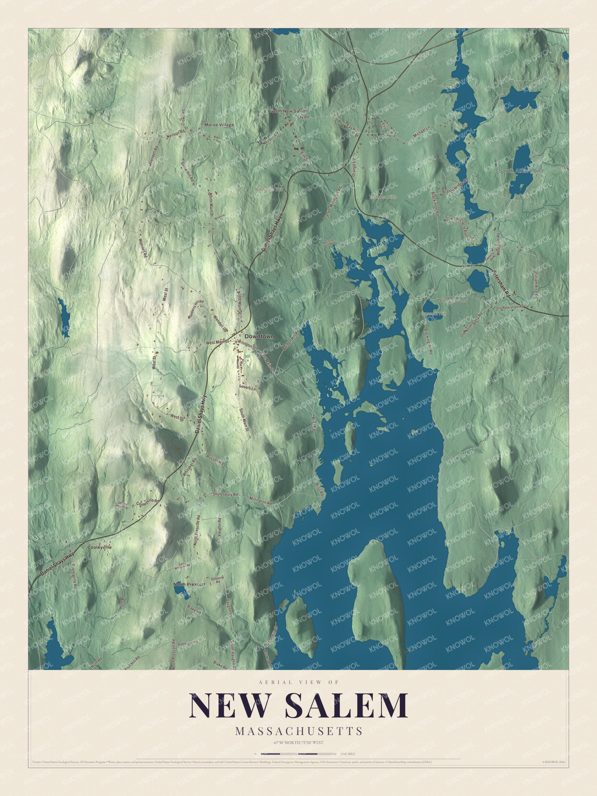
Click to explore a larger preview. The digital watermark does not appear on printed maps.
Names on this map
These names are printed on this map.
Places: Downtown, North New Salem, Morse Village, Adams Hills, Andrews Hill, Bassett Hill, Bassett Pond, South Athol Pond, Cooleyville and North Prescott.
Streets and roads: Petersham Road, Daniel Shays Highway, Meacham Road, Blackinton Road, Millington Road, Cooleyville Road, East Main Street, West Main Street, South Main Street, Elm Street, Neilson Road, North Main Street.
More street names, A to Z
Belden Hill Road, Blackington Road, Blake Road, Bliss Road, Blueberry Hill Road, Branch Bridge Road, Brown Road, Crowl Road, Earl Whitaker Road, Ellis Drive, Fay Road, Fish Hill Road, Hunt Road, Jennie Horr Road, Lavoie Lane, Lovers Lane, Michael Lane, Millington Street, North Prescott Road, North Spectacle Pond Road, Old Main Street, Old North Dana Road, Old Petersham Road, Orange-Millington Road, Orange Road, Osborne Road, Patterson Road, Regulating Dam Road, Russell Road, Shutesbury Road, Smith-Vaughn Road, Stone Hill Road, Sweezy Lane, Underhill Road, Vaughn Road, Wendell Road, West Street, Whitaker Road, William Rice Road.
See it on a wall
The New Salem map as a framed print. Swipe for more.


Around the map
Start with North New Salem, then follow Petersham Road, the Daniel Shays Highway, Meacham Road, Blackinton Road, Millington Road and Cooleyville Road across town. Then look outward toward Morse Village, Cooleyville and North Prescott. Bassett Pond, South Athol Pond, Andrews Hill and Bassett Hill are all labeled on the map, and every one of those names is printed directly on the artwork. The Daniel Shays Highway is the name for this stretch of U.S. Route 202, which runs north along the west side of the Quabbin through New Salem toward Athol; it opened in 1935 and honors Daniel Shays, the Revolutionary War veteran who led an uprising against the state government. North Prescott sat on the old line between Prescott and New Salem, and part of it’s still open to visitors.
The New Salem map makes a fine addition to an office, library or den, and it can help teach children the geography and history of a town of high ground on the edge of the Quabbin. It’s made for people who call New Salem home, from North New Salem to Cooleyville, and it shows the town as it looks today. Zoom in on the preview above to explore the details, then click here to get your copy of the New Salem, Massachusetts map.

Sources
- New Salem, Massachusetts, Wikipedia
- New Salem Common Historic District, Wikipedia
- Quabbin Reservoir, Wikipedia
- Prescott, Massachusetts, Wikipedia
- U.S. Route 202 in Massachusetts, Wikipedia
- City and Town Incorporation and Settlement Dates, Secretary of the Commonwealth of Massachusetts (archived copy)