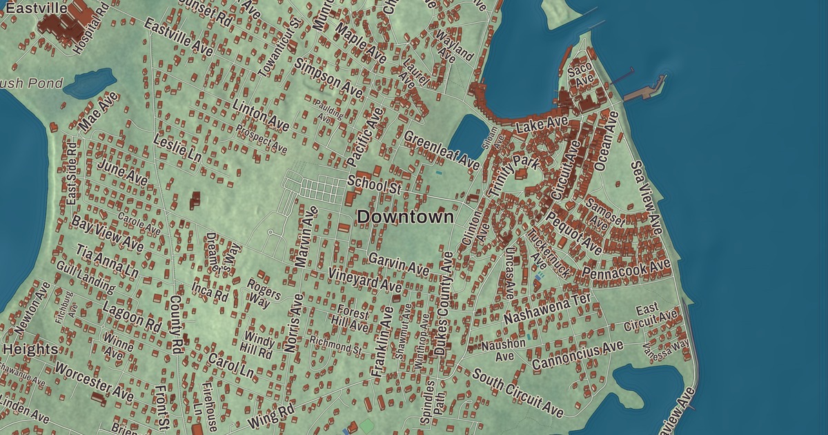
Oak Bluffs took its name from an oak grove on the bluffs over Nantucket Sound. This map prints its streets today, Circuit Avenue, Seaview Avenue, Beach Road, School Street, Wing Road and Little Pond Road, with Farm Pond, Crystal Lake and Brush Pond. Click here to purchase a print of this map for your wall.
Oak Bluffs is in Dukes County.
KNOWOL made this map in 2026 from public survey data and gave it the look of an old island atlas. United States Geological Survey elevation data shapes the bluffs and the ground between the ponds, and the Census Bureau supplied the streets and the town line. The town covers 26.0 square miles, but only 7.4 square miles are land; the rest is water. Nantucket Sound lies to the north and east, Edgartown to the south, and Vineyard Haven Harbor, Lagoon Pond and Tisbury to the west, and the town had 5,341 people at the 2020 census.
From Cottage City to Oak Bluffs
The Wampanoag people have lived on Martha’s Vineyard, which they call Noepe, for about 10,000 years, and they called this area Ogkeshkuppe, a damp or wet thicket. The Town of Oak Bluffs’ recorded history, in the Secretary of the Commonwealth’s list, dates European settlement to 1642. The land was part of Edgartown until 1880. Oak Bluffs was incorporated as a town in 1880, under the name Cottage City, and took the name Oak Bluffs when it re-incorporated in 1907.
Methodists began holding summer camp meetings in the oak grove called Wesleyan Grove in 1835. Families came back year after year, and their tents gave way to small wooden cottages trimmed with scrollwork and painted in bright colors, the gingerbread cottages; there were 500 by 1880, and about 318 remained in 2019. At the center stands the open-air iron Tabernacle, and each summer the Grand Illumination lights the whole campground with paper and silk lanterns. The cottages and the Tabernacle joined the National Register in 1978 and were declared a National Historic Landmark in 2005. In 1866 developers hired Robert Morris Copeland to plan a resort beside the camp, and the town page calls it one of the earliest planned residential communities in the country; five hundred lots sold between 1868 and 1871. The octagonal Union Chapel went up in 1870 for summer visitors who weren’t Methodist. The Flying Horses Carousel, built in 1876 and brought from New York in 1884, still turns at the foot of Circuit Avenue, and the town page calls it the oldest platform carousel still in operation.
A place of their own
Oak Bluffs has been an important center of African American culture since the 1700s. Its harbor drew formerly enslaved people, laborers and sailors in that century, and white residents sold them land. After slavery was abolished, freed people came to work in the fishing industries, and Black residents from the mainland followed to start businesses. In the late nineteenth and twentieth centuries middle-class Black families bought or rented summer homes here, their descendants returning summer after summer. Formerly enslaved people and their descendants bought land around Baptist Temple Park in the early twentieth century, drawn by the services held there. The town welcomed Black visitors when, the town page says, the island’s other towns kept Black guests out of their inns and hotels until the 1960s. Charles Shearer, seeing that Black visitors couldn’t stay at the island’s homes because of segregation, built Shearer Cottage as an inn for them, and its guests included Madam C. J. Walker, Paul Robeson, Ethel Waters and the composer Harry T. Burleigh. African American beachgoers have gathered at Oak Bluffs Town Beach, south of the Steamship Authority pier, since the late nineteenth century.
The writer Dorothy West, part of the Harlem Renaissance, moved to her family’s home in Oak Bluffs in the 1940s, wrote her novel The Living Is Easy there, and for decades wrote a weekly column about Oak Bluffs people and events. Her second novel, The Wedding, set on Martha’s Vineyard and edited by Jacqueline Kennedy Onassis, came out in 1995. Edward W. Brooke, the first African American elected to the United States Senate since Reconstruction, is among the many notable people the town page ties to Oak Bluffs, and Adam Clayton Powell Jr. owned a cottage in the area its Black homeowners called the Oval or the Highlands. The town remains part of Dukes County today.
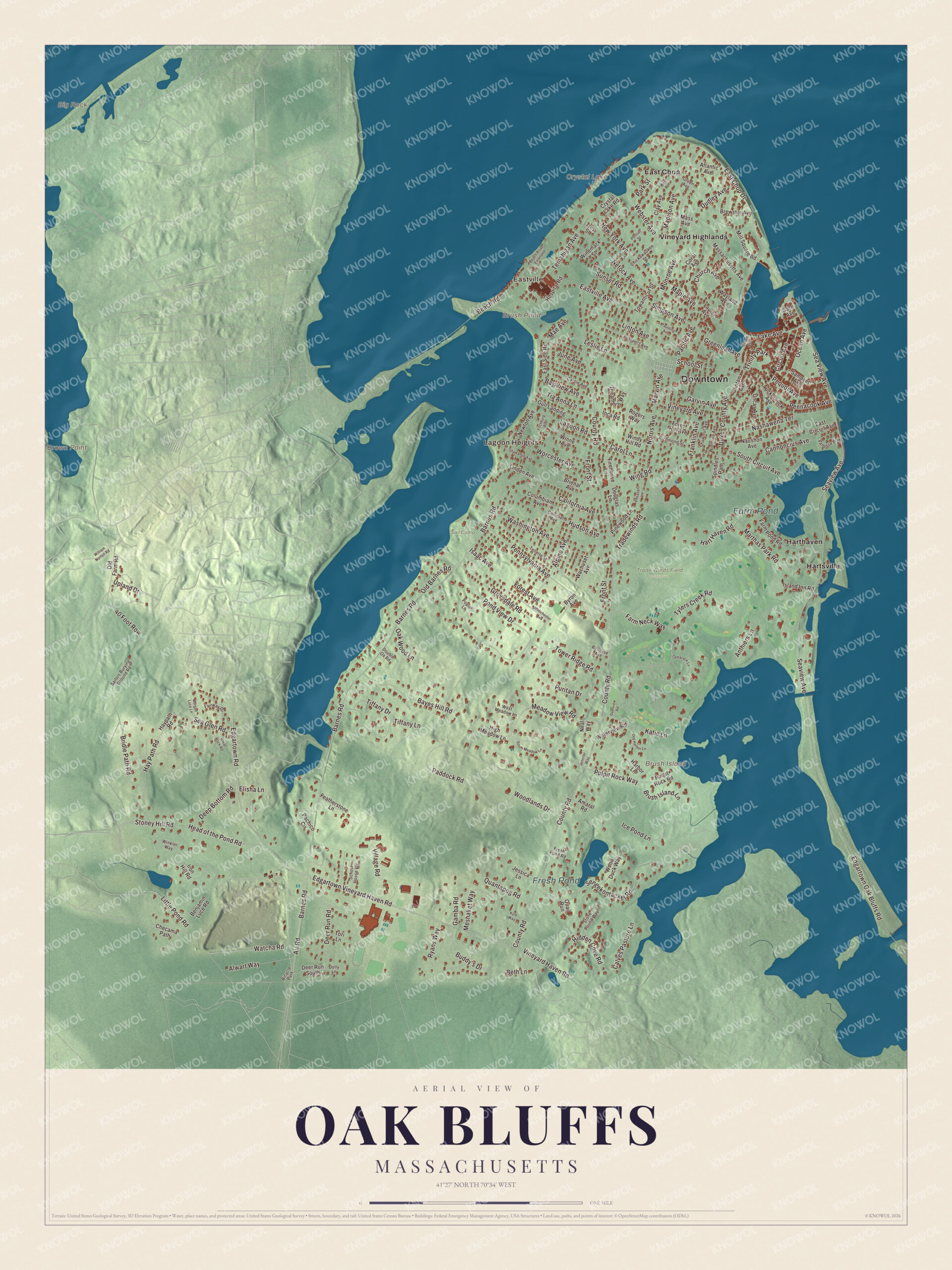
Click to explore a larger preview. The digital watermark does not appear on printed maps.
Names on this map
These names are printed on this map.
Places: Downtown, Lagoon Heights, Eastville, Big Rock, Brown Point, Brush Island, Brush Pond, Crystal Lake, Farm Pond, Fresh Pond, Sail Camp, Trade Winds Field Preserve, East Chop, Harthaven, Hartsville, Vineyard Highlands and Trinity Park.
Streets and roads: School Street, Little Pond Road, Circuit Avenue, Seaview Avenue, Wing Road, Beach Road, Barnes Road, Edgartown Vineyard Haven Road, Bridle Path Road, Watcha Road, County Road, Dukes County Avenue.
More street names, A to Z
40 Foot Row, Air Road, Alpine Avenue, Alwart Way, Amaral Road, Anthiers Lane, Atlantic Avenue, Bayes Hill Road, Bay View Avenue, Beach Road Extended, Bellevue Avenue, Benjamin Luce Road, Beth Lane, Bicycle Path, Brewster Avenue, Brienal Avenue, Brush Island Lane, Buddy's Drive, Byron Avenue, California Avenue, Calves Pasture Lane, Cannoncius Avenue, Carole Avenue, Carol Lane, Checama Path, Chickawaukee Street, Church Avenue, Clay Avenue, Clinton Avenue, Colonial Avenue, Columbian Avenue, Coral Avenue, Crystal Lake Road, Deep Bottom Road, Deer Run Road, Deer Run South, Dolly Lane, Double Ox Road, Douglas Lane, Dreamer's Way, Dudley Avenue, East Chop Drive, East Circuit Avenue, East Side Road, Eastville Avenue, Edgartown Oak Bluffs Road, Edgartown Road, Elisha Lane, Fairway Drive, Farm Neck Way, Farm Pond Road, Featherstone Lane, Firehouse Lane, Fitchburg Avenue, Forest Avenue, Forest Hill Avenue, Franklin Avenue, Fresh Pond Road, Front Street, Gamba Road, Garvin Avenue, Great Rock Road, Green Avenue, Greenleaf Avenue, Grovedale Road, Gull Landing, Harbor Lane, Hart Haven Road, Hay Path Road, Haypath Road, Head of the Pond Road, Hidden Cove Road, High Meadow Lane, Hospital Road, Hudson Avenue, Ice Pond Lane, Inca Road, Iron Hill Road, Isaac Avenue, Island Inn Road, Jennifer Way, Jessica Lane, June Avenue, Katie Lane, Kyle Way, Lagoon Road, Lake Avenue, Laurel Avenue, Leslie Lane, Linden Avenue, Linton Avenue, Madison Avenue, Mae Avenue, Manchester Avenue, Maple Avenue, Marthas Park Road, Marvin Avenue, Massachusetts Avenue, Mass Avenue, Meadow View Road, Meshaket Way, Mill Square Road, Morgan Luce Lane, Munroe Avenue, Nashawena Terrace, Naushon Avenue, Neal Way, Netock Avenue, Newton Avenue, New York Avenue, Norris Avenue, Oak Wood Lane, Ocean Avenue, Old Barnes Road, Old Farm Road, Old Harbor Lane, Overview Road, Pachico Circle, Pacific Avenue, Paddock Road, Park Street, Paulding Avenue, Pennacook Avenue, Pennsylvania Avenue, Pequot Avenue, Pheasant Lane, Pinewood Lane, Pond View Drive, Pontiac Street, Poplar Lane, Prospect Avenue, Pulpit Rock Road, Pulpit Rock Way, Puritan Drive, Quail Run, Quantapog Road, Richmond Street, Rogers Way, Ryans Way, Saco Avenue, Sailors Burying Ground Road, Samoset Avenue, School House Vlg, Sea Glen Road, Sea View Avenue, Sengekontacket Road, Shawanue Avenue, Shawmut Avenue, Siloam Avenue, Simpson Avenue, South Circuit Avenue, South Meadow Lane, Spindles Path, Stone Pound Way, Stoney Hill Road, Sunset Road, Tamarack Lane, Tellette Street, Temahigan Avenue, Tia Anna Lane, Tiffany Drive, Tiffany Lane, Tori Lane, Towanticut Street, Tower Ridge Road, Tradewinds Road, Troy Street, Tuckernuck Avenue, Tylers Creek Road, Uncas Avenue, Upland Drive, Vanessa Way, Village Road, Vineyard Avenue, Vineyard Haven Road, Wachuset Avenue, Washington Avenue, Waterview Road, Wayland Avenue, Webster Avenue, West Avenue, West Meadow Lane, William Norton Road, Windy Hill Road, Winemack Street, Winkler Way, Winne Avenue, Winthrop Avenue, Wood Duck Way, Woodlands Drive, Worcester Avenue.
See it on a wall
The Oak Bluffs map as a framed print. Swipe for more.


Around the map
Start with Lagoon Heights. Follow School Street, Little Pond Road, Circuit Avenue, Seaview Avenue, Wing Road and Beach Road across town. Then look outward toward Eastville, East Chop, Harthaven, Hartsville and Vineyard Highlands. Brush Pond, Crystal Lake, Farm Pond, Fresh Pond, Little Pond and Brush Island are all printed on the map. Circuit Avenue is the town’s business and entertainment street, with the Flying Horses at its foot. East Chop, also known as the Vineyard Highlands, is a residential peninsula with the high bluffs that gave the town its name; East Chop Light, a cast-iron tower of 1878, stands on Telegraph Hill above Vineyard Haven Harbor, and Baptists built a wooden tabernacle in the Highlands in 1877, its remains still in Temple Park. William H. Hart founded Harthaven in 1873 on a lot he bought from the Oak Bluffs Land and Wharf Company, and Eastville Beach faces Vineyard Haven Harbor at the entrance to Lagoon Pond.
The Oak Bluffs map is a handsome addition to an office, library or den, and it can help teach children the geography and history of an island town that people have come back to for generations. It’s made for anyone who calls Oak Bluffs home, from Lagoon Heights to East Chop, and it shows the town as it looks today. Zoom in on the preview above to explore the details, then click here to get your copy of the Oak Bluffs, Massachusetts map.

Sources
- Oak Bluffs, Massachusetts, Wikipedia
- Wesleyan Grove, Wikipedia
- Union Chapel (Oak Bluffs, Massachusetts), Wikipedia
- Flying Horses Carousel, Wikipedia
- Dorothy West, Wikipedia
- Edward Brooke, Wikipedia
- East Chop, Wikipedia
- East Chop Light, Wikipedia
- City and Town Incorporation and Settlement Dates, Secretary of the Commonwealth of Massachusetts (archived copy)