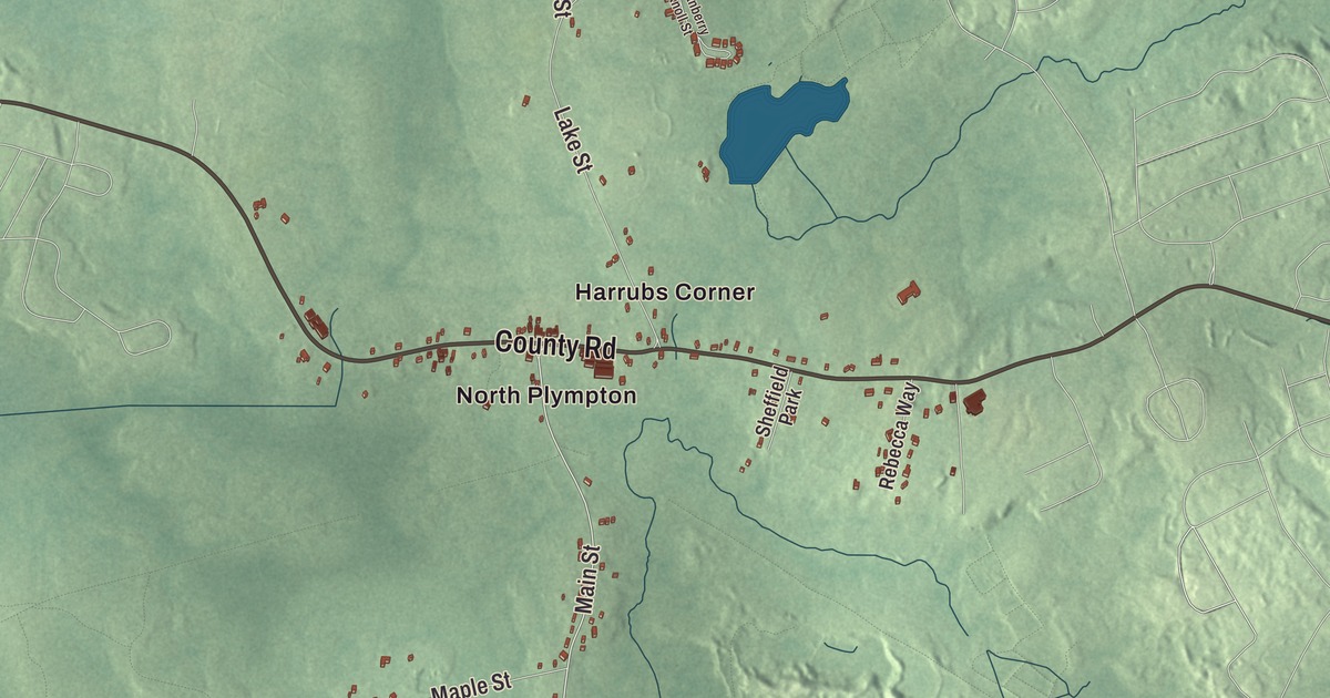
Deborah Sampson, who put on a man’s uniform to fight in the Revolution, was born in Plympton in 1760, in her grandparents’ house, which still stands. This map of the town prints Palmer Road, Main Street, County Road, Cedar Street, West Street and Churchill Road, with West Lake, East Lake, Hemlock Island, Howard Island and the Annasnappet Brook Reservoir. Click here to purchase a print of this map for your wall.
Plympton is in Plymouth County.
KNOWOL made this map in 2026 from public survey data and gave it the look of an old atlas. The land comes from United States Geological Survey elevation data, and the roads and the town line come from the Census Bureau. Plympton lies about 35 miles south of Boston, bordered by Halifax, Pembroke, Kingston, Carver and Middleborough, and forest covers much of the land. The northern tip of town runs along Silver Lake, and the Winnetuxet River and many brooks and small ponds lie within it. It covers 15.1 square miles and had 2,930 people at the 2020 census.
The western parish
Plympton began as the western parish of Plymouth, and its original lands took in all of today’s Carver and Halifax and small pieces of Kingston and Middleborough. The Town of Plympton’s recorded history dates European settlement to 1662. Plympton was incorporated as a town in 1707. The town remains part of Plymouth County today. It was named for Plympton in Devon, England. Halifax split off in 1734 and Carver in 1790, and the town’s present lines were set in 1862. The early residents were mostly farmers; later came factories making shoes and shovels, and lumber and cotton mills. Today the town is mostly rural and residential, with very little industry.
Deborah Sampson
Sampson’s mother was a great-granddaughter of William Bradford, the second governor of Plymouth Colony. As a girl Sampson was placed with relatives and neighbors, and she worked as an indentured servant in Middleborough from 1770 to 1778; the family didn’t send her to school, but she learned from the sons, who shared their schoolwork with her. She went on to teach school and to weave. During the Revolution she disguised herself as a man and served in the Continental Army under the name Robert Shirtliff. She was in uniform for 17 months before a fever in Philadelphia in 1783 revealed who she was, and she was honorably discharged at West Point. In 1802 she became one of the first women to go on a lecture tour, speaking about her wartime service. On May 23, 1983, she was proclaimed the Official Heroine of the Commonwealth of Massachusetts. Plympton is also the birthplace of William Bradford, born in 1729, a physician and lawyer who moved to Bristol, Rhode Island, served as the state’s deputy governor during the Revolution, and became a United States Senator and, in 1797, President pro tempore of the Senate.
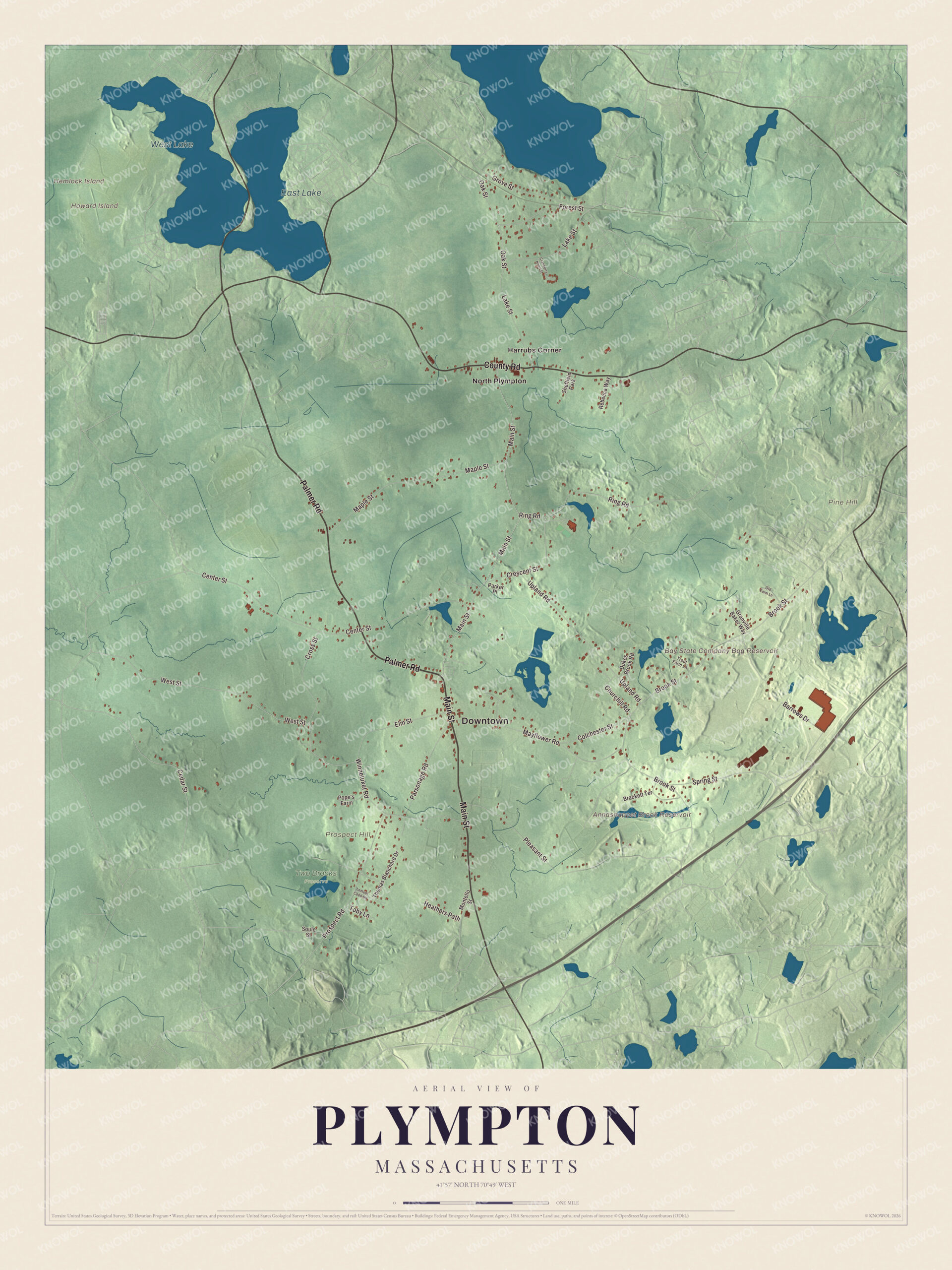
Click to explore a larger preview. The digital watermark does not appear on printed maps.
Names on this map
These names are printed on this map.
Places: Downtown, Hemlock Island, Howard Island, Pine Hill, Prospect Hill, Annasnappet Brook Reservoir, Bay State Company Bog Reservoir, West Lake, East Lake, Two Brooks Preserve, Harrubs Corner, North Plympton and Sheffield Park.
Streets and roads: Palmer Road, Main Street, County Road, Cedar Street, West Street, Churchill Road, Barrows Drive, Brook Street, Center Street, Lake Street, Maple Street, Ring Road.
More street names, A to Z
Brackett Terrace, Colchester Street, Cranberry Knoll Street, Crescent Street, Cross Street, Dukes Brook Road, Elm Street, Forest Street, Granville Baker Way, Grove Street, Heathers Path, Lemuel Cobb Road, Mayflower Road, Montello Street, Oak Street, Old Farm Lane, Parker Place, Parsonage Road, Pleasant Street, Pope's Farm, Prospect Road, Rebecca Way, Soule Street, Spring Street, Thomas Blanchard Drive, Toby Lane, Trout Farm Lane, Upland Road, Winnetuxet Road.
See it on a wall
The Plympton map as a framed print. Swipe for more.


Around the map
Start with Harrubs Corner, then follow Palmer Road, Main Street, County Road, Cedar Street, West Street and Churchill Road across town. Then look outward toward North Plympton. The Annasnappet Brook Reservoir, the Bay State Company Bog Reservoir, West Lake, East Lake, Pine Hill, Prospect Hill, Hemlock Island and Howard Island are all printed on the map. The town hall stands at the center of town, with the police and fire departments next to it and the Plympton Public Library beside it on its southern side. Silver Lake, 640 acres, lies in Pembroke, Kingston and Plympton; the whole of the Pembroke and Plympton line runs through the water, and the lake is the headwaters of the Jones River. Just south of the lake, the Kingston commuter rail line crosses the town. The Winnetuxet River runs 12.1 miles, flowing west from near Cole Mill in Carver through Plympton and Halifax to the Taunton River.
The Plympton map makes a fine addition to an office, library or den, and it can help teach children the geography and history of the town where Deborah Sampson was born. It’s made for people who call Plympton home, from North Plympton to the Carver line, and it shows the town as it looks today. Zoom in on the preview above to explore the details, then click here to get your copy of the Plympton, Massachusetts map.

Sources
- Plympton, Massachusetts, Wikipedia
- Deborah Sampson, Wikipedia
- William Bradford (Rhode Island politician), Wikipedia
- Silver Lake (Plymouth County, Massachusetts), Wikipedia
- Winnetuxet River, Wikipedia
- City and Town Incorporation and Settlement Dates, Secretary of the Commonwealth of Massachusetts (archived copy)