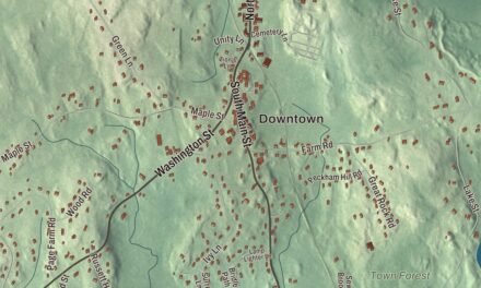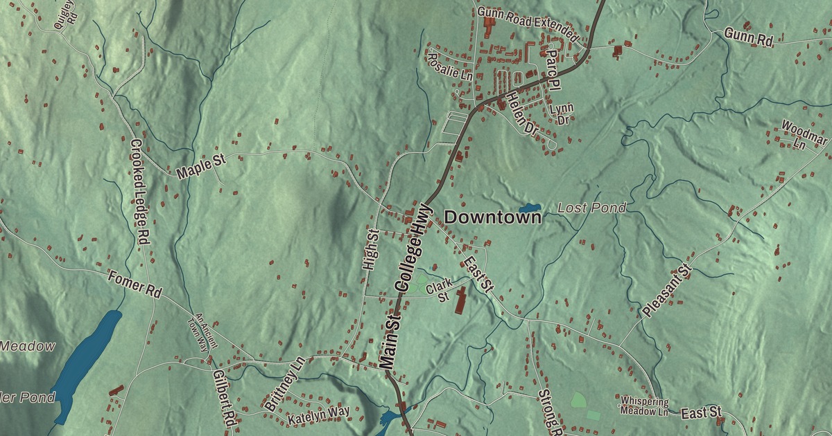
College Highway runs the length of Southampton, and this map follows it from Fomer through the town center, with Main Street, East Street and County Road reaching out to Russellville, Swanson Corners, Tighe Carmody Reservoir and Bungy Mountain. Click here to purchase a print of this map for your wall.
Southampton is in Hampshire County.
KNOWOL made this map in 2026 from public survey data and gave it the look of an old atlas. The hills and mountains are shaped from United States Geological Survey elevation data, and the roads and the town line come from the Census Bureau. Southampton covers 29.1 square miles about 17 miles northwest of Springfield. Easthampton lies to the northeast, Holyoke to the southeast, Westfield to the south, Montgomery to the southwest and Westhampton to the northwest, and Huntington touches it for a short stretch on the west. Southampton had 6,224 people at the 2020 census.
A district of Northampton
Southampton’s land was first part of Northampton, and its town center was planned in 1730. The Town of Southampton’s recorded history, in the Secretary of the Commonwealth’s list, dates European settlement to 1732, when it was set up as a district of Northampton. The name Southampton was chosen at the first town meeting in 1773, and Southampton was incorporated as a town in 1775. The plan of the center has changed little since it was drawn, with a wide grid of roads between College Highway and High Street. The town grew after 1790, and many of its fine Federal houses date from those years, along with the Congregational Church of 1788, built on or near the site of the first meetinghouse.
The Southampton Center Historic District runs from Fomer Road north along High Street and College Highway to Maple Street, with a row of houses on East Street between College Highway and Elm Street. Besides its eighteenth and nineteenth century houses, it holds the town’s only church, the town hall and the old public library. The center was also the business hub of a farming town. In the late 1800s, Southampton’s farms lost ground to larger farms in the Midwest, and its mills lost their streams to public water supplies. The center has seen little new building since the early twentieth century. Just north of it, on the west side of Route 10, the Center Cemetery was the town’s first burying ground. Its oldest marker dates from 1738, and the red sandstone Soldiers’ Monument at its entrance was set up in 1866.
Lockville and the canal
About a mile south of the center, College Highway crosses the Manhan River at Lockville. The drop in the river there powered a small group of mills from the 1830s until about 1900, including the Lyman Mill of around 1854 and Lyman Pond, whose dam was rebuilt in 1838 after a flood. The Ichabod Strong House, from about 1786, was the home of the first mill family on record here. The New Haven and Northampton Canal came through around 1835, and its three locks gave Lockville its name. The first canal boats reached Southampton in 1835. At 86 miles it was New England’s longest canal, though it ran its full length only until 1847. A former canal hotel, a storehouse and the remains of a lock still stand in the village. The Lymans opened a sheet metal factory in 1894, and it grew more important after the mills closed, when the city of Holyoke began drawing water from the river.
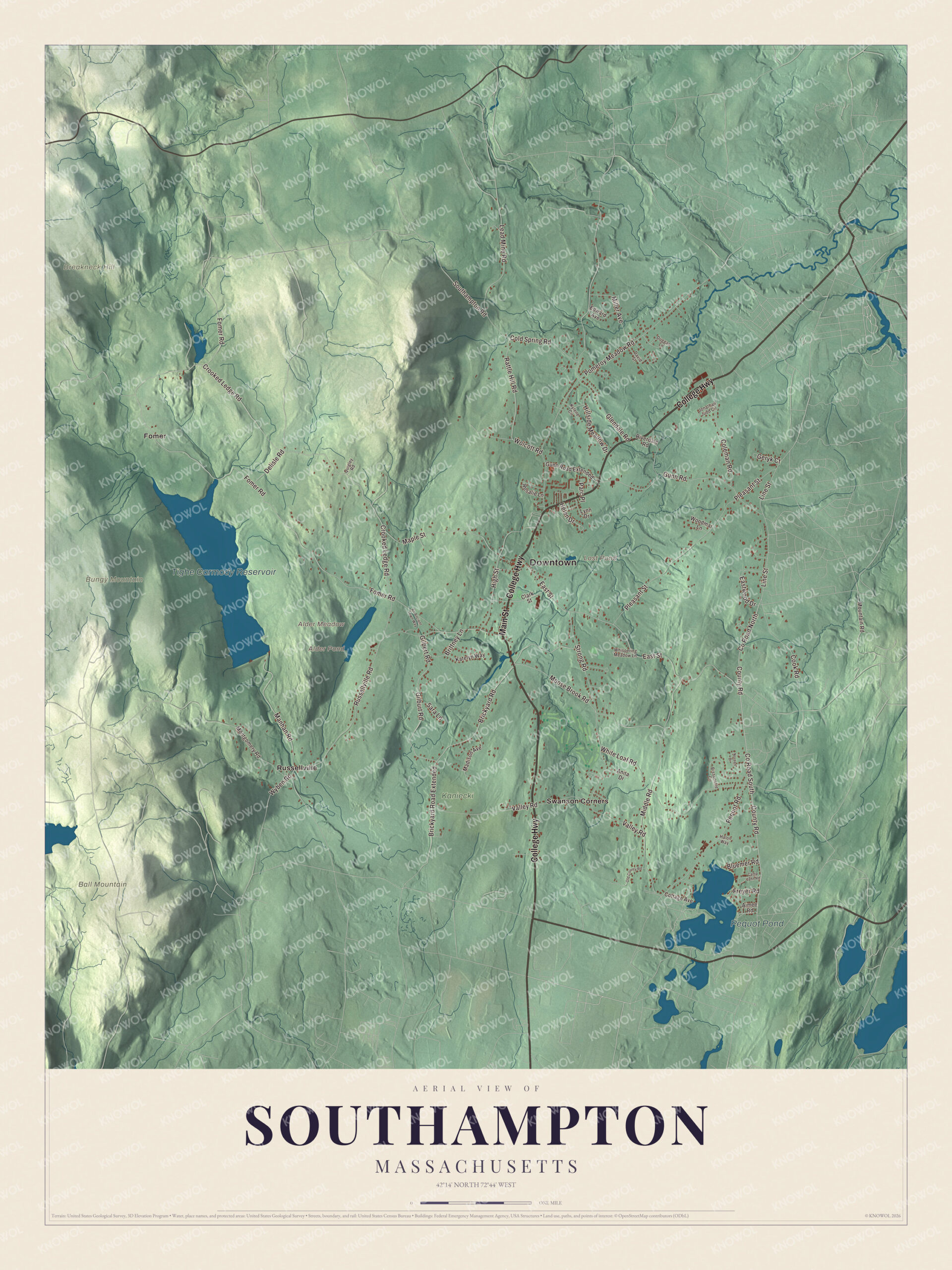
Click to explore a larger preview. The digital watermark does not appear on printed maps.
Names on this map
These names are printed on this map.
Places: Downtown, Alder Meadow, Ball Mountain, Breakneck Hill, Bungy Mountain, Alder Pond, Lost Pond, Tighe Carmody Reservoir, Pequot Pond, Kaniecki, Fomer, Russellville and Swanson Corners.
Streets and roads: College Highway, Main Street, County Road, Brickyard Road, Brickyard Road Extended, East Street, County Road North, Line Street, Fomer Road, Crooked Ledge Road, Pomeroy Meadow Road, Russellville Road.
More street names, A to Z
Aimee Road, An Ancient Town Way, Anita Drive, Bissonette Circle, Bluemer Road, Brittney Lane, Camp Jahn Road, Clark Street, Cold Spring Road, Coleman Road, Cook Road, Cottage Avenue, County Road South, David Street, Delisle Road, Duggan Lane, Eastwood Drive, Edward Avenue, Freyer Road, Geryk Court, Gilbert Road, Gilburt Road, Glendale Road, Gunn Road, Gunn Road Extended, Halon Way, Helen Drive, High Street, Hillside Meadow Drive, Jonathan Judd Circle, Katelyn Way, Kylene Circle, Lead Mine Road, Lynn Drive, Madison Avenue, Manhan Road, Maple Street, Middle Road, Miller Avenue, Montgomery Road, Moose Brook Road, Mountain Road, Noreen Drive, Old County Road, Parc Place, Pequot Road, Pleasant Street, Quigley Road, Rattle Hill Road, Riverdale Road, Rosalie Lane, Sara Lane, Southampton Road, Strong Road, Valley Road, Whispering Meadow Lane, White Loaf Road, Wolcott Road, Woodmar Lane, Wyben Road.
See it on a wall
The Southampton map as a framed print. Swipe for more.


Around the map
Start with Fomer. Follow College Highway, Main Street, County Road, Brickyard Road, East Street and Line Street across town. Then look outward toward Russellville and Swanson Corners. Alder Pond, Lost Pond, Tighe Carmody Reservoir, Pequot Pond, Ball Mountain, Breakneck Hill and Bungy Mountain are all printed on the map. The Manhan River starts near the Huntington and Westhampton line and flows southeast through White Reservoir and Tighe Carmody Reservoir in Southampton before it turns toward Easthampton and the Connecticut River. The paved Manhan Rail Trail follows the old railroad bed beside the river from Easthampton and ends at Coleman Road, just over the Southampton line, and there are plans to carry it south through Southampton toward Westfield.
The Southampton map makes a fitting addition to an office, library or den, and it can help teach children the geography and history of a hill town in the Pioneer Valley. It’s made for people who call Southampton home, from Fomer to Russellville, and it shows the town as it looks today. Zoom in on the preview above to explore the details, then click here to get your copy of the Southampton, Massachusetts map.

Sources
- Southampton, Massachusetts, Wikipedia
- Southampton Center Historic District, Wikipedia
- Center Cemetery (Southampton, Massachusetts), Wikipedia
- Lockville Historic District, Wikipedia
- New Haven and Northampton Canal, Wikipedia
- Manhan River, Wikipedia
- Manhan Rail Trail, Wikipedia
- City and Town Incorporation and Settlement Dates, Secretary of the Commonwealth of Massachusetts (archived copy)