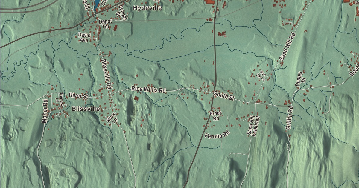
Castleton’s Main Street runs a tree-shaded mile through the village, and Hydeville, at the south end of Lake Bomoseen, is an extension of it. This map prints Lake Bomoseen, Loves Marsh, Pine Pond and Lily Pond, the villages of Bomoseen, Castleton Corners and Hydeville, Blissville and West Castleton, Point of Pines and Avalon Beach, and Main Street, South Street, Pond Hill Road, Staso Road, West Castleton Road and Moscow Road.
Castleton is a town in Rutland County, Vermont, about 15 miles west of Rutland.
KNOWOL made this map in 2026 from public survey data, finished with the look of an old atlas. The shaded terrain is from United States Geological Survey elevation data, and the roads and the town line are from the Census Bureau. Castleton covers 42.4 square miles, about 8 percent of it water, and it had 4,458 people at the 2020 census. Click here to purchase a print of this map for your wall.
Where the Green Mountain Boys gathered
Governor Benning Wentworth of New Hampshire chartered Castleton on September 22, 1761, as a township of 36 square miles divided into 70 shares. Amos Bird and Noah Lee came from Salisbury, Connecticut, in the spring of 1767, and Bird, who held 40 of the shares, built a permanent home in 1769. The town’s favorite landmark, Birdseye Mountain, carries his name. Main Street was laid out in 1772 as the main east and west road of the region.
In May 1775 Ethan Allen and his Green Mountain Boys met in Castleton with Benedict Arnold to plan the next day’s attack on Fort Ticonderoga, 30 miles to the west, and the village is where Allen mustered his men. Fort Warren, a wooden stockade, went up at what’s now the corner of East Hubbardton Road and Route 4A in 1778 and 1779 to guard the settlers on Vermont’s northern frontier.
Schools, slate and a mile of Main Street
Castleton has been a college town for a long time. Vermont State University’s campus here traces its roots to the Rutland County Grammar School, chartered on October 15, 1787. Castleton Medical College, founded in 1818, was the first medical college in Vermont, and its chapel-like building of 1821, now called the Old Chapel, is believed to be the oldest surviving medical school building in the United States. One of its students, David Swinson Maynard, born near Castleton, went west to become one of the founders of Seattle. In 1898 the town authorized the Hydeville School, one of the first schools in the state used to train new teachers from the normal school in Castleton.
The 19th century made Castleton prosperous with slate and marble, and Hydeville grew up in mid-century as a slate quarrying and milling center. Two railroad lines came in the 1850s. Residents replaced their log cabins with fine houses, and Main Street, a mile long and lined with Federal and Greek Revival houses and public buildings, many by the builder Thomas Royal Dake, is listed almost in its entirety on the National Register of Historic Places. Dake built the Castleton Federated Church in 1833, and the Higley House of 1810, home to the Higley family until 1973, is kept by the Castleton Historical Society. At the corner of Main Street and Cemetery Road, the old brick Cobbler’s Shop, built between 1774 and 1794 by Nehemiah Hoyt, is believed by some to be the oldest brick building in Vermont.
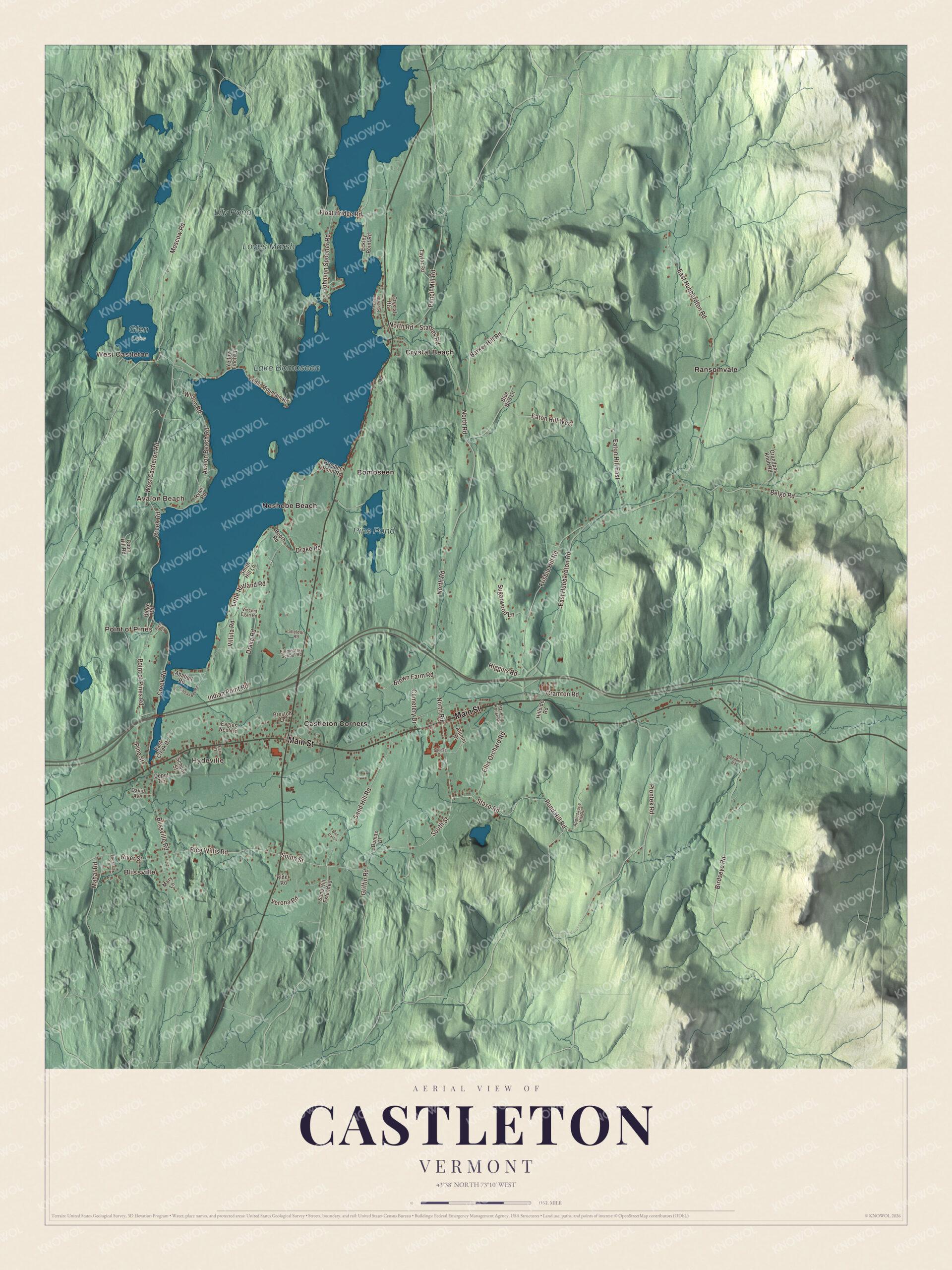
Click to explore a larger preview. The digital watermark does not appear on printed maps.
Names on this map
These names are printed on this map.
Places: Blissville, West Castleton, Hydeville, Point of Pines, Avalon Beach, Lake Bomoseen, Loves Marsh, Pine Pond, Lily Pond, Glen Lake, Bomoseen, Castleton Corners, Crystal Beach, Neshobe Beach and Ransomvale.
Streets and roads: Main Street, South Street, Pond Hill Road, Staso Road, West Castleton Road, Moscow Road, Avalon Beach Road, Rice Willis Road, Piontek Road, Sand Hill Road, East Hubbardton Road, North Road.
More street names, A to Z
Abatiell Road, Alumni Drive, Applesauce Hill Road, Barker Hill Road, Belgo Road, Birdseye Road, Blissville Road, Blue Bird Lane, Blue Cat Lane, Booth Road, Brown Farm Road, Cedar Mountain Road, Cemetery Drive, College Drive, Coon Hill Road, Cramton Road, Creek Road, Crystal Haven Road, Crystal Heights, David Avenue, Depot Terrace, Drake Road, Dumas Drive, Eagles Nest Road, East Creek Drive, Eaton Hill East, Eaton Hill West, Eckley Point Road, Elementary School Road, Ellis Orchard Road, Farr Drive, Float Bridge Road, Frisbie Hill Road, Grandpas Knob Road, Griffin Road, Higgins Road, Hillside Road, Indian Bay Road, Indian Point Road, Johnson Spooner Road, Little Rutland Road, Mahar Road, Mary Lane, Packing House Road, Pencil Mill Road, Pine Street, Point of Pines Road, Preston Lane, Prospect Point Road, Rider Road, Ridge Road, Riehl Road, River Street, Ryan Road, Sand Hill Extended, School Street, Sheldon Road, Smith Hill Lane, Stables Road, Sugarwood Lane, Taylor Road, Theresa Lane, Verona Road, Villula Road, Vincent Egan Road, Wilson Road, Woodbury Road, Yellow Finch Lane.
See it on a wall
The Castleton map as a framed print. Swipe for more.


Lake Bomoseen
Lake Bomoseen, shared with Hubbardton, is the largest lake that lies entirely within Vermont, about 2,400 acres. In the late 1800s it became a summer resort, with luxury hotels at the west end and a trolley that ran out from the center of town. Slate was quarried along its western shore, where Bomoseen State Park now keeps the quarry holes and the ruins of the West Castleton Railroad and Slate Company. In the 1920s the critic Alexander Woollcott owned Neshobe Island in the middle of the lake and made it a retreat for the Algonquin Round Table, and his guests over the years included Harpo Marx, Dorothy Parker, Helen Hayes and Walt Disney.
Bomoseen lies on the lake’s eastern shore along Route 30, and Castleton Corners, west of the village and southeast of the lake’s south end, has the Bomoseen post office. Up on Grandpa’s Knob in Castleton, the Smith-Putnam wind turbine went on line in 1941, the world’s first megawatt-size wind turbine. Point of Pines, Avalon Beach, Loves Marsh, Pine Pond, Lily Pond, West Castleton, Blissville and the town’s roads are printed on the map as well.
This map of Castleton deserves a place in an office, library or den, and it can even help teach children the geography and history of a college town on the largest lake that lies wholly inside Vermont. It’s made for everyone who calls Castleton home and shows the town as it looks today, from Main Street to Point of Pines. KNOWOL created it in 2026, and it’s printed on museum quality archival paper. Zoom in on the preview above to explore the details, then click here to get your copy of the Castleton, Vermont map.

Sources
- Castleton, Vermont, Wikipedia
- Town histories and representatives, C towns, Vermont Legislature
- Castleton (CDP), Vermont, Wikipedia
- Fort Warren (Vermont), Wikipedia
- Castleton University, Wikipedia
- Castleton Medical College Building, Wikipedia
- Doc Maynard, Wikipedia
- Hydeville School, Wikipedia
- Lake Bomoseen, Wikipedia
- Bomoseen, Vermont, Wikipedia
- Smith-Putnam wind turbine, Wikipedia