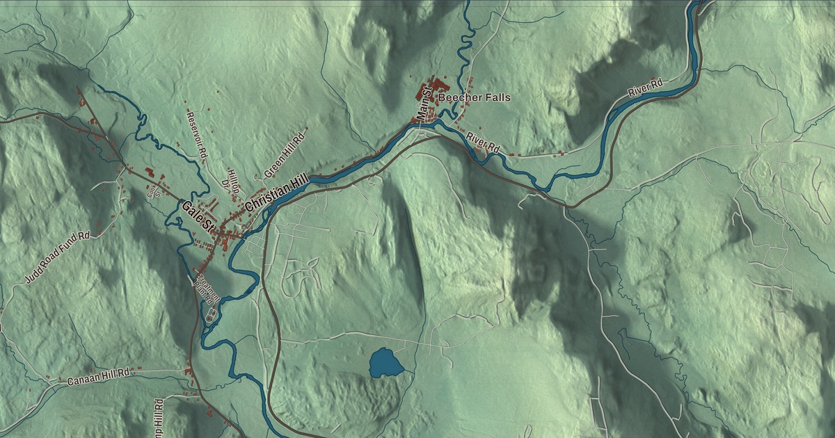
Canaan is as far northeast as Vermont goes, with Quebec on one side, New Hampshire on the other and the Connecticut River beginning its run as the state line. This map prints Beecher Falls, Wallace Pond and Arlins, and Gale Street, Canaan Hill Road, Hudson Road, River Road, Judd Road Fund Road and Kemp Hill Road.
Canaan is a town in Essex County, Vermont, the northeasternmost town in the state.
KNOWOL made this map in 2026 from public survey data, finished with the look of an old atlas. The shaded terrain comes from United States Geological Survey elevation data, and the roads and the town line come from the Census Bureau. The town covers about 21,376 acres and had 896 people at the 2020 census. Click here to purchase a print of this map for your wall.
A border town from the start
The Republic of Vermont chartered Canaan on February 25, 1782, to John Wheeler and forty-three associates. The first settlers came within a few years: John Hugh in 1785, Samuel Beach in 1796, John Dunning in 1799, Nathan Beecher in 1802 and Samuel Weeks in 1804. The town’s own history says its place on the Canadian and New Hampshire lines made it a crossroads for trade and travel, even before those lines were settled. The international boundary here was finalized only in 1925, and the line with New Hampshire in 1934. Canaan is one of just two Vermont towns, with Alburgh, that border both another state and Canada, and it’s the only town in Vermont that shares a land border with New Hampshire: its far northeast corner touches Pittsburg, above the point where the Connecticut River takes over as the state line.
Canaan Hill was the first center of town, where the early meetings, churches and gatherings were held, and the town’s history places it five miles south of today’s Canaan Village. Life later moved down to the villages along the Connecticut River. In the late 19th and early 20th centuries, French-Canadian families came over from Quebec to work in the woods and the mills, and their language and traditions became part of the town. Canaan is counted among New England’s “Little Canadas.”
Around the village
Canaan Village gathers around Fletcher Park, a gift from Charles Fletcher in the late 19th century, with its fountain, its memorials to the town’s veterans and a statue of Bea Holmes, a prominent member of the community, that lets visitors hear recordings about her life. On the west side of the triangular common stands the Alice M. Ward Library, built in 1846 by Fernando C. Jacobs as Jacobs Stand, a stagecoach inn and the northernmost stop on the stage route to Montreal. Jacobs was known to oppose slavery, and local tradition holds that the inn was the northernmost U.S. stop on the Connecticut River route of the Underground Railroad, though no evidence has been found to prove it. Dr. Artemas Ward bought the house in 1888, and after his wife Alice died it was left to the town as its library in 1930.
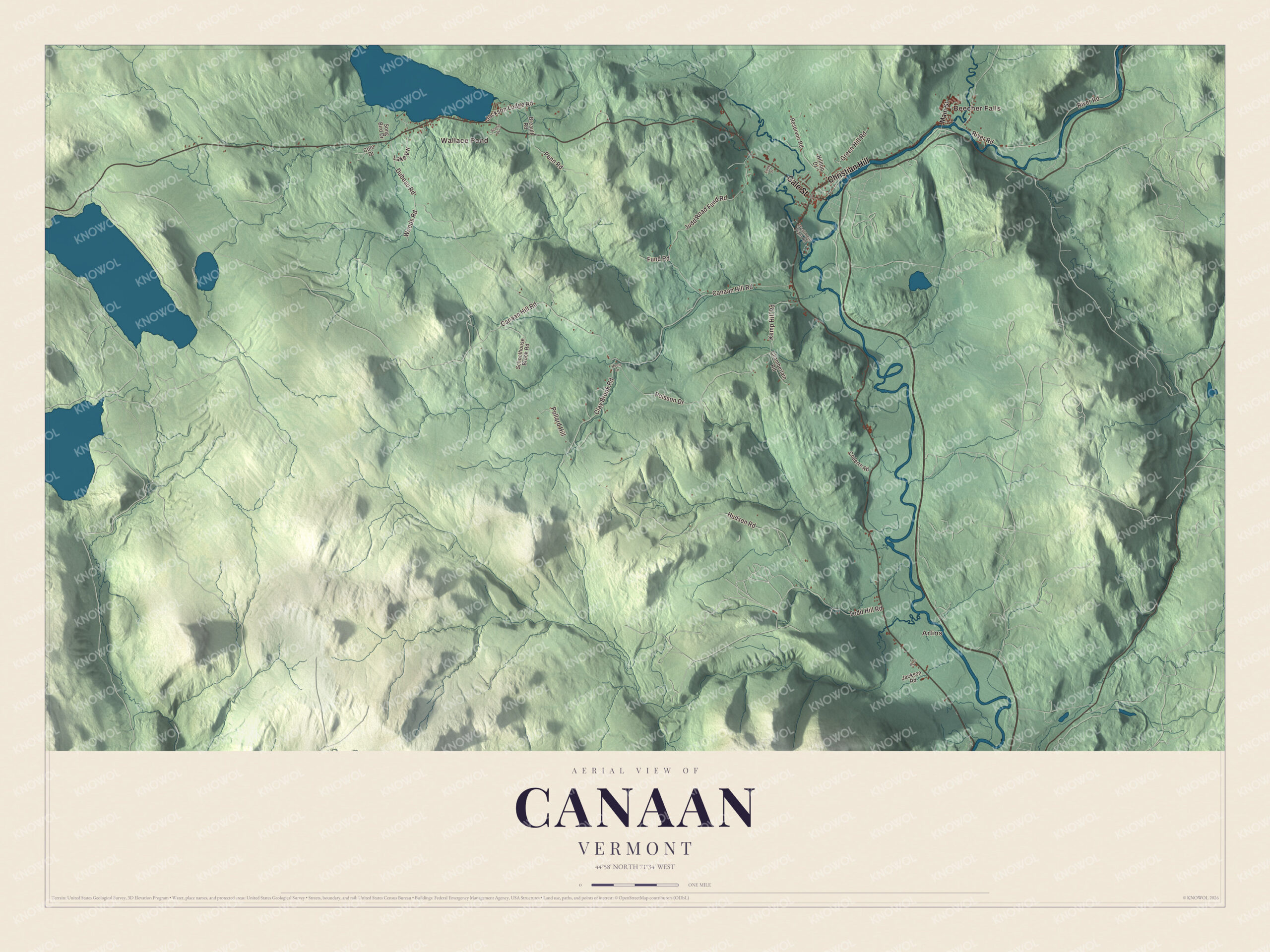
Click to explore a larger preview. The digital watermark does not appear on printed maps.
Names on this map
These names are printed on this map.
Places: Beecher Falls, Wallace Pond and Arlins.
Streets and roads: Christian Hill, Gale Street, Canaan Hill Road, Hudson Road, River Road, Judd Road Fund Road, Kemp Hill Road, Todd Hill Road, Clay Brook Road, Poisson Drive, Penn Road, Dubeau Road.
More street names, A to Z
Breault Road, Chamberlain Road, Coderre Road, Cook Street, Cote Drive, Fund Road, Green Hill Road, Hilltop Drive, Houle Drive, Jackson Lodge Road, Jackson Road, Lake Vw, Luc Road, Main Street, Pollard Hill, Reservoir Road, Scenic Drive, Schoolhouse Brook Road, Song Bird Drive, Treatment Plant Road, Woods Road.
See it on a wall
The Canaan map as a framed print. Swipe for more.


Beecher Falls and the border
Two miles north of the village, Beecher Falls sits where Halls Stream runs into the Connecticut River. Its furniture factory opened in 1895 and was once the largest furniture factory east of Michigan, and for generations it was one of the area’s biggest employers until most of the plant closed in 2009. The Beecher Falls and East Hereford crossing into Quebec stands right at the village, while the Canaan and Hereford Road crossing is about three miles away, on Route 141. The United States border stations at both were listed on the National Register of Historic Places in 2014. The Official Register of the United States first records a customs officer in Canaan in 1835.
Neil Tillotson, born in Canaan, worked out how to make latex balloons cheaply, founded the Tillotson Rubber Company in 1931, and later became famous as the first voter in every presidential primary and election at Dixville Notch, New Hampshire, for 40 years. Wallace Pond, also called Lake Wallace, lies about five miles west of the village. Arlins, Gale Street, Hudson Road, River Road, Judd Road Fund Road and Kemp Hill Road are printed on the map too.
This map of Canaan would look fine in an office, library or den, and it can even help teach children the geography and history of a town on two borders. It’s made for everyone who calls Canaan home and shows the town as it looks today, from Canaan Hill to Beecher Falls. KNOWOL created it in 2026, and it’s printed on museum quality archival paper. Zoom in on the preview above to explore the details, then click here to get your copy of the Canaan, Vermont map.

Sources
- Canaan, Vermont, Wikipedia
- Town History, Town of Canaan
- Town histories and representatives, C towns, Vermont Legislature
- Alice M. Ward Library, Wikipedia
- Beecher Falls, Vermont, Wikipedia
- Halls Stream, Wikipedia
- Beecher Falls-East Hereford Border Crossing, Wikipedia
- Canaan-Hereford Road Border Crossing, Wikipedia
- Neil Tillotson, Wikipedia