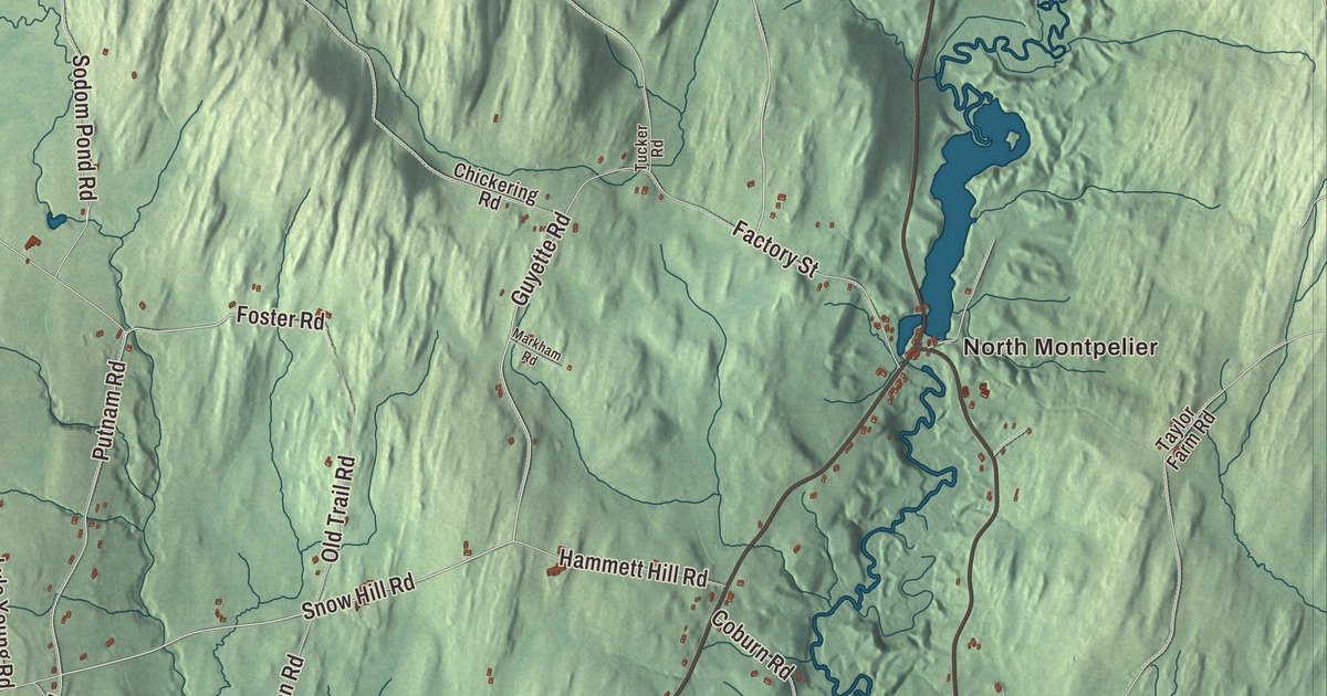
East Montpelier lies just northeast of the state capital, and for its first half century it was part of Montpelier. This map prints its villages, East Montpelier Center and North Montpelier, with part of Adamant, plus Sodom Pond, Horn of the Moon Pond and roads like Snow Hill Road, Vincent Flats Road, Guyette Road and East Montpelier Road.
East Montpelier is a town in Washington County, Vermont.
KNOWOL made this map in 2026 from public survey data and gave it the look of an old county atlas. The hills are shaded from United States Geological Survey elevation data, and the roads and town line come from the Census Bureau. East Montpelier covers 32.1 square miles, and it had 2,598 people at the 2020 census. Click here to purchase a print of this map for your wall.
The center of old Montpelier
The legislature made East Montpelier a town of its own from part of Montpelier on November 9, 1848, and it organized on January 1, 1849. Long before that, this was the heart of the old town. Parley Davis, the area’s first surveyor and one of its first settlers, built a log cabin here in 1791 and set up the mills that let the rest of the settlement grow. His house in East Montpelier Center, built in stages from about 1795 to about 1805, has fine Federal woodwork and a Palladian window over the door, and Montpelier held its town meetings there until 1828.
Davis gave land for a town common nearby, hoping it would become Montpelier’s center, and between 1823 and 1826 the Union Meetinghouse went up on it. It’s the oldest church building in the greater Montpelier area, and it housed the town meetings until 1849, the year East Montpelier went its own way. Down in East Montpelier village, settled in 1825, the Old Brick Church was built in 1833 and 1834 by a crew led by Truman and Stillman Kelton, including men who later worked on the Vermont State House. Out on the Winooski River, the Coburn Covered Bridge of about 1851 is the town’s only covered bridge.
Sodom becomes Adamant
Adamant sits on the line between Calais and East Montpelier. It began as a granite quarry village called Sodom, and local lore says a preacher pounded the pulpit and declared he was adamant the name had to change. In 1905 the residents asked the legislature to rename the village Adamant. The Adamant Co-op, a general store and post office at the corner of Sodom Pond Road, was founded in 1935 and is the state’s oldest co-operative. The village is also home to the Adamant Music School, a summer piano school founded in 1942, and the Quarryworks Theater, set on the grounds of the largest quarry. Locals like to say “Adamant is a state of mind.”
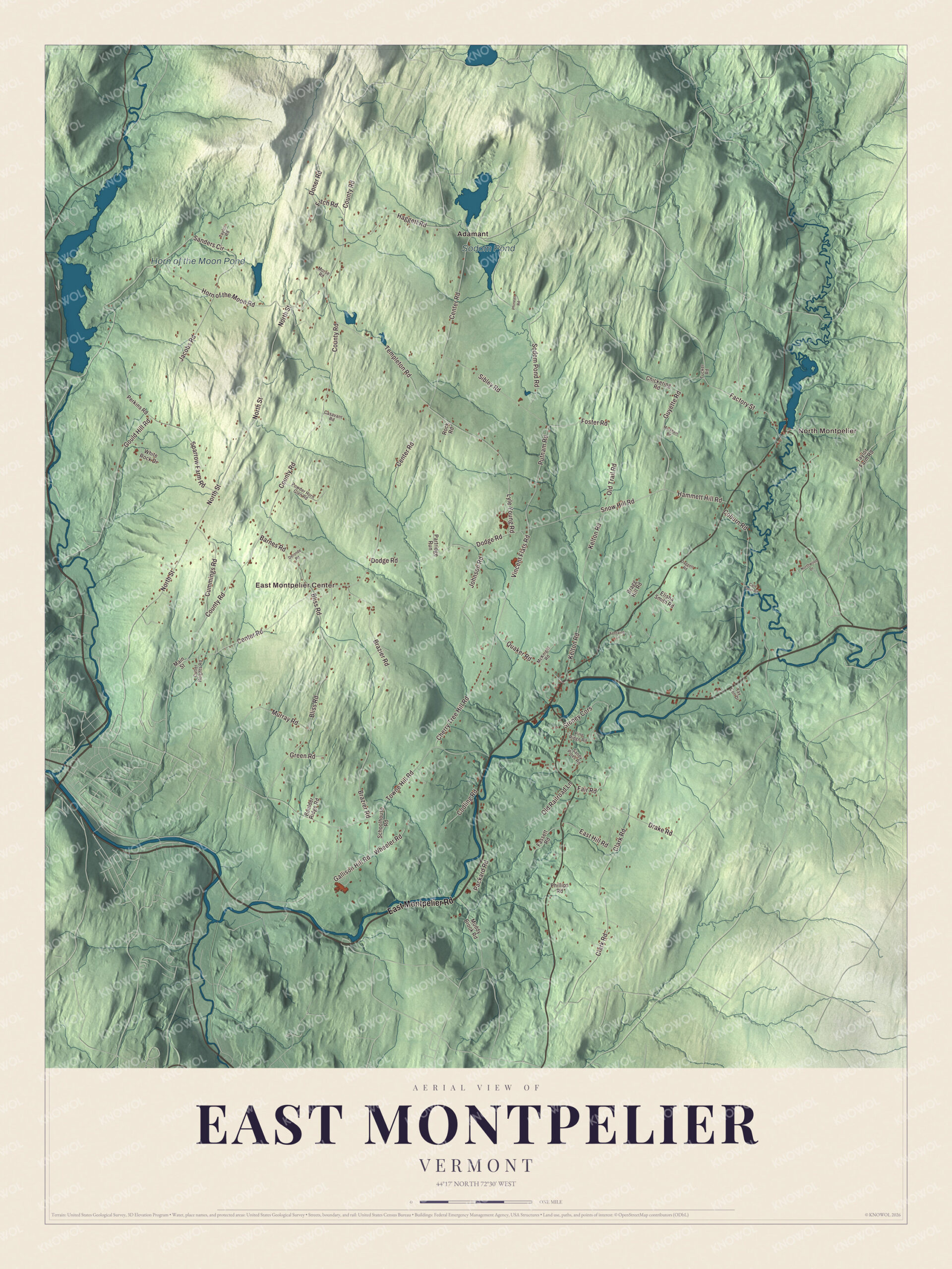
Click to explore a larger preview. The digital watermark does not appear on printed maps.
Names on this map
These names are printed on this map.
Places: North Montpelier, East Montpelier Center, Sodom Pond, Horn of the Moon Pond and Adamant.
Streets and roads: East Montpelier Road, Snow Hill Road, Guyette Road, Vincent Flats Road, Putnam Road, Foster Road, Center Road, County Road, North Street, Horn of the Moon Road, Towne Hill Road, Brazier Road.
More street names, A to Z
Barnes Road, Bliss Road, Boulder Ridge Road, Bragg Hill Road, Casavant Road, Cate Farm Road, Cherry Tree Hill Road, Chickering Road, Clark Road, Coburn Road, Codling Road, Cummings Road, Cutler Heights Road, Daggett Road, Deronde Road, Dodge Road, Doner Road, Drake Road, East Hill Road, Elisha Smith Road, Factory Street, Fair Road, Fassett Road, Fitch Road, Fontaine Lane, Gallison Hill Road, Gould Hill Road, Green Road, Haggett Road, Hammett Hill Road, Jacobs Road, Johnson Road, Kelton Road, Lyle Young Road, Main Street, Markham Road, McKnight Road, Morse Road, Muddy Brook Road, Murray Road, Northwood Drive, Old Railroad Lane, Old Trail Road, Packard Road, Partridge Run, Perkins Road, Phillips Road, Phineas Road, Pine Ridge Road, Powder Horn Glen Road, Quaker Road, Rock Road, Sanders Circle, Sandy Pines Road, Schoolhouse Road, Sibley Road, Sodom Pond Road, Sparrow Farm Road, Stoney Cors, Tay Con Drive, Taylor Farm Road, Taylor Road, Templeton Road, Tucker Road, Wheeler Road, White Rock Drive.
See it on a wall
The East Montpelier map as a framed print. Swipe for more.


The Washington Electric Cooperative has its home in East Montpelier, serving more than 10,500 members across parts of four counties. Liz Stephen, born in East Montpelier in 1987, skied cross-country for the United States at the 2010 and 2014 Winter Olympics and finished fifth overall in the 2015 Tour de Ski. The political cartoonist Jeff Danziger taught English at Union 32 High School in East Montpelier, starting in 1971.
On the map, find East Montpelier Road, Snow Hill Road, Guyette Road, Vincent Flats Road, Putnam Road and Foster Road. East Montpelier Center, North Montpelier and Adamant are printed too, and Sodom Pond and Horn of the Moon Pond are labeled on the map.
This map of East Montpelier is made for everyone who calls East Montpelier home and shows the town as it looks today, from the old meetinghouse to the quarry ponds. Hang it in an office, library or den, or use it to teach children the geography and history of the town that was once the center of Montpelier. KNOWOL created it in 2026, and it’s printed on museum quality archival paper. Zoom in on the preview above to explore the details, then click here to get your copy of the East Montpelier, Vermont map.

Sources
- East Montpelier, Vermont, Wikipedia
- Town histories and representatives, E towns, Vermont Legislature
- Parley Davis House, Wikipedia
- Union Meetinghouse (East Montpelier, Vermont), Wikipedia
- East Village Meetinghouse, Wikipedia
- Coburn Covered Bridge, Wikipedia
- Adamant, Vermont, Wikipedia
- Liz Stephen, Wikipedia
- Jeff Danziger, Wikipedia