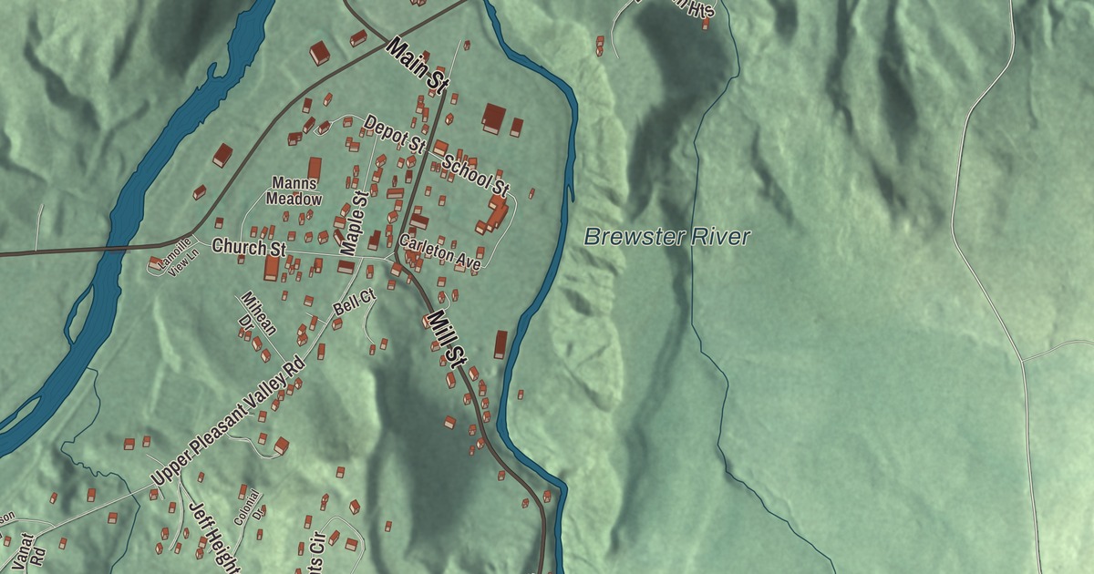
Jeffersonville sits where the Brewster River comes down out of the mountains to meet the Lamoille, with Mount Mansfield 7 miles to the south. This map prints the village streets, Main Street, Mill Street and School Street, along with Upper Pleasant Valley Road, Jeff Heights Road, Jeff Heights Circle and the Brewster River.
Jeffersonville is a village in Lamoille County, Vermont.
KNOWOL made this map in 2026 from public survey data and gave it the look of an old county atlas, shading the hills from United States Geological Survey elevation data and drawing the roads and village line from the Census Bureau. Jeffersonville is an incorporated village within the town of Cambridge, and it has its own incorporated-place boundary, about 0.81 square miles at 1,060 feet above sea level. Click here to purchase a print of this map for your wall.
Cambridge Center
The village grew up near the middle of Cambridge on flat, fertile ground between the Lamoille River and the Brewster River. Its earliest settler, John Brewster, came in the 1780s, and its historic district page says the village arose in the early 1800s because the Brewster River was well suited to power mills. It was first called Cambridge Center. In 1827 it took the name Jeffersonville to honor Thomas Jefferson. The village remains active today, the largest in Cambridge and long the town’s commercial heart, with 750 people at the 2020 census.
The Jeffersonville Historic District, on the National Register since 1987, runs west along Church Street and north along Main Street from where they meet, with School Street looping off Main Street to the east. Most of its 67 buildings date from the 19th and early 20th centuries, from Greek Revival houses to Victorian and Colonial Revival buildings from around 1900. Among its landmarks is the Cambridge Meetinghouse at 85 Church Street, known locally as the Old Brick Church. It was built in 1826 to be shared by four Christian denominations, and its page says the religious movement known as Perfectionism rose there and helped lead to the founding of the Oneida Community in New York. The town used it for town meetings from 1866, and its offices stayed there until 1958.
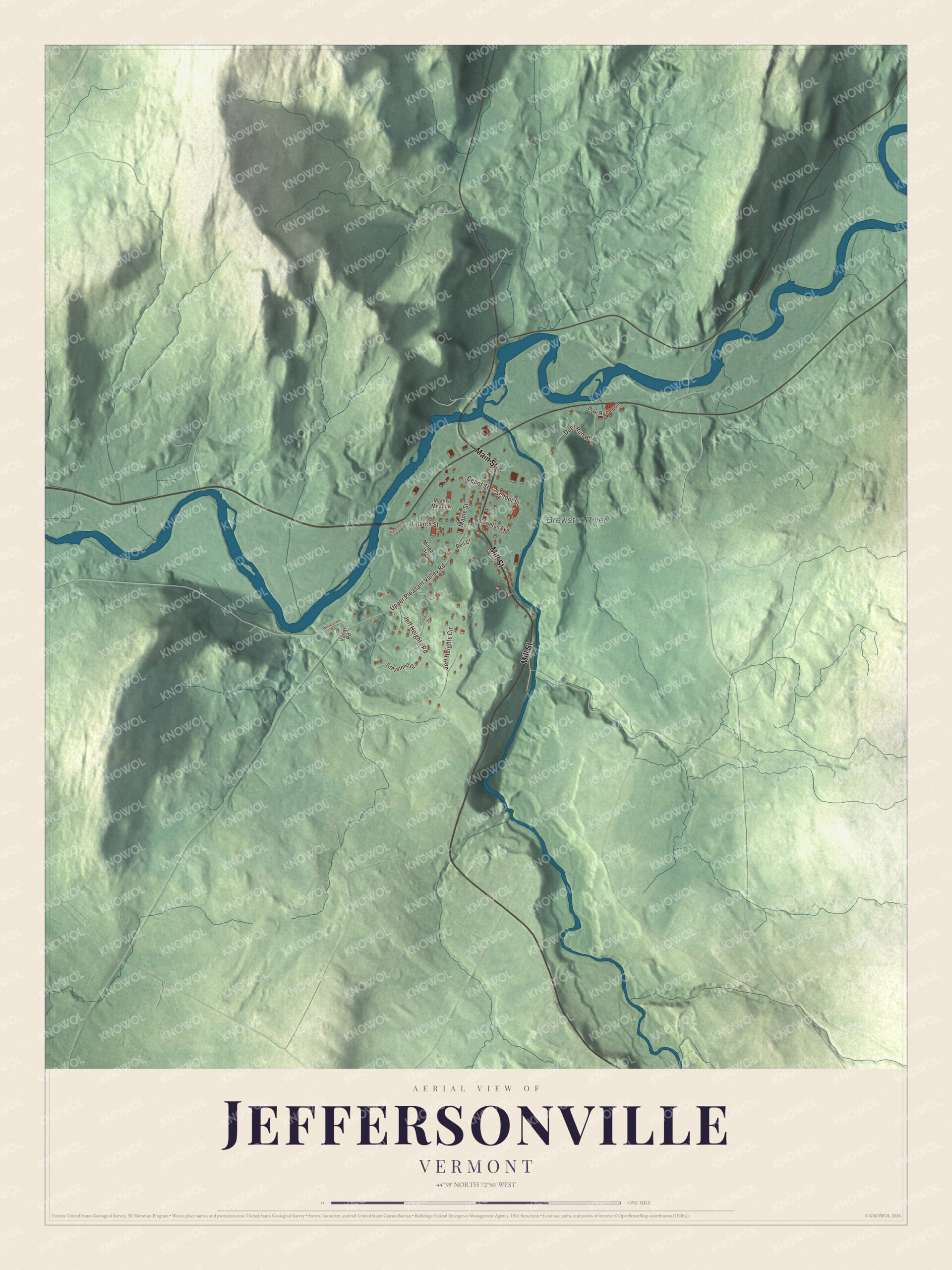
Click to explore a larger preview. The digital watermark does not appear on printed maps.
Names on this map
These names are printed on this map.
Places: Brewster River.
Streets and roads: Mill Street, Main Street, School Street, Upper Pleasant Valley Road, Jeff Heights Road, Jeff Heights Circle, Deer Run Heights, Church Street, Maple Street, Depot Street, Greystone Drive, Carleton Avenue.
More street names, A to Z
Bell Court, Colonial Drive, Deer Run Loop, Lamoille View Lane, Manns Meadow, Mihean Drive, Vanat Road, Williamson Road.
See it on a wall
The Jeffersonville map as a framed print. Swipe for more.


People of Jeffersonville
The philosopher and educator Scott Buchanan grew up in Jeffersonville. With Stringfellow Barr he founded the Great Books program at St. John’s College in Annapolis, Maryland. The painter Mary Bryan and her husband, the artist Alden Bryan, came to a winter workshop for artists at Jeffersonville in 1939 and bought a home and dairy farm in the area in 1941. After her death the Mary Bryan Memorial Gallery opened on Main Street in 1984. Barbara J. Sindall, a teacher of Latin and Greek who served in an anti-aircraft battery in England in World War II, retired from teaching in 1966, became a librarian in Vermont, and lived in Jeffersonville until her death in 1989.
Around the map
The Brewster River starts in Smugglers Notch at the crest of the Green Mountains and flows north to the village. Smugglers’ Notch Resort, founded in 1956 by a group of Vermont skiers, is 5 miles south of Jeffersonville, and Burlington is 30 miles away by Route 15.
On the map, start on Main Street, then take Mill Street and School Street, and head out on Upper Pleasant Valley Road, Jeff Heights Road and Jeff Heights Circle. The Brewster River is printed too.
This map of Jeffersonville is made for everyone who calls Jeffersonville home, and it shows the village as it looks today, from Main Street to the Brewster River. Hang it in an office, library or den, or use it to teach children the geography and history of their village. It’s printed on museum quality archival paper. Zoom in on the preview above to explore the details, then click here to get your copy of the Jeffersonville, Vermont map.

Sources