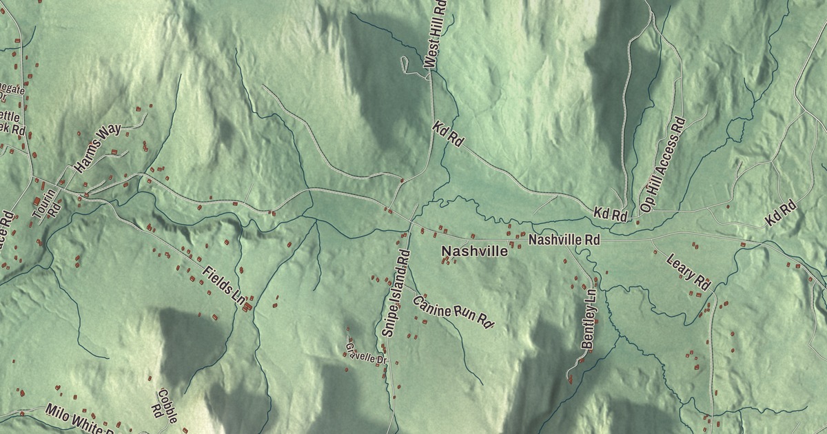
Jericho is where Snowflake Bentley caught snow crystals on a farm and photographed them, more than 5,000 of them in his lifetime. If you live here, you know the town by its corners and its river: Nashville and Riverside, Jericho Center, the Browns River and Underhill next door, and roads such as River Road, Lee River Road, Browns Trace Road, Onion River Road, Ethan Allen Road and West Bolton Road, all printed on this map.
Jericho is a town in Chittenden County, Vermont.
KNOWOL made this map in 2026 from public survey data and gave it the look of an old county atlas, shading the hills from United States Geological Survey elevation data and drawing the roads and town line from the Census Bureau. The town covers 35.6 square miles, its high point is Bald Hill at over 1,900 feet, and the town’s page says that as of 2024 close to 48% of its land was in public ownership or under conservation. Click here to purchase a print of this map for your wall.
Settling Jericho
New Hampshire’s governor, Benning Wentworth, granted Jericho on June 7, 1763, and named it after the ancient city. Ira Allen and Remember Baker surveyed it in 1773 for the Onion River Land Company, and the first settlers came from Berkshire County, Massachusetts, the next year, the Brown family among them with a cabin near the Browns River. In 1776 Continental soldiers were sent to hold a blockhouse along the Onion River, now the Winooski, and the town’s page says it’s believed to have stood along River Road near Skunk Hollow. The town organized on March 22, 1786, with Jedediah Lane as its first representative. Farming, logging and mills along the Browns River built its economy, and three village centers grew up: Jericho Corners, Jericho Center and Riverside. From 1876 to 1937, trains on the Burlington and Lamoille Railroad stopped in Jericho every day.
Down at Jericho Corners on Route 15, the Old Red Mill still stands on the Browns River, which powered it. James Hutchinson built it in 1856, and L. B. Howe enlarged it in 1885 with new rollers for grinding grain. Its products went all over New England until it closed in 1946, and today it’s a museum and the home of the Jericho Historical Society. Nearby, at the junction of Route 15 and Lee River Road, stands the Galusha House of 1790, named for Truman Galusha, the son of Governor Jonas Galusha. Out on River Road, overlooking the Winooski, is the brick Martin Chittenden House of the 1790s, most likely a wedding present from Thomas Chittenden, Vermont’s first governor, to his son Martin, who was governor himself during the War of 1812.
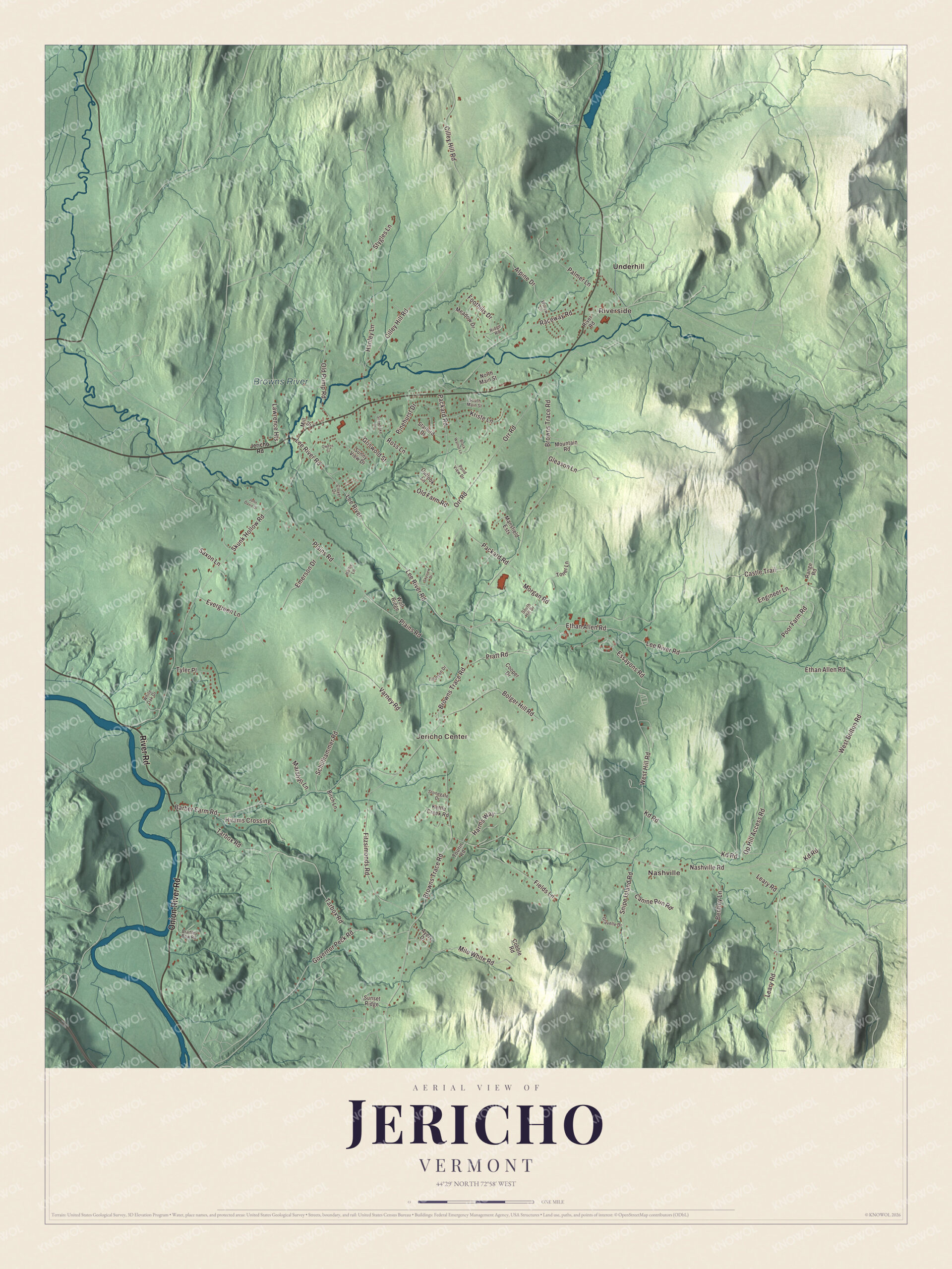
Click to explore a larger preview. The digital watermark does not appear on printed maps.
Names on this map
These names are printed on this map.
Places: Nashville, Riverside, Jericho Center, Browns River and Underhill.
Streets and roads: Onion River Road, River Road, Ethan Allen Road, Lee River Road, West Bolton Road, Lee River, Browns Trace Road, Poor Farm Road, Nashville Road, Cilley Hill Road, Plains Road, Castle Trail.
More street names, A to Z
Alpine Drive, Ayers Drive, Barber Farm Road, Bentley Lane, Birch Lane, Black Walnut Lane, Bolger Hill Road, Bradley Bow Road, Canine Run Road, Clover Drive, Cobble Road, Cooper Drive, Emerson Drive, Engineer Lane, Essayons Road, Evergreen Lane, Fields Lane, Fitzsimonds Road, Foothills Drive, Gleason Lane, Governor Peck Road, Gravelle Drive, Griswold Street, Hanley Lane, Harms Way, Hirams Crossing, Hollis Lane, Jericho Road, John Davis Drive, Kd Road, Kettle Creek Road, Kriste Lane, Lawrence Heights, Leary Road, Mansfield Ests, Marshall Lane, Meadow Drive, Mill Street, Milo White Road, Morgan Road, Mountain Road, North Main Street, Old Farm Road, Old Pump Road, Op Hill Access Road, Orr Road, Outlook Lane, Owens Street, Packard Road, Palmer Lane, Pinehurst Drive, Pond View Drive, Pratt Road, Raceway Road, Range Road, Ridge Road, Ross Lane, Saxon Lane, Schillhammer Road, Skunk Hollow Road, Skyview Drive, Snipe Island Road, Snowflake Drive, South Hill Drive, South Main Street, Starbird Drive, Stonegate Drive, Stygles Lane, Sunny View Drive, Sunset Ridge, Tarbox Road, Tillotson Drive, Toner Lane, Tourin Road, Tyler Place, Varney Road, West Hill Road, White Oak Drive, Willow Lane, Wolf Ridge.
See it on a wall
The Jericho map as a framed print. Swipe for more.


Jericho Center
Jericho Center grew around a green laid out on land given by the early settler Lewis Chapin, on the condition that the town meetinghouse be built there. The green sits where Browns Trace meets Varney Road and Bolger Hill Road, and its brick Congregational Church dates from 1836. Jericho Academy taught secondary school here from 1825 into the 20th century, and its old building is now the town library. Jericho Center is also home to the Jericho Center Country Store, which the town’s page calls Vermont’s oldest continuously running general store. The village has been on the National Register as a historic district since 1983.
Snowflake Bentley and other Jericho people
Wilson Bentley was born in Jericho in 1865 and lived his whole life in the farmhouse on Nashville Road. As a teenager he tried to draw snowflakes through an old microscope his mother gave him. Then he fixed a bellows camera to a microscope, and on January 15, 1885, he photographed his first snowflake. His page calls him the first known person to take detailed photographs of snowflakes. He argued that no two snow crystals are alike, and in 1931, with William J. Humphreys of the U.S. Weather Bureau, he published Snow Crystals, illustrated with 2,500 of his photographs. The Jericho Historical Society holds the broadest collection of his pictures. George Washington Henderson, who was born enslaved in Virginia and came to Vermont after the Civil War, worked as principal of Jericho Academy while finishing college. He graduated first in his class at the University of Vermont in 1877 and became the first Black member of Phi Beta Kappa. The mountain biker Lea Davison, from Jericho, raced in the Olympics in 2012 and 2016.
On the map, follow River Road and Onion River Road, then take Lee River Road, Browns Trace Road, Ethan Allen Road and West Bolton Road. Nashville and Riverside are printed, and so are Jericho Center, Underhill and the Browns River. Jericho dates to 1763.
This map of Jericho is made for everyone who calls Jericho home, and it shows the town as it looks today, from Riverside to Jericho Center. Hang it in an office, library or den, or use it to teach children the geography and history of their town. It’s printed on museum quality archival paper. Zoom in on the preview above to explore the details, then click here to get your copy of the Jericho, Vermont map.

Sources
- Jericho, Vermont, Wikipedia
- Town histories and representatives, J towns, Vermont Legislature
- Old Red Mill and Mill House, Wikipedia
- Jericho Village Historic District, Wikipedia
- Galusha House, Wikipedia
- Martin Chittenden House, Wikipedia
- Jericho Center Historic District, Wikipedia
- Wilson Bentley, Wikipedia
- Wilson Alwyn “Snowflake” Bentley House, Wikipedia
- George Washington Henderson, Wikipedia
- Lea Davison, Wikipedia