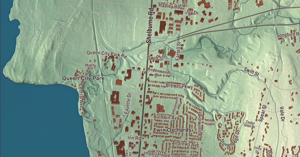
South Burlington lies south and east of Burlington, from Shelburne Bay on Lake Champlain to the Winooski River, with Shelburne Road and Williston Road carrying most of its traffic. This map prints Queen City Park and Twin Orchards, with Main Street, Shelburne Road, Williston Road, Hinesburg Road, Kennedy Drive and Airport Drive.
South Burlington is a city in Chittenden County, Vermont.
KNOWOL made this map in 2026 from public survey data and gave it the look of an old county atlas, shading the hills from United States Geological Survey elevation data and drawing the streets and city line from the Census Bureau. The city covers 29.6 square miles, 13.1 of them water, and 20,292 people lived here at the 2020 census, making it Vermont’s second-most populous city after Burlington. Click here to purchase a print of this map for your wall.
The rest of old Burlington
New Hampshire granted the land on June 7, 1763, as part of Burlington township, and the Town of Burlington organized around 1785. The rest of the old town was incorporated from a part of Burlington as South Burlington on November 22, 1864, as the village of Burlington became a city, and Asa R. Slocum was its first representative, in 1865. The Town of South Burlington became the City of South Burlington in 1971. Its neighbors are Burlington to the northwest, Winooski and Colchester to the north, Essex to the northeast, Williston to the east and Shelburne to the south, and the Winooski River runs along its northern edge. A large part of Lake Champlain west of Burlington, reaching to the New York line, is South Burlington too.
Shelburne Road, U.S. Route 7, and Dorset Street are two of the city’s main commercial roads, joined by Interstate 189. Williston Road is U.S. Route 2, and Route 116 comes in from Williston as Hinesburg Road and ends at Williston Road. Exit 14 of Interstate 89, which feeds Williston Road and Dorset Street, is the largest highway exit in Vermont. Most of the city’s 191 retail businesses cluster around City Center near Dorset Street and Williston Road, and in 2020 South Burlington led the state in gross retail and use sales.
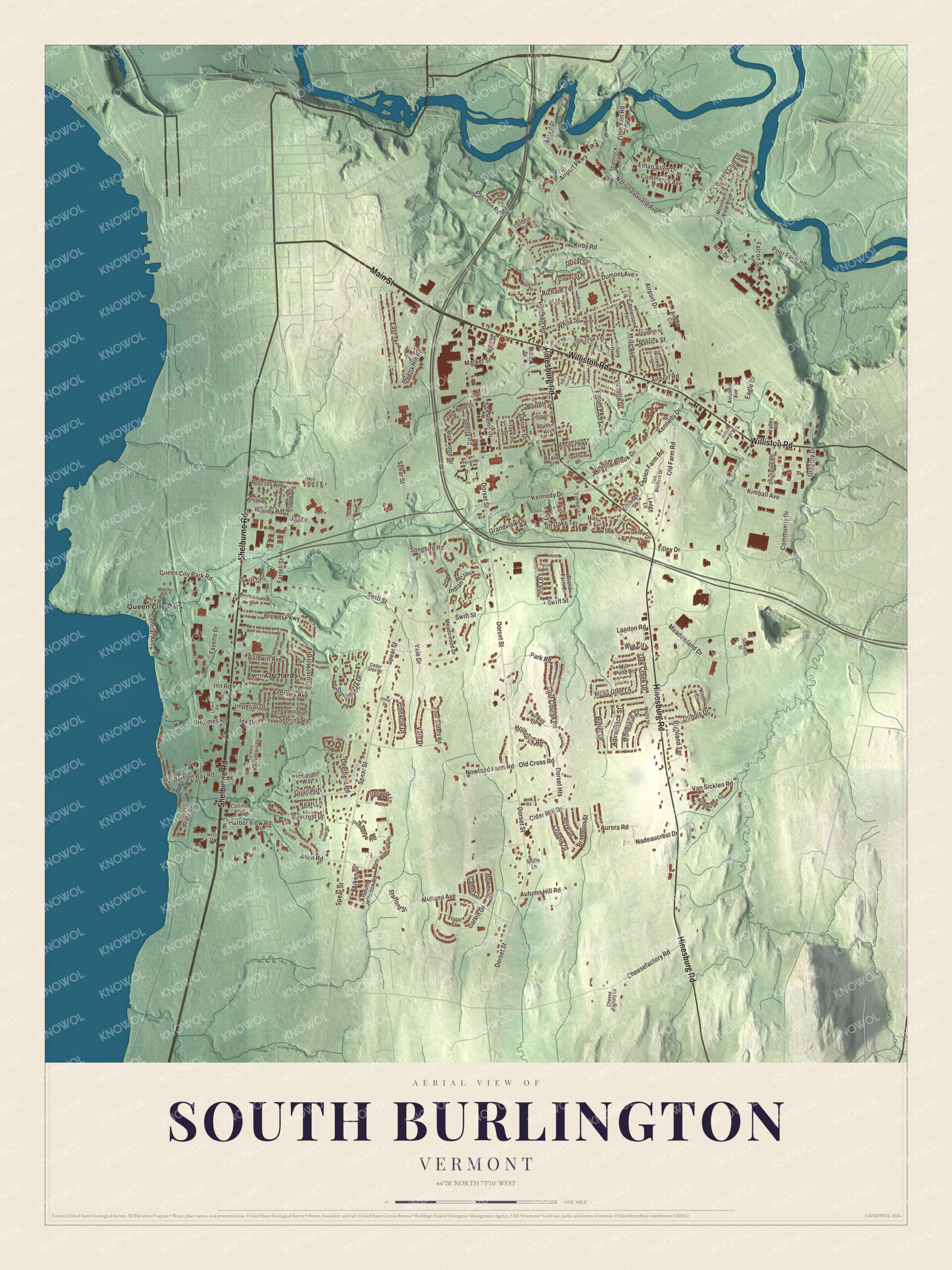
Click to explore a larger preview. The digital watermark does not appear on printed maps.
Names on this map
These names are printed on this map.
Places: Queen City Park and Twin Orchards.
Streets and roads: Main Street, Shelburne Road, Williston Road, Hinesburg Road, Kennedy Drive, Airport Drive, Twin Oaks Terrace, Spear Street, Laurel Hill Drive, Brewer Parkway, Farrell Street, Nowland Farm Road.
More street names, A to Z
Adirondack Street, Aiken Street, Airport Circle, Airport Parkway, Airport Road, Allen Road, Andrews Avenue, Aurora Road, Autumn Hill Road, Aviation Avenue, Baldwin Avenue, Barrett Street, Bartlett Bay Road, Baycrest Drive, Berard Drive, Berkley Street, Bowdoin Street, Bower Street, Braeburn Street, Brand Farm Drive, Brookwood Drive, Butler Drive, Cabot Court, Catkin Drive, Cedar Glen Drive, Central Avenue, Cheese Factory Lane, Cheesefactory Road, Cider Mill Drive, Clover Street, Cobblestone Circle, Collins Boulevard, Commerce Avenue, Community Drive, Country Club Drive, Crispin Drive, Davis Parkway, Deane Street, Deerfield Road, Derby Circle, Dorset Heights, Dorset Street, Dubois Drive, Dumont Avenue, Duval Street, Eagle Drive, East Terrace, Eldredge Street, Elizabeth Street, Elsom Parkway, Ethan Allen Drive, Fairway Drive, Falcon Street, Fayette Drive, Floral Street, Forest Street, Four Sisters Road, Golf Course Road, Grandview Drive, Green Mountain Drive, Gregory Drive, Hadley Road, Harbor Ridge Road, Harbor View Road, Hayden Parkway, Hayes Avenue, Highland Terrace, Holbrook Road, Holmes Road, Holt Street, Hopkins Street, Idx Drive, Imperial Drive, Indian Creek, Inn Road, Irish Cove Road, Iris Lane, Joy Drive, Juniper Drive, Keari Lane, Kimball Avenue, Kirby Road, Knoll Circle, Landfill Road, Landon Road, Ledge Lane, Lewis Road, Lime Kiln Road, Lindenwood Drive, Link Road, Lupine Lane, Maple Avenue, Marcy Street, Market Street, Mary Street, Meadowland Drive, Meadowood Drive, Meadow Road, Midas Drive, Midland Avenue, Millham Court, Mill Pond Lane, Mills Avenue, Moss Glen Lane, Mountain View Boulevard, Myers Court, Nadeaucrest Drive, National Guard Avenue, Nco Drive, Nesti Drive, North Jefferson Road, Oak Creek Drive, Oak Hill Drive, Oakwood Drive, Obrien Drive, Obrien Farm Road, Old Cross Road, Old Farm Road, Olivia Drive, Park Road, Patchen Road, Patrick Street, Peterson Terrace, Pheasant Way, Pine Street, Pine Tree Terrace, Pinnacle Drive, Poor Farm Road, Preserve Road, Proctor Avenue, Prouty Parkway, Pump Lane, Quail Run, Quarry Hill Road, Queen City Park Road, Richard Terrace, Royal Drive, Rye Circle, Sadie Lane, Sandalwood Drive, San Remo Drive, Sebring Road, Shamrock Road, Sherry Road, Shunpike Road, Simpson Court, Songbird Road, South Beach Road, South Jefferson Road, Southview Drive, Stafford Street, Stonehedge Drive, Sunset Avenue, Swift Street, Tanglewood Drive, Tilley Drive, Timber Lane, Town Square Drive, Two Brothers Drive, Upswept Lane, Vale Drive, Valley Road, Van Sicklen Road, Victoria Drive, Victory Drive, Whiteface Street, White Place, White Street, Winding Brook Drive.
See it on a wall
The South Burlington map as a framed print. Swipe for more.


Airport, ice cream and a new downtown
Patrick Leahy Burlington International Airport is owned by the City of Burlington but sits in South Burlington. The first aircraft landed on the field on August 14, 1920, and today it’s by far the busiest airport in Vermont and the home of the 158th Fighter Wing of the Vermont Air National Guard. Ben & Jerry’s, founded in Burlington in 1978, keeps its headquarters in South Burlington, and the University Mall, finished in 1979 and named for its nearness to the University of Vermont, is the largest shopping mall in the state.
City Center is the city’s new walkable downtown. South Burlington has built a city hall, a senior center and public library, streets and a main park there, and Market Street and Garden Street run through it. The 9.4-acre City Center Park has walking paths through a forest and a children’s discovery area. Red Rocks Park offers a public beach on Lake Champlain, and Overlook Park looks across the lake to the Adirondacks. Louvenia Bright represented South Burlington in the Vermont House of Representatives from 1988 to 1994, the first Black woman to serve in the Vermont General Assembly, and she helped pass Vermont’s first parental and family leave law.
On the map, start with Queen City Park and Twin Orchards, then follow Main Street, Shelburne Road, Williston Road, Hinesburg Road, Kennedy Drive and Airport Drive across the city. All six of those names are printed on the artwork. South Burlington dates to 1864.
This map of South Burlington is made for everyone who calls South Burlington home, and it shows the city as it looks today, from Queen City Park and Shelburne Road to Williston Road and Airport Drive. Hang it in an office, library or den, or use it to teach children the geography and history of their city. It’s printed on museum quality archival paper. Zoom in on the preview above to explore the details, then click here to get your copy of the South Burlington, Vermont map.

Sources