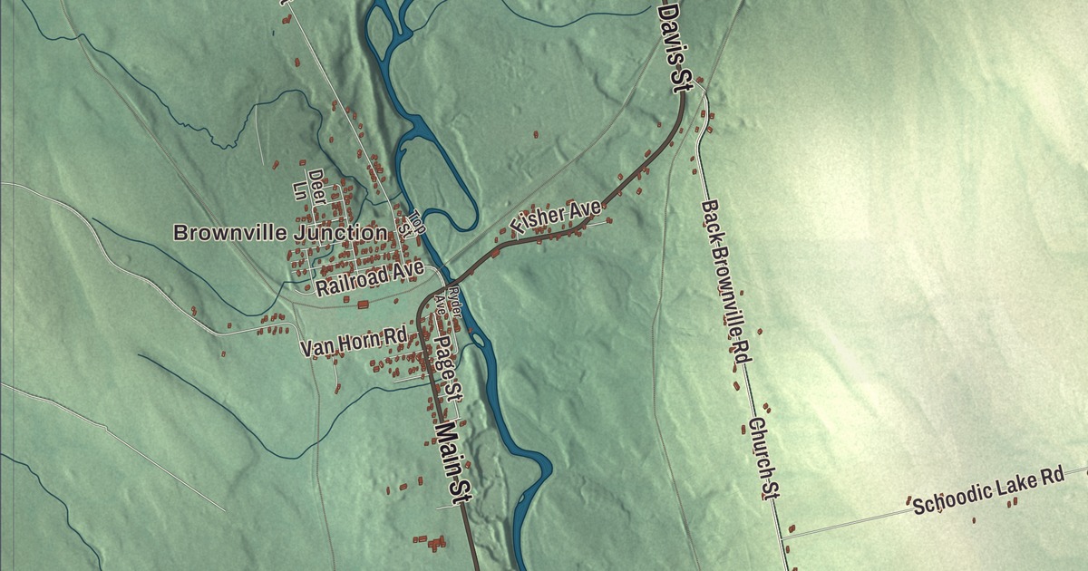
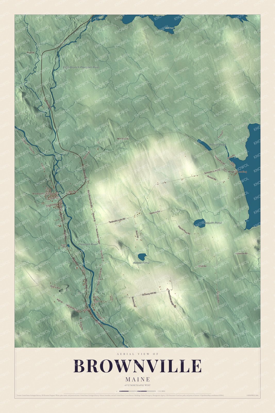
The Pleasant River is printed on this map of Brownville, and so are Brownville Junction, Knights Landing, Mill Brook and Prairie, and Jaquith Pond, Norton Pond and Abbee Pond. Main Street, Main Road, Davis Street, Page Street, Shore Road and Twelve Mile Road are printed as well. Click here to purchase a print of this map for your wall.
Brownville is a town in Piscataquis County, and 1,139 people lived here at the 2020 census.
KNOWOL made this map in 2026 from public survey data and gave it the look of an old atlas. United States Geological Survey elevation data shades the hills, and the Census Bureau supplies the roads and town line. The bureau counts 44.62 square miles in Brownville, 0.59 of them water, and the town lies between Sebec Lake and Schoodic Lake.
Mills on the Pleasant River
The land was part of the Waldo Patent, bought by Moses Brown and Major Josiah Hill of Newburyport, Massachusetts, who started its settlement, and in 1806 they built a dam and water mills on the Pleasant River. The township, first known as T5 R8 NWP, was organized in 1819 as Brownville Plantation, named for Francis Brown, a mill owner and trader from Newbury, Massachusetts. Brownville dates to 1824, the year it was incorporated as a town. Early settlers were each given 50 acres to clear, and their farms grew hay, oats, potatoes, wheat and vegetables. The river’s power brought sawmills, clapboard mills, gristmills, a shovel handle factory and a carriage factory.
Francis Brown’s own house still stands on High Street, a short way west of Main Street. He began it in 1815 and built it over twelve years, bringing hardware from Boston, foundation stones from the coast and clay for the chimney bricks from Charleston, and when it was finished it was by far the grandest house in town. Its upstairs ceiling hangs from a frame of massive hewn timbers, and the walls don’t support it at all. It’s on the National Register of Historic Places.
Slate and iron
The town page says the slate from its quarries won first prize at the 1876 Centennial Exposition. The Bangor and Piscataquis Slate Company opened in 1843 with 60 workers and shipped 8,000 to 12,000 squares of roofing slate a year, the Merrill Quarry opened in 1846 with about 80 workers and 30,000 squares a year, and the Highland Quarry hired workers from Wales who knew slate. The last quarry closed in 1917. One quarry company built its superintendent a house on Church Street with walls and foundation entirely of slate, believed to be unique in New England; the county’s National Register list notes that it was destroyed by fire in 2019.
Iron ore turned up at the foot of Ore Mountain, and in 1841 Samuel Smith built a road from Brownville to reach it. The Katahdin Iron Works was established in 1843, with a blast furnace and charcoal kilns, and the Bangor and Katahdin Iron Works Railway reached Brownville in 1881 and the ironworks two years later. In 1889 the Canadian Pacific’s line from Montreal to Saint John crossed it three miles north of the village, at the place named Brownville Junction.
Brownville people have kept its history. Edgar C. Smith, born here in 1870, read law in Brownville, served as its tax collector and superintendent of schools and became Maine’s Secretary of State from 1927 to 1933, and he wrote a life of Moses Greenleaf, Maine’s first mapmaker, and a bibliography of the maps of Maine. The local historian Bill Sawtell has written books on the Katahdin Iron Works, the Highland Quarry and the Bangor and Aroostook Railroad.
Click to explore a larger preview. The digital watermark does not appear on printed maps.
See it on a wall
The Brownville map as a framed print. Swipe for more.


The river, the ponds and the villages
The Pleasant River is printed on the map. It begins in Brownville where its East Branch and West Branch meet and runs 15.2 miles south and southeast to the Piscataquis River in Medford. Jaquith Pond and Norton Pond are printed too. The Schoodic Lake page places both in eastern Brownville and says streams carry their water to that lake. Abbee Pond is printed as well.
Brownville Junction and Knights Landing are printed on the map. The town page lists them, with Brownville village, as the town’s three villages, and says the 100-Mile Wilderness of the Appalachian Trail passes near. Mill Brook and Prairie are printed, along with Main Street, Main Road, Davis Street, Page Street, Shore Road and Twelve Mile Road.
This Brownville map makes a handsome addition to an office, library or den, and it can teach children the geography and history of a slate-quarrying town. It’s made for anyone who calls Brownville home, from Knights Landing to Brownville Junction, as it looks today. Zoom in on the preview above to explore the details, then click here to get your copy of the Brownville, Maine map.

Sources
- Brownville, Maine, Wikipedia
- Brown House (Brownville, Maine), Wikipedia
- Slate House (Brownville, Maine), Wikipedia
- National Register of Historic Places listings in Piscataquis County, Maine, Wikipedia
- Katahdin Iron Works, Wikipedia
- Edgar C. Smith, Wikipedia
- Pleasant River (Piscataquis River tributary), Wikipedia
- Schoodic Lake, Wikipedia