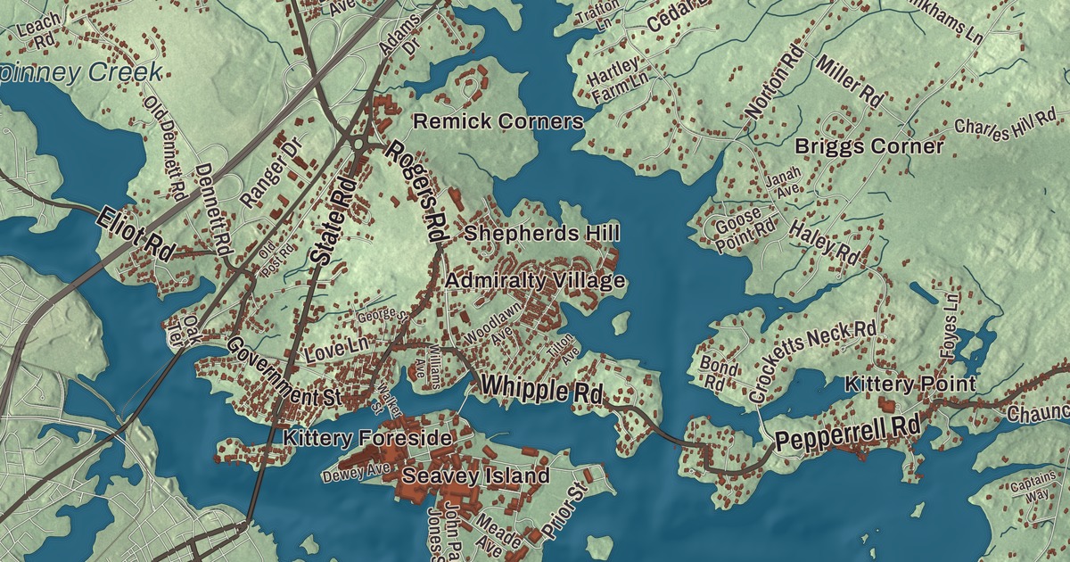
Kittery Foreside and Kittery Point offer starting points for this Kittery map. Look for State Road and Pepperrell Road, then take in the neighborhoods, buildings and coastline around the familiar names. Click here to purchase a print of this map for your wall.
Kittery is a town in York County.
KNOWOL made this map in 2026 using public survey records, United States Geological Survey elevation data and Census Bureau files. We arranged Kittery’s streets, buildings, neighborhoods, coastline, ponds and waterways, and terrain, the town boundary and the pattern of buildings with the relief, lettering and layout of an atlas.
Shipbuilding on the Piscataqua
Kittery incorporated in 1647 and takes its name from Kittery Court in Devon, England, the birthplace of founder Alexander Shapleigh. In 1652, Maine came under the Massachusetts Bay Colony.
Trade and shipbuilding developed beside the Piscataqua River. The Portsmouth Naval Shipyard was established in 1800, and the Treaty of Portsmouth was signed there in 1905, ending the Russo-Japanese War.
Rock Rest
Clayton and Hazel Sinclair bought the Rock Rest property in Kittery in 1938. Clayton worked at the Portsmouth Naval Shipyard and enlarged the house; Hazel’s cooking helped draw guests by word of mouth.
From 1946 to 1977, they operated Rock Rest as a summer guest house welcoming Black travelers during an era of discrimination in public accommodations. The property joined the National Register of Historic Places in 2008, and objects from it are in the National Museum of African American History and Culture.
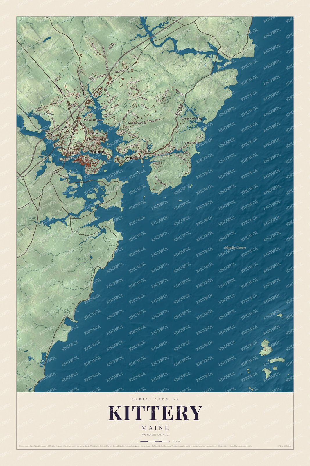
Click to explore a larger preview. The digital watermark does not appear on printed maps.
See it on a wall
The Kittery map as a framed print. Swipe for more.


Explore the Kittery map
Admiralty Village, Bedell Crossing, Briggs Corner and Cutts Island are printed names. Kittery Foreside, Kittery Point and Remick Corners are labeled too.
State Road, Pepperrell Road, Whipple Road, Rogers Road, Dow Highway and Eliot Road are printed roads. Spinney Creek and Atlantic Ocean are water names to look for in the aerial view.
This map shows Kittery as it looks today, made for people who call Kittery home. Hang it in your office, library, or den, or use it to teach children the geography and history of the area. Zoom in on the preview above to explore the details, then click here to get your copy of the Kittery, Maine map.

Sources