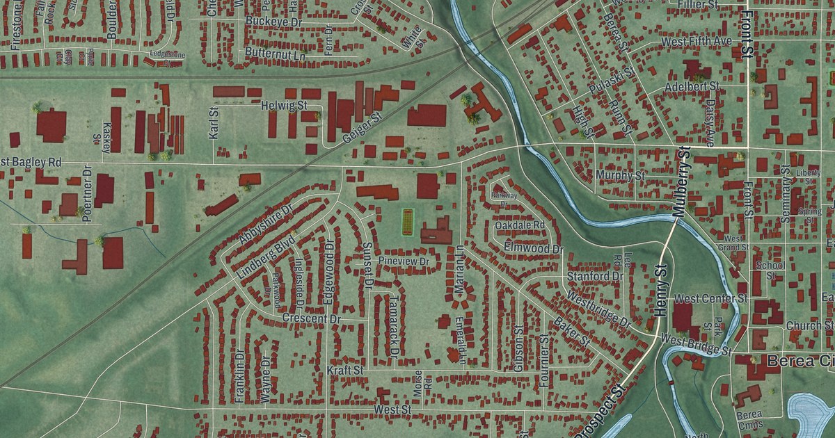
If you grew up in Berea, or still have family on the streets off Front Street and Bagley Road, this map gives you plenty to find. It's a modern aerial view of Berea in Cuyahoga County, Ohio, built from today's data with a vintage feel. Berea City Hall is printed just right of the middle. Mill Stream Run Reservation sits below it, with its lakes in soft blue. A river winds through the middle of town, and West Bagley Road runs west past rows of big red buildings. More than 12,000 buildings are drawn in dark red on green shaded land. Explore the print options for Berea.
Front Street, Depot Street and Mill Stream Run Reservation
Start at Berea City Hall, printed just right of the middle of the sheet. Seminary Street and Church Street run right beside it. Front Street is the long road heading north from here. Follow it up past Liberty Street and Spring Street toward the top right, and you'll reach Depot Street. Keep going and Sheldon Road crosses the top of the sheet near a row of big red buildings. Now go back to City Hall and take Valley Parkway south. It runs past Mill Stream Run Reservation and its lakes. Prospect Street runs down the west side of the park to the bottom of the sheet. West of Prospect, Fair Street, Kraft Street and Wyleswood Drive fill a big grid of homes. Over on the left side, look for Stone Ridge Way and Sandstone Ridge Way. Many of the roads are labeled, and each red shape is a building, so zoom in on the preview and look for yours.
Berea was built on stone. In the early 1830s, John Baldwin found that the sandstone here made very good grindstones. It made good building stone too. By the 1840s, the quarries were the town's lifeblood. Workers came from Germany, Ireland, Italy, Hungary and Poland, among other places. The quarries grew to nearly 250 acres. They swallowed the fine houses of Berea's South Side and the buildings of Baldwin University. Berea sandstone went into the Cuyahoga County Court House, Ohio's Capitol and Canada's parliament buildings. Less demand and the Great Depression closed the last quarries in the mid-1930s. That story is on the historical marker for the Berea sandstone quarries.
The quarries aren't labeled on the map, but the stone still shows up in the street names. North Quarry Lane and South Quarry Lane are both printed. So are Slate Drive and Boulder Drive, near Stone Ridge Way. The Berea Union Depot on Depot Street was built of Berea sandstone. It was dedicated on May 3, 1876, and the Cleveland Plain Dealer called it "the finest facility outside the big cities." It closed in 1958 and later came back as a restaurant. The depot isn't marked on the print, but Depot Street is, running up to meet Front Street.
For anyone who knows Front Street and Depot Street
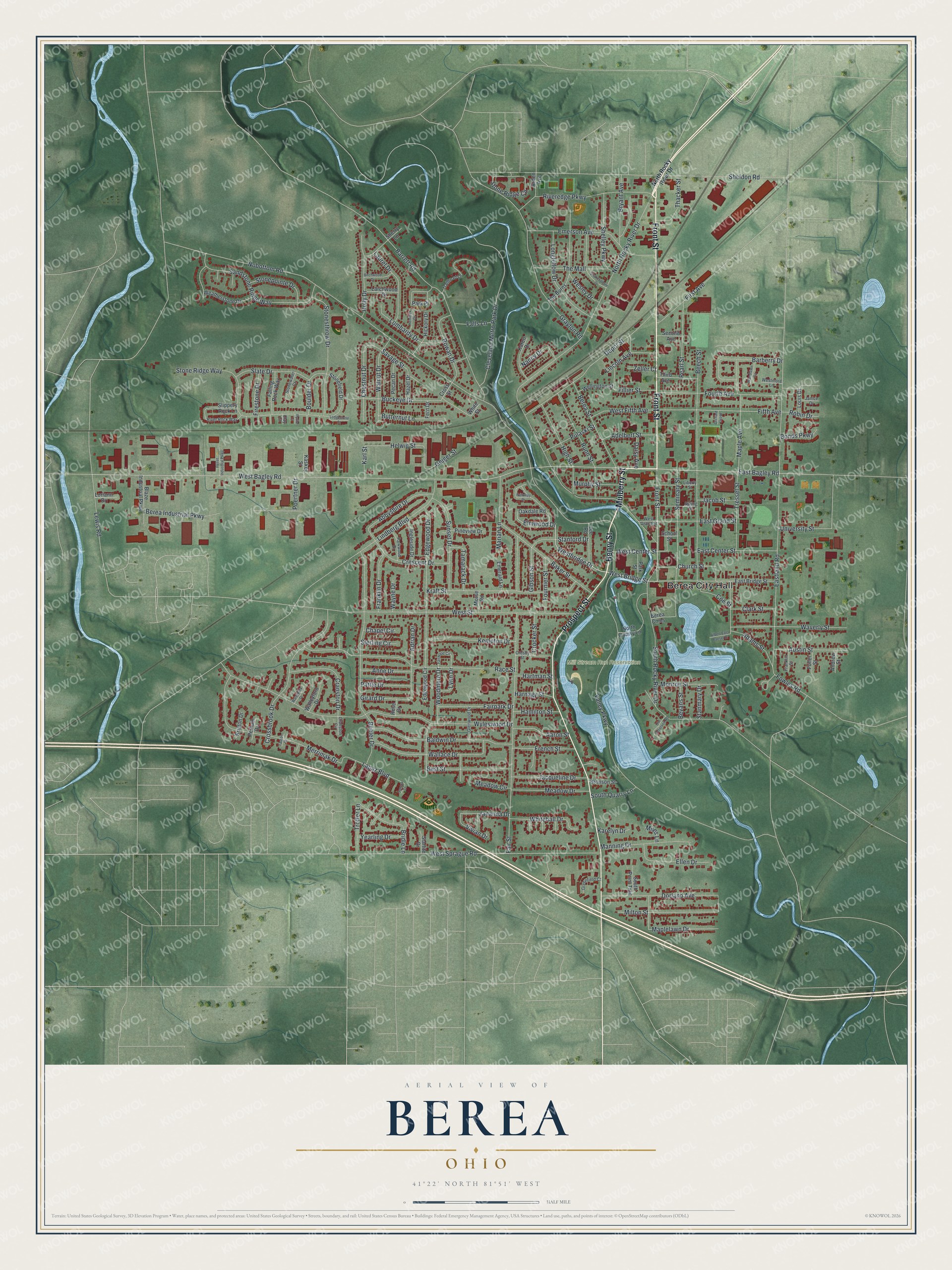
Created by KNOWOL in 2026, this Berea map shades the land from USGS elevation data and takes its streets from Census Bureau records. The buildings are dark red, and the river and the park lakes are soft blue. The title panel reads "Aerial View of Berea, Ohio" above 41°22' North 81°51' West and a half-mile scale bar.
It suits a living room, a den or an office wall. It's a good gift for someone who grew up in Berea and moved away, or for a family with roots in the quarry days. Open the preview, zoom in and find a street you know. Shop the Berea, Ohio map.