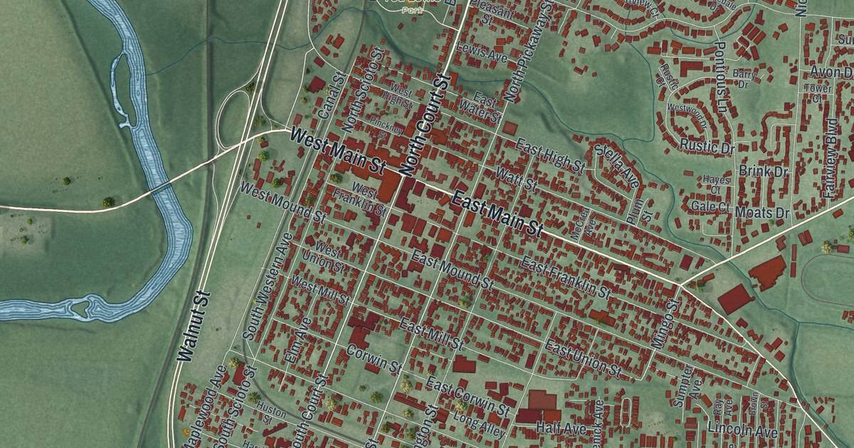
If you grew up in Circleville or still have family here, this map gives you plenty to find. It's a modern aerial view of Circleville in Pickaway County, Ohio, made from modern data and given a vintage look. More than 7,500 buildings are marked in deep red on soft green hills. The old downtown grid sits where North Court Street crosses West Main Street and East Main Street. A river winds down the west edge, though it isn't labeled. Explore the print options for Circleville.
North Court Street, East Main Street and Ted Lewis Park
Start downtown, where North Court Street meets West Main Street and East Main Street. West Main Street heads west to Walnut Street, which runs down the whole left side of the map near the river. Go back to the center and follow East Main Street southeast out of town. Just off it, near the bottom of the built-up area, Barthelmas Park sits beside Kingston Pike. Back near downtown, Lancaster Pike angles off to the northeast. Farther east, Circleville Stoutsville Road runs just above Pickaway Golf Course and out to Heathergreen. Now go north on North Court Street. Ted Lewis Park sits just to the west, and Forest Cemetery is a little farther up. From there, Northridge Road heads northeast, and Atwater Avenue runs north past Graystone Villas. Northwood Park sits a little farther northeast, near the top. Many of the roads are labeled, and each red shape is a building, so zoom in on the preview and look for yours.
Circleville got its name from the ground under it. The town was built on a large earthwork from the Hopewell era. The Ohio historical marker on East Franklin Street says it was a circle about 1,100 feet across, joined to a 900-foot square. A minister named David Jones wrote about it in 1772 for a Boston magazine. Circleville became the seat of Pickaway County in 1810. Daniel Dreisbach laid out the town right on top of the earthworks. An eight-sided courthouse stood directly in the center.
Caleb Atwater moved to Circleville around 1814. He got curious about the earthworks nearby. In 1820 he published a book about them. It was the first to gather the ancient sites of the Ohio and Mississippi valleys in one place. The circle isn't drawn on the map, because the town grew over it. The marker that tells its story stands on East Franklin Street, inside the downtown grid.
Ted Lewis Park has its own story. Ted Lewis was born in Circleville as Theodore Leopold Friedman. He moved to New York in 1915 and played the clarinet on stage with a cane and a battered top hat. His "Me and My Shadow" act was a big hit in the 1920s, when he was the highest-paid entertainer in the business, according to a second marker at the park.
For someone who knows East Main Street
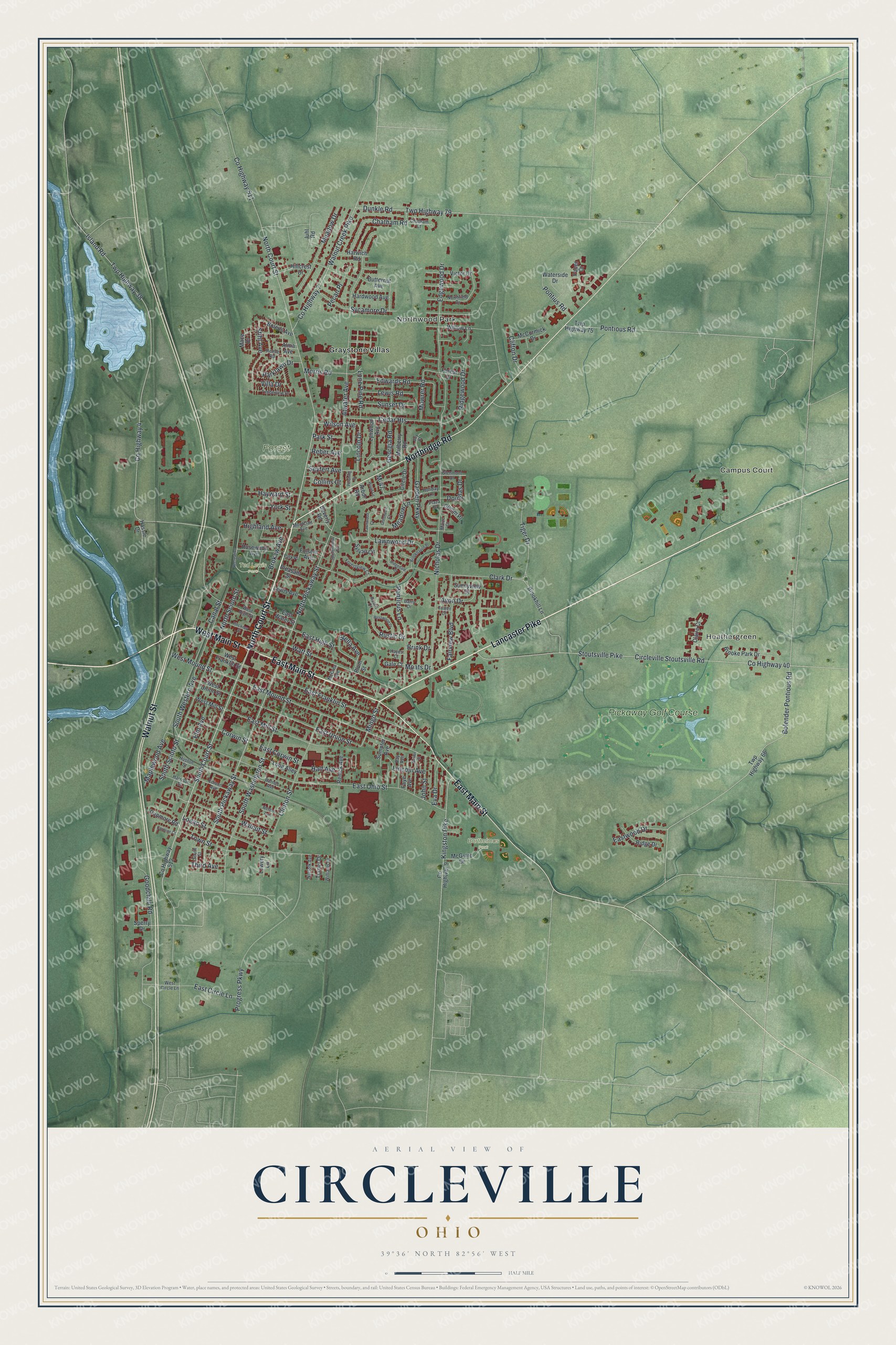
Created by KNOWOL in 2026, this Circleville map uses USGS elevation data for the shaded hills and Census Bureau records for the roads. The town shows up in deep red against soft green farmland, with the river curving along the left side. The title panel reads "Aerial View of Circleville, Ohio" with the coordinates 39°36' North, 82°56' West and a half-mile scale bar.
It fits an office, a den, a kitchen or a family room where people can stop and find a street they know. It makes a good gift for someone who grew up here, moved away, or still has family near downtown. Open the watermarked preview and trace a road you know, then choose your print on the product page. Shop the Circleville, Ohio map.