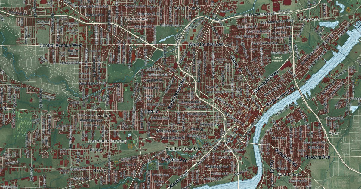
If you grew up in Toledo, whether in West Toledo, East Toledo or out at Point Place, this map gives you a lot to find. It's a modern aerial view of Toledo in Lucas County, Ohio, made from modern data and given a vintage look. Buildings are drawn in deep red on soft green ground. A wide blue river runs through the middle of the city and meets open water at the top right. The view runs from West Alexis Road and East Alexis Road at the top down to Airport Highway and the river's islands at the bottom.
Cherry Street, North Summit Street and East Toledo
Start downtown, on the west bank of the river near the middle of the sheet. Cherry Street and Collingwood Boulevard both head north from here. Monroe Street starts close by and runs all the way out to the top left corner. Now take North Summit Street the other way, up along the river. Just inland, Greenbelt Parkway runs past Forest Cemetery. Keep going north past Galena Street. You'll reach Point Place, Willow Beach and Shore Acres at the top right, where the river meets open water.
Now cross to the other bank. In East Toledo, Main Street meets Front Street and Starr Avenue. Front Street heads east past Ironville. The Birmingham and Ironville neighborhoods got their names from early iron works along Front Street and the river. Woodville Road runs off to the southeast, and Navarre Avenue heads east. Back on the west side, Anthony Wayne Trail follows the river down toward the lower left. It passes Western Avenue near Air Line Junction. Many roads are labeled, and each red shape is a building, so zoom in on the preview and look for yours.
Willys-Overland, the Jeep and Jeep Parkway
Toledo is a car town, and Willys-Overland is a big part of why. In 1908, John North Willys brought all of his company's car making together in Toledo. By 1912, only the Ford Motor Company sold more cars. The company's most famous product was the Jeep. It carried Allied service members from World War II all the way to the 1980s. It was also an early form of today's sport utility vehicle.
Around 1916, Willys-Overland put up a building at 14th and Adams Streets to finish, ship and sell its cars. The Whippet and other models came over from the Willys plant, along what became Jeep Parkway. They were delivered to a loading dock on the second floor. Downstairs, cars were shown behind floor-to-ceiling windows. The Remarkable Ohio marker there says the building has been home to the Toledo School for the Arts since 2004. On the map, look near the top center for Willys Parkway. Follow it south past Sylvania Avenue and Berdan Avenue until it meets Jeep Parkway. Adams Street is printed closer to downtown.
For someone who knows Willys Parkway or Point Place
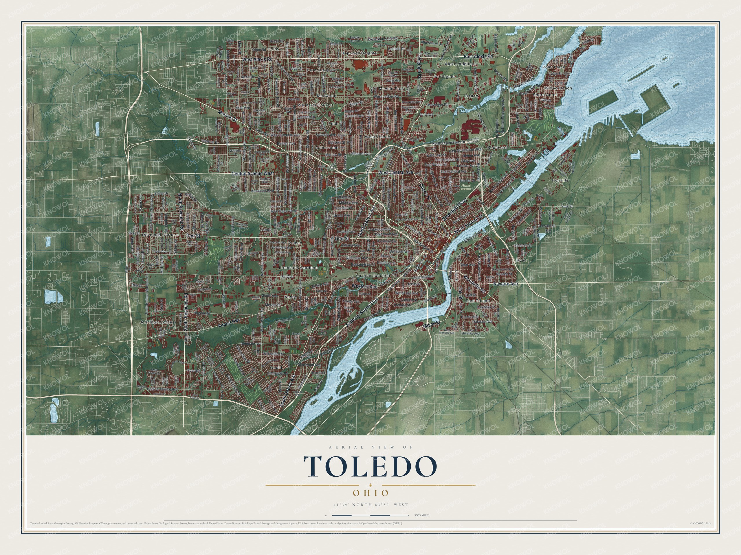
Created by KNOWOL in 2026, this Toledo map fits an office, a den or a family room. Buildings are drawn in deep red, and the ground is shaded green from USGS elevation data. Zoom in and you can pick out the blocks around Cherry Street, then follow the river up to Point Place. The title panel reads "Aerial View of Toledo, Ohio," with 41°39' North 83°32' West and a two-mile scale bar.
It's a thoughtful gift for someone who grew up in East Toledo or Point Place and moved away, or for a parent who still lives off Sylvania Avenue. Open the watermarked preview, find Willys Parkway near the top and follow Cherry Street down to the river. See sizes and frames for the Toledo map.