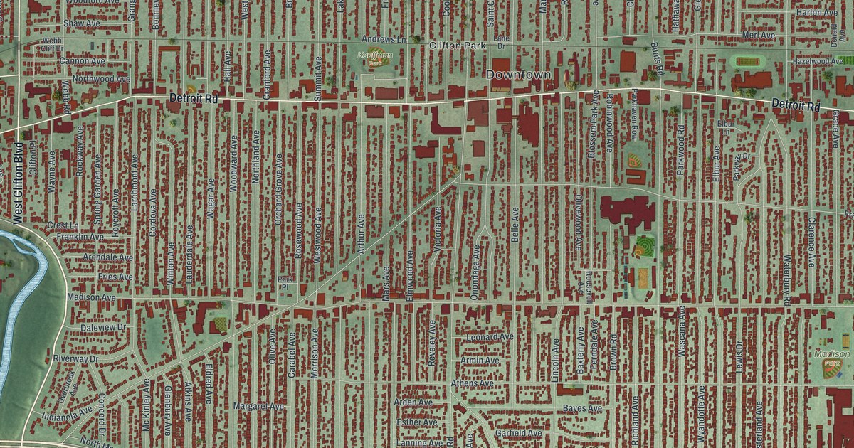
If you grew up in Lakewood, went to school here, or still have family on a street off Detroit Road, this map gives you plenty to find. It's a modern aerial view of Lakewood in Cuyahoga County, Ohio, made from modern data with a vintage artistic look. The lakeshore runs across the top in soft blue. A winding river curls down the left side. In between, more than 28,000 buildings are drawn in dark red along long, straight streets.
Lakewood Park, Detroit Road and the Birds Nest
Start at Lakewood Park, the green point that sticks out into the lake at the top of the sheet. Lake Avenue runs along its south side, and Edgewater Drive follows the shore east. Now head south on Belle Avenue. You'll cross Clifton Boulevard and come to Detroit Road near the Downtown label. Detroit Road is the long main street across the middle. Kauffman Park sits a little to the west, near Andrews Avenue. Follow Detroit Road west, and Sloane Avenue drops down toward the river.
Madison Avenue runs below Detroit Road, all the way across town. Take it east to Madison Park and the Birds Nest. Here the little streets have bird names: Robin, Lark, Quail, Thrush and Plover. Berea Road cuts down to the bottom right past big red buildings. Lakewood Heights Boulevard runs along the bottom of town. Many of the roads are labeled, and each red shape is a building, so zoom in on the preview and look for yours.
How Lakewood Park started as John Honam's farm
Lakewood Park is a good story to tell when someone asks about the map. An early settler named John Honam had a farm that ran from Detroit up to Lake Erie. It sat between Belle and Cook Avenues. His stone house went up in 1834. The Lakewood Historical Society restored it, and today it's the Oldest Stone House Museum. Later the land became The Hickories, the grand estate of Robert Russell Rhodes. The city bought it in 1919 and made the grounds into Lakewood Park. The mansion was a hospital annex during the flu epidemic. After that, it was City Hall until 1959. That's all on the Ohio historical marker for Lakewood Park.
Only one piece of The Hickories is left. It's the old stone wall with the estate's name carved in it. To find the old farm on the print, start at Lakewood Park. Belle Avenue and Cook Avenue both run south from Lake Avenue. The Honam farm filled the land between them, down to Detroit Road. Today that strip is packed with red houses.
For anyone who knows Detroit Road and Lakewood Park
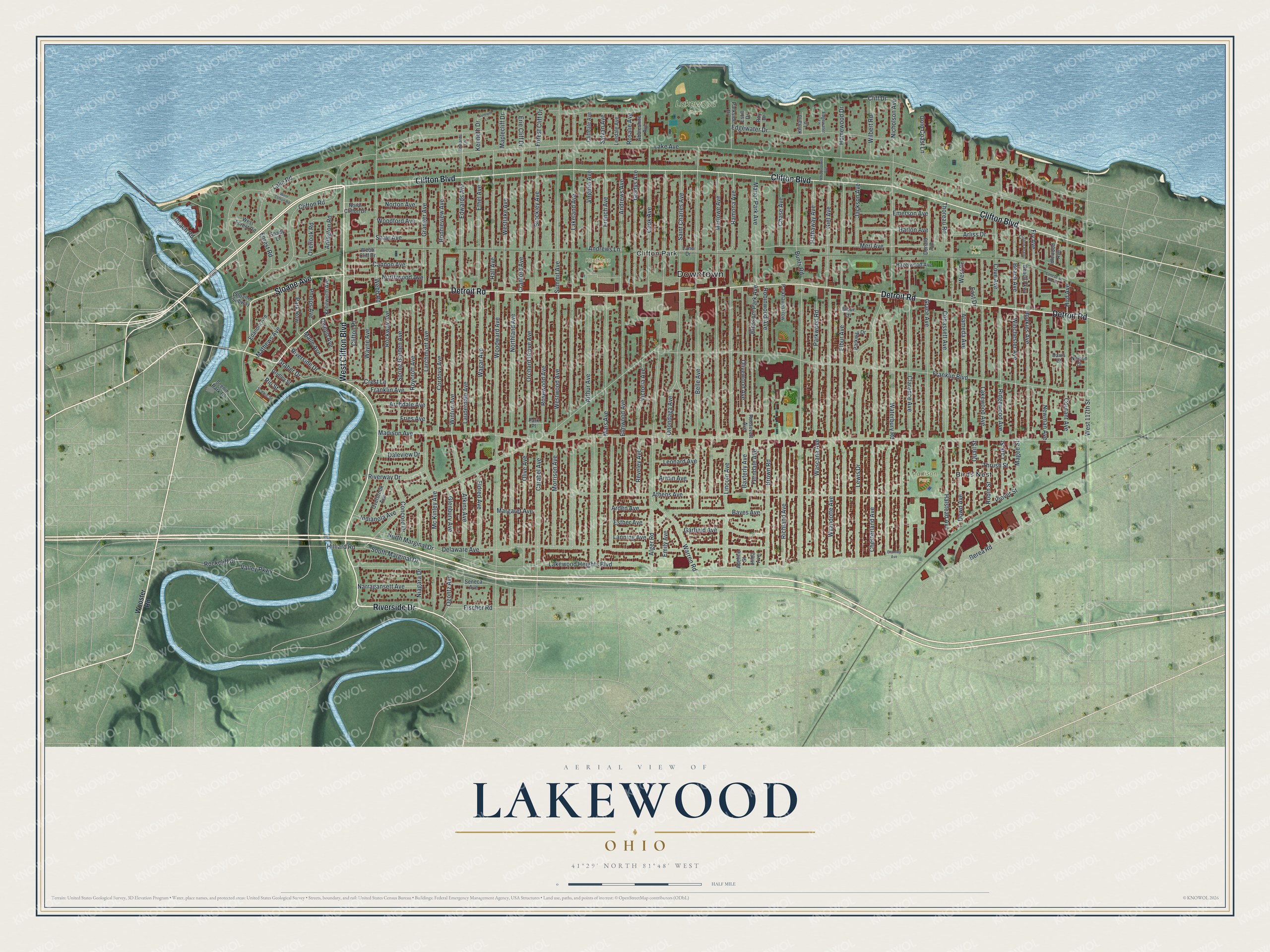
Created by KNOWOL in 2026, this map of Lakewood shades the land and the river bluffs from USGS elevation data. The streets come from Census Bureau records. The title panel says "Aerial View of Lakewood, Ohio," with 41°29' North, 81°48' West and a half-mile scale bar.
It fits a living room, a front hall or a home office. It's a thoughtful gift for someone who grew up near Lakewood Park and moved away, or for a family that's lived off Madison Avenue for years. Open the preview, zoom in and find your street. See sizes and frames for the Lakewood map.