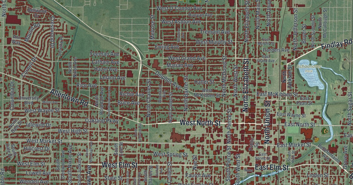
If you grew up in Lima, went to school here, or still have family near Public Square, this map gives you a lot to find. It's a modern aerial view of Lima in Allen County, Ohio, built from modern data and finished with a vintage feel. More than 26,000 buildings are drawn in deep red. They're packed tight around downtown and thin out toward the farm fields at the edges. A blue river winds through the city from the east side down to the southwest. A big blue basin sits near the right edge of the sheet.
Public Square, Findlay Road and Schoonover Park
Start at Public Square in the middle of downtown. North Main Street runs north from it. A few blocks west, North West Street runs the same way, all the way to the top of the sheet. West North Street and West Elm Street head west through the neighborhoods. Farther out, Elida Road angles off to the northwest and Allentown Road runs west. Spencerville Road goes southwest, past Faurot Park.
Now go back downtown and look northeast. Findlay Road runs out past Schoonover Park and a small blue pond. Bellefontaine Avenue runs east of downtown, not far from Harding Highway. To the south, South Pine Street and Reese Avenue lead down toward Foundry Park. Saint Johns Road and Commerce Parkway sit near the bottom of the sheet. Many of the roads are labeled, and each red shape is a building. Zoom in near Public Square and Findlay Road and look for yours.
How Lima's oil boom began near East North Street
In 1885, Benjamin Faurot struck oil in Lima. He'd drilled 1,251 feet down into a layer of rock called Trenton limestone. That well started the great oil boom of northwest Ohio. People rushed in to drill hundreds more wells. By 1886, the Lima field led the whole country in oil. A year later, it was thought to be the largest oil field in the world. The Ohio History Connection marker for the well stands on East North Street, near the river bridge. The well itself was 800 feet north of it. On the map, find East North Street just east of downtown, where it reaches the blue line of the river.
Lima's oil had a problem, though. It was full of sulfur and it smelled bad. John D. Rockefeller of Standard Oil put big money into it anyway, against his board's advice. He sent his top refining man, J.W. Van Dyke, to Lima to build and run the Solar Refinery. Van Dyke and a German chemist, Herman Frasch, worked out how to take the sulfur out. Then Lima crude could be made into good kerosene and fuel oil. A second state marker stands at the refinery on South Metcalf Street, south of downtown.
The river, Schoonover Park and the title panel
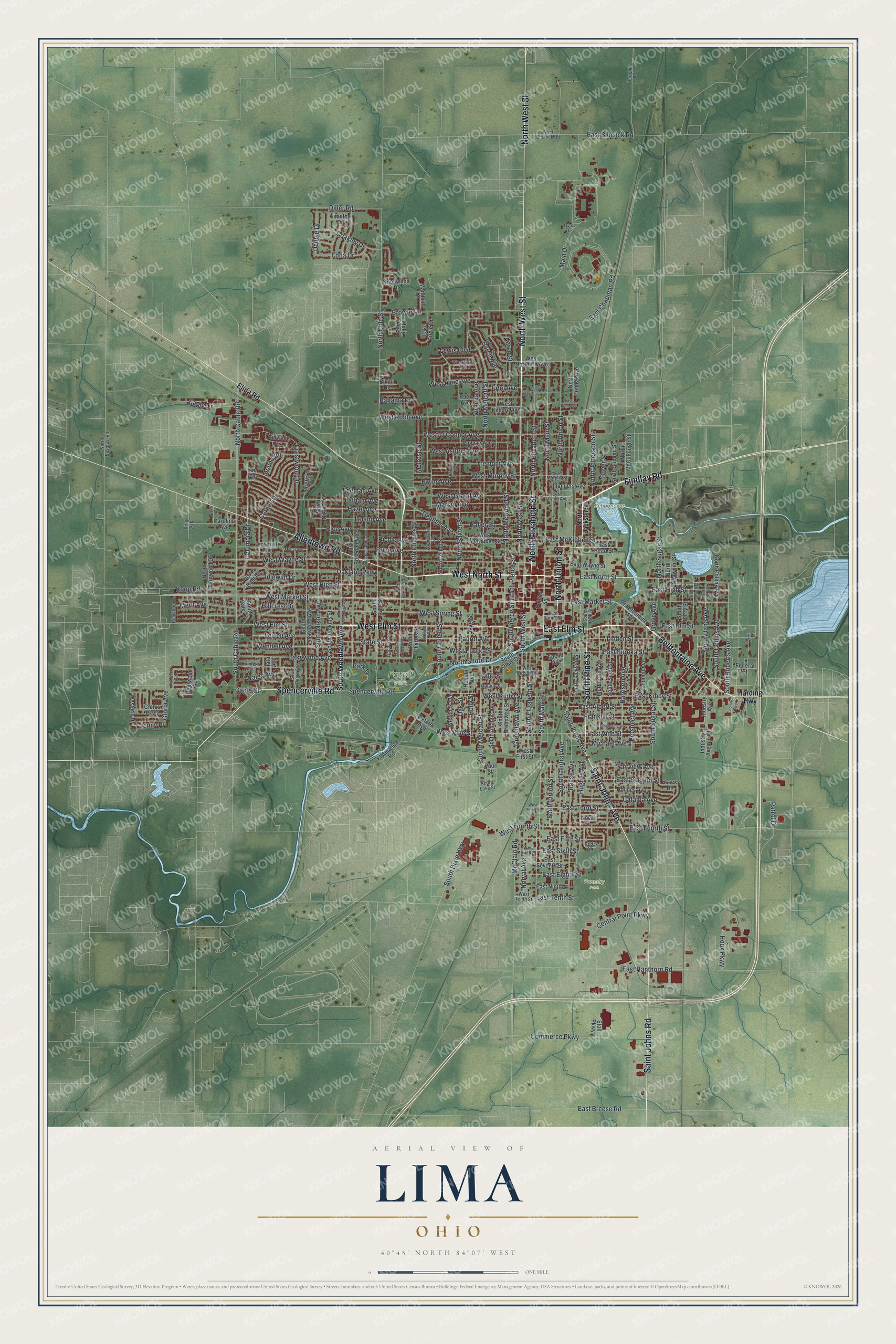
Created by KNOWOL in 2026, the Lima print is soft green with deep red buildings, and its gentle shading comes from USGS elevation data. The water stands out in pale blue: the winding river, the pond by Schoonover Park and the big basin to the east. Across the bottom, the title panel reads "Aerial View of Lima, Ohio" with 40°45' North, 84°07' West and a one mile scale bar.
Hang it in an office, a den or a family room. It's a good gift for someone who grew up near Faurot Park, or anyone who moved away from Allen County and misses it. Open the preview, zoom in and find the streets you know. See sizes and frames for the Lima map.