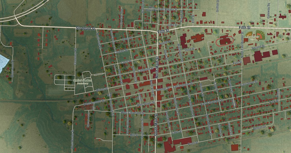
If you grew up in Monroe City, went to school here, or still have family a few blocks off Main Street, this map puts the whole town on one sheet. It's a modern aerial view of Monroe City in Monroe County, Missouri, built from modern data and given a vintage look. More than 1,500 buildings are drawn in red on soft green land. Fifth Street crosses the top of town, and Main Street runs down the middle. A small blue lake sits off to the west, with farm fields all around.
From Main Street to Fifth Street and Lion's Field Park
Start in the middle of the sheet, where North Main Street meets South Main Street. Head north on North Main Street to Fifth Street, the bold road across the top of town. Turn east. Farther along, Lion's Field Park is printed just below Fifth Street. Gateway Square sits just north of the road. Keep going east to County Line Road near the right edge. Follow it south. Lower down it's printed as South County Line Road, and it meets State Highway West near the bottom.
Now go back to Fifth Street and head west. Past Main, it becomes Stoddard Street and runs toward the left edge. Below it, a small blue lake is drawn, with Lakeview Drive and Mosswood Place running down beside it. Closer to town, Saint Judes Cemetery is printed just west of the grid. Second Street runs east of Main, near Lion's Field Park. Summer Street and Winter Street cross the middle of town. Many of the roads are labeled, and each red shape is a building, so zoom in on the preview and look for yours.
Monroe City's history, printed in 1876
In July 1876, a paper called the News printed a history of Monroe City. Its writer said the first time they saw the place where Monroe City now stands was in the early summer of 1841 or 1842. An 1884 county history reprinted that account. The same book said Monroe City was "rich in the number and variety" of its secret and social societies. It also noted the town's many churches. In its Civil War chapter, the book gives a section to the Battle at Monroe City.
Two Main Street buildings on the National Register
Two buildings on Main Street are now on the National Register of Historic Places. St. Jude's Episcopal Church stands at 301 North Main Street. It was listed in 2000. The Farmers and Merchants Bank Building stands at 201 to 207 South Main Street. It was listed in 2012. Both sit near the middle of the map, right where the tour starts. Zoom in on the red shapes along Main Street and find their blocks.
A gift for anyone who grew up near Lion's Field Park
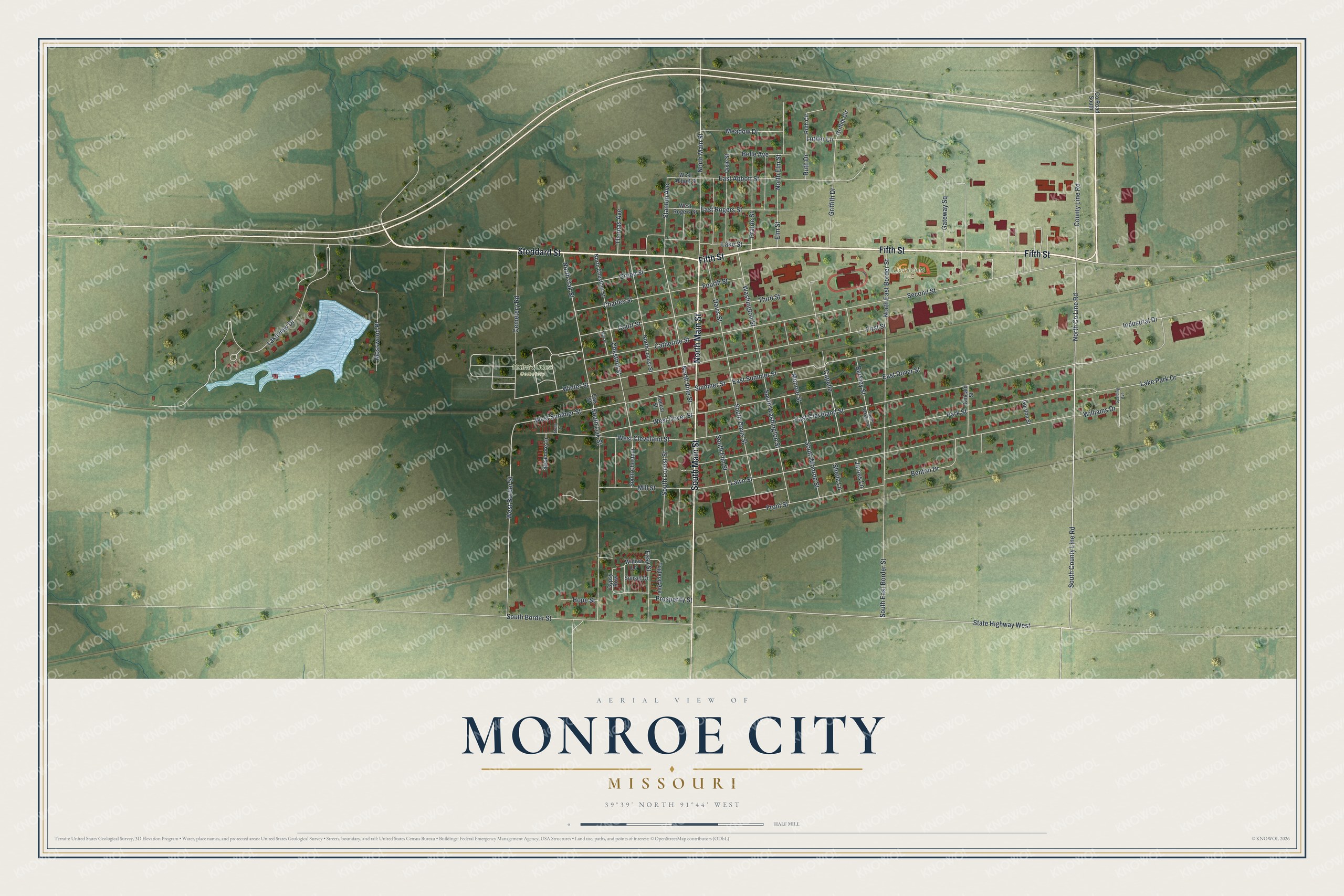
Created by KNOWOL in 2026, this Monroe City map shows the town's streets and red buildings on soft green land, with a small blue lake to the west and farm fields all around. The shading comes from USGS elevation data, and the streets come from Census Bureau records. The title panel reads "Aerial View of Monroe City, Missouri" with 39°39' North, 91°44' West beneath it.
Hang it in a front room, a kitchen or a home office, where guests can find Main Street. It makes a good gift for someone who grew up near Lion's Field Park, or for a family with roots in Monroe County. Open the preview and trace the route from Main Street up to Fifth Street. See sizes and frames for the Monroe City map.