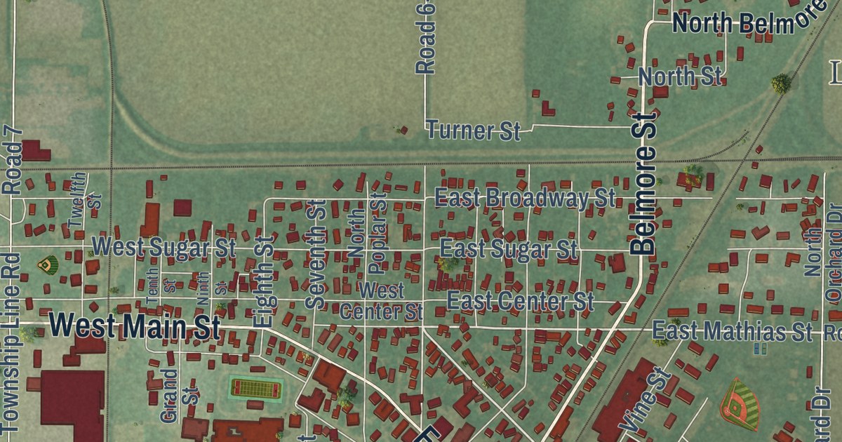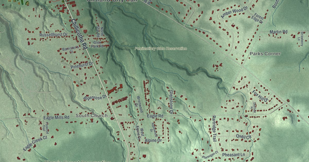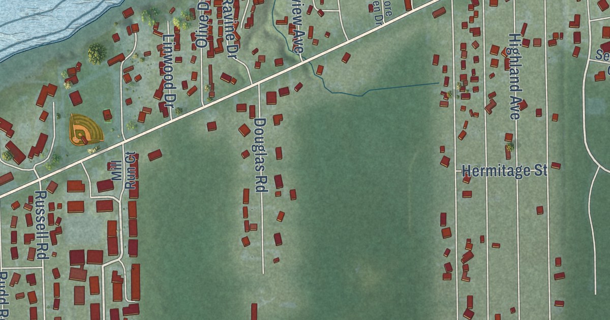
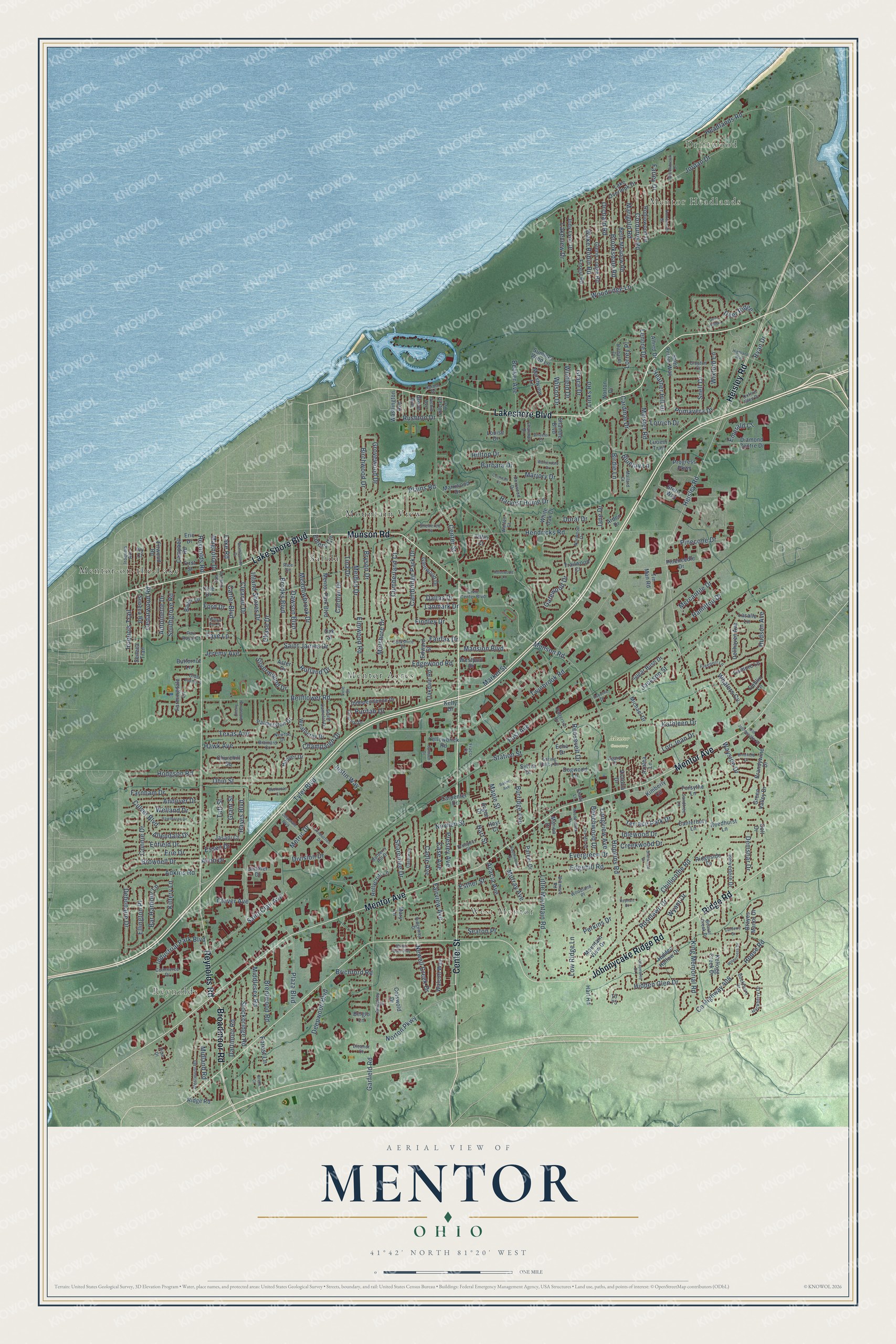
This beautifully detailed map of Mentor, Ohio was created in 2026 using aerial imagery combined with modern topographical, census, street and landmark data. It’s a one-of-a-kind view of Mentor that combines accurate data with a vintage aesthetic. The map shows every building in its true location, many of the roads carry their names, and the shaded topographic relief shows the shape of the land.
Explore an aerial view of Mentor, Ohio
On the map you’ll find Mentor City Hall, Driftwood, Brentwood, Reynolds, Mentor Headlands, West Mentor, Mentor Cemetery, Arrowhead Beach, Mentor Acres, Mountain View, and Salida, along with Center Street, and more. If you look closely you can even find your house accurately drawn in its correct location. Zoom in on the preview to look for yours.
Did you know this piece of Mentor, Ohio history?
James A. Garfield bought a home in Mentor in 1876. From that house he waged the first winning front porch campaign for the presidency in 1880. The house is now the James A. Garfield National Historic Site.
Take a closer look at the Mentor map
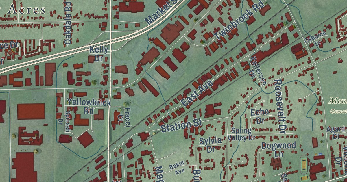
Street and place names on the Mentor, Ohio map
These names are printed on the map of Mentor, Ohio.
Places: Driftwood, Reynolds, Mentor Headlands, West Mentor, Mentor Cemetery, Mentor-on-the-Lake, Mentor Acres, Salida and Mountain View.
Streets and roads: Center Street, Lakeshore Boulevard, Munson Road, Mentor Avenue, Johnnycake Ridge Road, Reynolds Road, Heisley Road, Lake Shore Boulevard, Broadmoor Road, Ridge Road, Chillicothe Road, Dawson Boulevard.
More street names, A to Z
Acacia Avenue, Adkins Road, Agard Court, Alfred Drive, Allendale Drive, Amberley Drive, Andover Drive, Antoinette Drive, Arden Drive, Argee Drive, Aster Drive, Avon Drive, Azalea Lane, Baker Avenue, Barbara Drive, Barberry Hill Drive, Bar Harbour Lane, Bauer Lane, Beaver Creek Drive, Becker Avenue, Beechwood Drive, Belglo Lane, Belle Meadow Road, Bellflower Road, Belvedere Drive, Biltmore Road, Birchwood Drive, Birdie Lane, Bluejay Lane, Brainard Court, Brambleside Drive, Brandywine Drive, Brayes Manor Drive, Brentwood Road, Brichford Road, Bridle Court, Brimfield Drive, Brooks Boulevard, Brooksdale Road, Brownell Drive, Bryson Drive, Buchanan Court, Buckthorn Drive, Burridge Avenue, Butternut Lane, Cadle Avenue, Cambridge Park Drive, Campbell Road, Canterbury Lane, Cardinal Drive, Carole Drive, Carolyn Drive, Carpenter Drive, Carter Boulevard, Case Avenue, Cedarwood Road, Champaign Drive, Chapelway Drive, Charmar Drive, Chase Drive, Cherry Blossom Drive, Churchill Square, Civic Center Boulevard, Clearair Drive, Clopton Court, Clover Avenue, Cole Drive, Colonial Drive, Colt Drive, Commerce Drive, Connie Drive, Corduroy Road, Cornwall Court, Corporate Boulevard, Cotswold Drive, County Highway 408, Creekwood Drive, Culver Boulevard, Cumberland Court, Curberry Drive, Dallas Drive, Dartmoor Road, Debonaire Drive, Deepwood Boulevard, Deer Hollow, Deer Ridge, Dellhaven Avenue, Demshar Drive, Diamond Centre Drive, Division Drive, Dogwood Lane, Doral Drive, Dorrwood Drive, Dublin Lane, East Avenue, Echo Drive, Edgehill Road, Edgewood Road, Edward Street, Eleanor Court, Ellington Place, Elmwood Road, Emerald Court, Emery Circle, Enfield Drive, Eric Drive, Erie Drive, Essex Drive, Esther Street, Evergreen Drive, Fairfax Drive, Fairview Avenue, Farley Drive, Farmingdale Lane, Farnham Drive, Faye Lane, Findley Drive, First Street, Firwood Road, Ford Drive, Forest Lane, Forest Road, Forsythe Lane, Fox Mill Road, Fracci Court, Freeport Lane, Garfield Road, Gatewood Drive, Glenn Lodge Road, Glenwood Drive, Grace Drive, Grant Street, Green Valley Drive, Grove Avenue, Grovewood Drive, Hackberry Drive, Hamilton Drive, Harbor Drive, Hart Road, Hart Street, Harvest Home Drive, Hawk Avenue, Hawthorne Drive, Hayes Boulevard, Headlands Road, Heather Hill Drive, Hendricks Road, Hidden Glen Drive, Hidden Hollow Drive, Highland Way, Hillcrest Avenue, Hilltop Drive, Hodgson Road, Hollycroft Lane, Homewood Drive, Hoose Road, Hoover Drive, Hopkins Road, Hoyt Court, Hudson Avenue, Idlewood Drive, Independence Drive, Industrial Park Boulevard, Inland Shores Drive, Iroquois Avenue, Iroquois Trail, Ivy Court, Jackson Street, Jane Drive, Jasani Court, Jenther Drive, Jeremy Avenue, Jody Lynn Drive, Jordan Drive, Justin Way, Kathleen Drive, Kellogg Creek Drive, Kelly Drive, Kephart Drive, Kimberly Circle, King Memorial Road, Kittery Lane, Lake Overlook Drive, Lake Road, Lakeview Drive, Lanmark Drive, Lasalle Lane, Lenore Drive, Links Road, Lismore Lane, Little Mountain Road, Longview Avenue, Lori Jean Drive, Lorrey Place, Lorrich Drive, Louise Drive, Low Ridge Lane, Luoem Trail, Magnolia Drive, Mallard Court, Manor Gate Way, Mansion Boulevard, Maple Street, Marigold Road, Marion Drive, Marjory Drive, Market Street, Markwood Drive, Marshview Lane, Mary Lane, Meadowbrook Drive, Meadowlawn Drive, Meister Road, Meldon Drive, Melshore Drive, Mentor Park Boulevard, Mercantile Drive, Metric Drive, Michael Drive, Middlesex Road, Midland Road, Mountain View Drive, Murray Avenue, Newell Creek Drive, Newton Drive, Norton Drive, Norton Parkway, Norwood Drive, Nowlen Street, Oakdale Road, Oak Street, Ohio Street, Olde Farm Lane, Old Johnnycake Road, Orchard Road, Orchid Avenue, Osborne Drive, Oxford Glen Drive, Palmerston Drive, Parker Drive, Patterson Drive, Perkins Drive, Pinecone Drive, Pine Drive, Pineneedle Drive, Plains Road, Plaza Boulevard, Port Royal Court, Presley Avenue, Primavera Drive, Production Drive, Progress Parkway, Prospect Street, Puritan Drive, Reedhurst Lane, Rice Drive, Richards Drive, Ridgeside Drive, Ridgeway Drive, Robinwood Drive, Roosevelt Drive, Roselawn Drive, Rosewood Lane, Rushton Drive, Rutland Drive, Ryan Drive, Saint Clair Avenue, Saint James Drive, Saint Peters Way, Sandtree Lane, Seaton Place, Seneca Road, Seneca Trail, Shady Lane, Shandle Boulevard, Sharonlee Drive, Sheltered Cv, Sherwood Drive, Silvermound Drive, Snell Drive, South Camelot Drive, Southgrove Road, Southwood Drive, Spinach Drive, Spring Valley Drive, Station Street, Steris Way, Stockbridge Road, Sugar Bush Drive, Summer Wind Lane, Sylvia Drive, Taft Street, Tall Oaks Drive, Terrace Park Drive, Texas Avenue, Tiffin Court, Tina Drive, Tin Man Road, Trailwood Court, Twinbrook Road, Tyler Boulevard, Victoria Drive, Vine Street, Wake Robin Road, Walcott Way, Walden Court, Warrendale Drive, Washington Avenue, Wayside Drive, Weatherby Drive, Welland Drive, Westmoor Road, Westport Drive, Whalers Cv, Wheeler Court, White Oak Drive, Wilderness Drive, Willowbrook Drive, Willow Run Drive, Wilson Drive, Winfield Drive, Wixford Lane, Woodland Place, Woodridge Lane, Wyant Drive, Yellowbrick Road, Yorkshire Drive.
See the Mentor, Ohio map on a wall
The Mentor map as an 18 x 24 inch print in a black frame.

This beautifully detailed map of Mentor makes an attractive addition to your office, library, or den, and it can even be used to teach children the geography and history of the area. It also makes a great gift for someone who left Mentor and still calls it home. When you’re done exploring, click here to get your copy of the Mentor map.