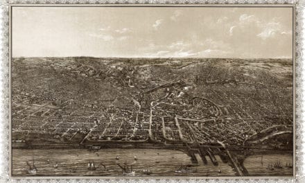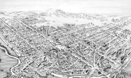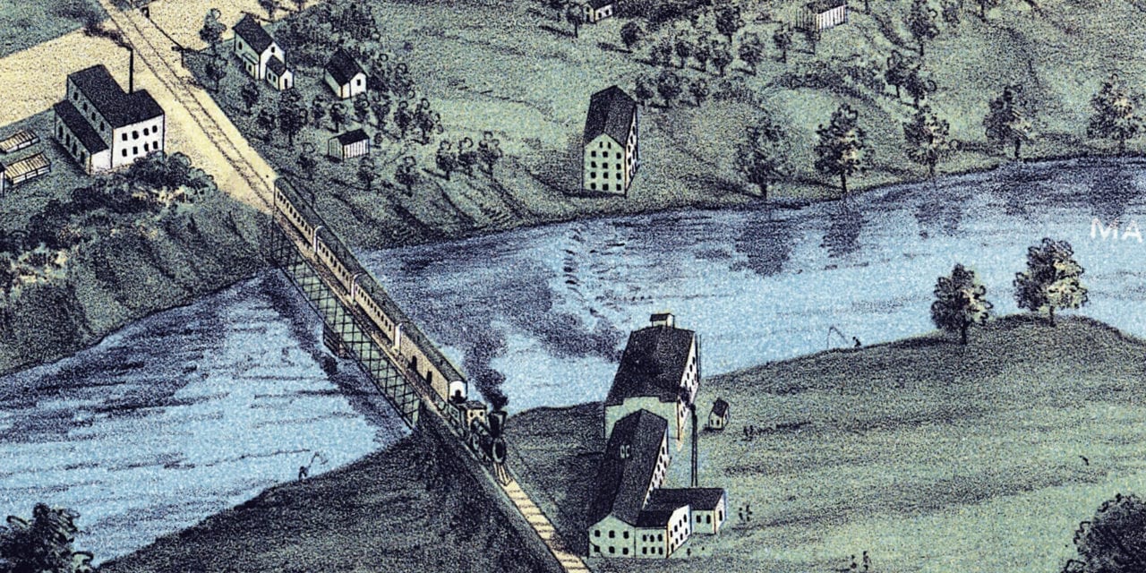
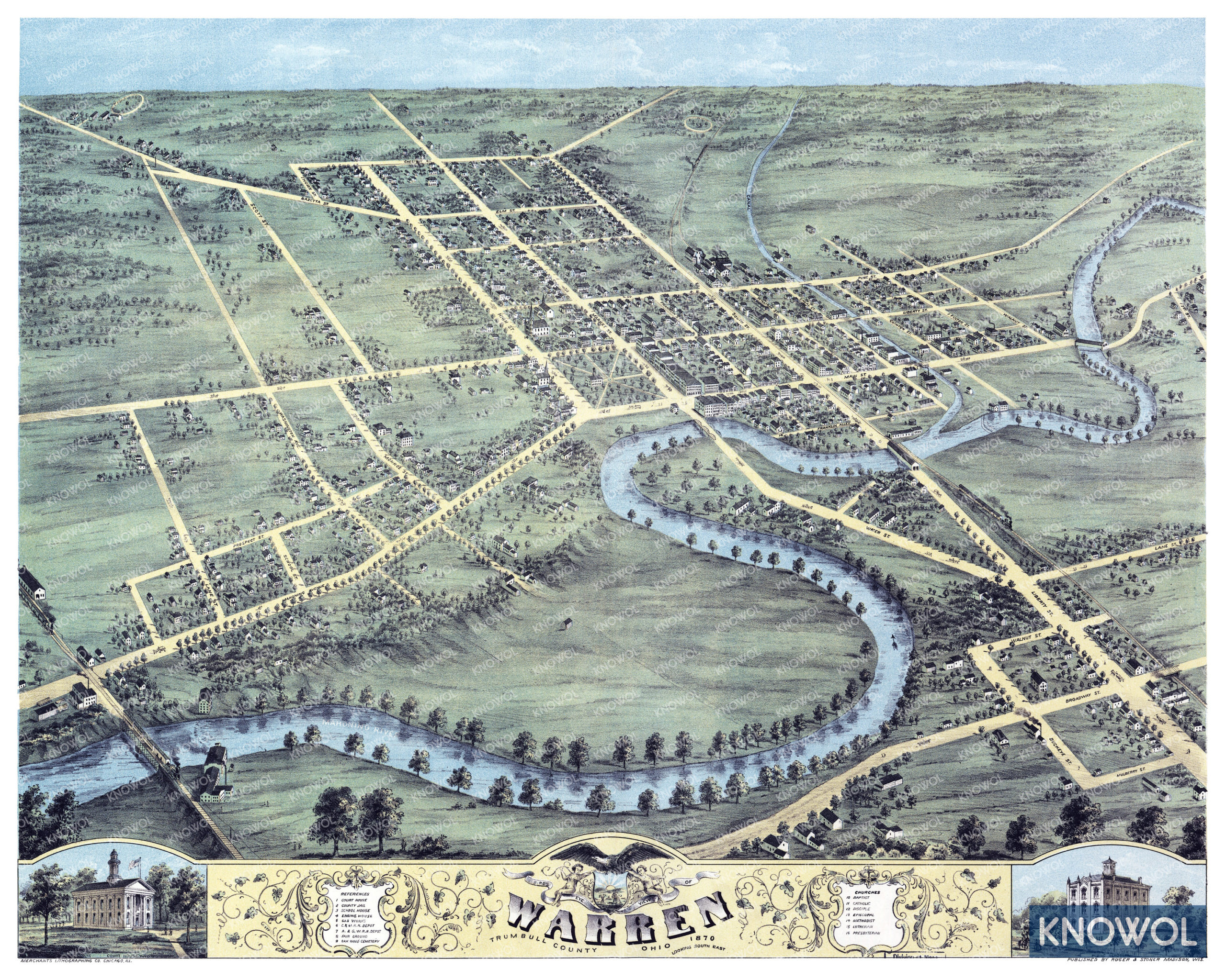
This historic map of Warren, Ohio was created in 1870 by Albert Ruger, a prominent 19th century map maker. The map shows a bird’s eye view of the city looking South West, including street names and old landmarks.
Landmarks on the map include the Atlantic and Great Western Railroad Depot, Warren Fair Grounds, Cleveland and Mahoning Railroad Depot, Engine House, Oak Wood Cemetery, Mahoning River, Public School, County Jail, Court House, and more.
This historic map of Warren was restored by KNOWOL. Reproductions of the restored map are available here.
Historic Old Map of Warren, Ohio from 1870
This map of Warren will make an attractive addition to your office, library, or den and can even be used to teach children the geography and history of the area. When you’re done exploring, click here to get your copy of the restored map.