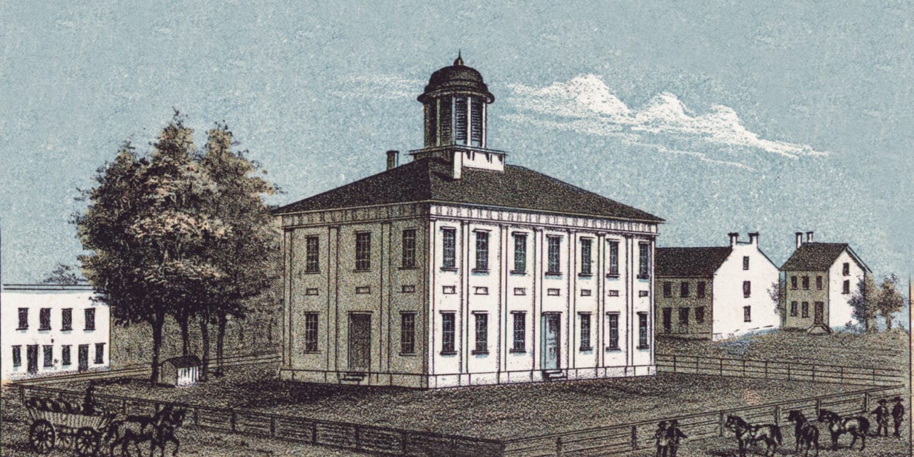
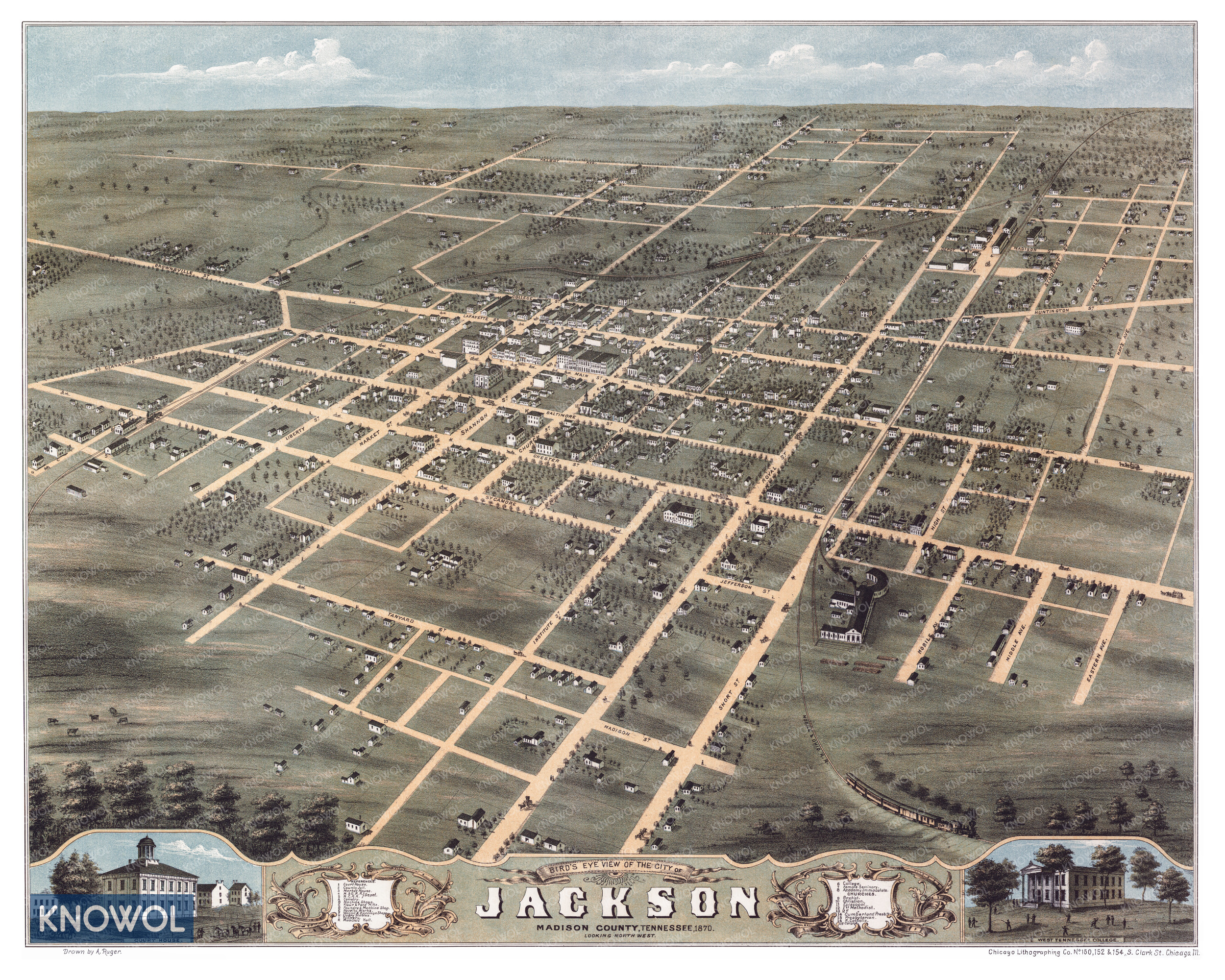
This historic map of Jackson, Tennessee was created in 1870 by Albert Ruger, a prominent 19th century map maker. The map shows a bird’s eye view of the city looking North West, including street names and old landmarks.
Landmarks on the map include West Tennessee College, Female Seminary, Masonic Hall, Tannery, Novelty Works, Wagon & Carriage Shops, Foundry & Machine Shop, Flour & Feed Mills, Court House, Railroad Depots, Market House, and more.
This historic map of Jackson was restored by KNOWOL. Reproductions of the restored map are available here.
Historic Old Map of Jackson, Tennessee from 1870
This map of Jackson will make an attractive addition to your office, library, or den and can even be used to teach children the geography and history of the area. When you’re done exploring, click here to get your copy of the restored map.