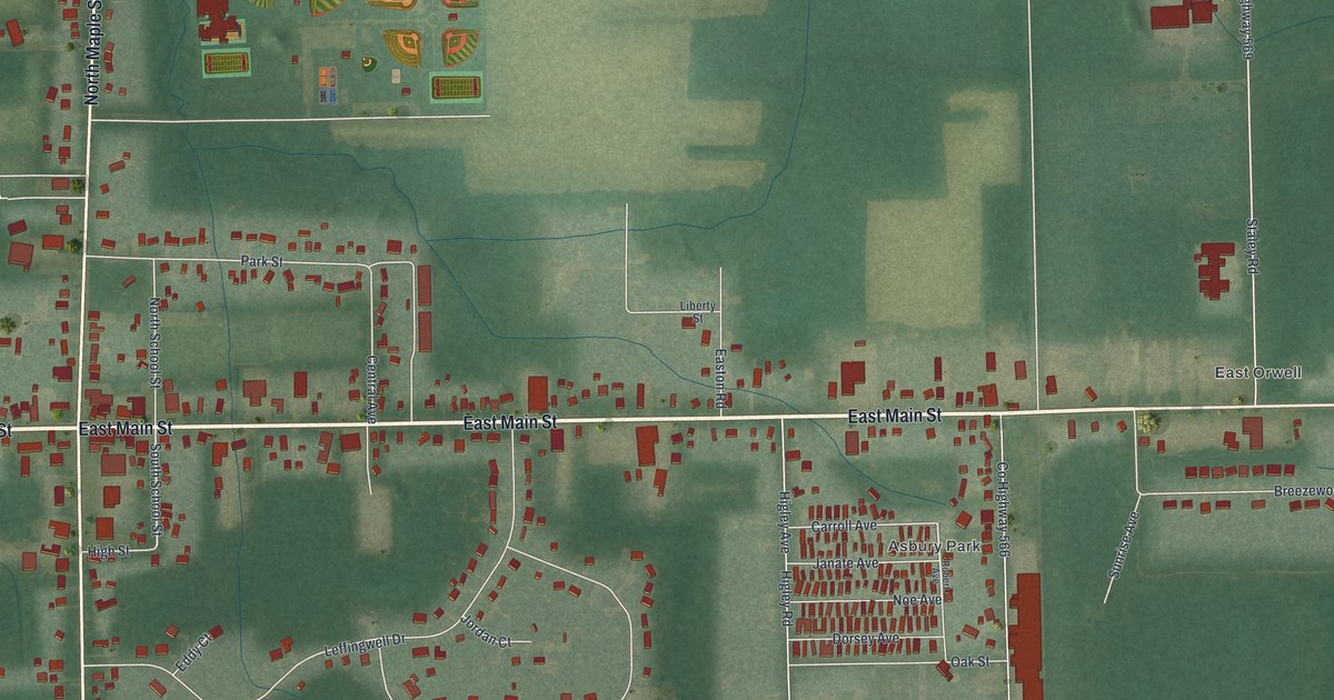
If you grew up in Orwell, or you still drive East Main Street to get home, this map is for you. It's a modern aerial view of Orwell in Ashtabula County, Ohio, built from modern data and given a warm vintage feel. You'll see West Main Street and East Main Street crossing the whole sheet, with North Maple Street and South Maple Street meeting them near the Orwell Village Hall. Asbury Park and East Orwell sit to the east, and green fields and hills wrap around the edges.
Adna R. Chaffee, the Orwell farm boy who led the Army
On this map you'll find East Main Street, West Main Street, North Maple Street, South Maple Street, Orwell Village Hall, Asbury Park, East Orwell, North School Street, South School Street, Grand Valley Avenue, Park Street, Chaffee Drive, Leffingwell Drive, Penniman Road, Mayfield Road, and more. Each red shape is a building, so zoom in on the preview and look for yours.
Adna R. Chaffee was born in Orwell on April 14, 1842. He grew up on the family farm. In 1861 he left home to join the Army and fought in the Civil War, including at Gettysburg. Later he served in the West, where he helped in the capture of Geronimo. He also served in China and the Philippines. In 1904 he became Chief of Staff of the U.S. Army. According to the Ohio marker for Adna R. Chaffee, he was the first to hold that job without going to West Point.
He retired in 1906 and died in 1914. He was buried at Arlington National Cemetery with the highest military honors. His marker stands in Orwell Township Park, at the southeast corner of Main and Maple. On the map, that's near where East Main Street meets South Maple Street, in the middle of town. South of Main, you'll also spot Chaffee Drive.
Main Street and Maple Street in Orwell

Created by KNOWOL in 2026, this print shows Orwell from above with soft green hills, pale fields, thin blue creeks and red buildings along the streets. The title panel reads Aerial View of Orwell, Ohio, 41°32' North 80°52' West.
It fits a living room, a hallway, a den or an office. It's a good gift for anyone who grew up on North Maple Street, near the Orwell Village Hall or out in East Orwell, or moved away and wants Main Street on the wall. Open the preview and find the corner you know best. See sizes and frames for the Orwell map.